
Learn LiDAR
Lidarvisor vs Carlson Point Cloud
Cloud Automation vs CAD Integration
No credit card required • 50 hectares included
Looking for the fastest way to process LiDAR point clouds? Carlson Point Cloud offers powerful CAD integration, but requires desktop software, CAD skills, and a $2,000+ investment.
Lidarvisor delivers classified point clouds, terrain models, and CAD-ready exports in minutes—entirely from your browser, starting free.
Feature Comparison
| Feature | Lidarvisor | Carlson Point Cloud |
|---|---|---|
| Platform | Cloud (browser) | Desktop (CAD required) |
| Pricing | $0–$167/month | $2,000+ perpetual |
| Setup Time | Instant | Days |
| Classification | Fully automatic (12+ classes) | Semi-automatic |
| Learning Curve | Minimal | Moderate (CAD skills) |
| CAD Integration | DXF export | Native AutoCAD/IntelliCAD |
| Free Tier | 50 ha | Trial only |
| Best For | Speed & automation | CAD-centric workflows |
Lidarvisor: Speed for Modern Workflows
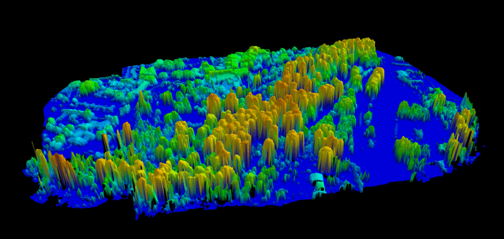
Upload your LAS file and get classified point clouds, DTMs, and CAD-ready deliverables in minutes.
- No Installation — Works in your browser on Mac, Windows, Linux, even tablets
- Automatic Classification — AI-powered ground, vegetation, building, wire, and pole detection across 12+ ASPRS classes
- Instant Deliverables — DTM, DSM, CHM, contours, and DXF exports ready in minutes
- Affordable Pricing — Start free with 50 ha, scale from $19 to $167/month (billed annually) as needed
- Utility & Vegetation — Powerline vectorization and encroachment analysis included
CAD-CENTRIC
Carlson Point Cloud: For Survey Firms
A modular desktop application for surveyors and engineers who work within the Carlson ecosystem.
- CAD Native — Works directly inside AutoCAD or IntelliCAD environment
- Carlson Integration — Seamless workflow with Carlson Survey, Civil, and Mining modules
- Surface Generation — Create DTMs, contours, cross-sections, and profiles
- Large Dataset Handling — Process up to 1 billion points
- Perpetual License — One-time $2,000+ purchase (Basic version)
Carlson information based on publicly available data from carlsonsw.com and reseller sites.
Which Should You Choose?
The right tool depends on your workflow and existing software investments.
Choose Lidarvisor When…
You need results quickly without tuning parameters
You process up to 500 hectares per month
Budget flexibility matters (pay monthly vs $2,000+ upfront)
You want to try before committing (free tier)
You need to share results with clients via web links
You need utility/vegetation features without extra costs
You work on Mac, Linux, or tablets (not just Windows)
Consider Carlson Point Cloud When…
- You already use Carlson Survey, Civil, or Mining software
- Your workflow is CAD-centric (AutoCAD/IntelliCAD)
- You prefer perpetual licensing over subscriptions
- You need detailed cross-section and profile tools
- Your team has CAD expertise
Frequently Asked Questions
Can I try both platforms before committing?
Yes! Lidarvisor offers a free tier with 50 hectares of processing, no credit card required. Carlson Point Cloud offers trial licenses through their sales team or resellers.
Which is better for drone LiDAR data?
For most drone surveys, Lidarvisor’s automatic classification delivers fast, accurate results. Upload your LAS file and get classified point clouds in minutes. Carlson Point Cloud requires more manual work but offers tighter CAD integration for firms already using Carlson software.
Do I need AutoCAD to use Carlson Point Cloud?
Carlson Point Cloud can run as a standalone install using the included IntelliCAD engine, or you can install it on your existing AutoCAD platform. Lidarvisor requires no CAD software—it runs entirely in your web browser.
What about terrain model generation?
Both platforms generate DTMs and contours. Lidarvisor also generates DSM, CHM (Canopy Height Model), hillshade, and slope maps automatically. Carlson Point Cloud excels at cross-sections and profiles for corridor analysis.
More Comparisons
Ready to Process Your Point Cloud?
Upload your LAS file and get classified point clouds, terrain models, and CAD-ready exports in minutes. Start with 50 hectares of free processing.
Create free account50 hectares free. No credit card. No software to install.