
Comparisons
Lidarvisor vs LiDAR360
Transparent Pricing vs Enterprise Complexity
No credit card required • 50 hectares included
Streamlined cloud processing with clear pricing, or a comprehensive desktop suite with quote-based licensing. Which fits your workflow?
Feature Comparison
| Feature | Lidarvisor | LiDAR360 |
|---|---|---|
| Platform | Cloud (browser) | Desktop application |
| Pricing | $0–$249/month (transparent) | Quote-based (~$2,150+ framework) |
| Free Tier | 50 hectares | No |
| Setup Time | Instant | Installation required |
| Classification | AI automatic + manual tools | AI-powered (32+ classes) |
| Learning Curve | Minimal | Moderate to steep |
| Collaboration | Web sharing | File export |
| Best For | Speed & simplicity | Multi-industry enterprise |
Lidarvisor
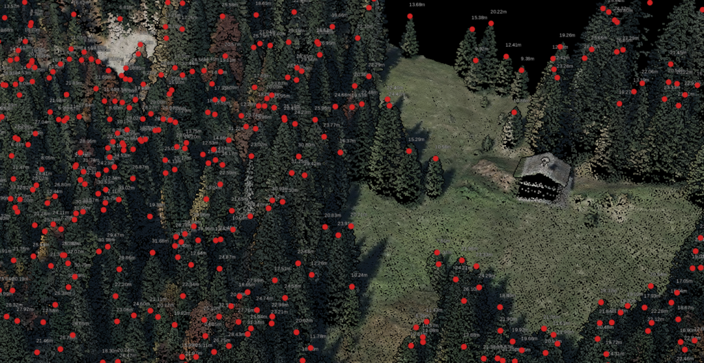
Speed & Simplicity for Modern Workflows
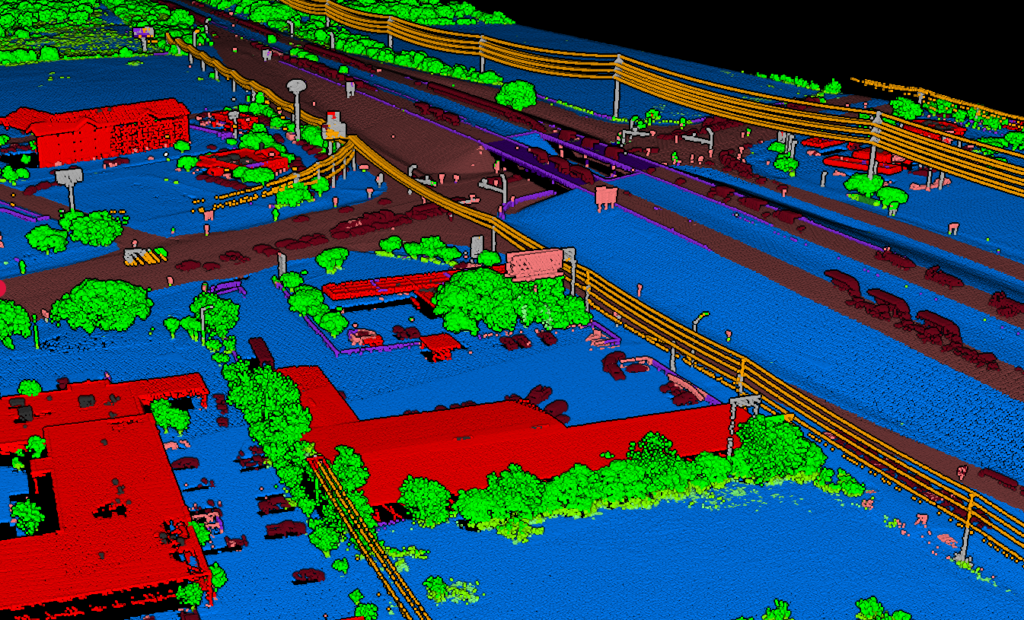
Upload your LAS file and get classified point clouds, DTMs, and CAD-ready deliverables in minutes—not weeks. No installation, no training, no parameter tuning.
No Installation — Works in your browser on Mac, Windows, Linux, even tablets
Automatic Classification — AI-powered ground, vegetation, and building detection. Built-in manual tools for refinement.
Instant Deliverables — DTM, DSM, CHM, contours, and DXF exports ready in minutes
Transparent Pricing — $0–$249/month, clearly listed on website
Utility & Vegetation — Powerline vectorization and encroachment analysis included
Carbon Estimation — Per-tree carbon stock with 102 species-specific allometric models
LiDAR360
Comprehensive Desktop Suite for Enterprises
A full-featured desktop application by GreenValley International with specialized modules for forestry, powerline, mining, and terrain analysis.
Deep Learning Classification — AI-powered with 32+ feature classes
Multi-Industry Modules — Forestry, powerline, terrain, mining specializations
Distributed Computing — Process across multiple machines for large datasets
Custom AI Training — Train your own classification models
Considerations: Desktop installation required, quote-based pricing (some resellers list ~$2,150 for framework), steeper learning curve, module licensing for specialized features
LiDAR360 information based on publicly available data. Images show LiDAR forestry analysis concepts.
Utility Corridor Capabilities
Both platforms support utility corridor analysis, but with different approaches:
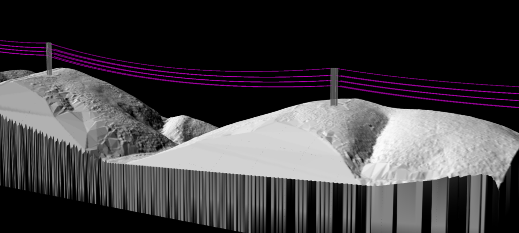
Lidarvisor includes automated vegetation risk detection and powerline vectorization in all plans at no extra cost. Upload your corridor data and get encroachment reports.
LiDAR360 offers a dedicated powerline module with span analysis, clearance reports, and detailed conductor modeling. Requires additional module licensing.
Which Should You Choose?
The right tool depends on your project scope, budget, and workflow requirements
Choose Lidarvisor When…
• You need results quickly without parameter tuning • You want to try before committing (free tier) • Budget transparency matters — no surprise quotes • You process aerial/drone LiDAR for topographic deliverables • You need to share results with clients via web links • You want utility/vegetation features without add-on costs • You need carbon stock estimation for sustainability projects
Consider LiDAR360 When…
• You work across multiple industries (forestry, mining, powerline) • You need custom AI model training for specialized classification • You have distributed computing requirements for massive datasets • You require detailed forestry analysis (individual tree, thinning) • Enterprise-level budget available • You already have dedicated GIS/LiDAR specialists on staff
Detailed Capability Comparison
| Capability | Lidarvisor | LiDAR360 |
|---|---|---|
| Ground classification | Automatic | AI-powered |
| Vegetation classification | Low/Med/High | Detailed forestry |
| Building extraction | ||
| Wire detection | + vectorization | + powerline module |
| Vegetation risk detection | ||
| DTM/DSM generation | ||
| Individual tree analysis | Tree tops/crowns | Full forestry suite |
| Carbon/Biomass estimation | 102 species models | Forestry module |
| Custom AI training | — | |
| Distributed processing | Cloud-handled | Multi-node |
| Web visualization | Built-in | — |
| Photogrammetry | Photogrammetric point clouds accepted (no image reconstruction) |
More Comparisons
Frequently Asked Questions
Can I try before buying?
Lidarvisor: Yes! A generous free tier with 50 hectares of processing—no credit card required. Sign up and start processing immediately.
LiDAR360: Typically requires contacting the vendor or authorized resellers for demos or trial access.
Which is easier to learn?
Lidarvisor is designed for minimal learning curve: upload your LAS file and get results. No parameters to configure.
LiDAR360 offers more features but requires more time to master the desktop interface and module-specific workflows.
What about utility/vegetation corridor work?
Both platforms support utility corridor analysis.
Lidarvisor includes automated vegetation risk detection and powerline vectorization in all plans at no extra cost.
LiDAR360 offers a dedicated powerline module, typically requiring additional licensing.
Do I need powerful hardware?
Lidarvisor runs entirely in the cloud—any modern browser works. No workstation requirements.
LiDAR360 runs locally on your machine. Large datasets require capable workstations with sufficient RAM and GPU resources.
What about forestry and carbon estimation?
Lidarvisor provides tree top detection, crown delineation, CHM generation, and per-tree carbon stock estimation with 102 species-specific allometric models covering 8 geographic regions. Outputs include carbon (t C), CO₂ equivalent (t CO₂eq), and above-ground biomass (t AGB).
LiDAR360 has a dedicated forestry module with biomass estimation and thinning analysis. Requires forestry module licensing.
Create a FREE account now and start processing your point cloud
Get 5 GB of storage space and classify up to 50 hectares for free.
Create free account50 hectares free. No credit card. No software to install.