
Surveyors
Generate contours and TINs for topographic deliverables.
Features
Point Cloud Viewer Point Cloud Preprocessing Point Cloud Classification Point Cloud Rasterization Point Cloud Vectorization Processing APIIndustry
Land Surveying Utility Vegetation Management Forestry Hydrology & WaterMore
Pricing ContactAI-powered vectorization
Contours, breaklines, buildings, roads, road markings, trees, powerlines, water, bridges, rails and cadastral parcels — extracted from your LiDAR data automatically. No manual tracing, no parameter tuning.
No credit card required • DXF, SHP and GeoJSON export
What you can extract
Every feature type below comes out of the same point cloud, automatically, in formats your CAD and GIS tools already read.
Terrain
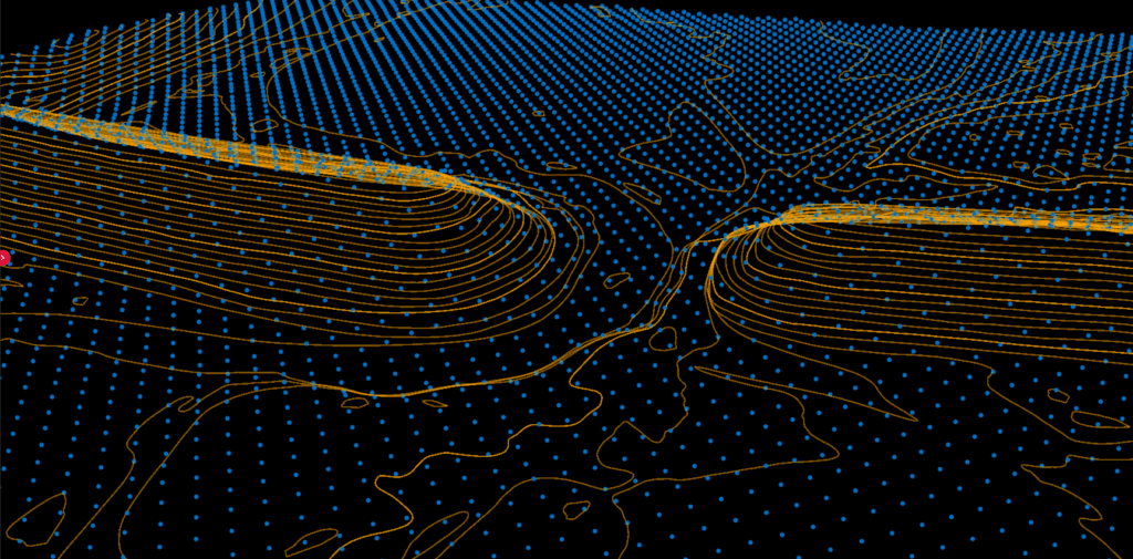
Generate survey-grade contour lines and gridded DTMs in one click.
Upload your point cloud, set your interval, and export contour lines or gridded DTM to DXF, SHP, or GeoJSON. No scripting, no parameter tuning.
Breaklines New
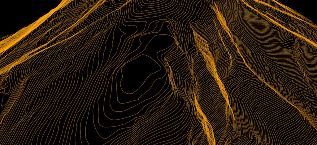
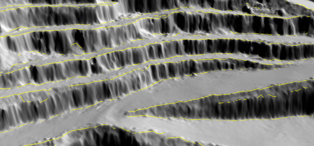
Embankments, ditch sides, terraces and rim crests, detected automatically.
Tracing breaklines onto a hillshade is the slowest part of finishing a terrain model. Lidarvisor detects them from the DTM itself — no manual labelling — and delivers them at three cumulative density levels, so you decide how much detail your deliverable carries.
Buildings
Extract accurate building footprints automatically.
Automatically detect and outline buildings from LiDAR data. Even in dense urban environments, our AI identifies structures and applies intelligent orthogonalization for cleaner geometry.
Roads Beta
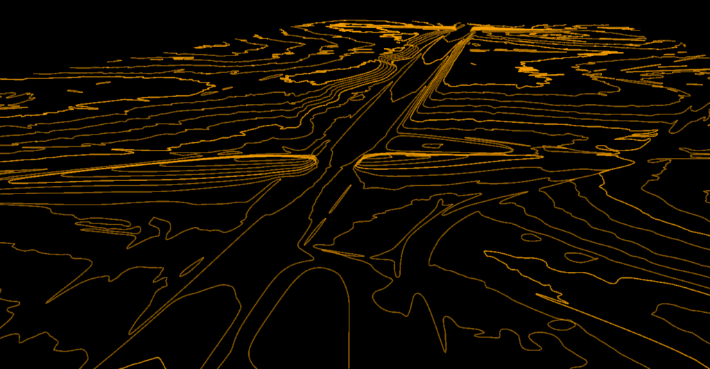
Vectorize the road network straight from the cloud.
Lidarvisor renders an overhead image from the point cloud, identifies road surfaces on it, and traces their edges as vector lines. Two modes tune the detector to the terrain you actually flew. The painted markings on the road come out as a layer of their own, which you can tick with or without the edges.
Forest inventory
Map every tree with crown boundaries and height data.
Pinpoint each tree apex and accurately map canopy boundaries. Generate complete digital forest inventories with exportable CSV data and detailed PDF reports.
Powerlines
Vectorize conductors for vegetation management.
Extract accurate 3D vector lines for conductors automatically. Every conductor knows the two towers it hangs between, and every support is measured, so the corridor arrives as an inventory rather than a drawing.
Hydrography Beta
Trace the water boundary, and know which side of it you are on.
Lidarvisor finds water on the orthophoto and confirms it against the point cloud itself, then traces the boundary. Water fully inside your coverage comes back as a closed polygon; water that runs off the edge of the survey comes back as shoreline — two banks for a stream, one for a coast.
Infrastructure & boundaries New
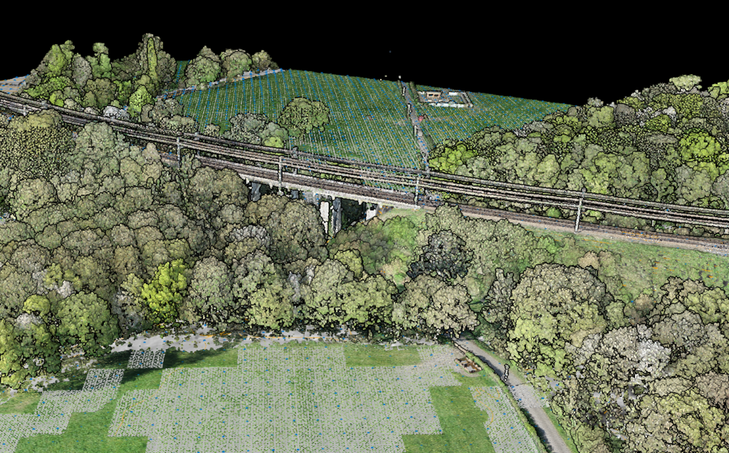
The structures and boundaries a plan gets read against.
A bridge deck stops being a scatter of classified points and becomes a footprint you can draw. Railway tracks come out as polylines. And cadastral parcels are pulled straight from national open-data services onto the plan, so you no longer export boundaries from a separate tool and align them by hand in AutoCAD.
Topographic maps
Get a head start with organized layers and raster backgrounds.
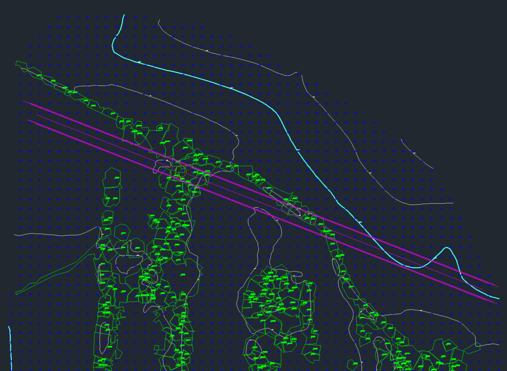
Skip hours of manual tracing. Lidarvisor exports organized DXF files with terrain, vegetation, and infrastructure layers, plus raster backgrounds for context. Open in any CAD software and refine as needed. Most of the work is already done. For the whole workflow, from classification to a layered DXF, see our point cloud to CAD guide.
Real project, real output
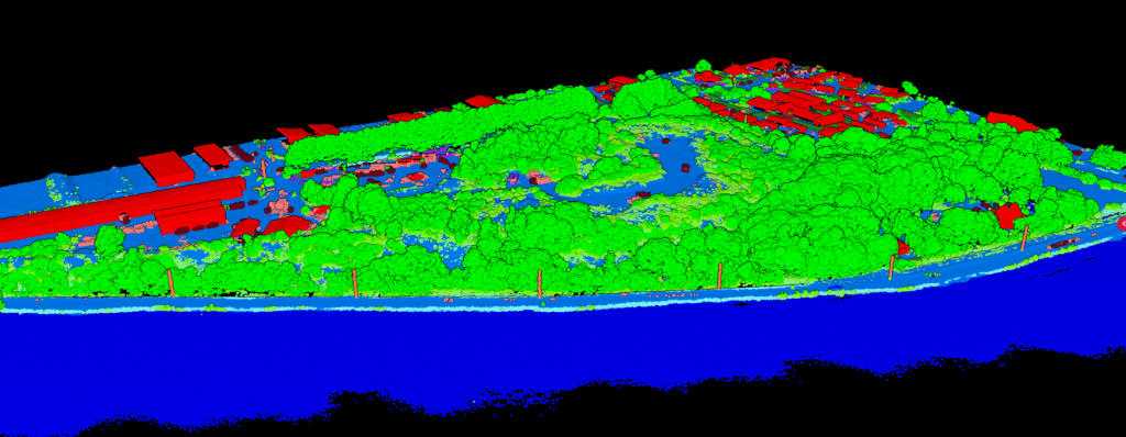
Demo 1 is a DJI drone survey of 18 hectares at Ouistreham, France. It opens in every Lidarvisor account, so you can switch each layer on and off yourself.
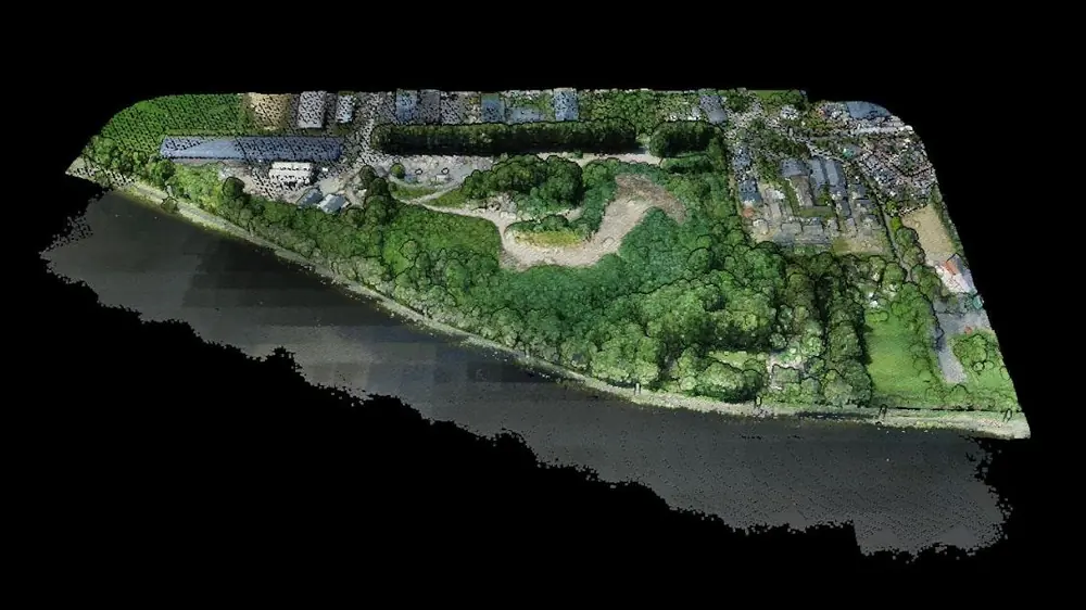
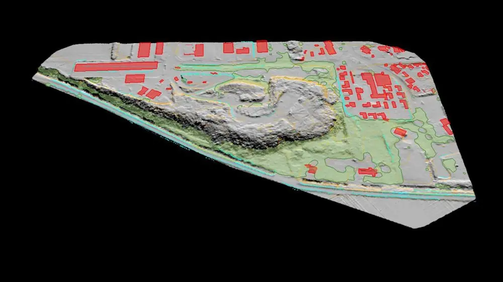
Both views come from the Lidarvisor viewer, from the same camera position, on 12 October 2026.
Feature counts of each layer in this project. The detailed and exhaustive breakline layers hold 63 and 226 lines; contours are 5 major lines at 5 m and 35 minor lines at 2 m.
| Output | Formats |
|---|---|
| Buildings, wooded areas, shoreline | DXF, Shapefile or GeoJSON |
| Contours and grid of spot heights | DXF, Shapefile or GeoJSON |
| Breaklines, three densities | DXF, Shapefile or GeoJSON |
| Topographic map | DXF drawing, plus a printable PDF sheet |
These are the files this project holds today. Demo projects download on every plan, the free one included.
The difference
Require you to set dozens of parameters: tree detection thresholds, building minimum areas, contour smoothing factors. Get one wrong, re-run everything. Hours of trial and error.
Learns from thousands of point clouds. It adapts to your terrain automatically: flat or steep, urban or rural, dense canopy or open field. Clean vectors on the first try.
Who it's for
Generate contours and TINs for topographic deliverables.
Extract tree inventories with CSV export and PDF reports.
Detect building footprints automatically.
Vectorize powerlines for clearance analysis.
Customer stories
The powerful classification is the best feature. It saves a lot of time and money compared to manual classification or expensive solutions.
 Emilio Segovia
We saved a lot of time classifying our point clouds. Not only classified data, but also DEM, DSM, DXF exports we could use directly in our analysis software.
 Marcel Aertssen
Excellent software. Processing is extremely fast and highly accurate. Exemplary DSM and DTM outputs.
 Theoharis Papadiamantis
Lidarvisor has transformed my LiDAR post-processing workflow. The speed of results is impressive, all the useful data is correlated, and what I find exceptional is the DXF export function.
 Carolina Collaro
We used to outsource our LiDAR processing. With Lidarvisor, we brought it in-house and cut our costs significantly while keeping full control over the workflow.
 Bodie Lloyd Kirori
We tested Lidarvisor and achieved excellent results using a single platform. Previously, we needed up to three different programs to get similar results, which took us far more time and effort.
 Eduardo Bonilla
Questions
All vectorized features export in DXF (compatible with AutoCAD and other CAD software), SHP (for GIS workflows), and GeoJSON formats. Choose the format that fits your workflow.
Breaklines mark the sharp changes in slope that contours alone miss: embankment tops and toes, ditch sides, terraces, rim crests and field edges. They are what makes a terrain model respect real terrain instead of smoothing across it, and they are normally traced by hand in CAD over a hillshade. Lidarvisor detects them from the terrain model directly and delivers three cumulative density levels, so you pick how much detail your deliverable needs.
It depends on whether the water fits inside your survey. Water fully enclosed by your coverage is returned as a closed polygon (a water body). Water that runs off the edge of the coverage is returned as an open line instead: a stream gives you two banks, a coastline gives you one. Both are delivered in the same formats as every other vector layer.
Our deep learning models have been trained on thousands of diverse point clouds: flat terrain, steep slopes, urban areas, rural landscapes, dense forests, and open fields. The AI adapts automatically without any parameter adjustments from you.
Yes. You can choose which features to extract: contours only, buildings only, trees only, or any combination. Each feature type exports as a separate layer for easy organization in your CAD/GIS software.
Our building detection includes intelligent orthogonalization that produces cleaner, more usable geometry even in dense urban areas with overlapping structures.
Yes. Tree detection exports include CSV data with coordinates, heights, and crown diameters, plus PDF reports for easy sharing with stakeholders.
Documentation
Step-by-step guides for every feature type, in our documentation.
Start with 50 Ha of free processing. No credit card required. See results in minutes.
Create free accountQuestions? Contact our team or check our pricing plans