
Land Surveyors
Survey-grade DTMs for topographic mapping, cut/fill and site planning.
Features
Point Cloud Viewer Point Cloud Preprocessing Point Cloud Classification Point Cloud Rasterization Point Cloud Vectorization Processing APIIndustry
Land Surveying Utility Vegetation Management Forestry Hydrology & WaterMore
Pricing Contact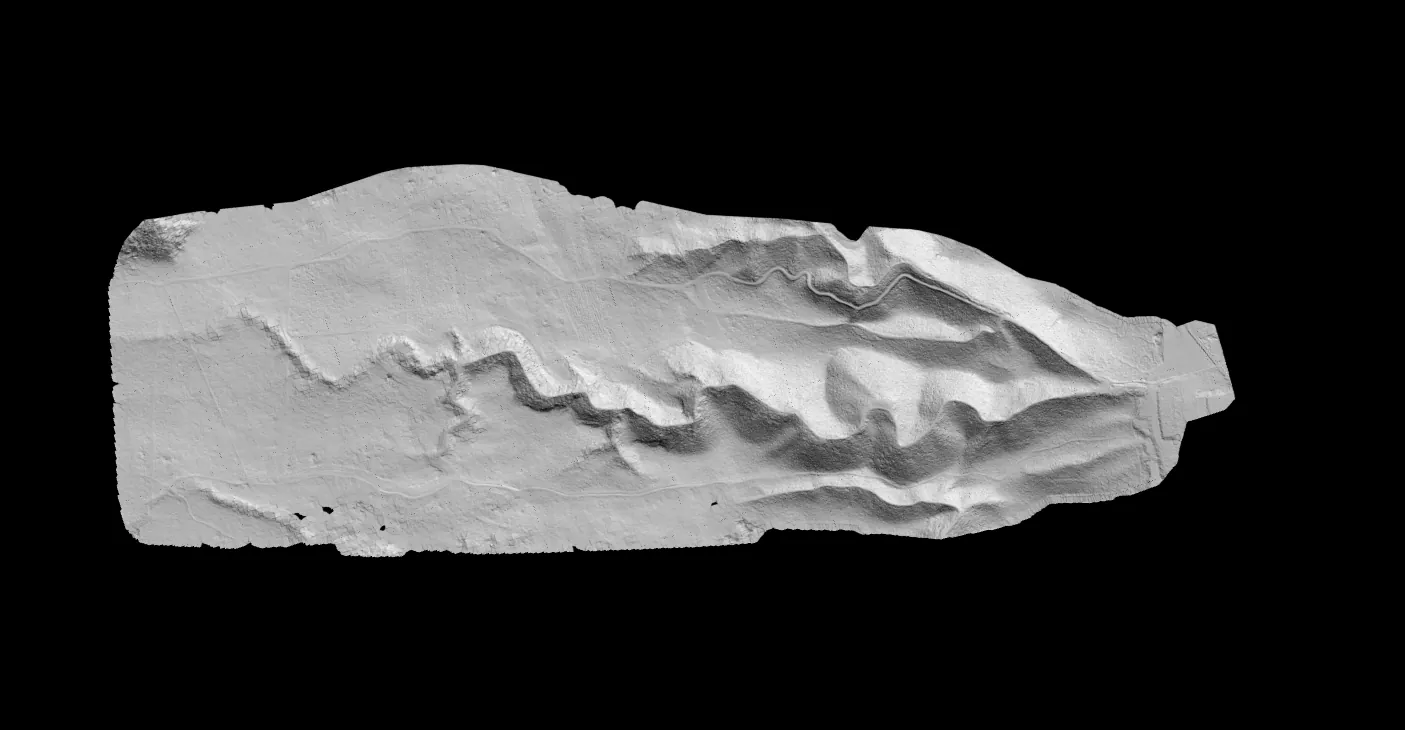
Terrain modeling
Upload LAS or LAZ data, classify ground automatically, and generate DTM, DSM, CHM, slope maps and TIN outputs — without desktop GIS setup or manual parameter tuning.
No credit card required • 50 hectares included
The outputs
All five generate in a single workflow, from the same classified point cloud.
Bare earth extraction
See the ground beneath the clutter.
Ground points are isolated automatically from vegetation, buildings and noise to give a clean bare-earth surface, with hillshade colourization for instant terrain visualisation.
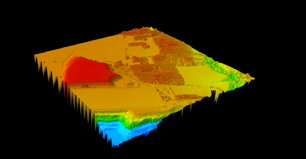
Surface elevation
Capture everything above ground level.
The DSM preserves the highest elevation at each location, including buildings, trees and infrastructure, with a smooth colour gradient so structures and canopy patterns read immediately.
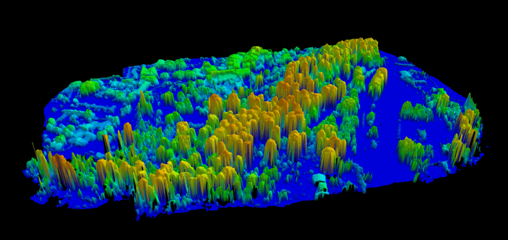
Vegetation analysis
Measure vegetation height across the whole site.
The CHM is computed automatically by subtracting DTM from DSM, giving the true height of vegetation, buildings and structures above ground. Essential for forestry, corridor analysis and vegetation management.
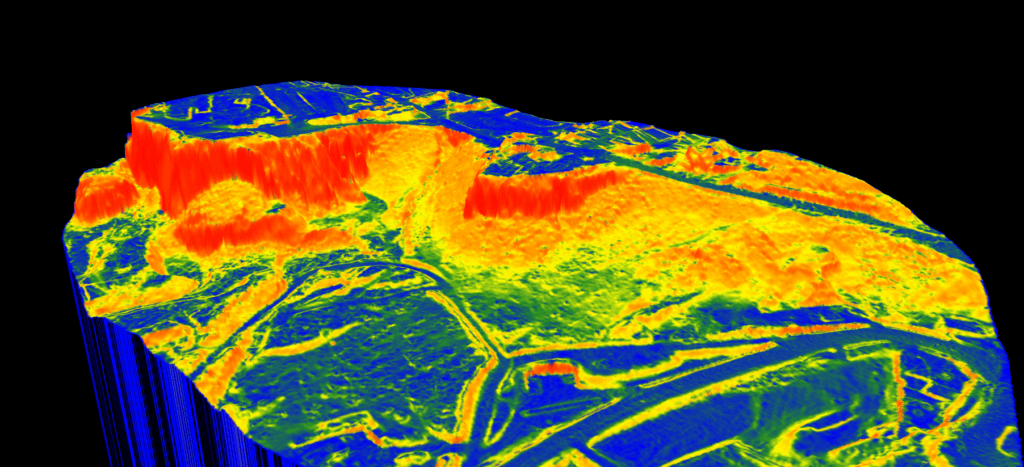
Terrain analysis
Visualize terrain steepness in one click.
Slope is calculated straight from your DTM and colour-coded by intensity — built for construction planning, erosion analysis, drainage studies and accessibility assessment.
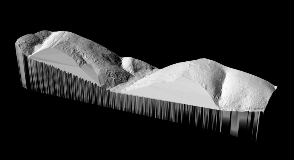
3D mesh generation
An accurate 3D mesh straight from the point cloud.
The TIN represents terrain as connected triangles that adapt to elevation change, giving a highly accurate 3D surface. Generated automatically, hillshaded for clarity, and exported for CAD.
Real project, real output
Demo 1 is a DJI drone survey of 18 hectares at Ouistreham, France, processed in one run with the topographic options. It opens in every Lidarvisor account, so you can check every layer yourself.
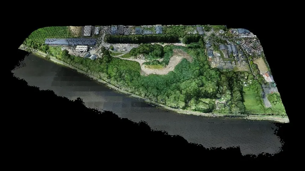
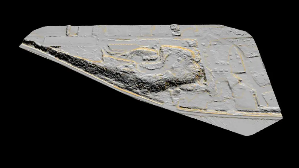
Both views come from the Lidarvisor viewer, from the same camera position, on 12 October 2026.
Figures from the project panel and its run settings. The run time covers every layer this project holds, not the terrain model alone.
| Output | Formats |
|---|---|
| Terrain model (DTM) | GeoTIFF elevation, plus a GeoTIFF hillshade |
| Surface model (DSM) | GeoTIFF elevation, colourised GeoTIFF and its legend |
| Slope map | GeoTIFF slope, colourised GeoTIFF and its legend |
| Contours, major and minor | DXF, Shapefile or GeoJSON |
| Breaklines, three densities | DXF, Shapefile or GeoJSON |
| Grid of spot heights | DXF, Shapefile or GeoJSON |
| Topographic map | DXF drawing, plus a printable PDF sheet |
| Classified point cloud | LAS, LAZ, COPC, E57 or PLY |
These are the files this project holds today. Demo projects download on every plan, the free one included.
The difference
Traditional terrain modeling takes hours of manual work. Lidarvisor does it in minutes.
Use cases
Survey-grade DTMs for topographic mapping, cut/fill and site planning.
CHM for canopy heights, timber volume and growth monitoring.
CHM for encroachment, clearance corridors and maintenance priority.
Slope maps for drainage analysis, grading and accessibility.
Customer stories
The powerful classification is the best feature. It saves a lot of time and money compared to manual classification or expensive solutions.
 Emilio Segovia
We saved a lot of time classifying our point clouds. Not only classified data, but also DEM, DSM, DXF exports we could use directly in our analysis software.
 Marcel Aertssen
Excellent software. Processing is extremely fast and highly accurate. Exemplary DSM and DTM outputs.
 Theoharis Papadiamantis
Lidarvisor has transformed my LiDAR post-processing workflow. The speed of results is impressive, all the useful data is correlated, and what I find exceptional is the DXF export function.
 Carolina Collaro
We used to outsource our LiDAR processing. With Lidarvisor, we brought it in-house and cut our costs significantly while keeping full control over the workflow.
 Bodie Lloyd Kirori
We tested Lidarvisor and achieved excellent results using a single platform. Previously, we needed up to three different programs to get similar results, which took us far more time and effort.
 Eduardo Bonilla
Questions
The DTM represents the bare earth surface with vegetation, buildings and other features removed. The DSM captures the highest point at each location, including everything above ground. Both are useful depending on the job: DTM for grading and earthwork, DSM for obstruction and visibility studies.
You choose the output resolution to match the project. Higher resolution gives more detail for small-area analysis; lower resolution suits large-area mapping where file size matters.
All raster outputs (DTM, DSM, CHM, slope) export as GeoTIFF, compatible with any GIS or CAD software. TIN exports as a raster TIFF, as vectors in DXF, Shapefile and GeoJSON, as a LandXML 1.2 surface read by Civil 3D, Carlson, Trimble Business Center and Bentley, or as OBJ and PLY meshes.
Automatically, by subtracting the DTM (ground surface) from the DSM (top surface). That gives the height of everything above ground level, including trees, buildings and other structures.
No. Upload your LAS file and the system generates every terrain output without parameter configuration. The algorithms are tuned to work with any standard aerial LiDAR dataset.
Documentation
How to create DTM, DSM and CHM outputs with Lidarvisor.
Upload your LAS or LAZ file and generate a DTM, DSM, CHM, slope map and TIN in minutes.
Create free accountQuestions? Contact our team or check our pricing plans