
Noise & outliers
Low points, atmospheric interference and sensor artefacts contaminate the data.
Features
Point Cloud Viewer Point Cloud Preprocessing Point Cloud Classification Point Cloud Rasterization Point Cloud Vectorization Processing APIIndustry
Land Surveying Utility Vegetation Management Forestry Hydrology & WaterMore
Pricing ContactPoint cloud preprocessing
Raw LiDAR is messy. Noise, excessive density and missing colour make analysis harder than it needs to be. Lidarvisor cleans and optimises your point clouds automatically, so every downstream step starts from better data.
No credit card required • 50 Ha of free processing
The problem
Traditional software answers these with hours of manual cleanup and parameter tweaking. Lidarvisor automates the whole preprocessing pass.
Low points, atmospheric interference and sensor artefacts contaminate the data.
Modern sensors capture millions of points per second, making files too large to process efficiently.
Monochrome point clouds are hard to interpret and hard to present to a client.
Minor variations produce rough terrain models that do not reflect reality.
What it does
Combine any of them in a single workflow — Lidarvisor sequences them for you.
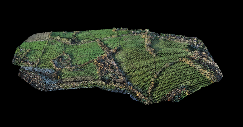
Surface smoothing
Reduce noise while preserving real terrain features.
Surface-aware smoothing with quadratic surface fitting smooths the cloud without destroying the detail that matters.
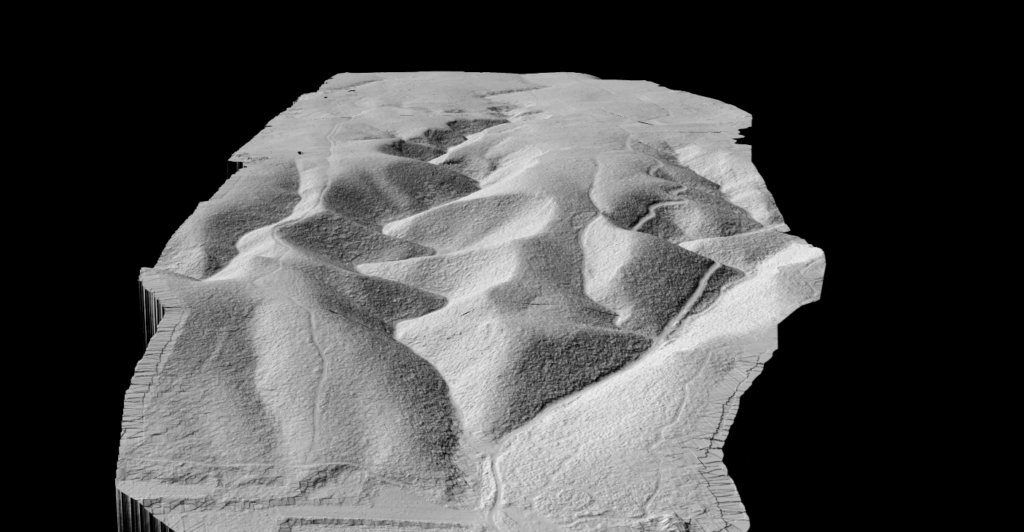
Density optimization
Reduce file size without losing data quality.
Grid-based subsampling removes redundant points while keeping the structure and accuracy of the cloud. Built for dense UAV and terrestrial scans.
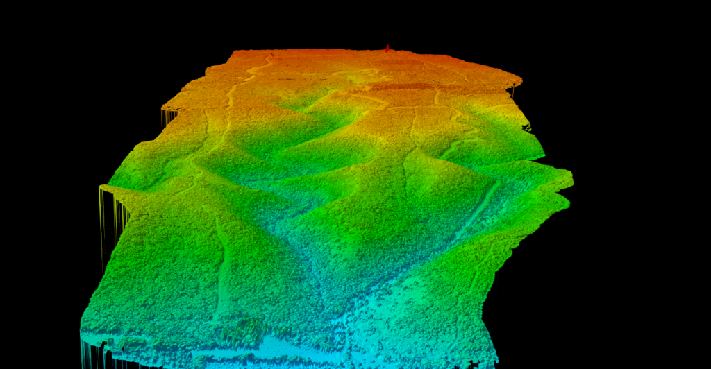
Satellite imagery
Turn a monochrome cloud into a full-colour 3D scene.
RGB colour is applied from satellite imagery automatically, making the data easier to interpret and far easier to present. No manual alignment.
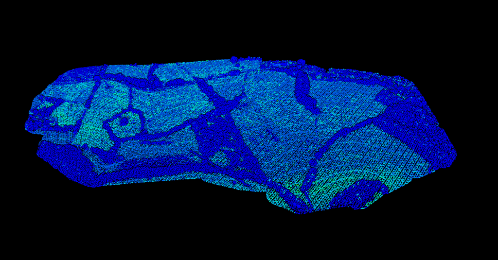
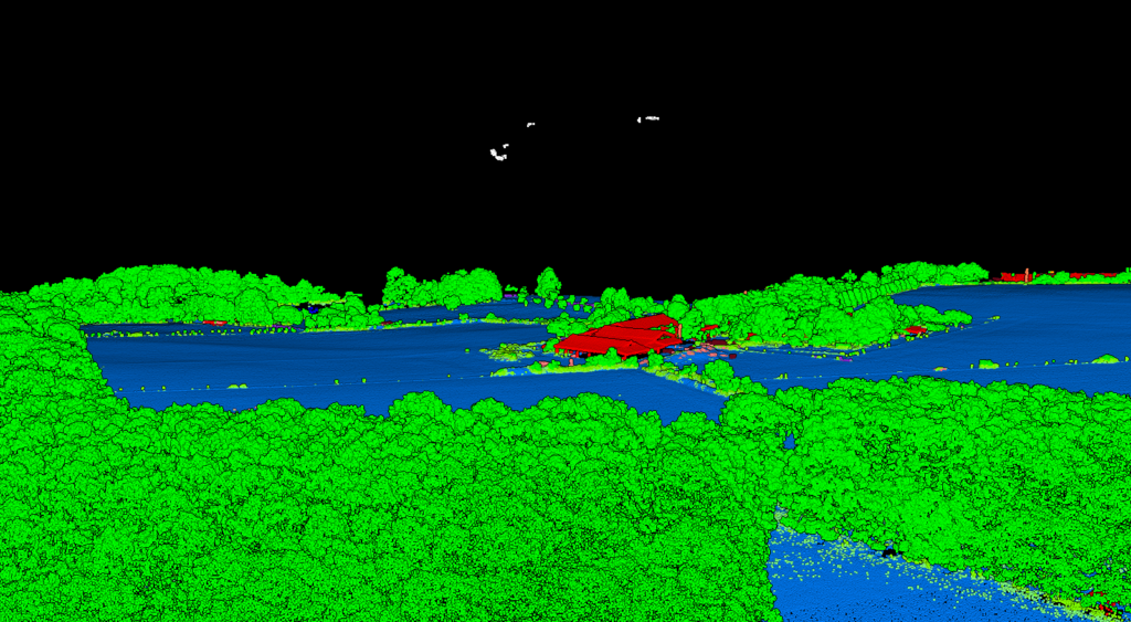
Outlier detection
Separate noise from valid data automatically.
Low points and high noise are detected and classified separately, so your analysis only ever runs on clean data.
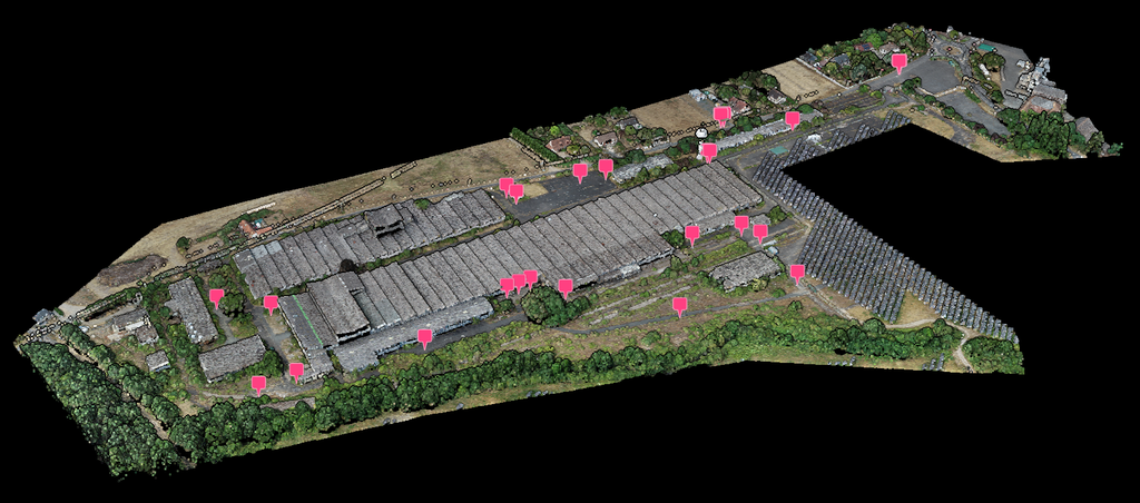
Ground control points
Anchor the cloud to your ground survey.
Import surveyed control points and Lidarvisor measures the cloud against them — every point checked individually, with its offset visible in the viewer. When a correction is worth applying, it is applied during processing.
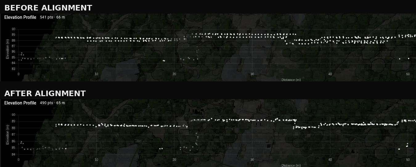
Flight line alignment
Even with a post-processed trajectory, individual passes can disagree with each other by anything from 5 to 50 cm where they overlap. That step goes straight into the terrain model, the contours, the breaklines and the volumes — and nothing further down the pipeline can see it. Tick Align Flight Lines and Lidarvisor finds the passes, measures how well each one fits its neighbours, and corrects the ones that are clearly out.
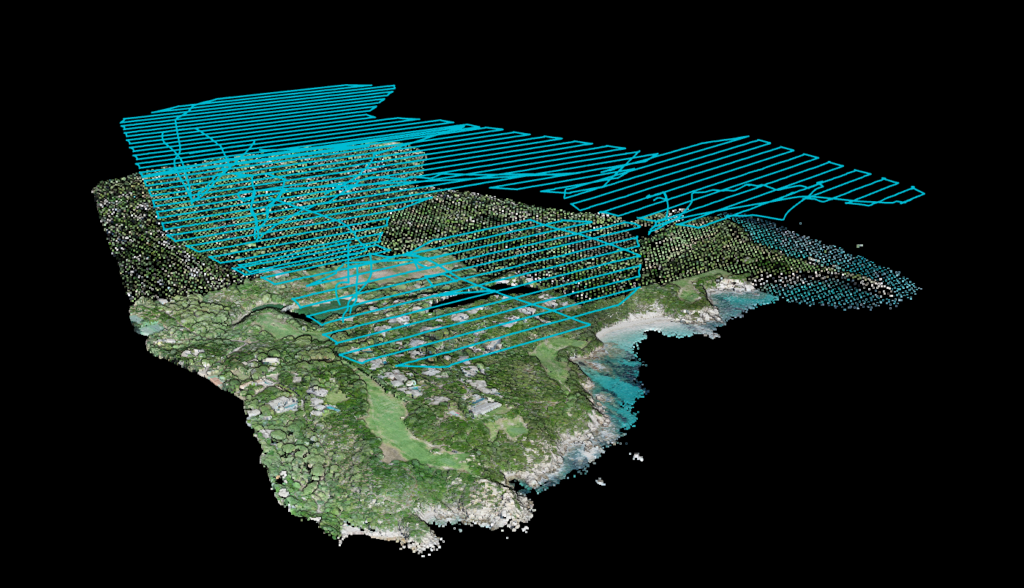
Finding the passes
Works from the point cloud on its own.
Most software records which pass each point came from, and when it is there, Lidarvisor uses it. When it is not, the passes are recovered from the data itself — GPS time, scan angle and the heading of the track. A LAS or LAZ on its own is enough.
Verdict and correction
Only the lines that are genuinely out get moved.
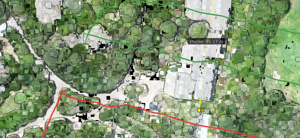
Every overlapping pair of passes is compared, then the whole set is solved together, so a disagreement is charged to the line that is actually wrong rather than to its neighbour. The detection floor is measured on your own survey, and nothing below it is ever reported as a finding. The lines then become a layer you can look at: green where a pass fits its neighbours, amber where it sits close to the threshold, red where it is out, grey where the overlaps disagree too much to judge.
How it works
LAS, LAZ or any other supported format.
Pick smoothing level, thinning grid and colorization.
Lidarvisor runs it automatically — no parameters to tune.
Export clean, optimised data ready for analysis.
Who it's for
Smooth ground points for accurate terrain models.
Thin dense scans for faster processing.
Colourized point clouds a client can actually read.
Remove noise before analysis so results hold up.
Questions
No. Lidarvisor always preserves your original point cloud. Preprocessing creates a new, optimised version while keeping the original intact, and you can download either at any time.
It uses quadratic surface fitting that adapts to local geometry. The algorithm smooths noise while respecting terrain breaks, edges and real surface variation, and displacement limits prevent over-smoothing.
You configure the grid size in centimetres. Common values run from 5 to 50 cm depending on your accuracy requirements and target file size. Smaller grids retain more detail; larger grids produce smaller files.
Satellite imagery from Azure Maps. The system georeferences your point cloud coordinates against the imagery and applies RGB values per point. No manual alignment is needed.
Yes. Smoothing, thinning, colorization and noise removal can be combined in a single workflow, and Lidarvisor applies them in the optimal order automatically.
Yes. Tick Align Flight Lines and Lidarvisor finds the passes in your cloud, compares every overlapping pair and gives each line its own verdict. Lines that are clearly out are corrected before classification, so everything built afterwards comes off the corrected data; lines that already fit are left alone. It needs at least three overlapping lines — with only two there is no way to tell which of the pair is the one that moved.
No. Alignment works from the point cloud on its own, which is the normal case. Adding the post-processed trajectory — one file per flight, POSPac sbet.out or sbet.txt, or DJI Terra POS — makes the flight lines more exact and lets Lidarvisor tell you whether a misaligned line came from a poor navigation solution, in which case it needs re-flying rather than correcting.
No. Credits are counted on the area you process, whichever options you tick, so alignment never adds a line item. That also means the module can look, find nothing, and say so without it costing you anything.
Yes. Import the control points from your ground survey and Lidarvisor checks the cloud against them automatically. If a correction helps, it recommends one — from a simple vertical shift to a full local fit — and applies it during processing. A correction is only ever applied when it measurably improves the result. The ground control points guide walks through the whole flow, from the file your instrument exports to the accuracy statement in your report.
No. Importing control points and the automatic accuracy check are free. Only the alignment itself runs as part of a normal processing run, and the delivered report then states the accuracy that was actually measured against your points.
Documentation
How to preprocess and clean your point clouds in Lidarvisor.
Every Lidarvisor account includes full access to the preprocessing tools. Start with 50 Ha of free processing.
Start freeQuestions? Contact our team or check our pricing plans