
DXF — CAD workflows
Opens directly in AutoCAD, Civil 3D, MicroStation, BricsCAD and DraftSight. No conversion step.
Features
Point Cloud Viewer Point Cloud Preprocessing Point Cloud Classification Point Cloud Rasterization Point Cloud Vectorization Processing APIIndustry
Land Surveying Utility Vegetation Management Forestry Hydrology & WaterMore
Pricing ContactLiDAR for land surveying
Turn your LiDAR point clouds into professional DTMs, contour lines, slope maps and vector exports in DXF, SHP and GeoJSON. No desktop software required.
No credit card required • 50 hectares included

The problem
The deliverables
Terrain models
Clean terrain models you can trust.
Ground is separated from vegetation, buildings and noise without manual parameter tuning, ready for engineering and design work.
Vectorization
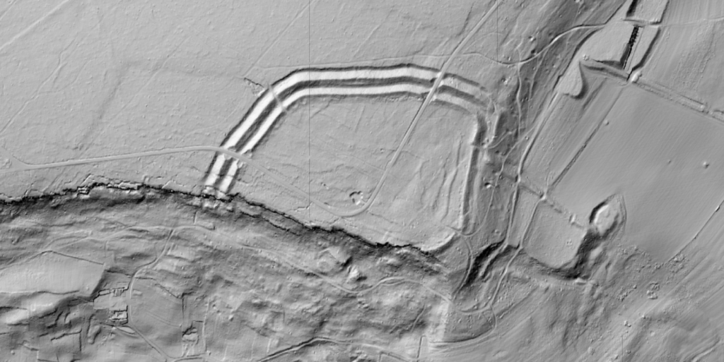
From elevation data to a contour map.
Generate contours directly from the processed terrain, choose your interval, and download in the format your client expects.
Terrain analysis
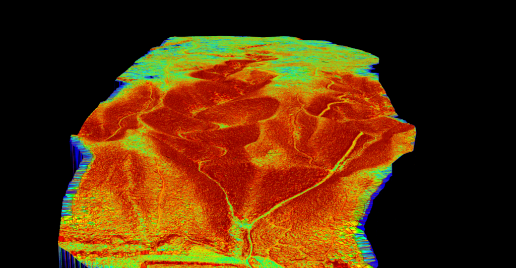
Complete terrain characterisation.
Visualize slope for drainage analysis, erosion assessment and site suitability. Slope complements your elevation data rather than replacing it.
Automatic vectorization
Every one is CAD and GIS ready in DXF, Shapefile or GeoJSON. To take them all the way to a drawing, read how to convert a point cloud to CAD.
| Output | What you get | Derived from |
|---|---|---|
| Contour lines | Customizable intervals from 0.1 m | DTM |
| Breaklines | Embankments, ditches, terraces, rim crests | DTM |
| Building footprints | Orthogonalized polygons with clean right angles | Point cloud |
| Tree crowns & tops | Crown polygons and tree-top points | CHM |
| Power lines | 3D conductors with span, sag and clearance | Point cloud |
| Towers & poles | Support positions with type, height and lean | Point cloud |
| Roads | Edge line extraction (beta) | Point cloud |
| Road markings | Painted lines, crossings and arrows as typed outlines (beta) | Orthophoto or point colour |
| Gridded DTM | Regular grid points for direct CAD import | DTM |
Export formats
Download all three from the same processed dataset — no need to reprocess.
Opens directly in AutoCAD, Civil 3D, MicroStation, BricsCAD and DraftSight. No conversion step.
The universal GIS format. ArcGIS Pro, QGIS and GRASS, with full attribute tables and projection support.
The modern standard for web mapping. Mapbox, Leaflet, OpenLayers and Google Earth. Human-readable.
How it works
Drag and drop LAS files up to 250 GB or LAZ up to 50 GB. No format conversion needed.
The cloud is classified automatically: ground, vegetation, buildings and noise, all separated.
Download in DXF, SHP or GeoJSON. Works with CAD, GIS and web platforms.
Use cases
Accurate terrain models for boundary surveys, site plans and ALTA/NSPS work.
DTMs and contours for grading plans, earthwork calculations and staking.
High-resolution terrain for drainage studies and flood risk assessment.
Stockpile and excavation surveys with accurate ground for cut/fill analysis.
Customer stories
The powerful classification is the best feature. It saves a lot of time and money compared to manual classification or expensive solutions.
 Emilio Segovia
We saved a lot of time classifying our point clouds. Not only classified data, but also DEM, DSM, DXF exports we could use directly in our analysis software.
 Marcel Aertssen
Excellent software. Processing is extremely fast and highly accurate. Exemplary DSM and DTM outputs.
 Theoharis Papadiamantis
Lidarvisor has transformed my LiDAR post-processing workflow. The speed of results is impressive, all the useful data is correlated, and what I find exceptional is the DXF export function.
 Carolina Collaro
We used to outsource our LiDAR processing. With Lidarvisor, we brought it in-house and cut our costs significantly while keeping full control over the workflow.
 Bodie Lloyd Kirori
We tested Lidarvisor and achieved excellent results using a single platform. Previously, we needed up to three different programs to get similar results, which took us far more time and effort.
 Eduardo Bonilla
Questions
Upload point clouds in LAS, LAZ or COPC. Export results as LAS, DTM/DSM rasters in GeoTIFF, or vectors in DXF (for AutoCAD and Civil 3D), Shapefile (for ArcGIS and QGIS) and GeoJSON (for web mapping).
DXF for CAD users, Shapefile for GIS professionals who need full attribute support, GeoJSON for web developers and collaboration tools. You can download all three from the same processed dataset without reprocessing.
The models are trained on diverse aerial LiDAR datasets and achieve high accuracy across terrain types, from flat urban areas to steep forested slopes. They handle edge cases that trip up rule-based systems, giving reliable results on the first try.
Yes. Specify the interval you want when generating contours. They are produced directly from your terrain model and exported in DXF, Shapefile or GeoJSON.
It depends on file size and point density, but most datasets classify within 5 to 15 minutes. Large projects take longer, and you get an email when processing completes.
No. Lidarvisor is entirely web-based. Open your browser, upload, and process. No plugins, no installation, no configuration.
Stop wrestling with desktop software. Upload your point cloud, export to DXF, Shapefile or GeoJSON, and deliver. Start with 50 hectares free.
Get started freeNo credit card required. No software to install. Contact our team or check our pricing plans