
Tutorials,Learn LiDAR
Automatic Vectorization for CAD: Point Clouds to DXF
Automatic vectorization converts dense point cloud data into clean vector geometry — lines, polylines, polygons — that can be used directly in CAD software like AutoCAD, Civil 3D, or MicroStation.
No credit card required • 50 hectares included
Why Vectorization Matters
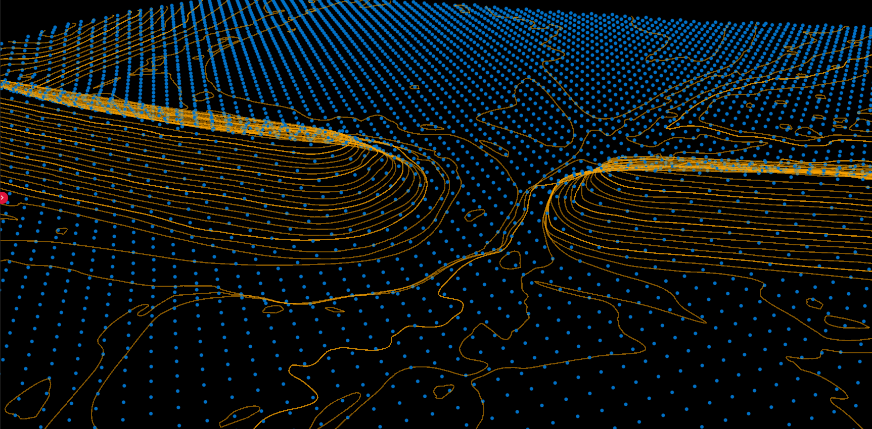
Point clouds contain millions of individual points — powerful for visualization but difficult for design work. CAD applications need defined geometry:
- Property boundaries
- Building footprints
- Contour lines
- Road edges
- Utility locations
Vectorization bridges the gap between raw 3D survey data and production-ready deliverables.
2D and 3D Vector Outputs
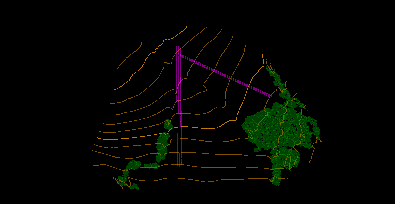
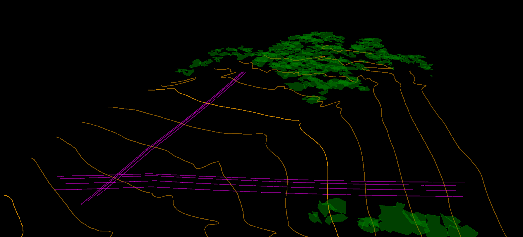
Modern vectorization software generates both 2D and 3D deliverables:
2D Outputs:
- Planimetric maps with contours
- Building footprint polygons
- Road and parcel boundaries
3D Outputs:
- 3D building models with heights
- TIN surfaces for terrain
- 3D breaklines at true elevation
Benefits of Automatic Vectorization
Time Savings
Hours instead of days of manual tracing. Process large areas efficiently.
Consistency
Uniform linework quality across entire projects and multiple operators.
Accuracy
Algorithm-derived geometry directly from source data without interpretation.
Building Footprint Extraction
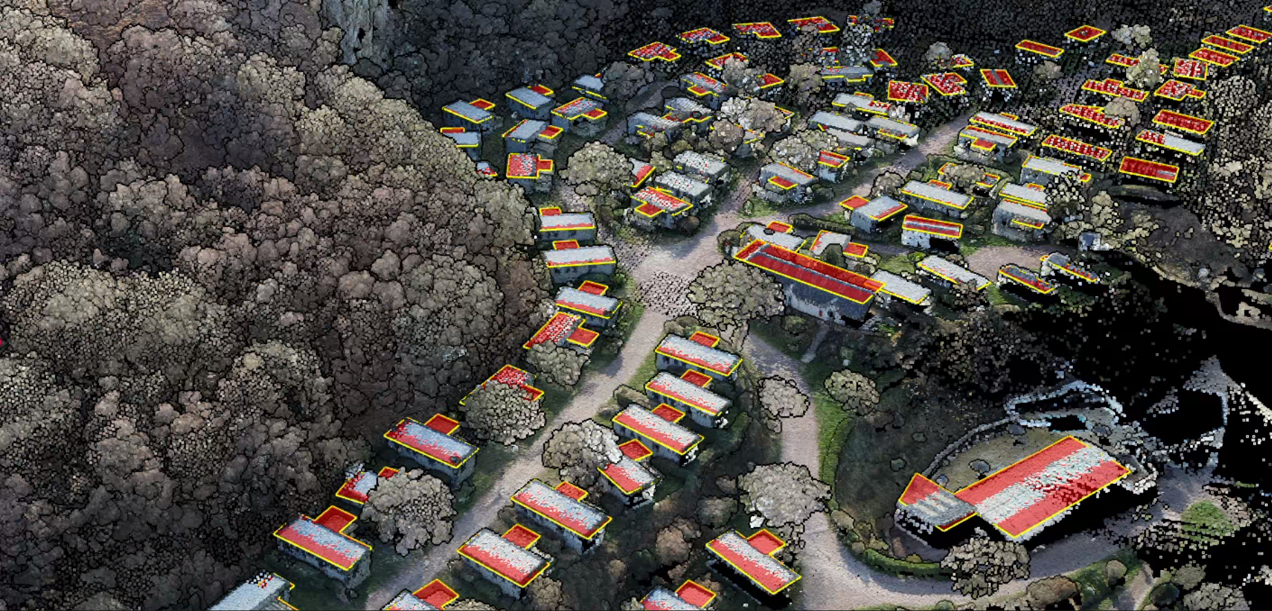
Automated building footprint extraction creates CAD-ready polygons from classified point clouds:
- Roof perimeter detection from building-classified points
- Regularization — straightening edges to architectural standards
- Height attributes — building elevation data preserved
- LOD1/LOD2 models — extruded 3D building geometry
Perfect for urban planning, digital twins, and municipal GIS databases.
Types of Vector Features
Contour Lines
Connect points of equal elevation representing terrain shape:
- Major contours: Index lines at regular intervals (5m, 10m)
- Minor contours: Intermediate detail (1m, 2m)
- Supplementary: Half-interval for flat terrain
CAD output: Polylines at specific elevations with attributes
Building Footprints
Outlines extracted from classified point clouds:
- Roof perimeter outlines
- Simplified/regularized polygons
- 3D extruded models with heights
Breaklines
Critical terrain features that control surface modeling:
- Ridge lines and valley bottoms
- Road edges and curbs
- Retaining walls and embankments
Utility Features
Linear infrastructure extracted from point clouds:
- Power line conductors
- Tower/pole locations
- Pipeline routes
Output Formats
DXF/DWG
AutoCAD native format with layers, attributes, and 3D geometry
Shapefile
GIS standard for attribute-rich vector data with projection info
GeoJSON
Web-friendly format for modern GIS applications
Related Articles
Processing & Software
• Best LiDAR Software • Open Source Software • Processing Costs • Point Cloud Cleaning • Point Cloud to CAD
LiDAR Fundamentals
• What is a Point Cloud? • How Does LiDAR Work? • LiDAR Resolution • LiDAR Accuracy • Multi-Return LiDAR
Generate CAD-Ready Vectors Automatically
LidarVisor extracts contours, building footprints, and breaklines from your point clouds automatically. Export to DXF, Shapefile, or GeoJSON for direct use in CAD and GIS workflows.
Create free account50 hectares free. No credit card. No software to install.