
Learn LiDAR
ASPRS LiDAR Classification Codes: LAS 1.4 Classes 0-255 Quick Reference
Manual point cloud classification gets easier when you can check ASPRS codes fast.
No credit card required • 50 hectares included
Use this quick reference for class 2 ground, class 6 building, class 9 water, class 14 wire conductor, class 15 transmission tower, and the extended LAS 1.4 codes, then see how to automate classification in minutes.
Use this ASPRS class quick reference to check common LAS 1.4 codes fast, including class 2 ground, class 6 building, class 9 water, class 14 wire conductor, class 15 transmission tower, and the reserved or user-definable ranges. Then see how Lidarvisor helps teams move from code lookup into production classification workflows.
Before: Raw RGB Point Cloud
What Are LiDAR Classification Codes?
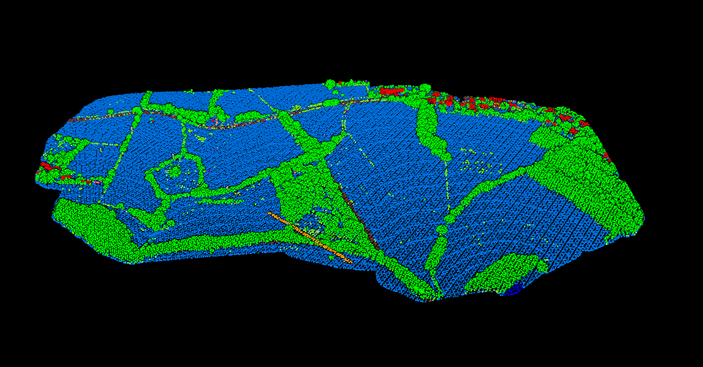
Every point in a LiDAR point cloud can have a classification code that defines the type of object that reflected the laser. When a LiDAR sensor fires a pulse, it measures the return signal, but it doesn’t inherently know if that return came from the ground, a tree, a building, or a power line.
Classification is the process of assigning meaning to each point. This transforms raw point clouds into actionable geospatial data that can be used to create Digital Terrain Models (DTMs), extract features, and perform analysis.
ASPRS Standard Classification Codes (LAS 1.4)
The ASPRS defines the standard classification scheme used in LAS format files (versions 1.1 through 1.4). LAS 1.4 is the current standard and supports classification values from 0 to 255.
Core Classification Codes (0-18)
| Code | Classification | Description |
|---|---|---|
| 0 | Never Classified | Points that have not been processed through any classification algorithm |
| 1 | Unassigned | Points processed but not assigned to a specific class |
| 2 | Ground | Bare earth surface points, essential for DTM creation |
| 3 | Low Vegetation | Grass, crops, and vegetation under 0.5 meters |
| 4 | Medium Vegetation | Shrubs and vegetation between 0.5 and 2 meters |
| 5 | High Vegetation | Trees and vegetation above 2 meters |
| 6 | Building | Roof surfaces and building structures |
| 7 | Low Point (Noise) | Low outliers, typically errors or ground clutter |
| 8 | Reserved | Model Key-point in older specs (reserved in LAS 1.4) |
| 9 | Water | Water surfaces (lakes, rivers, ponds) |
| 10 | Rail | Railway tracks |
| 11 | Road Surface | Paved road surfaces |
| 12 | Reserved | Overlap points in older specs (reserved in LAS 1.4) |
| 13 | Wire – Guard | Shield wires on power lines |
| 14 | Wire – Conductor | Phase/conductor wires carrying electricity |
| 15 | Transmission Tower | Power line towers and poles |
| 16 | Wire Connector | Insulators and connectors on power infrastructure |
| 17 | Bridge Deck | Bridge surfaces |
| 18 | High Noise | High outliers, typically atmospheric interference or birds |
Extended and User-Defined Codes (19-255)
LAS 1.4 reserves codes 19-63 for future ASPRS definitions and allows codes 64-255 for user-defined classifications. Common extended classifications include:
- 19: Conveyor / Overhead Machinery – Elevated industrial equipment (mining sites)
- 20: Ignored Ground – Ground points near breaklines (USGS specification)
- 21: Snow – Snow-covered surfaces
- 22: Temporal Exclusion – Points to exclude from temporal analysis
Classification Flags
Beyond numeric codes, LAS files (version 1.1+) support classification flags that provide additional metadata for each point:
- Synthetic – Point created from other sources (e.g., photogrammetry), not from LiDAR collection
- Key-point – Important point that should not be removed during thinning
- Withheld – Point should be excluded from processing
- Overlap – Point within overlapping flight lines (LAS 1.4 only)
These flags can be combined with classification codes. For example, a water point (code 9) can also be flagged as withheld to exclude it from terrain modeling while keeping it in the dataset.
How Automated Classification Works
Modern LiDAR processing software uses algorithms to automatically classify point clouds. The general workflow follows these steps
1. Ground Classification
Ground classification is typically performed first, as it forms the foundation for other classifications. Algorithms analyze the geometric relationship between points, identifying the lowest points that form a continuous surface as ground (class 2).
2. Above-Ground Features
Once ground is established, points above ground are classified based on height, shape, and spatial patterns. Vegetation by height bands, buildings by planar surfaces, and power lines as linear suspended features.
3. Noise Removal
Outlier detection algorithms identify points that are statistical anomalies, classifying them as low noise (class 7) or high noise (class 18) to clean the dataset for analysis.
Skip the Manual Work
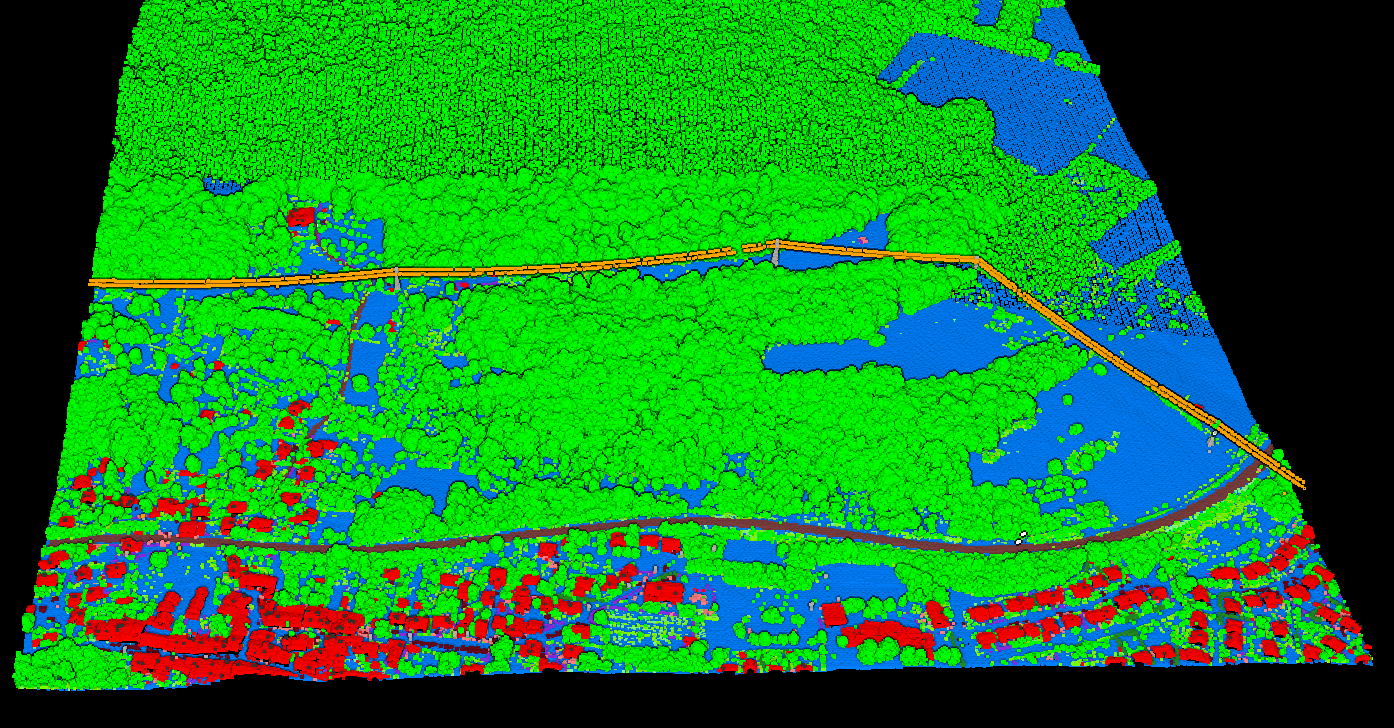
Lidarvisor automates point cloud classification using AI. Upload your data, get ASPRS-compliant classified outputs in minutes.
No software to install, no parameters to tune. Need to reassign specific points?
Built-in manual tools (brush selection, class permutation, filtering) let you refine results without leaving the platform.
Lidarvisor AI Output
Lidarvisor Classification Output
Lidarvisor’s AI-powered classification automatically identifies 12+ classes from aerial LiDAR data
| Lidarvisor Class | ASPRS Code | Use Case |
|---|---|---|
| Ground | 2 | DTM generation, terrain analysis |
| Low Vegetation | 3 | Agricultural analysis, ground cover |
| Medium Vegetation | 4 | Shrub detection, landscaping |
| High Vegetation | 5 | Forest inventory, tree canopy analysis, carbon estimation |
| Building | 6 | Building footprint extraction, urban mapping |
| Water | 9 | Hydrology, flood modeling |
| Wire | 14 | Power line mapping, vegetation management |
| Tower | 15 | Infrastructure inventory |
| Bridge Deck | 17 | Transportation infrastructure |
| Vehicle | User-defined | Point cloud cleaning (remove temporary objects) |
| Pole | User-defined | Utility pole detection |
| Fence/Wall | User-defined | Property boundary detection |
The classified point cloud can be exported as a LAS file with standard ASPRS codes, ensuring compatibility with any GIS or CAD software.
Why Classification Matters
Proper classification transforms raw point clouds into usable geospatial products
Digital Terrain Models (DTM)
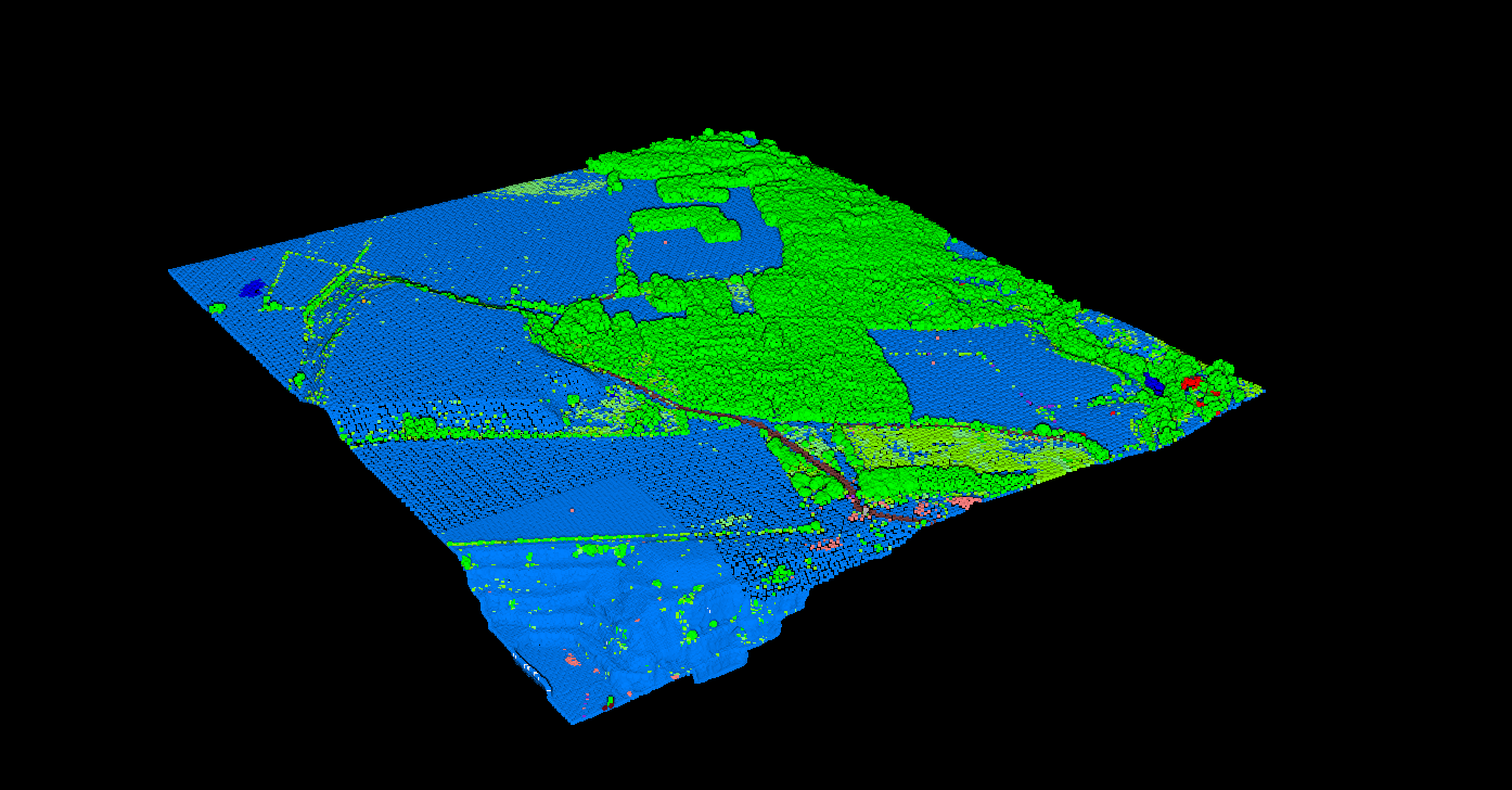
Ground-classified points (class 2) are used to create bare-earth terrain models. Without accurate ground classification, DTMs will include buildings, trees, and other features, making them unusable for hydrology, civil engineering, or site planning.
Digital Surface Models (DSM)
DSMs use the highest points (first returns) regardless of classification, capturing the top of buildings, vegetation, and other features. The difference between DSM and DTM reveals feature heights.
Common Classification Challenges
Dense Urban Areas
Buildings close together, narrow streets, and complex rooftop structures can confuse classification algorithms. Multi-level parking structures and elevated roads add complexity.
Steep Terrain
On hillsides and cliffs, the geometric assumptions used for ground classification may fail, sometimes classifying exposed rock faces as buildings.
Mixed Vegetation
Orchards, vineyards, and manicured landscapes blur the boundaries between vegetation height classes, requiring careful parameter tuning.
Related Articles
Point Cloud Classification
• Classification Guide • Classification Methods • What is Classification? • Classification Software
Terrain & Elevation
• DTM Guide • DSM Guide • DEM Guide • DTM vs DSM • Hillshade Maps
Get Classified Point Clouds in Minutes
LiDAR classification codes are the foundation of point cloud analysis. With Lidarvisor, skip the manual classification workflow entirely. Upload your data, let the AI handle ground, vegetation, buildings, and infrastructure classes, then download ASPRS-compliant LAS files ready for your GIS or CAD software.
Create free account50 hectares free. No credit card. No software to install.