
Learn LiDAR
Drone LiDAR Software: UAV LiDAR Systems & Processing Guide
Sensors, Flight Planning & Processing Workflows
No credit card required • 50 hectares included
Drone LiDAR software helps survey teams turn UAV point clouds into terrain models, contours, classified outputs, and CAD or GIS deliverables. This guide covers sensors, aircraft choices, flight-planning considerations, and the processing workflows that matter after the flight.
What is a LiDAR Drone?
A LiDAR drone is any unmanned aircraft equipped with a LiDAR sensor. The sensor emits thousands of laser pulses per second, measuring the time it takes for each pulse to return after hitting a surface.
This creates a dense point cloud with precise XYZ coordinates for every measured point.
Unlike traditional airborne LiDAR mounted on manned aircraft, drone-based systems fly at lower altitudes (typically 50-150m AGL), enabling higher point densities and the ability to access areas where larger aircraft cannot operate.
Key Advantages of Drone LiDAR
Vegetation Penetration
Multiple returns capture both canopy and ground surface through dense vegetation
High Point Density
100-500+ points per square meter at typical flying heights
Works in Any Lighting
Unlike photogrammetry, LiDAR operates in low light, shadows, or darkness
Direct Georeferencing
Combined GNSS/IMU provides accurate positioning without ground control points
Fast Data Acquisition
Cover large areas per day depending on terrain and accuracy requirements
Low-Altitude Detail
Flying close to the ground captures small features that crewed aircraft surveys average out.
How UAV LiDAR Systems Work
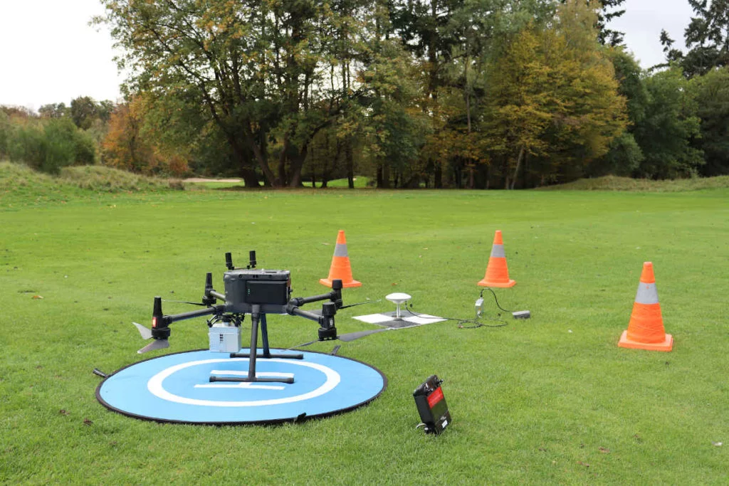
A complete drone LiDAR system consists of several integrated components working together:
LiDAR Sensor: Emits and receives laser pulses at 100,000 to over 1 million pulses per second.
GNSS Receiver: High-precision GPS/GLONASS/Galileo receiver records sensor position. PPK or RTK correction achieves centimeter-level positioning.
IMU: Records orientation (pitch, roll, yaw) at high frequency for accurate pulse direction calculation.
Drone Platform: Provides stable platform with sufficient payload capacity (500g to 3kg+).
Best LiDAR Sensors for Drones
The UAV LiDAR market offers options from affordable entry-level systems to high-end professional equipment.
DJI Zenmuse L2
DJI’s flagship LiDAR payload for the Matrice 350 RTK. Features 240,000 pts/sec repetition rate, 450m detection range, and integrated 4/3 CMOS camera for true color point clouds.
DJI Zenmuse L1
Previous generation still widely used. Lower specifications than L2 but more accessible price point. Compatible with M300 RTK and M350 RTK platforms.
RIEGL miniVUX Series
Professional-grade sensors known for exceptional accuracy and online waveform processing. Higher price but industry-leading specifications for demanding survey applications.
YellowScan
French manufacturer offering integrated systems including Mapper, Vx, and Explorer. Known for robust hardware and included processing software. Popular among commercial operators.
Livox Sensors
Budget-friendly options including Avia and Mid-360. Non-repetitive scanning patterns achieve good coverage. Often integrated into third-party payloads.
Phoenix LiDAR
US-based manufacturer with systems from survey-grade to bathymetric. The miniRANGER and TerraHawk series serve different accuracy and budget requirements.
Best Drones for LiDAR Mapping
Not every drone can carry a LiDAR payload. The aircraft needs sufficient lift capacity, stable flight characteristics, and RTK/PPK positioning capability
DJI M350 RTK
2.7kg payload, 55min flight, native L1/L2 support
Freefly Astro
NDAA-compliant, modular design for third-party payloads
IF800 Tomcat
US-built, government & defense applications
Fixed-Wing
WingtraOne, eBee X for large area coverage
Why drone surveying software shortlists are splitting in 2026
Buyer shortlists are no longer just comparing flight apps or sensor bundles. Survey teams now separate capture software from post-flight LiDAR processing software because the work that matters after collection is different: QA, classification, terrain outputs, corridor review, and CAD or GIS handoff.
That split is showing up across current vendor coverage. LP360 continues to publish drone-user and raw-processing workflow updates around DJI L1/L2 and trajectory processing, while DJI keeps the emphasis on capture hardware and mission ecosystems.
For teams processing mixed vendor datasets, the practical question becomes whether the software can open the point cloud quickly, verify classification, and deliver DTM, DSM, contours, and vector outputs without locking the workflow to a single sensor stack.
Lidarvisor fits the post-flight side of that shortlist. It helps teams review, classify, and export deliverables from drone LiDAR projects in the browser after the flight is done.
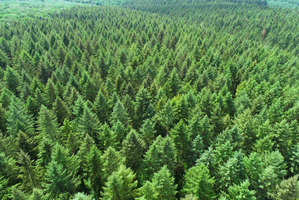
UAV LiDAR excels in scenarios requiring accurate terrain measurement, especially under vegetation.
Already collecting drone LiDAR data?
Process your first 50 hectares free with Lidarvisor
LiDAR Drone Applications
Topographic Surveying
Creating accurate digital terrain models (DTM) for engineering design, land development, and construction. LiDAR captures ground surface even in forested areas where photogrammetry fails.
Forestry & Vegetation
Forest inventory applications measure tree heights, crown dimensions, and stem density. Utility vegetation management identifies clearance risks along power corridors.
Mining & Earthworks
Stockpile measurement, pit surveys, and progress monitoring benefit from LiDAR’s ability to capture accurate elevations regardless of surface texture or lighting conditions.
Corridor Mapping
Pipelines, transmission lines, roads, and railways are efficiently surveyed with drone LiDAR. Linear flight paths maximize coverage efficiency.
Archaeological Survey
LiDAR reveals hidden structures beneath forest canopy, enabling discovery of previously unknown archaeological sites.
Stockpile Volumes
Repeatable surface models for measuring material volumes on quarry and construction sites.
LiDAR Drone vs Photogrammetry Drone
Both technologies create 3D point clouds, but with fundamental differences
| Factor | LiDAR Drone | Photogrammetry Drone |
|---|---|---|
| Vegetation penetration | Yes (multiple returns) | No (surface only) |
| Lighting requirements | Works in any conditions | Requires good lighting |
| Ground control points | Optional with PPK/RTK | ~ Usually required |
| Texture/color | ~ Limited (intensity, optional RGB) | Full RGB imagery |
| Processing time | Faster classification | Longer processing |
| Best for | Terrain under vegetation, utilities | Urban mapping, stockpiles |
Many professionals use both technologies. Learn more about LiDAR vs photogrammetry to understand when each is appropriate.
Processing Drone LiDAR Data
Raw drone LiDAR data requires processing before creating usable deliverables. A practical UAV LiDAR workflow usually looks like this:
01 PPK/RTK correction: Combine the flight trajectory with base station GNSS to georeference the point cloud accurately.
02 Point cloud cleaning: Remove noise, bad returns, and strip-edge artifacts before classification.
03 Classification: Separate ground, vegetation, buildings, poles, and other classes needed for analysis.
04 Surface generation: Build a bare-earth DTM and, when needed, a DSM for structures and canopy.
05 Deliverable export: Create contours, GeoTIFF rasters, DXF linework, and other CAD/GIS-ready outputs.
Read our complete drone LiDAR processing guide for step-by-step workflows, classification details, and export guidance.
What Survey Teams Usually Need from Drone LiDAR
| Project type | Typical outputs | Why LiDAR helps |
|---|---|---|
| Topographic surveys | DTM, contours, slope map, DXF linework | Captures bare earth faster in brushy or uneven terrain. |
| Utility corridors | Ground class, vegetation class, wire and pole extraction | Supports clearance analysis and encroachment review. |
| Forestry and canopy work | Tree tops, tree crowns, DSM, canopy height inputs | Separates canopy structure from terrain for inventory workflows. |
| Construction and earthworks | DTM, cut/fill-ready surfaces, stockpile measurements | Produces elevation deliverables that downstream CAD teams can use quickly. |
Manual drone LiDAR cleanup and classification can turn a short flight into a long desktop workflow. Lidarvisor helps survey, utility, and mapping teams upload UAV LiDAR, classify points automatically, and export usable deliverables without a heavyweight desktop stack.
Process Your Drone LiDAR with Lidarvisor
Auto Classification
Ground, vegetation, buildings, poles, and more without manual class-by-class cleanup
Survey Deliverables
DTM, DSM, contours, building footprints, wire lines, and pole locations
Large Project Support
Upload large multi-flight point clouds and keep the workflow browser-based
CAD & GIS Export
Export GeoTIFF, DXF, SHP, GeoJSON, and LAS outputs for downstream teams
Frequently Asked Questions
How much does a LiDAR drone system cost?
Entry-level Livox-based systems start around $5,000-15,000. Mid-range professional systems like DJI M350 RTK with Zenmuse L2 run $30,000-60,000. High-end RIEGL-based systems can exceed $150,000. Don’t forget ongoing costs for maintenance, software, and training.
What accuracy can I expect from drone LiDAR?
With proper PPK/RTK workflow, professional drone LiDAR achieves 2-5cm vertical accuracy in open terrain. Accuracy degrades under dense canopy to 5-15cm depending on vegetation type and sensor quality. The IMU grade significantly impacts accuracy in challenging GNSS environments.
Do I need ground control points for drone LiDAR?
Not necessarily. Unlike photogrammetry, LiDAR with PPK/RTK achieves survey-grade accuracy without GCPs. However, check points are recommended to verify accuracy. Some projects may require GCPs for contractual or regulatory compliance.
Can I use LiDAR on a consumer drone?
Consumer drones lack the payload capacity, flight stability, and positioning accuracy needed for survey-grade LiDAR. Lightweight Livox sensors can be integrated with some prosumer platforms, but results won’t match professional systems. For serious mapping work, invest in a proper platform.
How much area can I cover in one flight?
Coverage depends on flying height, overlap settings, and battery life. A typical M350 RTK flight covers 20-40 hectares at 100m altitude with 50% sidelap. Fixed-wing platforms can cover 200+ hectares per flight. Higher accuracy requirements (lower altitude, more overlap) reduce coverage.
Summary
LiDAR drones have made high-precision 3D mapping accessible to organizations of all sizes. Whether evaluating hardware options, learning the technology, or ready to process your drone LiDAR data, the key is matching equipment and workflow to your accuracy requirements and budget.
Related Guides: Drone LiDAR Processing • LiDAR vs Photogrammetry • Airborne LiDAR Guide • What is a Point Cloud?
Ready to Process Your Drone LiDAR?
Upload your UAV LiDAR data and get automatic classification, DTM, DSM, and complete deliverables in minutes. Start with 50 Hectares of free processing — no software to install.
Create free account50 hectares free. No credit card. No software to install.