
Learn LiDAR
LiDAR Accuracy Explained: ASPRS Standards, RMSE, and Survey Tolerances
ASPRS Standards & Professional Specifications
No credit card required • 50 hectares included
Confusing accuracy specifications slow survey decisions and create avoidable QA risk. Whether you’re evaluating vendor data or planning your own survey, this guide explains LiDAR accuracy in plain language, including ASPRS standards, RMSE, checkpoint testing, vertical vs horizontal accuracy, and the tolerances that matter for terrain and engineering workflows.
What is LiDAR Accuracy?
LiDAR accuracy describes how close measured values are to the true position of points on the Earth’s surface. Unlike precision (which measures repeatability), accuracy measures correctness against a known reference
Vertical Accuracy
How close elevation values are to true ground elevation. Most applications prioritize vertical accuracy because LiDAR systems inherently achieve better horizontal positioning through GPS/INS integration.
Horizontal Accuracy
How close XY coordinates are to true position. Typically better than vertical accuracy due to GPS/INS integration in modern LiDAR systems.
Absolute vs Relative Accuracy
LiDAR accuracy specifications include two distinct measurements that serve different purposes.
Absolute Accuracy
Absolute accuracy compares LiDAR measurements to independently surveyed ground control points. This tells you how well the data represents real-world coordinates.
It is assessed using Root Mean Square Error (RMSE) calculated against checkpoints. For vertical accuracy, checkpoints are typically placed on flat, open terrain (bare earth) to minimize interpolation errors.
The accuracy achieved on such terrain is called fundamental vertical accuracy.
Relative Accuracy
Relative accuracy measures internal consistency within the dataset without external reference points. It indicates how well individual points align with neighboring points.
Two types are commonly assessed:
- Within-swath accuracy: Consistency of points collected in a single flight line
- Swath-to-swath accuracy: Alignment between adjacent, overlapping flight lines
Good relative accuracy is essential for slope analysis, drainage modeling, and contour generation.
ASPRS Accuracy Standards
The American Society for Photogrammetry and Remote Sensing (ASPRS) defines standardized accuracy classes for LiDAR data. These are commonly referenced in project specifications
| Quality Level | Vertical Accuracy (RMSE) | Point Density | Typical Applications |
|---|---|---|---|
| QL0 | 5 cm | ≥8 pts/m² | Detailed engineering, flood modeling |
| QL1 | 10 cm | ≥8 pts/m² | Infrastructure, urban mapping |
| QL2 | 10 cm | ≥2 pts/m² | General topographic mapping |
| QL3 | 20 cm | ≥0.5 pts/m² | Large-area reconnaissance |
Higher quality levels require more ground control points for validation and typically cost more to acquire.
Multiple factors influence the final accuracy of LiDAR-derived products. Understanding these helps set realistic expectations for your data.
Stop Tuning Parameters Manually
AI-Powered Classification That Maintains Accuracy
Factors Affecting LiDAR Accuracy
System Calibration
LiDAR systems require precise calibration of three integrated components: the laser scanner, Inertial Navigation System (INS), and GNSS receiver. Calibration errors propagate through the entire dataset.
Flight Parameters
Flying height, speed, and scan angle all affect accuracy. Lower altitude improves point density and reduces ranging errors. Slower speed increases overlap. Narrower scan angles reduce edge distortion.
Point Density
Higher point density improves accuracy through averaging and better canopy penetration. However, beyond 8-10 points/m², additional density provides diminishing returns for accuracy.
Ground Classification Quality
For DTMs, the accuracy of ground point classification directly impacts the final product. Challenging terrain includes steep slopes, dense forests, urban areas, and coastal zones.
Terrain Complexity
Accuracy specifications are typically reported for “open terrain” conditions. In complex environments, actual accuracy may be lower due to interpolation between sparse ground points.
Accuracy Requirements by Application
Different applications have varying accuracy requirements. Specifying tighter accuracy than needed increases cost without benefit
| Application | Typical Vertical Accuracy | Notes |
|---|---|---|
| Detailed engineering design | 2-5 cm | Requires QL0 data, extensive ground control |
| Flood modeling (detailed) | 5-10 cm | Critical for urban flood extents |
| Infrastructure corridors | 10 cm | Power lines, pipelines, transportation |
| Forestry inventory | 15-30 cm | Tree height calculations tolerate some error |
| Regional flood studies | 20-30 cm | Broader coverage, less precision needed |
| Reconnaissance mapping | 50+ cm | Planning-level data only |
How to Verify LiDAR Accuracy
Before using LiDAR data for critical applications, verify the accuracy meets your requirements
Check the Metadata Report
Quality LiDAR datasets include accuracy reports with RMSE values, checkpoint distribution, swath-to-swath consistency, and point density statistics.
Independent Validation
For high-stakes projects, compare LiDAR elevations against your own survey points at locations not used in the original calibration. Lidarvisor does this for you: see the ground control points guide.
Visual Quality Checks
Review classified point clouds for floating ground points, coverage gaps, swath edge artifacts, and noise points.
How Processing Affects Accuracy
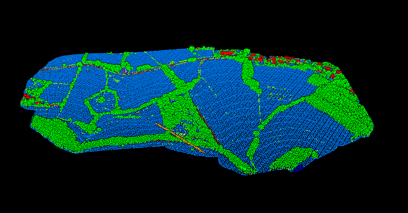
Raw LiDAR point clouds require classification before generating terrain models. The processing workflow directly impacts the accuracy of derived products.
Noise Removal
Eliminating outlier points (birds, atmospheric returns)
Ground Classification
Separating terrain from above-ground features
Surface Interpolation
Generating continuous elevation models from discrete points
Lidarvisor uses AI-powered classification that handles these steps automatically while maintaining your data’s accuracy. Upload your point cloud, and the system classifies points into ASPRS-standard classes without manual parameter tuning, eliminating the risk of human error in the processing workflow.
Accuracy vs Precision: Key Differences
Low Precision
Low Accuracy
High Precision
Low Accuracy
Low Precision
High Accuracy
High Precision
High Accuracy
Precision
Repeatability of measurements. High precision means repeated scans give consistent results, even if those results are wrong.
Accuracy
Correctness relative to true values. High accuracy means measurements are close to reality.
A LiDAR system can be highly precise but inaccurate if it has a systematic calibration error. Proper calibration is essential to achieve both.
Common Accuracy Misconceptions
Tab 1
Beyond 8-10 points/m², additional density primarily improves detail resolution, not accuracy. System calibration and ground control quality matter more for overall accuracy.
Tab 1
Accuracy varies by terrain type. The reported RMSE applies to open terrain; vegetated or urban areas typically have lower accuracy due to classification challenges and interpolation between sparse ground points.
Tab 1
Specifying tighter accuracy than needed increases acquisition and processing costs without providing meaningful benefit for your application. Match specifications to your actual requirements.
Summary
LiDAR accuracy depends on system calibration, acquisition parameters, point density, classification quality, and terrain conditions. Understanding these factors helps you select appropriate data for your application and set realistic expectations for derived products.
For most mapping and modeling applications, ASPRS QL1 or QL2 data (10 cm vertical accuracy) provides sufficient quality. Higher accuracy specifications are reserved for detailed engineering and critical infrastructure projects.
Related Articles
LiDAR Fundamentals
• What is a Point Cloud? • How Does LiDAR Work? • LiDAR Resolution • Multi-Return LiDAR • Airborne LiDAR
Terrain & Elevation
• DTM Guide • DSM Guide • DEM Guide • DTM vs DSM • Hillshade Maps
Process Your LiDAR Data in Minutes
Create a FREE account now and start processing your point cloud. Get 5 GB of storage space and classify up to 50 hectares for free. Lidarvisor’s AI-powered classification maintains data accuracy with automated ground filtering and ASPRS-standard class assignments.
Create free account50 hectares free. No credit card. No software to install.