
Learn LiDAR
LAZ Viewer Online: Open LAZ Files in Your Browser
Open compressed LAZ point clouds online without another desktop viewer
No credit card required • 50 hectares included
Need to open a LAZ file quickly without installing another desktop viewer? A browser-based LAZ viewer lets survey, forestry, and utility teams review compressed LiDAR point clouds online, check coverage and classes, and decide what needs full processing next.
What an online LAZ viewer should help you do
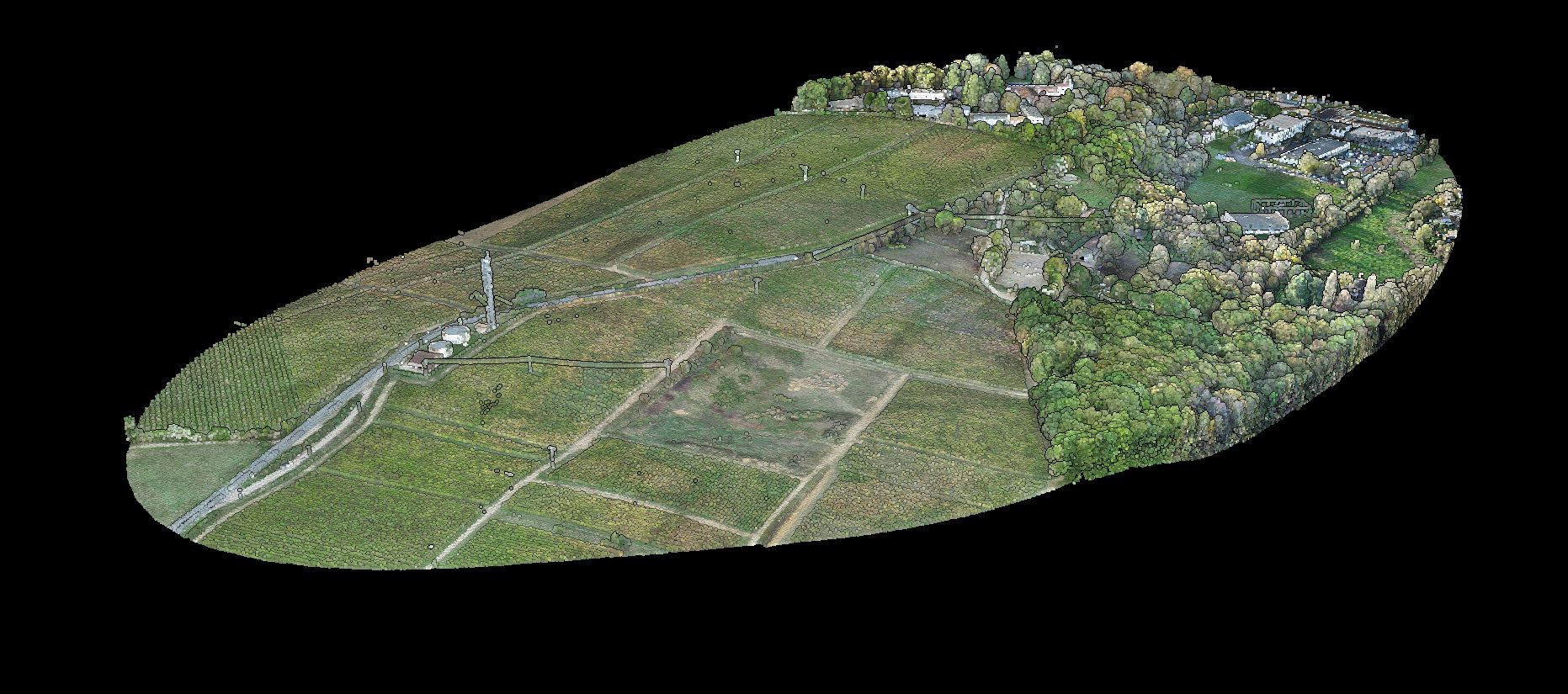
A good LAZ viewer should remove friction at the start of the workflow. Instead of decompressing data locally or passing large files between machines, teams can open the point cloud in a browser, inspect what matters, and decide whether to keep the job at review level or move straight into production outputs.
- Open compressed LAZ point clouds online in your browser
- Review RGB, elevation, intensity, or classification views
- Spot gaps, density issues, and obvious QA problems before deeper processing
- Share browser-based review with teammates or clients
- Move into terrain, contour, or vector deliverables when the dataset is ready
With Lidarvisor, that browser review does not have to stop at visualization. You can move from a quick first look into deliverables like DTM, DSM, contours, building footprints, tree outputs, wire lines, and pole locations inside the same workflow.
LAZ is the compressed version of LAS, which makes it a practical fit for browser-first workflows. Smaller files are easier to upload, store, and share between capture crews, consultants, and clients while keeping the same core LiDAR data available for review and downstream processing.
Why LAZ works so well for browser-based review
Faster file handoff
Compressed files are easier to upload and share
Quick browser QA
Open the dataset without relying on another heavy desktop install
Client and stakeholder review
Keep review simple before sending CAD or GIS deliverables
Downstream processing
Stay close to DTM, DSM, contours, and vector outputs after the first review
Typical LAZ viewer workflow in Lidarvisor
Upload the LAZ file and open it in the browser for a first review. Check coverage, elevation patterns, and classification views for obvious issues.
Share the viewer when teammates or clients need to confirm the scene or project area. Generate the outputs you actually need, such as DTM, DSM, contours, slope maps, building footprints, tree outputs, wire lines, or pole locations.
Export results in formats that fit the handoff, including TIFF, DXF, SHP, GeoJSON, or LAS.
If the job starts as a quick inspection but turns into deliverable work, you do not need to restart in a separate tool. That is the real advantage of pairing a browser LAZ viewer with processing and export workflows.
When a browser LAZ viewer is enough — and when you need more
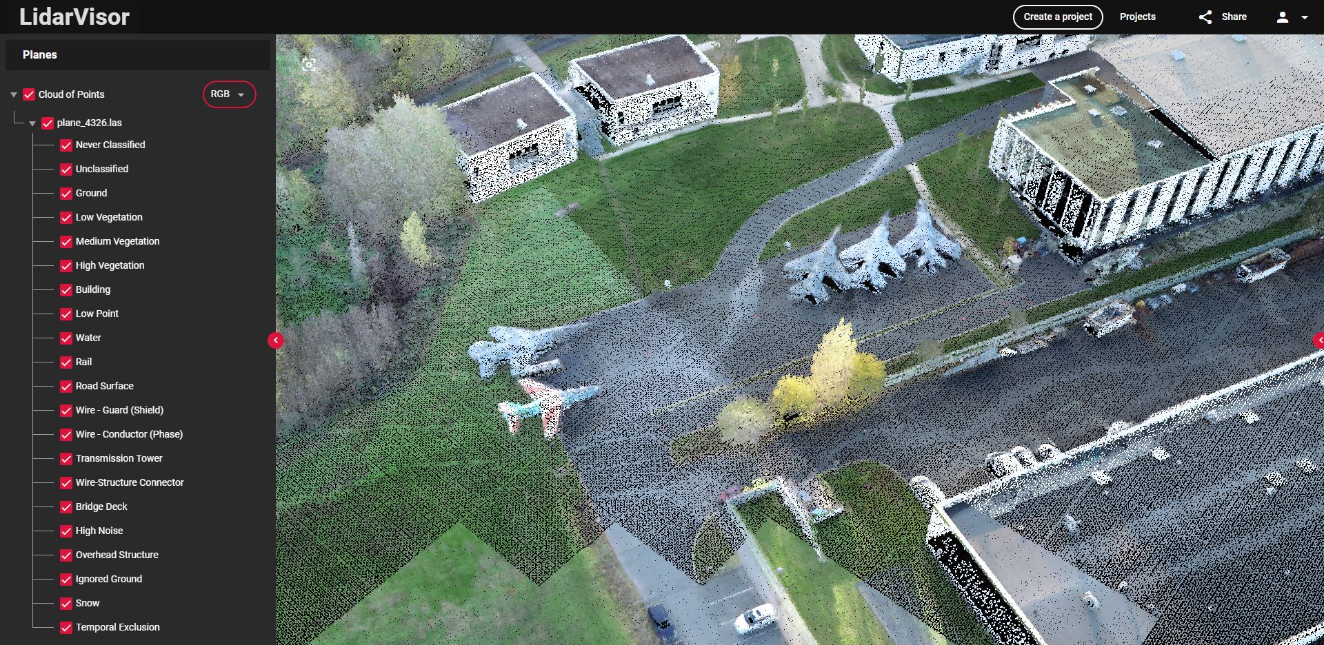
Viewer-only use
Quick review, client preview, file validation, visual QA
Processing use
DTM and DSM creation, contour generation, vector extraction, survey and GIS handoff
Who this fits best
Land survey teams
Checking topographic and terrain capture before export
Utility corridor teams
Reviewing wires, poles, and vegetation context
Forestry teams
Validating canopy and ground separation before analysis
Engineering teams
Wanting a lighter first look before CAD or GIS delivery
Frequently Asked Questions
What is a LAZ viewer?
A LAZ viewer opens compressed LAZ LiDAR point cloud files so you can inspect them visually before deeper processing or export work.
Is LAZ different from LAS?
Yes. LAZ is the compressed version of LAS. The main advantage is smaller file size for storage, transfer, and browser-friendly review workflows.
Can I share a LAZ file review with clients or teammates?
Yes. A browser-based viewer is useful when project stakeholders need a fast visual review without installing desktop software first.
What should I do after viewing a LAZ file?
That depends on the project. Survey teams often move into terrain and contour deliverables, utility teams into vegetation or pole workflows, and forestry teams into canopy and tree analysis.
Summary
If you need to open LAZ files online, review them quickly, and keep the path to deliverables short, Lidarvisor gives you a browser-first workflow with no software to install.
Related guides: LAS Viewer Online, Point Cloud Viewer, Point Cloud Processing Software, and the LAS and LAZ file format guide.
Why LAZ viewer demand is rising in 2026
Browser LAZ review is no longer just a nice-to-have for desktop GIS teams. Survey, utility, forestry, and mobile mapping workflows increasingly pass around compressed LAZ files first because they are lighter to share, faster to open, and easier to review before anyone commits to terrain models, contour cleanup, or downstream CAD and GIS work.
Survey teams
Use a LAZ viewer online to spot coverage gaps, check strip alignment visually, and confirm that a contractor handoff is worth deeper processing.
Utility and corridor teams
Open compressed corridor data quickly to review poles, wires, and vegetation context before moving into extraction or repeat-inspection workflows.
Forestry and field crews
Share lighter LAZ datasets for browser-based review when handheld, SLAM, or drone capture teams need a fast checkpoint without mailing around huge LAS packages.
Ready to Open LAZ Files Online?
Open compressed LiDAR point clouds in your browser, review them quickly, and move straight into the deliverables you need. Start free with 50 ha included.
Create free account50 hectares free. No credit card. No software to install.