
Learn LiDAR
Point Cloud Software: 12 Best Tools for LiDAR, Surveying and 3D Scans
Free & Paid Options for 2026
No credit card required • 50 hectares included
Need point cloud software for LiDAR, surveying, and E57 or LAS/LAZ workflows? This guide compares 12 tools for point cloud viewing, classification, terrain modeling, and CAD or GIS export in 2026.
Quick Comparison: Point Cloud Software at a Glance
| Software | Best For | Price | Platform |
|---|---|---|---|
| Lidarvisor | Web-based LiDAR classification, DTM/DSM | Free tier available | Web (browser) |
| CloudCompare | Free all-rounder, mesh comparison | Free (open source) | Win/Mac/Linux |
| MeshLab | Mesh generation, surface reconstruction | Free (open source) | Win/Mac/Linux |
| Potree | Web-based viewing, client sharing | Free (open source) | Web (browser) |
| Autodesk ReCap | AEC workflows, Revit integration | ~$700/year | Windows |
| Leica Cyclone | TLS registration, enterprise workflows | $5,000+/year | Windows |
| LiDAR360 | Forestry, power line analysis | $2,500+/year | Windows |
| Carlson Point Cloud | Surveying, CAD integration | $1,800+ | Windows |
| FARO SCENE | FARO scanner integration | $5,000+/year | Windows |
| Pointly | Cloud processing, secure storage | Subscription | Web (browser) |
| Pix4Dmatic | Photogrammetry point clouds | $350/month | Win/Mac |
| Global Mapper | GIS workflows, terrain analysis | ~$700/year | Windows |
What is Point Cloud Software?
Point cloud software processes collections of 3D coordinate points (X, Y, Z) captured by LiDAR scanners, photogrammetry, or terrestrial laser scanners. These tools help you
Visualize
View and navigate millions of points in 3D
Clean
Remove noise, outliers, and unwanted objects
Classify
Separate ground, vegetation, buildings
Register
Align multiple scans into one dataset
Export
Convert to CAD, mesh, DEM, or GIS
Measure
Take distances, areas, and volumes directly on the point cloud
Best Web-Based Point Cloud Software
Lidarvisor — Best for LiDAR Classification Online
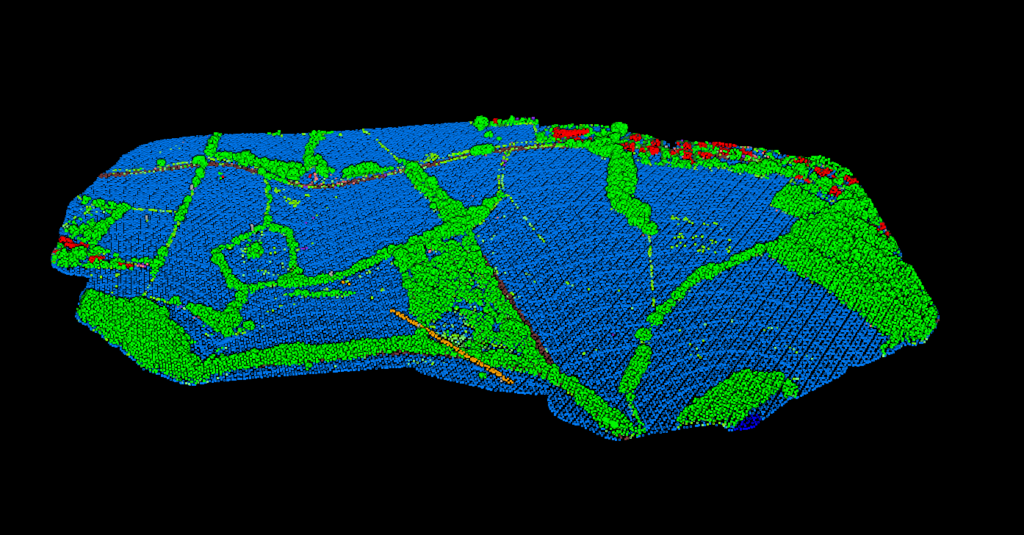
Cloud-based platform with AI-powered classification
Lidarvisor combines AI-powered point cloud classification with automatic terrain model generation (DTM, DSM), contours, and vector outputs. No installation required, no learning curve, no parameters to tune.
- AI ground classification in minutes
- Automatic DTM, DSM, hillshade, slope maps
- Export to LAS, GeoTIFF, DXF, SHP, GeoJSON
- Free tier: 50 hectares processing included
#2 WEB-BASED
Potree — Best for Web Viewing
Open-source WebGL point cloud renderer
#3 WEB-BASED
Potree loads massive point clouds directly in the browser, making it perfect for sharing scan data with clients who do not have desktop software installed.
- Read-only (no editing/classification)
- Requires server setup for hosting
Potree loads massive point clouds directly in the browser, making it perfect for sharing scan data with clients who do not have desktop software installed.
- No installation required for viewers
- Handles billions of points via octree streaming
Pointly — Best for Secure Cloud Processing
Cloud-based with encrypted storage
Pointly offers cloud-based point cloud processing with encrypted storage, suitable for organizations with strict data security requirements.
- Subscription pricing
- Smaller community than open-source
Pointly offers cloud-based point cloud processing with encrypted storage, suitable for organizations with strict data security requirements.
- End-to-end encryption
- Flexible deployment (cloud or on-premise)
Best Free Point Cloud Software
CloudCompare — Best Free All-Rounder
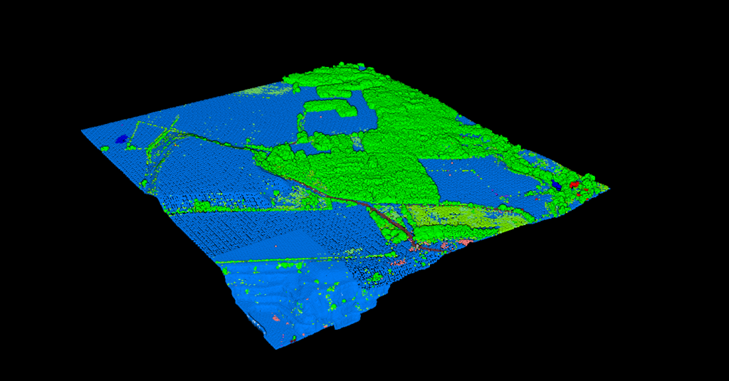
Open-source for Win/Mac/Linux
#5 FREE
CloudCompare is the go-to open-source tool for point cloud processing. It supports all major formats (E57, LAS/LAZ, PLY, PTS, XYZ), handles billions of points, and offers registration, segmentation, and cloud-to-cloud comparison.
- Steep learning curve for beginners
- No built-in AI classification
CloudCompare is the go-to open-source tool for point cloud processing. It supports all major formats (E57, LAS/LAZ, PLY, PTS, XYZ), handles billions of points, and offers registration, segmentation, and cloud-to-cloud comparison.
- 100% free with no feature limits
- Excellent for comparing scan datasets
MeshLab — Best for Mesh Generation
Surface reconstruction specialist
MeshLab specializes in converting point clouds into triangular meshes. If your end goal is a watertight 3D model for visualization or 3D printing, MeshLab excels at surface reconstruction.
- Not designed for GIS/surveying
- Limited point cloud editing tools
MeshLab specializes in converting point clouds into triangular meshes. If your end goal is a watertight 3D model for visualization or 3D printing, MeshLab excels at surface reconstruction.
- Poisson surface reconstruction
- Filter pipeline for batch processing
Best Professional Point Cloud Software
#6 PROFESSIONAL
Autodesk ReCap Pro
Best for AEC Workflows | ~$700/year
ReCap Pro integrates tightly with Revit, AutoCAD, and other Autodesk products. Standard choice for AEC firms in the Autodesk ecosystem.
Pros: Seamless BIM integration, automatic registration
Cons: Windows only, limited GIS functionality
#7 PROFESSIONAL
Leica Cyclone
Best for TLS Registration | $5,000+/year
Industry standard for terrestrial laser scanner data. Offers advanced registration, editing, and integration with Leica hardware.
Pros: Sub-millimeter accuracy, enterprise support
Cons: High cost, complex interface
#8 PROFESSIONAL
LiDAR360
Best for Forestry & Utilities | $2,500+/year
GreenValley International’s specialized modules for forestry inventory, power line analysis, and terrain modeling.
Pros: Individual tree segmentation, power line tools
Cons: Modular pricing adds up
#9 PROFESSIONAL
Carlson Point Cloud
Best for Surveying | $1,800+
Integrates with Carlson Survey and Civil software for surveyors extracting topographic data and delivering CAD drawings.
Pros: Direct CAD integration, perpetual license
Cons: Best with other Carlson products
How to Choose Point Cloud Software
Use this checklist to match point cloud software to your workflow, deliverables, and team setup:
1. Data Source
- Aerial LiDAR: Lidarvisor, LiDAR360, Global Mapper
- Terrestrial laser scanning: Leica Cyclone, FARO SCENE, ReCap
- Photogrammetry: Pix4D, MeshLab, CloudCompare
2. Output Requirements
- DTM/DSM for GIS: Lidarvisor, Global Mapper
- CAD drawings: Carlson, ReCap
- 3D meshes: MeshLab, CloudCompare
- BIM models: ReCap + Revit
3. Budget
- Free: CloudCompare, MeshLab, Potree
- Under $500/year: Lidarvisor, ReCap
- Enterprise ($2K+): Leica Cyclone, LiDAR360
Frequently Asked Questions
What is the best free point cloud software?
CloudCompare is widely regarded as the best free point cloud software. It handles all major formats, supports billions of points, and offers registration, segmentation, and comparison tools without any licensing costs.
Can I process LiDAR data in a web browser?
Yes. Lidarvisor provides web-based LiDAR processing with AI classification, DTM/DSM generation, and export to LAS, GeoTIFF, and CAD formats. No installation is required.
What software do surveyors use for point clouds?
Surveyors commonly use Leica Cyclone (for TLS), Carlson Point Cloud (for CAD integration), Autodesk ReCap (for AEC), and Lidarvisor (for aerial LiDAR). The choice depends on scanner hardware and deliverable requirements.
What is the difference between point cloud software and LiDAR software?
Point cloud software handles 3D point data from any source (LiDAR, photogrammetry, structured light, etc.). LiDAR-specific software is optimized for airborne and mobile LiDAR workflows, including flight planning, waveform processing, and standardized classification (ASPRS codes).
How many points can point cloud software handle?
Most modern software handles 100+ million points. CloudCompare and Potree can process 1+ billion points through octree indexing. Web-based tools like Lidarvisor stream data progressively, so point count is less of a limitation.
Summary
The best point cloud software depends on your data source, outputs, and budget:
- Best for web-based LiDAR: Lidarvisor
- Best free all-rounder: CloudCompare
- Best for mesh generation: MeshLab
- Best for AEC/BIM: Autodesk ReCap
- Best for TLS registration: Leica Cyclone
- Best for forestry: LiDAR360
- Best for surveyors: Carlson Point Cloud
Related resources
See the full LiDAR processing cost comparison for how these tools price up, or estimate your own cost in seconds.
Ready to Process Your Point Cloud?
Skip the learning curve and expensive licenses. Upload your LiDAR data and get AI-classified point clouds with DTM, DSM, and vector outputs in minutes. Start with 50 hectares of free processing.
Create free account50 hectares free. No credit card. No software to install.