
Industries,Learn LiDAR
Slope Map Applications
How Different Industries Use LiDAR-Derived Slope Analysis
No credit card required • 50 hectares included
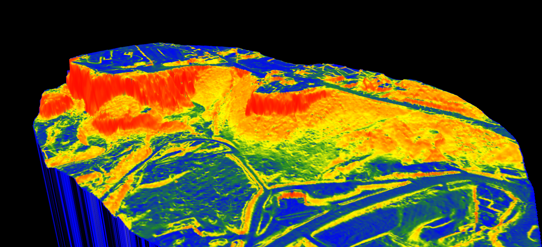
Slope maps reveal terrain gradient—critical information for everything from drainage planning to solar farm siting. LiDAR-derived slope maps offer superior accuracy calculated from high-resolution Digital Terrain Models.
What is a Slope Map?
A slope map represents the rate of change in elevation across a terrain surface, typically expressed in degrees (0-90°) or percent rise. LiDAR-derived slope maps filter out vegetation and structures to show true terrain gradient.
Industry Applications
Land Surveying
Site grading analysis before construction. Identify areas exceeding specs (3% for parking lots, 2% for ADA compliance, up to 33% for embankments):
• Pre-construction site analysis
• Earthwork volume calculations
• Retaining wall requirements
• Road alignment optimization
Hydrology
Model water flow direction and accumulation:
• Watershed delineation
• Storm drain placement
• Flood-prone low-gradient areas
• Erosion risk mapping
Mining
Continuous slope monitoring for safety. Maintain pit wall angles within geotechnical limits (45-70°):
• Pit slope stability monitoring
• Haul road gradient compliance (8-12% max)
• Stockpile assessment
• Reclamation planning
Solar Energy
Identify optimal panel placement. Ground-mounted arrays require slopes under 5-10%:
• Buildable area identification
• Grading requirements
• Panel row spacing
• Access road routing
More Applications
Agriculture
Drainage tile design—steeper slopes allow wider drain spacing and smaller diameter pipe.
Forestry
Logging road planning, harvest unit delineation, and erosion control on steep terrain.
Construction
Grade compliance verification and earthworks tracking throughout project lifecycle.
Related Articles
Terrain & Elevation
• DTM Guide • DSM Guide • DEM Guide • DTM vs DSM • Hillshade Maps
Point Cloud Classification
• Classification Guide • Classification Codes • Classification Methods • What is Classification? • Classification Software
Create a FREE account now and start processing your point cloud
Get 5 GB of storage space and classify up to 50 hectares for free.
Create free account50 hectares free. No credit card. No software to install.