
Learn LiDAR
What Is Point Cloud Classification? LiDAR Classes and Methods Explained
How raw LiDAR points become usable ground, vegetation, building, wire, and utility classes
No credit card required • 50 hectares included
Point cloud classification is the process of assigning every LiDAR point to a class such as ground, vegetation, building, wire, pole, bridge deck, or water. Without classification, you only have millions of raw XYZ points.
With classification, you can build terrain models, isolate vegetation, extract buildings, and prepare survey-ready deliverables from the same dataset.
How Classification Works
Traditional classification uses rule-based algorithms that analyze geometric relationships between points. Ground classification looks for relatively flat surfaces at the lowest local elevations.
Vegetation appears as irregular clusters above the ground surface. Buildings show planar surfaces with sharp edges.
The challenge is that rules tuned for one environment often fail in another. Parameters optimized for flat farmland produce terrible results in mountainous terrain. Urban settings with complex architecture confuse algorithms trained on natural landscapes.
AI-Powered Classification
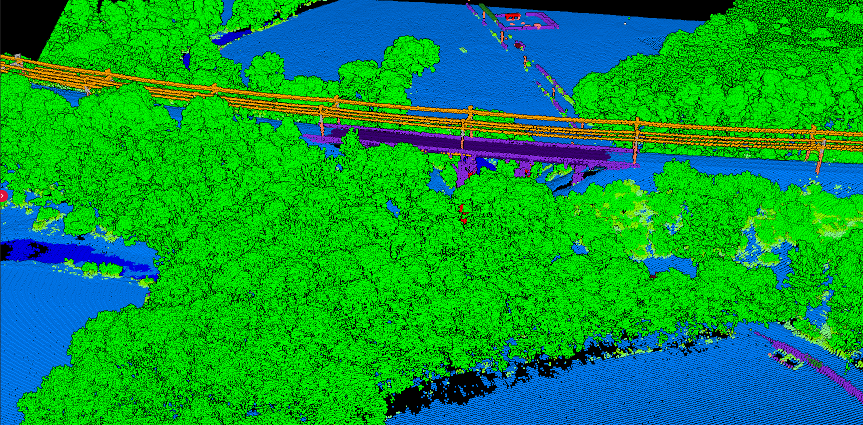
This is where machine learning changes the game. AI-powered classification learns patterns from labeled training data rather than following rigid rules.
Traditional Rule-Based
- Rigid geometric rules
- Manual parameter tuning per project
- Fails in diverse terrain types
- Hours of manual adjustment (or use platforms with built-in manual tools like Lidarvisor)
AI-Powered (LidarVisor)
- Neural networks process 3D neighborhoods
- Learns from diverse global datasets
- Adapts to any environment automatically
- Results in minutes, not hours
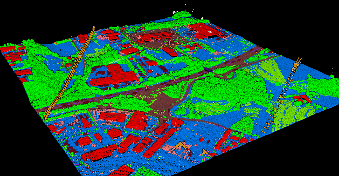
Urban Classification Results
Classification in urban environments requires accurate separation of buildings, roads, vegetation, and infrastructure. AI-powered algorithms distinguish between complex architectural features that would confuse traditional rule-based methods.
Why Classification Matters
Every downstream product depends on classification quality. Poor classification cascades into poor deliverables, while accurate classification enables analysis that would be impossible with unclassified data
Terrain Models
DTM generation requires accurate ground identification. Misclassified vegetation or buildings produce false terrain surfaces.
Vegetation Analysis
Forest inventory and canopy analysis need reliable separation of trees from structures and ground.
Infrastructure Mapping
Power line inspection demands precise detection of wires, towers, and vegetation encroachments.
Power Line Corridor Analysis
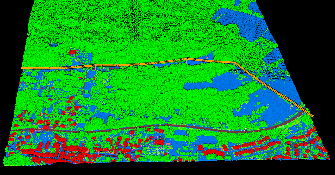
Utility companies rely on accurate classification to identify vegetation encroachments on power lines. Separating wires, towers, and surrounding vegetation enables automated clearance analysis and maintenance planning.
Agricultural Applications
Classification supports precision agriculture by separating crop areas from infrastructure, roads, and natural vegetation. Accurate ground classification enables drainage analysis and terrain modeling for field management.
Classification with LidarVisor
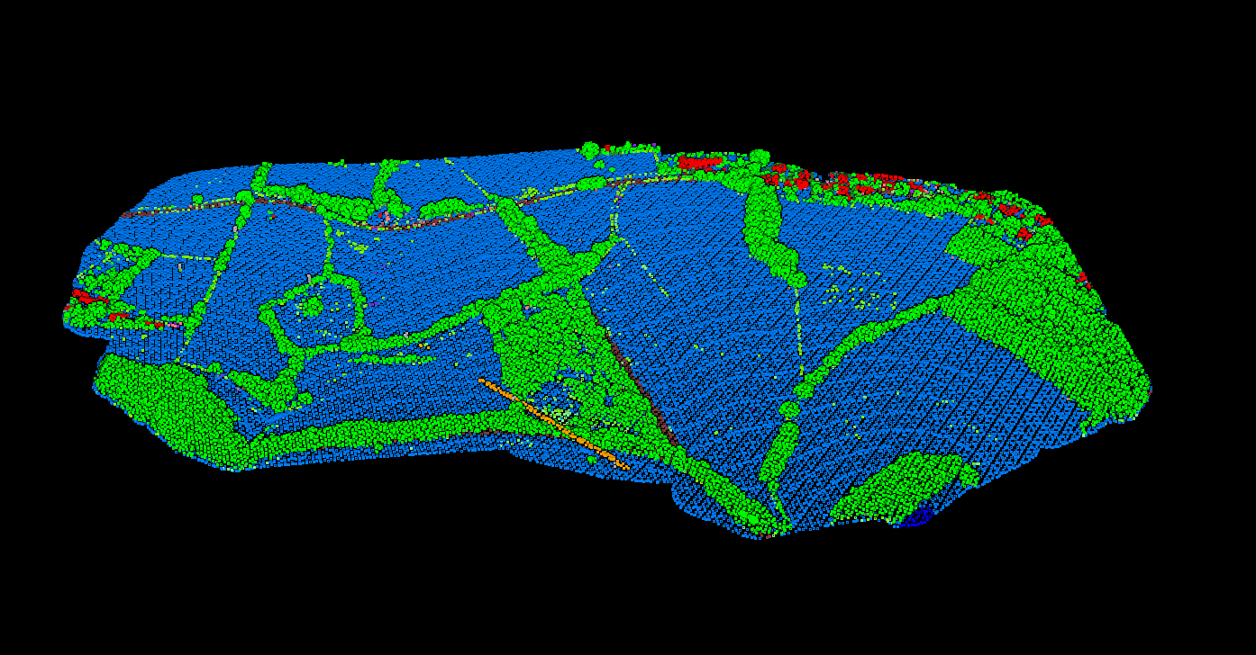
LidarVisor uses deep learning models trained on diverse global datasets. Upload your LAS or LAZ file and receive classified results in minutes: ground, vegetation, buildings, and infrastructure labeled automatically and ready for analysis.
For airborne datasets, explore our automatic aerial LiDAR classification capabilities.
Related Articles
Point Cloud Classification
• Classification Guide
• Classification Codes
• Classification Methods
• Classification Software
• Manual Classification
Terrain & Elevation
• DTM Guide
• DSM Guide
• DEM Guide
• DTM vs DSM
• Hillshade Maps
Ready to Classify Your Point Cloud?
Upload your LiDAR data and get AI-powered classification in minutes. Start with 50 hectares of free processing.
Create free account50 hectares free. No credit card. No software to install.