
Comparisons
LiDAR vs Photogrammetry: Which Technology Fits Your Project?
Pick wrong, and you could spend weeks processing data that doesn’t capture what you need.
No credit card required • 50 hectares included
This guide breaks down accuracy, cost, processing time, and ideal applications so you can choose confidently for your surveying, forestry, or mapping project.
A Brief History: From Aerial Photos to Laser Pulses
Photogrammetry: 150+ Years of Development
Photogrammetry has roots stretching back to the mid-1800s. The French scientist Aimé Laussedat pioneered “iconometry” in the 1850s, using photographs to create maps. By World War I, aerial photogrammetry became a critical military tool.
Key milestones:
- 1858: First aerial photograph from a balloon
- 1913: First stereoscopic aerial mapping
- 1950s-70s: Analytical plotters automate map production
- 1990s: Digital cameras and computer vision emerge
- 2010s: Structure from Motion (SfM) makes drone mapping practical
LiDAR: 60 Years of Laser Innovation
LiDAR emerged shortly after Theodore Maiman demonstrated the first working laser in 1960. By 1961, Hughes built the first LiDAR prototype. NASA began using laser ranging to measure distances to the Moon in 1962.
Key milestones:
- 1960: First laser demonstrated (ruby laser)
- 1961: First LiDAR system built at Hughes Aircraft
- 1971: Apollo 15 carries laser altimeter to the Moon
- 1984: First commercial airborne LiDAR
- 2000s: GPS/IMU integration enables wide-area mapping
- 2010s: Drone LiDAR becomes affordable
The Fundamental Difference
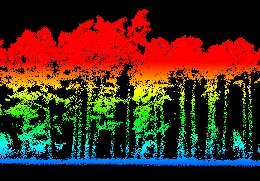
LiDAR (Light Detection and Ranging)
Active sensing technology that emits laser pulses and measures the time for them to return. Works independently of ambient light conditions, including complete darkness. Laser pulses can penetrate gaps in vegetation to reach the ground surface below.
Photogrammetry
Passive sensing technology that derives 3D geometry from overlapping photographs using triangulation. Relies entirely on visible light and requires surfaces with distinct texture for feature matching. Cannot see through vegetation.
This fundamental difference drives all practical distinctions in accuracy, cost, and ideal applications.
Complete Feature Comparison
| Factor | LiDAR | Photogrammetry |
|---|---|---|
| Sensing Type | Active (emits laser pulses) | Passive (captures reflected light) |
| Vertical Accuracy | 3-15 cm RMSE | 5-15 cm RMSE (with GCPs) |
| Vegetation Penetration | Yes (multiple returns) | No (surface only) |
| Light Conditions | Any (works in darkness) | Requires good daylight |
| Color/Texture Data | Intensity only | Full RGB color |
| Equipment Cost | $15,000-$300,000+ | $2,000-$50,000 |
| Processing Time | Minutes to hours | Hours to days |
Accuracy figures represent typical ranges for survey-grade equipment.
How Each Technology Works
LiDAR Operation
- Scanner emits rapid laser pulses (100,000-2,000,000+ pulses/sec)
- Pulses travel to target surfaces and reflect back
- Sensor measures precise time-of-flight for each pulse
- Distance calculated: (Speed of Light × Time) ÷ 2
- Combined with GPS position and IMU orientation
- Multiple returns recorded through vegetation
Key capability: Multiple returns allow LiDAR to capture both canopy surface and bare earth beneath, enabling DTM extraction in dense forests.
Photogrammetry Operation
- Camera captures overlapping images (60-80% overlap)
- Software identifies matching features across images
- Bundle adjustment calculates camera positions
- Dense matching generates millions of 3D points
- Structure from Motion reconstructs geometry
- Textures mapped from photos onto 3D mesh
Key capability: Rich color and texture creates photorealistic 3D models and orthophotos, ideal for visual inspection and documentation.
Visual Comparison: Same Area, Different Technologies
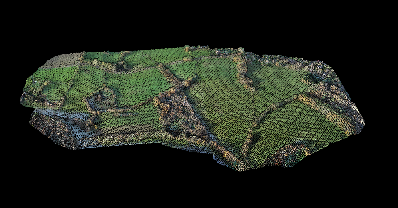
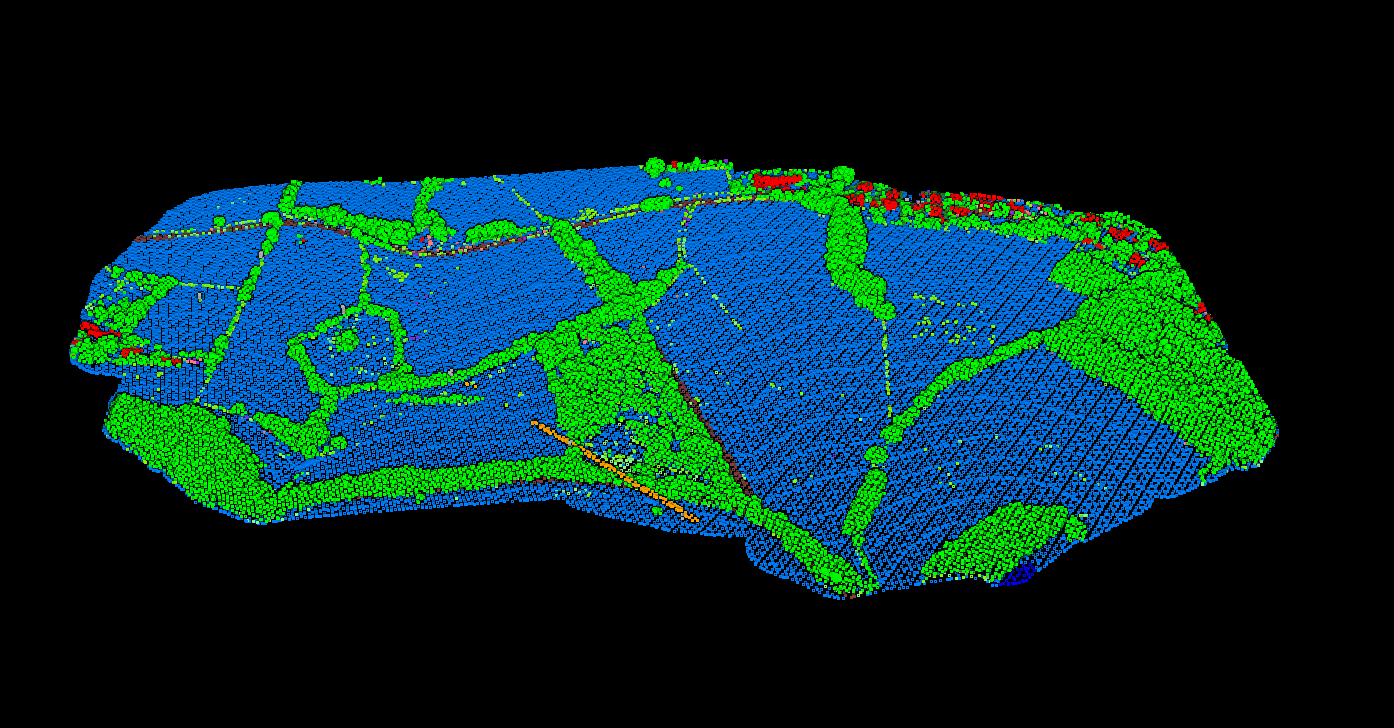
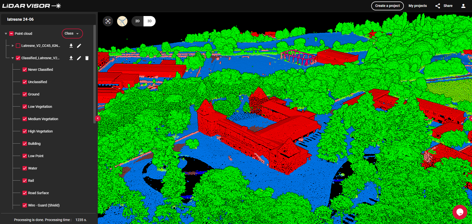
See how photogrammetry (RGB imagery) and LiDAR classification capture the same agricultural landscape differently:
LiDAR in Complex Terrain
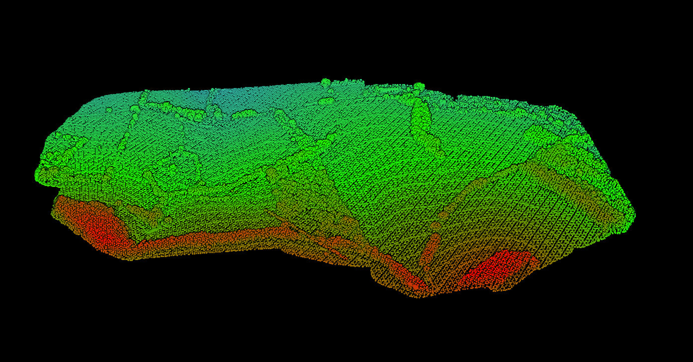
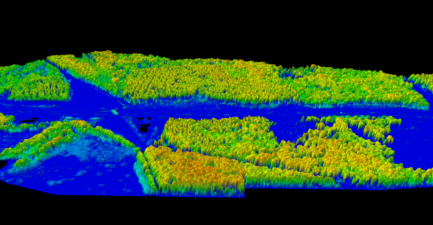
In mountainous terrain with steep slopes and dense vegetation, LiDAR excels where photogrammetry struggles. The point cloud captures ground surface beneath forest canopy—something impossible with camera-based methods.
This makes LiDAR the preferred choice for:
- Forestry: Measuring tree heights, canopy structure, and biomass
- Hydrology: Creating accurate DTMs for flood modeling
- Infrastructure: Planning roads through forested areas
- Archaeology: Discovering hidden structures beneath jungle canopy
LiDAR’s Vegetation Penetration Advantage
LiDAR’s multiple-return capability allows it to see through vegetation to the ground below—something photogrammetry cannot do. This 3D visualization shows canopy height modeling in a forested corridor:
Limitations and Edge Cases
No technology is perfect. Understanding these limitations helps you choose the right tool.
LiDAR Limitations
- Water surfaces: Laser pulses absorbed or scattered
- Glass and mirrors: Specular surfaces cause erratic reflections
- Dark surfaces: Fresh asphalt, wet coal absorb laser energy
- Rain and fog: Atmospheric moisture scatters pulses
- No color data: Intensity only, no true RGB
- Higher cost: Entry-level starts around $15,000-30,000
Photogrammetry Limitations
- Vegetation: Cannot see through tree canopy
- Textureless surfaces: Snow, sand, water lack features
- Shadows: Strong shadows cause matching failures
- Moving objects: Vehicles, people create artifacts
- Lighting dependency: Requires consistent daylight
- Processing time: Hours to days for large datasets
When to Choose Each Technology
Choose LiDAR When
- Vegetation canopy covers the survey area
- Bare-earth terrain model (DTM) is required
- Low-light or night operations needed
- Consistent accuracy across varying terrain
- Forestry inventory or biomass estimation
- Flood modeling under tree cover
- Utility vegetation management
- Archaeological surveys in forests
- Corridor mapping for infrastructure
Choose Photogrammetry When
- Budget is the primary constraint
- Visual texture and orthophotos required
- Open terrain without vegetation cover
- Construction site documentation
- Mining stockpile volumes (open pit)
- Real estate visualization
- Agricultural field mapping
- Building facade inspection
- Cultural heritage preservation
Real-World Application Examples
Forestry Inventory
Technology: LiDAR (required)
Forest managers need accurate tree heights, crown areas, and stand density beneath the canopy. LiDAR’s multiple returns separate canopy from ground.
Why not photogrammetry: Only sees canopy top. Cannot measure individual tree heights.
Construction Monitoring
Technology: Photogrammetry (preferred)
Weekly progress documentation benefits from color orthophotos and lower per-flight cost. Stakeholders can visually track progress.
Why not LiDAR: Higher cost per flight. No color data for visual comparison.
Utility Vegetation Management
Technology: LiDAR (required)
Electric utilities must maintain safe clearances between powerlines and vegetation. LiDAR measures exact distances to nearby trees.
Why not photogrammetry: Cannot measure clearance to wires hidden by foliage.
Cost Comparison: Equipment and Projects
Equipment Cost (Drone Systems):
- LiDAR sensor only: $15,000-$150,000+ (survey-grade)
- Complete drone + LiDAR system: $30,000-$300,000+
- Photogrammetry camera: $2,000-$30,000 (survey-grade)
- Complete drone + camera system: $5,000-$50,000
Project Cost per Square Kilometer:
- Airborne LiDAR: $150-$500/km²
- Drone LiDAR: $200-$800/km² (includes mobilization)
- Drone photogrammetry: $50-$200/km²
Costs vary by region, project size, and accuracy requirements. Large-area projects benefit from economies of scale.
Frequently Asked Questions
Can I use both LiDAR and photogrammetry together?
Yes, and this is increasingly common. Many projects combine LiDAR for accurate terrain modeling with photogrammetry for color and texture. The LiDAR point cloud can be colorized using camera images, giving you the best of both worlds: accurate geometry with visual context. Some sensors now integrate both in a single payload.
Which technology is more accurate?
It depends on the environment. In open, well-lit terrain with distinct features, photogrammetry with good ground control can achieve horizontal accuracy of 2-5 cm. However, LiDAR typically wins for vertical accuracy (3-5 cm RMSE) and is dramatically more accurate in vegetated areas where photogrammetry cannot see the ground. For consistent accuracy across varied terrain types, LiDAR is generally the safer choice.
How does point density compare between the two?
Photogrammetry often produces higher raw point densities (100-1000+ pts/m²) because every pixel can become a point. However, these points are all on visible surfaces only. LiDAR typically produces 2-100+ pts/m² depending on settings, but includes multiple returns penetrating vegetation. A single LiDAR pulse might generate 2-5 return points through canopy layers. For vegetated terrain, LiDAR’s lower density often provides more useful information.
Can photogrammetry work in forests?
Photogrammetry can map the visible canopy surface, useful for crown mapping and visual assessment. However, it cannot see through to the ground. Any “terrain model” derived from photogrammetry in a forest will actually be a Digital Surface Model (DSM) showing canopy height, not true ground elevation. For bare-earth terrain models (DTM) under tree cover, LiDAR is required.
What about processing time?
LiDAR processing is generally faster. Point cloud classification and DTM extraction can complete in minutes to a few hours with modern software. Photogrammetry involves computationally intensive image matching. A 1,000-image dataset might take 12-48 hours for dense point cloud generation on a workstation, though cloud processing services can parallelize this significantly.
Which is better for flood modeling?
LiDAR is strongly preferred for hydrological modeling. Accurate flood predictions require true bare-earth elevation data (DTM), especially in vegetated floodplains. Photogrammetry would incorrectly show vegetation as terrain, leading to inaccurate water flow predictions. Most government flood mapping programs specify LiDAR as the data source.
Is LiDAR worth the extra cost?
For projects requiring true terrain elevation through vegetation, LiDAR’s premium is justified. The cost of incorrect flood predictions, timber volume estimates, or infrastructure designs based on flawed photogrammetric terrain data typically exceeds the cost difference. For open-area projects where photogrammetry’s visual output adds value, photogrammetry often provides better cost-benefit. Consider your specific deliverable requirements rather than defaulting to the cheaper option.
More Comparisons
Process Your LiDAR Data in Minutes
LidarVisor automates classification, terrain modeling, and feature extraction for LiDAR point clouds. Upload your LAS/LAZ files and get classified outputs, DTM, DSM, contours, and CAD-ready vectors without specialized software.
Create free account50 hectares free. No credit card. No software to install.