
Learn LiDAR
LiDAR Topography: Survey Workflow for DTM, Contours, and Hillshade
Topographic Mapping from Point Clouds to Terrain Deliverables
No credit card required • 50 hectares included
Process LiDAR topography data into survey-ready DTM, contour, hillshade, slope, and classified outputs. Follow the workflow from raw point clouds to CAD and GIS deliverables.
What is LiDAR Topography?
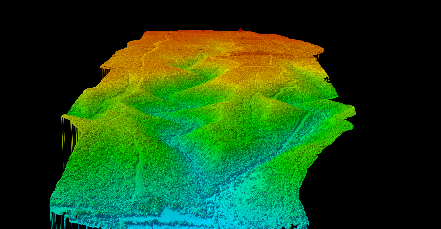
LiDAR topography transforms aerial point cloud data into detailed terrain maps that reveal the true shape of the earth’s surface. Unlike traditional surveying methods that require ground crews to physically measure each point, LiDAR captures up to a million elevation measurements per second.
The key advantage is LiDAR’s ability to penetrate vegetation canopy. While the first laser return hits treetops and structures, subsequent returns reach through gaps to measure the actual ground surface—making LiDAR uniquely suited for mapping terrain in forested areas.
Core LiDAR Topographic Products
Processing LiDAR point clouds for topography produces several complementary products, each serving different purposes in terrain analysis and mapping.
Digital Terrain Model (DTM)
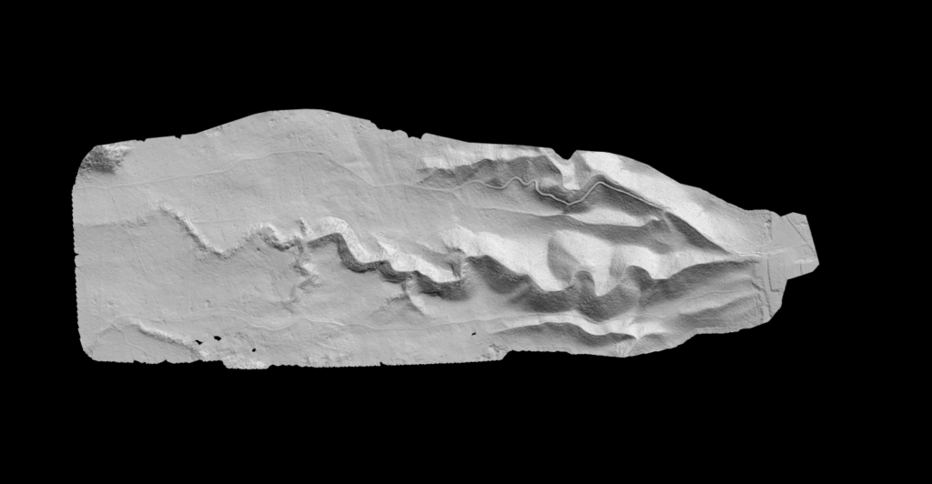
See the ground beneath the clutter
The DTM represents the bare earth surface with all vegetation, buildings, and structures removed. Created by filtering the point cloud to retain only ground-classified points, then interpolating into a continuous elevation grid.
- Flood modeling and drainage analysis
- Earthwork volume calculations
- Archaeological feature detection
SURFACE ELEVATION
Digital Surface Model (DSM)
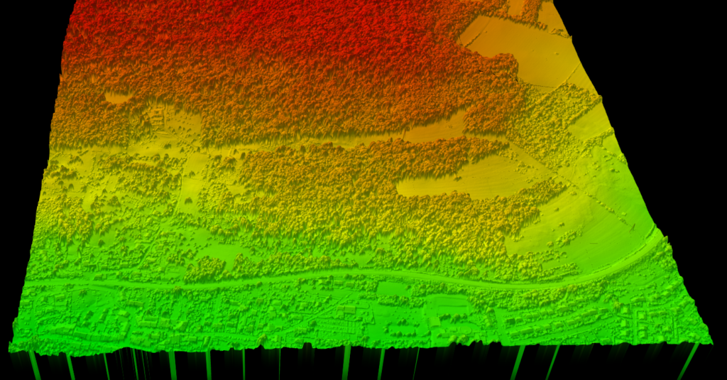
Capture everything above ground level
The DSM captures the top surface of everything on the ground, including trees, buildings, and structures. Created from first-return LiDAR points, representing what you would see from directly above.
- Line-of-sight analysis
- Urban 3D modeling
- Solar potential analysis
Hillshade Maps
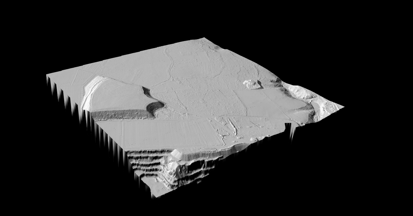
Hillshade is a terrain visualization technique that simulates sunlight casting shadows across the landscape. By applying directional lighting to a DTM, subtle terrain features become visible that would otherwise be hidden in raw elevation data.
Hillshade maps excel at revealing:
- Ancient earthworks and archaeological sites
- Landslide scars and geological features
- Drainage patterns and old stream channels
- Mining disturbances and quarries
Slope Maps
Slope maps calculate the gradient or steepness of terrain at each point, typically expressed in degrees or percent. Derived from DTM elevation data, slope analysis is critical for engineering and environmental applications.
Common slope map applications:
- Construction site suitability assessment
- Road and trail alignment planning
- Erosion risk modeling
- Agricultural drainage planning
Contour Lines
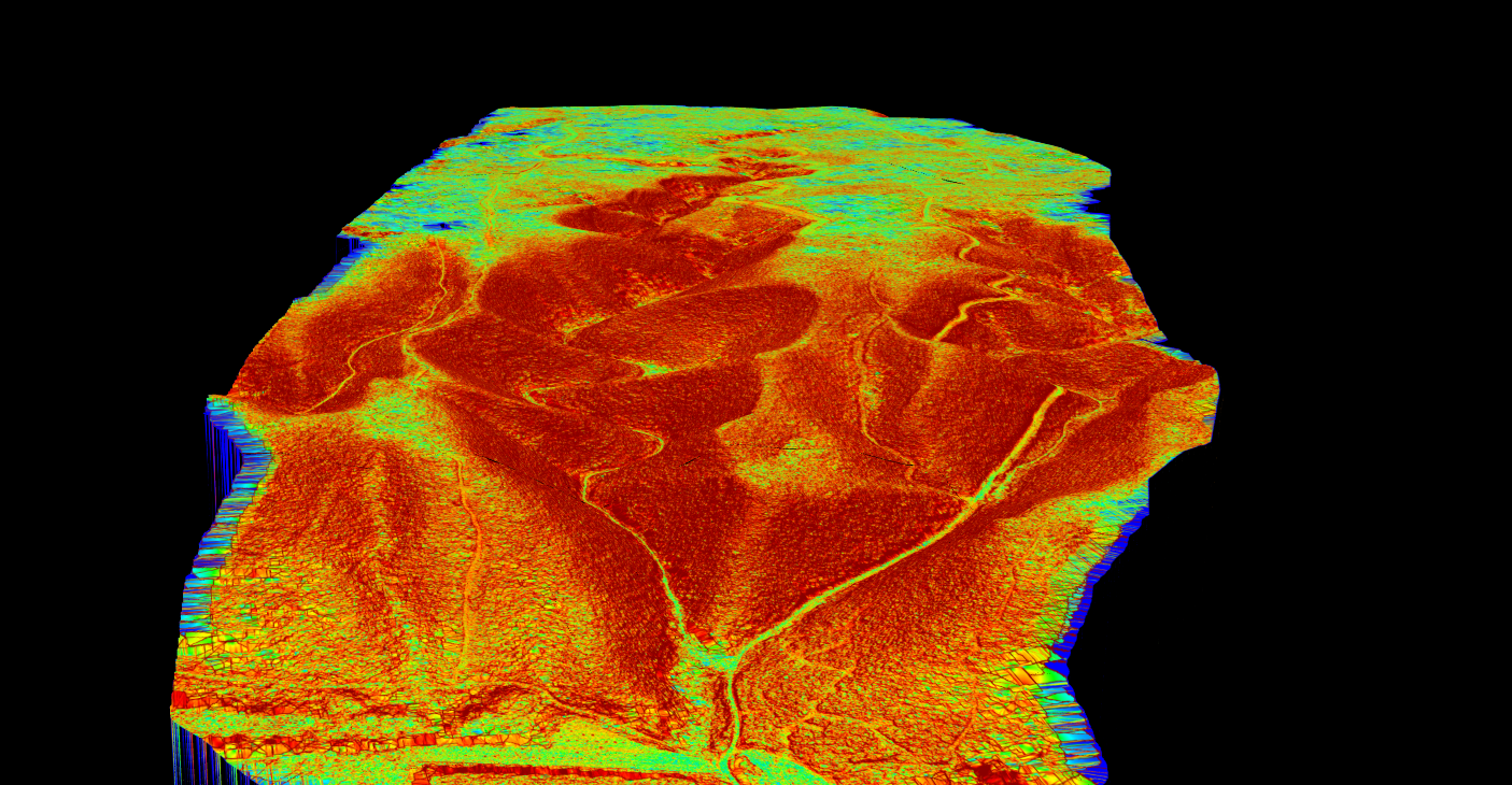
Contour lines connect points of equal elevation, providing the traditional cartographic representation of terrain on topographic maps. LiDAR-derived contours offer superior accuracy and detail compared to those created from photogrammetry or traditional surveying.
Contours are usually the reason a topographic survey ends up in CAD. If a DXF is the deliverable, see how to turn a point cloud into a DXF topographic map.

Contour line uses include: Topographic map production • CAD deliverables for engineering • Earthwork volume estimation • Trail and road design • Regulatory compliance mapping
No More Parameter Tuning
Just Upload and Process
50 hectares free processing. No credit card required.
LiDAR Topography Processing Workflow
Turning raw LiDAR point clouds into useful topographic products requires a multi-step processing workflow. Modern cloud-based platforms automate much of this process, reducing what once took days to minutes
1. Upload
Upload your point cloud in LAS or LAZ format
2. Classify
AI identifies ground, vegetation, buildings automatically
3. Generate
Create DTM, DSM, hillshade, slope, and contours
4. Export
Download GeoTIFF, DXF, or classified LAS
Industry Applications
Land Surveying
Create precise base maps for boundary surveys, subdivision planning, and site assessments with rapid data capture.
Civil Engineering
Accurate DTMs for earthwork calculations, road alignment design, and drainage planning.
Flood Modeling
High-resolution DTMs enable accurate simulation of water flow patterns and flood extents.
Forestry
Combine DSM and DTM to calculate canopy height models for forest inventory and biomass estimation.
Mining & Quarrying
Stockpile volume calculations, pit design, and extraction progress monitoring.
Archaeology
Hillshade visualizations reveal subtle earthworks hidden beneath forest canopy.
Why Choose LiDAR for Topography?
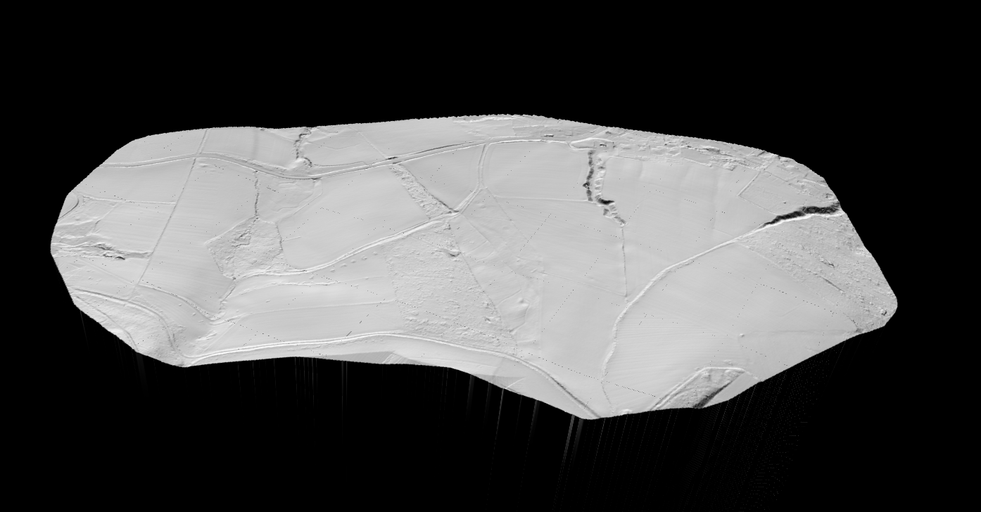
LiDAR offers distinct advantages over traditional topographic survey methods:
- Speed: Capture hundreds of hectares per day vs. hectares with ground crews
- Vegetation penetration: Measure ground through canopy gaps
- Point density: 10-100+ points per square meter
- No ground access: Survey remote or hazardous terrain
- Accuracy: 5-15 cm vertical precision
LiDAR vs. Traditional Topographic Survey Methods
| Factor | LiDAR Survey | Traditional Ground Survey |
|---|---|---|
| Speed | Rapid: hundreds of hectares per day | Slow: hectares per day |
| Terrain Access | No ground access required | Must physically access each point |
| Vegetation Penetration | Measures through canopy gaps | Requires clearing or line-of-sight |
| Point Density | 10-100+ points per square meter | Sparse point selection |
| Best For | Large areas, vegetated terrain | Small areas, high-precision control |
Processing LiDAR Topography with Lidarvisor
Lidarvisor is a cloud-based platform that automates LiDAR point cloud processing for topographic applications. Upload your LAS or LAZ file, and AI-powered classification extracts the terrain products you need.
- ✓ Digital Terrain Model (DTM) as GeoTIFF with hillshade imagery
- ✓ Digital Surface Model (DSM) capturing all surface features
- ✓ Hillshade maps for terrain visualization
- ✓ Slope maps showing terrain gradient in degrees
- ✓ Contour lines in DXF format for CAD
- ✓ Classified point cloud with ASPRS standard classes
Frequently Asked Questions
What accuracy can LiDAR topography achieve?
Airborne LiDAR typically achieves vertical accuracy of 5-15 cm RMSE (Root Mean Square Error) depending on flight parameters, ground control, and terrain characteristics. Horizontal accuracy is generally 10-30 cm. These accuracies are sufficient for most topographic mapping applications.
What’s the difference between DTM and DEM?
The terms are often used interchangeably, but technically a Digital Elevation Model (DEM) is a generic term for any elevation dataset, while a Digital Terrain Model (DTM) specifically represents the bare earth surface with vegetation and structures removed. A DTM is a type of DEM.
How much area can LiDAR survey in a day?
Production rates depend on equipment and specifications, but typical airborne LiDAR missions can cover 50-200+ square kilometers per day. Drone-based systems cover smaller areas (10-100+ hectares per day) but offer higher point density and flexibility for smaller projects.
Can LiDAR measure underwater topography?
Standard topographic LiDAR cannot penetrate water. Specialized bathymetric LiDAR systems use green wavelength lasers that can penetrate clear water to measure shallow underwater terrain, typically up to 1-3 times the Secchi depth (water clarity depth).
What file formats are used for LiDAR topography?
Raw point clouds use LAS or compressed LAZ formats. Derived raster products (DTM, DSM, hillshade, slope) typically use GeoTIFF. Vector products like contour lines are delivered in DXF for CAD, Shapefile for GIS, or GeoJSON for web applications.
Related Articles
Ready to Process Topographic LiDAR Data?
Upload your point cloud and generate DTM, DSM, hillshade, slope maps, and contour lines automatically. Start with 50 hectares of free processing, no credit card required.
Create free account50 hectares free. No credit card. No software to install.