
Learn LiDAR
What is a Canopy Height Model (CHM)?
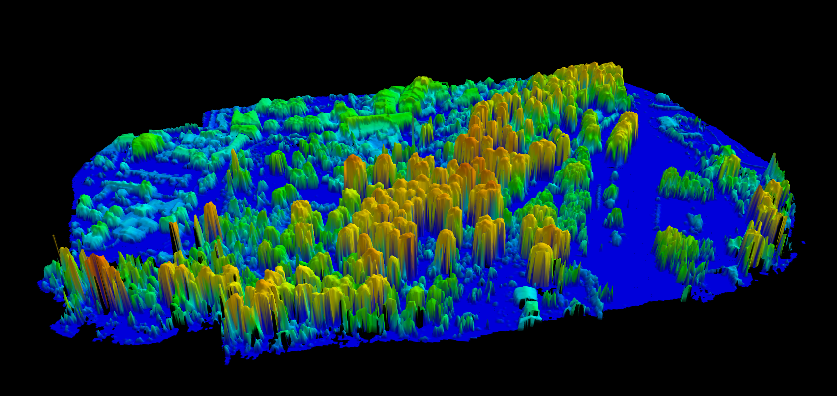
A Canopy Height Model shows vegetation height above the ground, not elevation above sea level, but the actual height of trees measured from their base to their crown.
No credit card required • 50 hectares included
For forestry, ecology, and carbon accounting, the CHM is often the most valuable product derived from LiDAR data.
The Simple Calculation
CHM = DSM – DTM
Take the Digital Surface Model (capturing the top of the canopy) and subtract the Digital Terrain Model (capturing the ground below). What remains is the vegetation height at every point.
If a tree’s crown sits at 145 meters elevation and the ground beneath it sits at 120 meters, that tree stands 25 meters tall.
This calculation works across the entire survey area, producing a raster where every cell contains a height value. Tall trees appear as high values; shrubs appear as low values; bare ground appears as zero.
What CHMs Enable
Tree Detection
Algorithms identify individual trees as local height maxima in the CHM.
Carbon Estimation
Convert tree heights to carbon stock, CO₂eq, and biomass per tree.
Biomass Estimation
Height statistics combined with allometric equations estimate timber volume.
Change Detection
Compare CHMs from different years to track growth or damage.
From CHM to Carbon Stock
Tree heights extracted from CHMs are the foundation for carbon stock estimation. Using species-specific allometric models, LidarVisor converts height measurements into:
• Carbon stock (tonnes C) per tree
• CO₂ equivalent (tonnes CO₂eq) for carbon credit reporting
• Above-ground biomass (tonnes AGB)
With more than 100 allometric models covering 8 geographic regions (Europe, Canada, USA, Tropical, Australia, Boreal/Russian, East Asian, African Dryland), you can generate defensible carbon estimates for forests worldwide.
Carbon Estimation Workflow
1. Generate CHM from classified LiDAR
2. Detect individual trees and heights
3. Select region and species
4. Export CSV with carbon columns
5. Download PDF Carbon Estimation Summary
Related Articles
Forestry & Vegetation
Terrain & Elevation
• DTM Guide • DSM Guide • DEM Guide • DTM vs DSM • Hillshade Maps
Generate Accurate CHMs with LidarVisor
LidarVisor generates accurate CHMs by first producing high-quality terrain models through AI-powered ground classification. Use them for tree detection, height statistics, carbon estimation, or export for analysis in your forestry software.