
Learn LiDAR
How to Measure Tree Height with LiDAR: CHM Method Explained
Centimeter-Accurate Tree Heights from Airborne LiDAR
No credit card required • 50 hectares included
Measuring individual tree heights across large forest areas has traditionally required field crews with clinometers, trigonometry calculations, and days of walking transects. LiDAR changes this completely.
With airborne LiDAR data, you can measure every tree in a forest to centimeter-level accuracy from a single overflight.
Why Measure Tree Height?
Tree height is a fundamental measurement for forestry, ecology, and land management. Traditional field measurement limits you to sample plots. LiDAR enables wall-to-wall coverage of entire forest areas
Timber Volume
Height combined with diameter predicts harvestable volume
Carbon Stock
Allometric models convert height to carbon content
Forest Inventory
Track stand development and growth rates
Habitat Assessment
Vertical structure indicates wildlife habitat quality
Fire Fuel Modeling
Canopy height affects fire behavior predictions
Traditional Methods vs LiDAR
Clinometer Method
Stand at known distance, measure angles, calculate with trigonometry Coverage: Sample plots Time/100ha: 40+ hours Accuracy: ±1-2 m
Hypsometer
Laser device measures distance and angle, computes height Coverage: Sample plots Time/100ha: 30+ hours Accuracy: ±0.5-1 m
LiDAR + CHM
Single aerial survey captures millions of points for every tree Coverage: Wall-to-wall Time/100ha: Minutes Accuracy: ±0.1-0.3 m
The CHM Method: How LiDAR Measures Tree Height
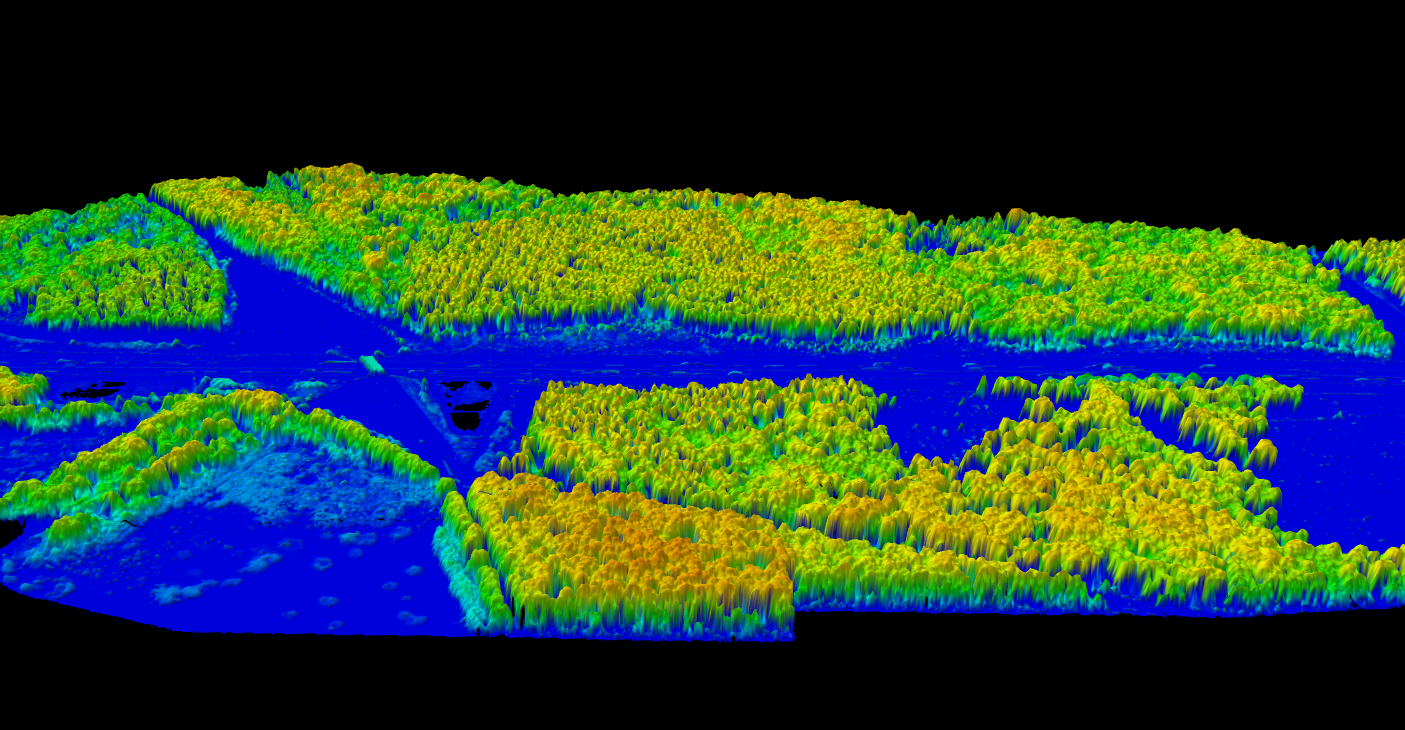
The Canopy Height Model (CHM) is the key to measuring tree height with LiDAR. The calculation is straightforward:
CHM = DSM − DTM
- DSM (Digital Surface Model) – Elevation of the highest point at each location (tree tops, building roofs)
- DTM (Digital Terrain Model) – Bare ground elevation after removing vegetation
- CHM (Canopy Height Model) – The difference, representing actual object heights above ground
If a tree crown sits at 145 meters elevation and the ground beneath it sits at 120 meters, the CHM shows that tree as 25 meters tall.
Why Multi-Return LiDAR Matters
Multi-return LiDAR captures multiple echoes from a single pulse:
- First return hits the canopy surface
- Later returns penetrate through gaps to record mid-canopy vegetation
- Final return reaches the ground
This gives you both the DSM (first returns) and DTM (ground returns) from the same dataset.
Step-by-Step: Measure Tree Height from LiDAR
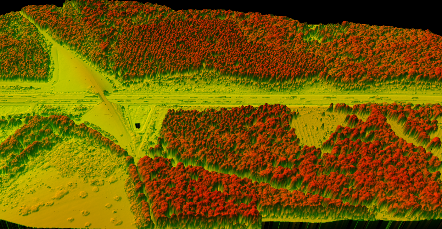
Here is the workflow to extract tree heights from airborne LiDAR data
Classify Ground
Separate ground returns from vegetation using AI-based classification.
Generate DTM
Create Digital Terrain Model from classified ground points.
Generate DSM
Create Digital Surface Model from highest returns at each location.
Calculate CHM
Subtract DTM from DSM to get vegetation heights.
Detect Trees
Identify local maxima in CHM for tree tops and heights.
Individual Tree Detection
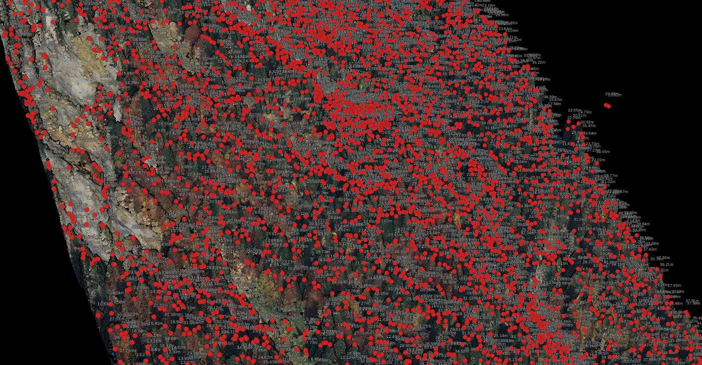
Tree top detection algorithms identify local maxima in the CHM, representing the highest point of each tree crown. This gives you:
- Tree top locations – XY coordinates for each detected tree
- Tree heights – CHM value at each tree top
- Crown boundaries – Polygon delineating each tree canopy extent
AUTOMATED WORKFLOW
Tree Height Measurement with Lidarvisor
One-click processing from point cloud to tree inventory
Lidarvisor automates the entire workflow. Upload your LAS or LAZ file, and the platform handles everything:
- Classifies ground points automatically using AI
- Generates DTM, DSM, and CHM rasters
- Detects individual tree tops and crown boundaries
- Exports tree metrics as CSV (height, crown diameter, XY)
- Generates Digital Forest Inventory report (PDF)
From Tree Height to Carbon Stock
Tree height is the foundation for carbon estimation. Lidarvisor uses species-specific allometric models to convert LiDAR-measured heights into:
• Carbon stock (tonnes C per tree)
• CO₂ equivalent (tonnes CO₂eq)
• Above-ground biomass (tonnes AGB)
Choose from 102 species models across 8 geographic regions. Results support carbon credit programs and REDD+ reporting with IPCC-referenced methodology.
Accuracy Considerations
Point Density
Higher point density means better crown capture. For forestry, 10+ points per square meter is recommended. Lower densities may miss narrow crown peaks.
Ground Classification
DTM errors propagate directly to CHM errors. AI-powered ground classification trained on forest data is essential for accurate results.
Canopy Structure
Open-canopy forests with distinct individual trees yield more accurate heights. Dense closed-canopy may have merged crowns.
Typical accuracy for LiDAR tree height measurement is ±0.1 to 0.5 meters, significantly better than field methods.
Frequently Asked Questions
Can LiDAR measure tree height in dense forests?
Yes. Multi-return LiDAR penetrates forest canopy. Some pulses reach the ground through gaps, allowing accurate DTM generation even under dense cover. The CHM calculation then gives you vegetation height above that ground surface.
What LiDAR data do I need?
Aerial LiDAR in LAS or LAZ format. Multi-return data with at least 4 points per square meter works well, though higher densities (10+ pts/m²) improve individual tree detection in dense stands.
Is LiDAR more accurate than field measurement?
Generally yes. LiDAR provides ±0.1-0.5 m accuracy versus ±1-2 m for clinometer methods. More importantly, LiDAR measures every tree while field methods only sample.
Can I use drone LiDAR for tree height?
Yes. Drone LiDAR works the same way as manned aircraft LiDAR for this application. The processing workflow is identical. Lidarvisor accepts LAS/LAZ files from any airborne source.
Ready to Measure Tree Heights with LiDAR?
Skip the manual workflow. Upload your point cloud to Lidarvisor, get tree heights with one click, and export the data you need for forest inventory, carbon estimation, or timber planning.
Create free account50 hectares free. No credit card. No software to install.