
Learn LiDAR
Vegetation Management Software for Utility Corridors: LiDAR Clearance Review and Export Workflows
LiDAR Clearance Review and Export Workflows
No credit card required • 50 hectares included
If your vegetation management software stops at displaying a point cloud, your corridor team still has the hard part ahead: separating vegetation from utility features, checking terrain context, and handing off usable files to GIS, CAD, and field crews.
Lidarvisor fits that post-capture step. It helps utility teams upload LAS or LAZ in the browser, classify ground, vegetation, wires, poles, and towers, generate terrain outputs, and export deliverables without forcing every reviewer into a desktop workflow.
Why vegetation management software shortlists are splitting in 2026
Utility buyers are increasingly comparing two different categories under the same label: field-work and work-order systems on one side, and LiDAR processing plus review workflows on the other. That split matters because corridor programs still need classified point clouds, terrain models, and export-ready layers before crews can act.
Current market pressure is pushing that distinction harder, not softer. GeoCue’s 2026 LP360 launch around AI Utilities and corridor classification keeps reinforcing buyer demand for faster utility-specific LiDAR review, while broader utility teams still need browser access, terrain context, and handoff-ready exports instead of another desktop-only bottleneck.
If you are evaluating vegetation management software for utility corridors, make sure the shortlist reflects the stage you actually need to improve: post-capture LiDAR cleanup and review, field dispatch, or both.
What vegetation management software should help your team do
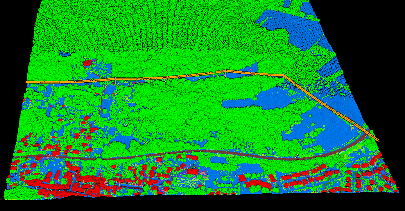
- Separate ground, vegetation, wires, poles, and towers before corridor review starts
- Generate DTM, DSM, hillshade, and slope outputs for terrain-aware planning
- Extract utility and vegetation context such as power lines, tree crowns, and tree tops when downstream teams need them
- Export LAS, GeoTIFF, SHP, DXF, and GeoJSON deliverables for GIS, CAD, and contractor workflows
- Keep review accessible in a browser instead of forcing every stakeholder into the same desktop setup
That mix matters because vegetation programs rarely end at detection. Teams still need review-ready data they can pass into trimming plans, asset updates, contractor coordination, and documentation.
How Lidarvisor helps: Browser-based processing and review
How Lidarvisor helps: Automatic classification for corridor-ready review
How Lidarvisor helps: Generate DTM, DSM, hillshade, and slope outputs
How Lidarvisor helps: Review vegetation near wires, poles, and towers before handoff
How Lidarvisor helps: Export LAS, GeoTIFF, SHP, DXF, and GeoJSON outputs
This is the strongest fit for utility vegetation management, corridor mapping, and asset inventory programs that need usable deliverables after LiDAR processing, not just another viewer.
Where Lidarvisor fits in the workflow
Upload and review
What teams need: Open LAS or LAZ without a heavy desktop setup
Classification
What teams need: Separate ground, vegetation, wires, poles, towers, buildings, and water
Terrain context
What teams need: Understand bare earth, slope, and corridor shape
Utility review
What teams need: Check vegetation and infrastructure in the same scene
Handoff
What teams need: Send usable files to GIS, CAD, or field teams
Reporting
What teams need: a record of what was processed and what was produced, ready to attach to the job.
Best-fit use cases
Utility corridor screening
review vegetation near wires, poles, and towers before follow-up work starts
Contractor handoff
export maps and layers for trimming plans or field inspection
Asset inventory support
generate infrastructure and terrain context for GIS updates and corridor records
Forestry-adjacent corridor work
add tree crowns, tree tops, and canopy context when the project extends beyond basic clearance review
Questions to ask before choosing vegetation management software
- Can it separate vegetation from ground and utility structures clearly enough for review?
- Can it generate terrain outputs that support corridor planning, not just on-screen visualization?
- Can it export files your GIS, CAD, and contractor teams can actually use without cleanup?
- Can multiple stakeholders review results in a browser, or does every step depend on desktop software?
- Does it fit post-capture corridor processing, or is it mainly a work-order or outage-management platform?
If your team needs crew dispatch, outage management, or work-order execution, you will still need systems outside Lidarvisor. The fit here is LiDAR processing, classification, terrain generation, review, and export for vegetation programs.
Related utility and vegetation guides
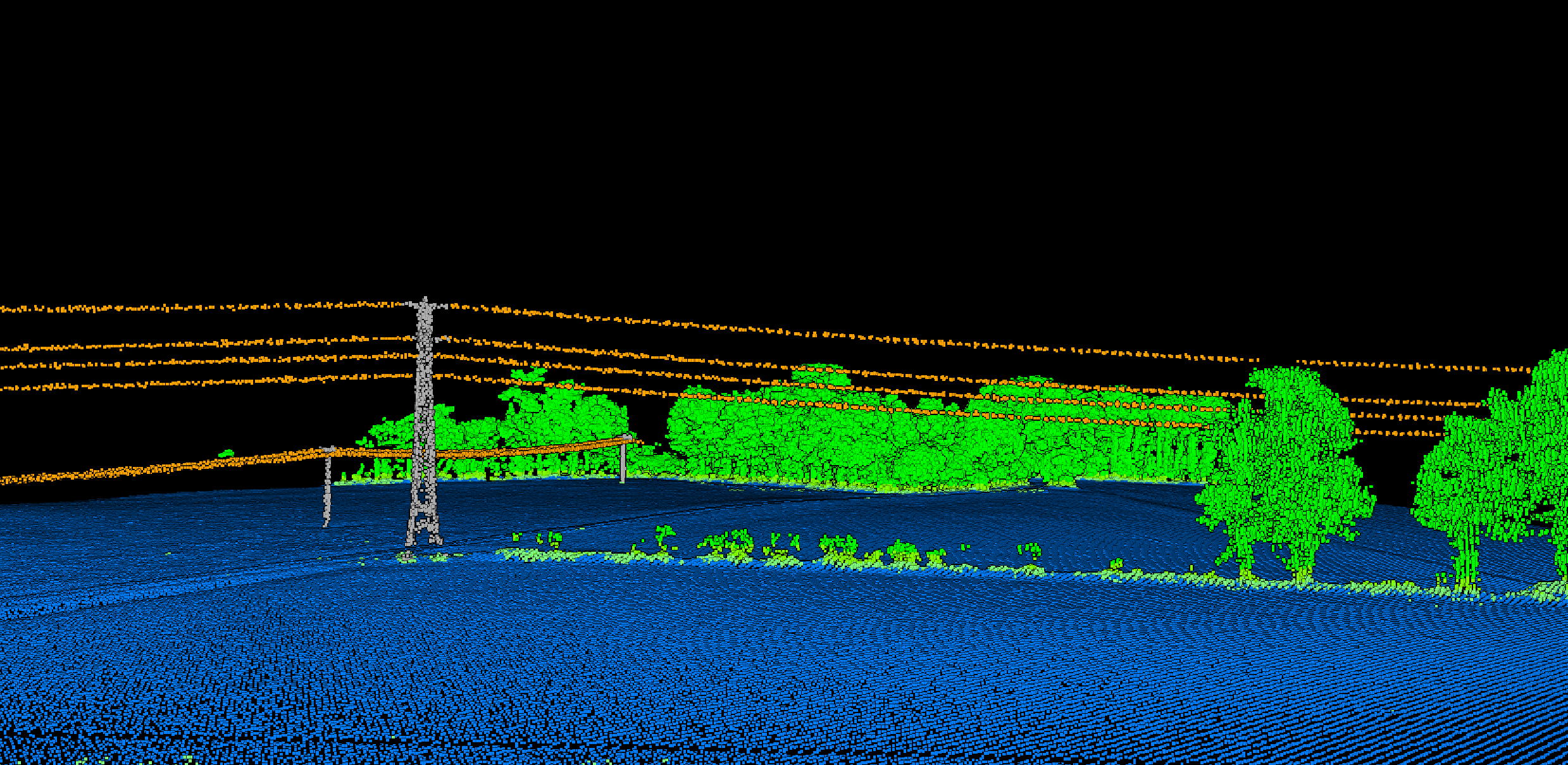
Vegetation clearance is one layer of the corridor. See LiDAR corridor mapping software for the rest.
Ready to review corridor LiDAR in the browser?
Create a free account to test the workflow with up to 50 hectares of processing included, then move to a paid plan when you need downloadable data exports plus higher processing, storage, and file-size limits.
Create free account50 hectares free. No credit card. No software to install.