Infrastructure
• Bridge & Road Inspection
• Construction
• Solar Assessment
Related Industry Applications
Natural Resources
• Forest Inventory
• Forest Guide
• Vegetation Management
Geospatial
• Surveying
• Terrain Mapping
• Archaeology
Why Extract Powerline Wires from LiDAR?
Utilities need wire position data for multiple critical workflows:
- Vegetation Management — measuring clearance to prevent outages and wildfires
- Sag and Clearance Analysis — verifying safe distances under thermal conditions
- Asset Inventory — comprehensive databases of transmission infrastructure
- Inspection Planning — identifying spans requiring maintenance
Traditional survey methods are slow, expensive, and often dangerous along high-voltage corridors.
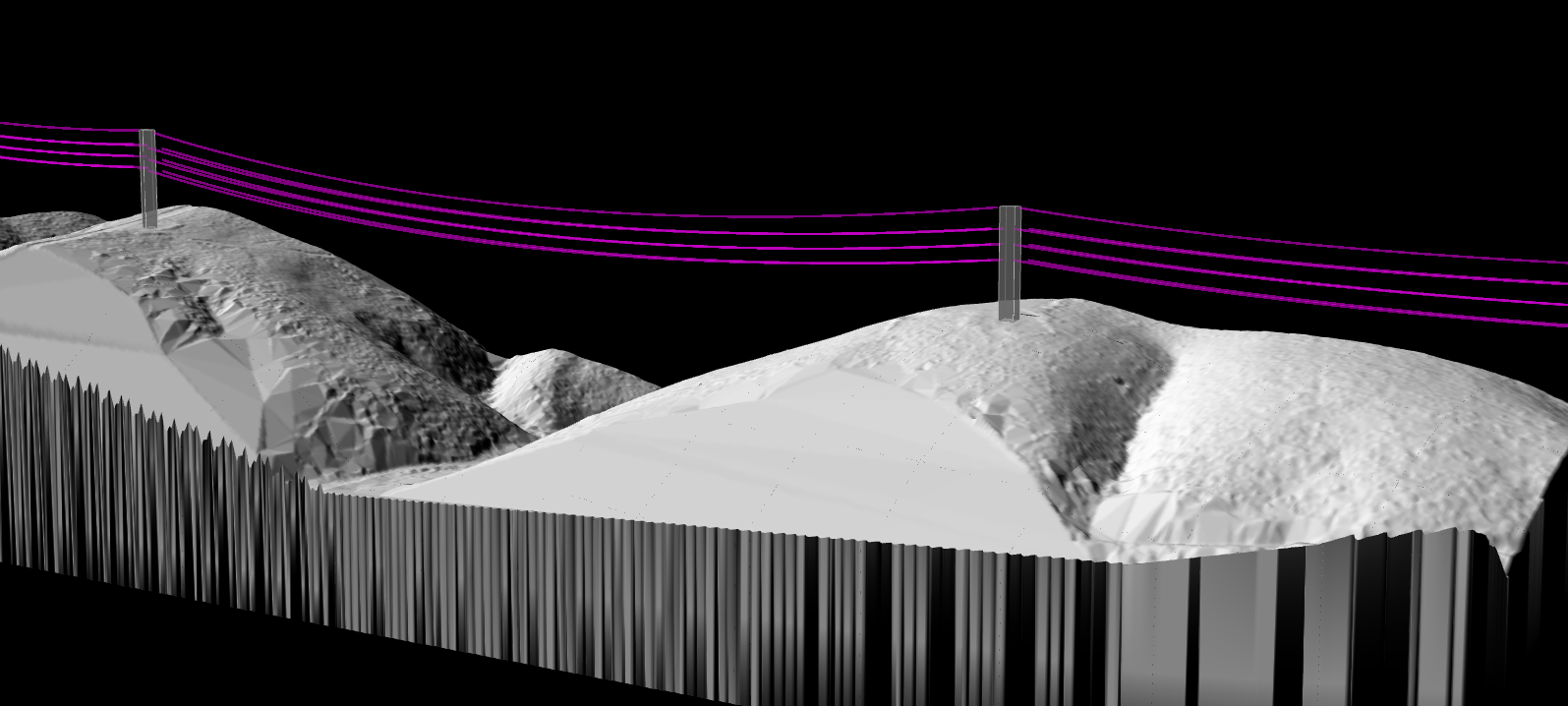
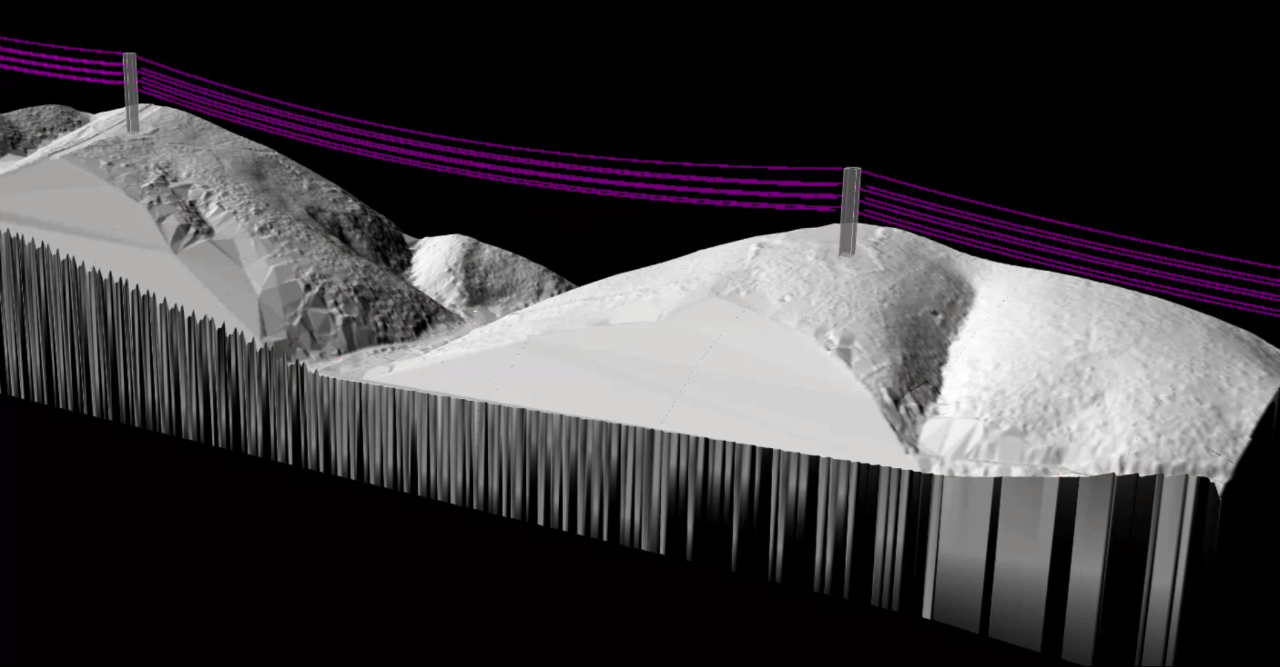
Automated power line extraction from LiDAR point cloud data
Point Cloud Classification: The Foundation
Before extracting wire vectors, the point cloud must be classified. Lidarvisor automatically identifies standard LAS classes:
Wire
Class 14
Conductor cables
Tower
Class 15
Lattice towers
Pole
Class 18
Distribution poles
Vegetation
Classes 3-5
Low to high veg
Ground
Class 2
Bare earth
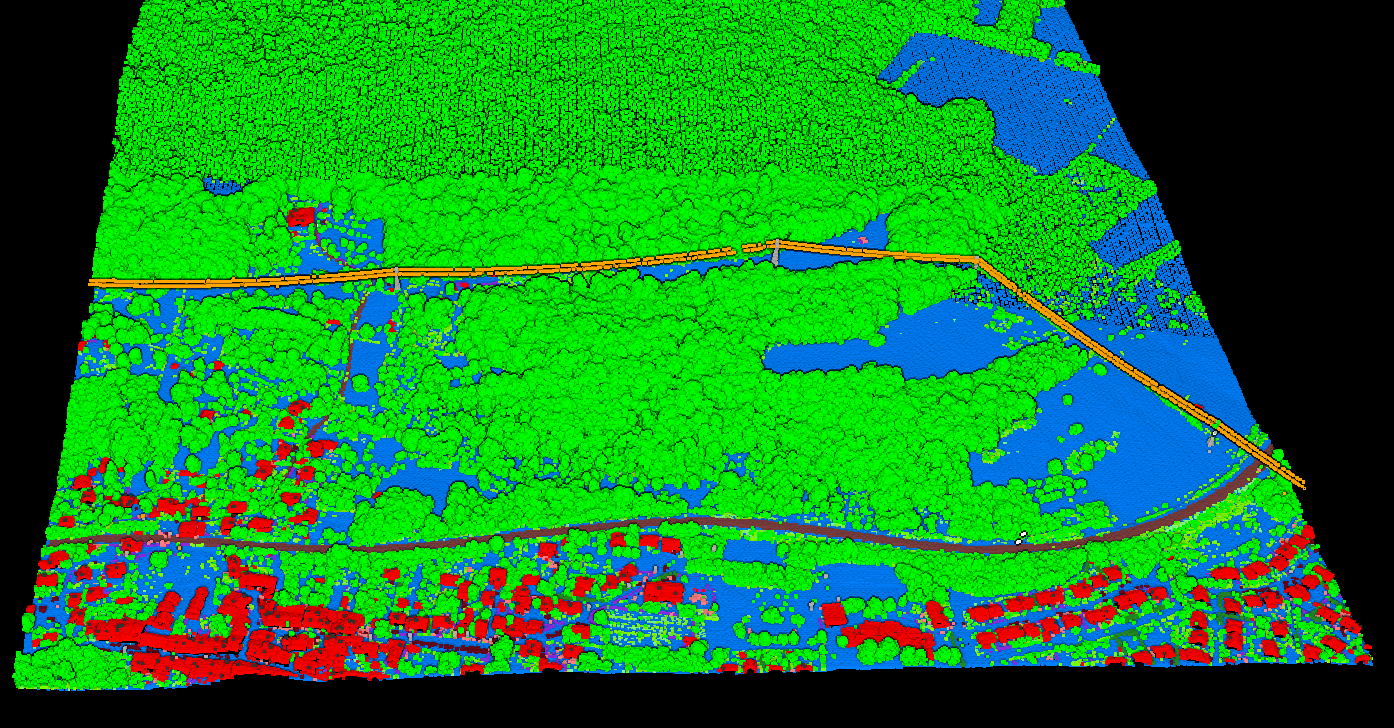
Classified point cloud with power line corridor
Utility Corridor Deliverables
- Classified Point Cloud — wires, poles, vegetation, ground separated
- Digital Terrain Model — bare-earth surface under the corridor
- Vegetation Height Model — identify encroachment risks
- Slope Analysis — assess access and erosion risk
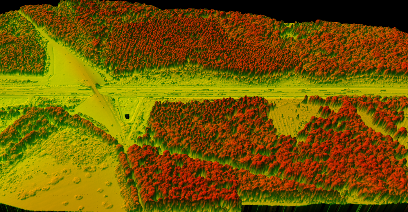
Canopy Height Model (CHM) for vegetation encroachment analysis
Create a FREE account now and start processing your point cloud
Get 2 GB of storage space and classify up to 10 hectares for free.