Upload. Process. Download.
Automatic classification, terrain modeling, and vectorization. No setup, no parameter tuning, just results.
Trusted by Survey Professionals Worldwide
"The powerful classification is the best feature. It saves a lot of time and money compared to manual classification or expensive solutions."

Emilio Segovia
Head of Operations, PDM 4 Cero
"We saved a lot of time classifying our point clouds. Not only classified data, but also DEM, DSM, DXF exports we could use directly in our analysis software."

Marcel Aertssen
Survey Analyst, SkySense UAV Solutions
"Excellent software. Processing is extremely fast and highly accurate. Exemplary DSM and DTM outputs."

Theoharis Papadiamantis
Surveying Engineer, Geodimetro
"Lidarvisor has transformed my LiDAR post-processing workflow. The speed of results is impressive, all the useful data is correlated, and what I find exceptional is the DXF export function."

Carolina Collaro
Architect | University of Jaén, Spain
"We used to outsource our LiDAR processing. With Lidarvisor, we brought it in-house and cut our costs significantly while keeping full control over the workflow."

Bodie Lloyd Kirori
Managing Director | Geolens Engineering, Papua New Guinea
"We tested Lidarvisor and achieved excellent results using a single platform. Previously, we needed up to three different programs to get similar results, which took us far more time and effort."

Eduardo Bonilla
Project Manager | Topcom S.A. de C.V., El Salvador
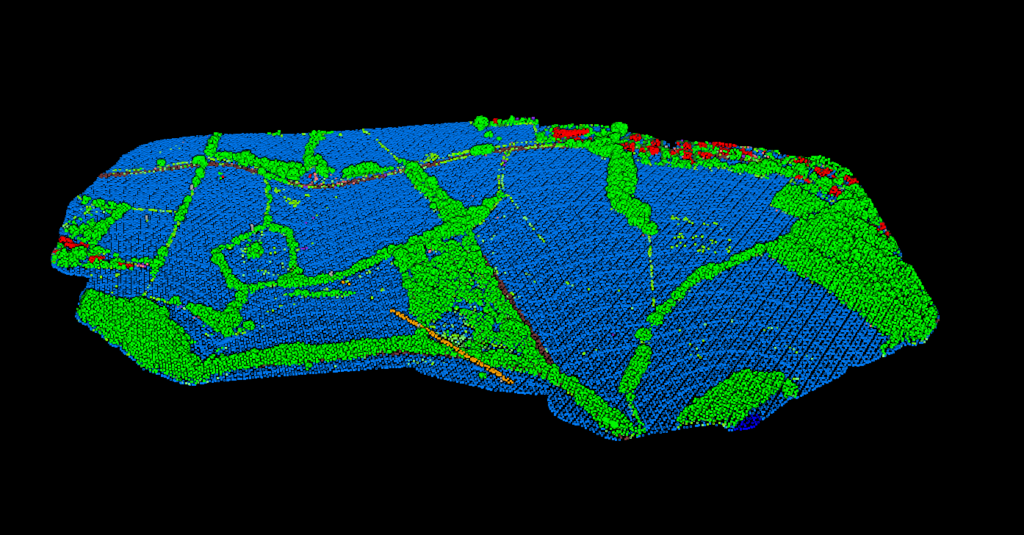
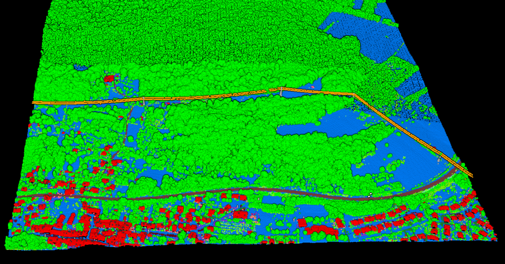
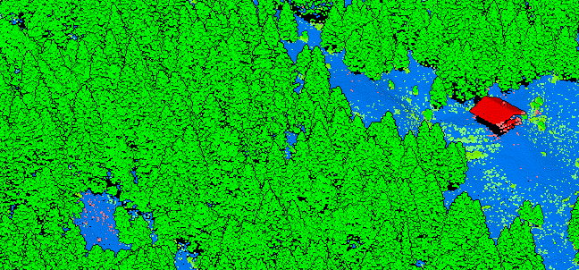
Automatic Point Cloud Classification
Our AI-powered classification segments your data into standard LAS classes with a single click: ground, vegetation, buildings, wires, poles, water, vehicles, and more.
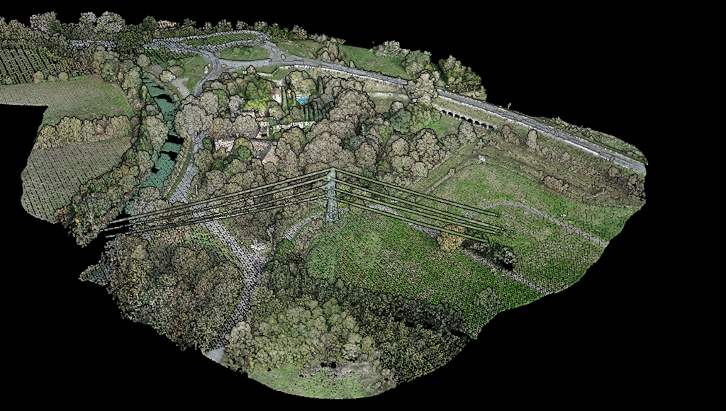
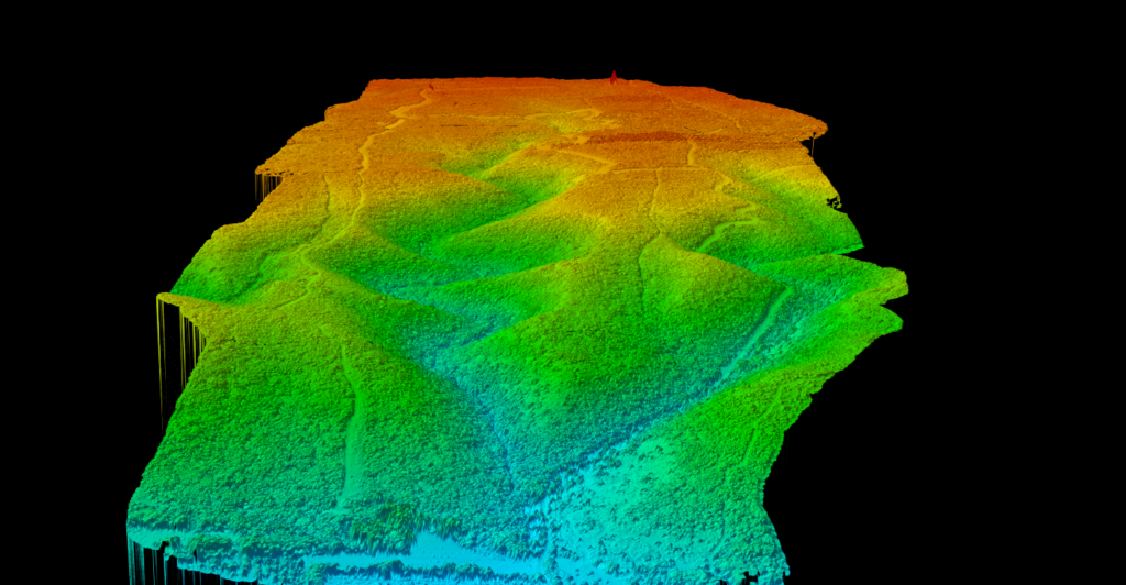
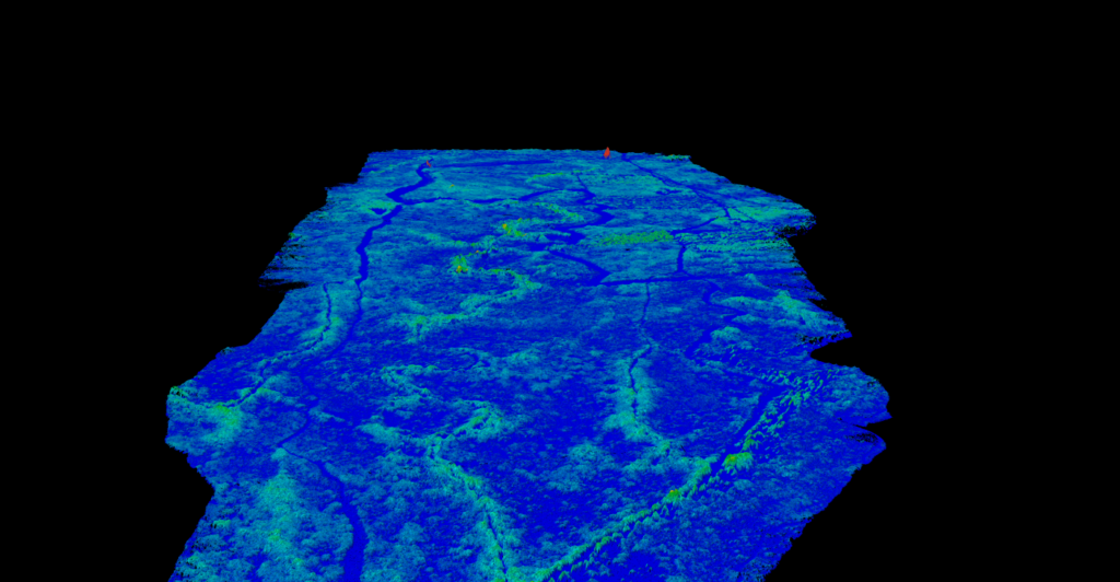
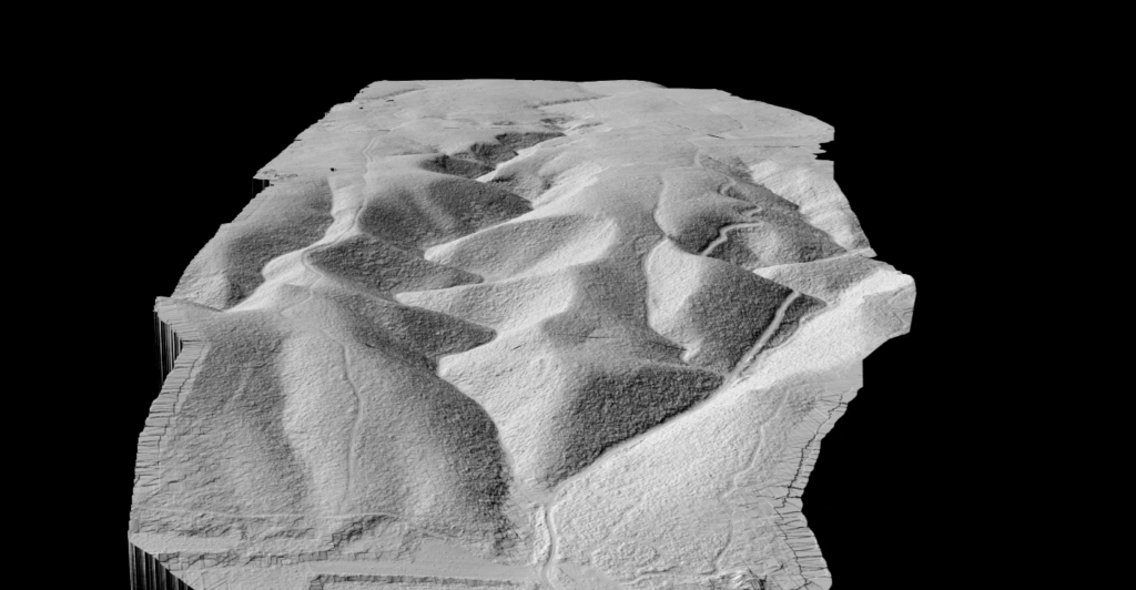
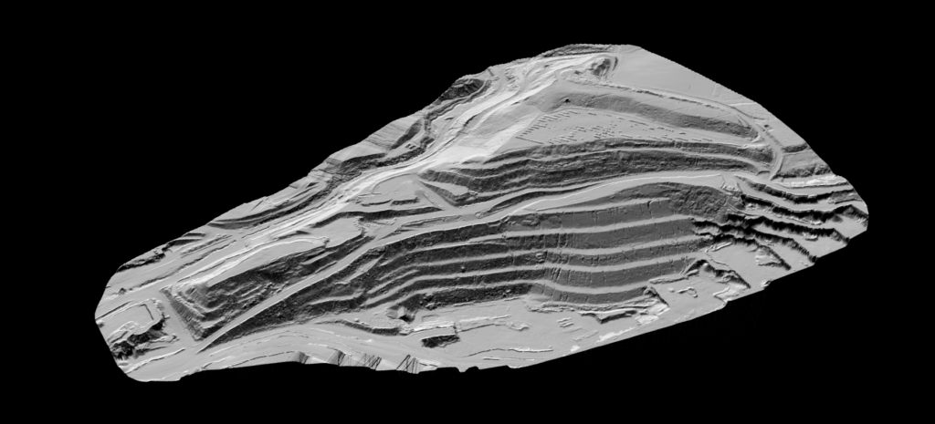
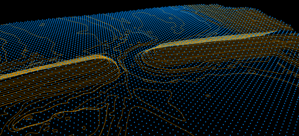
Terrain & Surface Modeling
Lidarvisor automatically generates Digital Terrain Models (DTM) and hillshade maps from your classified point cloud. Visualize terrain in 3D, overlay with other layers, and export in TIFF format for any GIS software.
- DTM & DSM in GeoTIFF format
- Hillshade visualization for terrain analysis
- 3D web viewer for immediate inspection
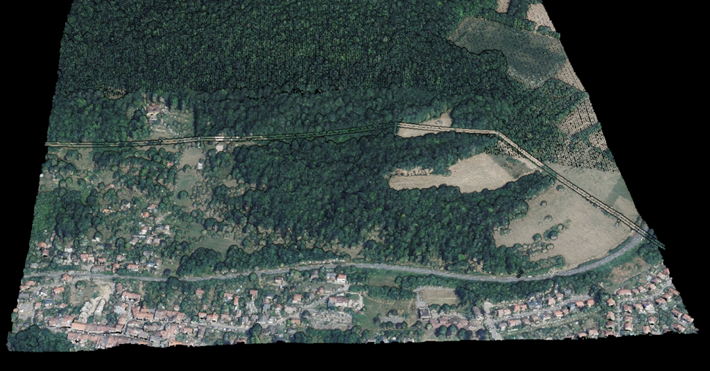
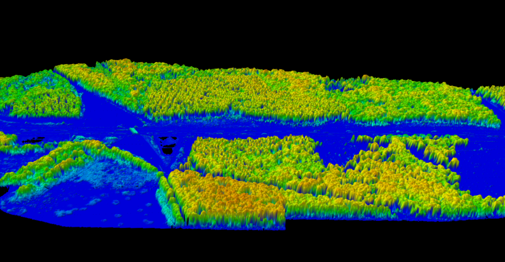
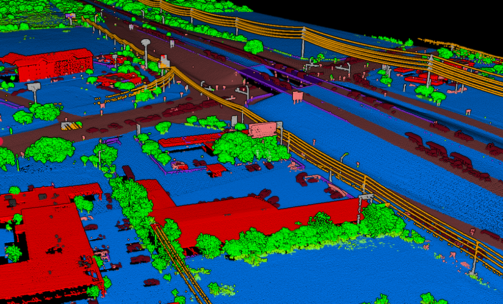
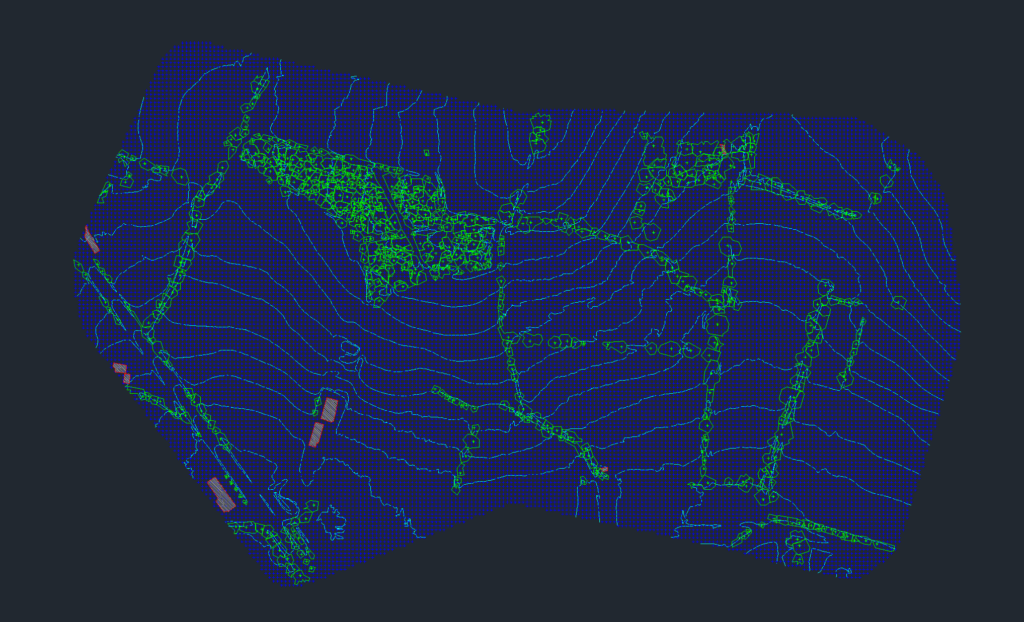
Vectorization & Feature Extraction
Generate contour lines, building footprints, tree crowns, and power line features automatically. Export CAD-ready deliverables in DXF, SHP, or GeoJSON formats for immediate use in your workflows.
- Contour lines, major and minor intervals
- Building footprints and roof outlines
- Vegetation: tree crowns, tree tops, and carbon estimation
- Infrastructure: wires, poles, towers
CAD-Ready Topographic Maps
Lidarvisor creates a fully layered topographic map in DXF format. Each layer, from contours to buildings to vegetation, is intelligently organized for easy editing in any CAD software. The presentation is preconfigured, eliminating manual setup.
Why Professionals Choose Lidarvisor
Ready to Simplify Your LiDAR Workflow?
Start with 10 Ha of free processing. No credit card required. See results in minutes.
Questions? Contact our team or check our pricing plans