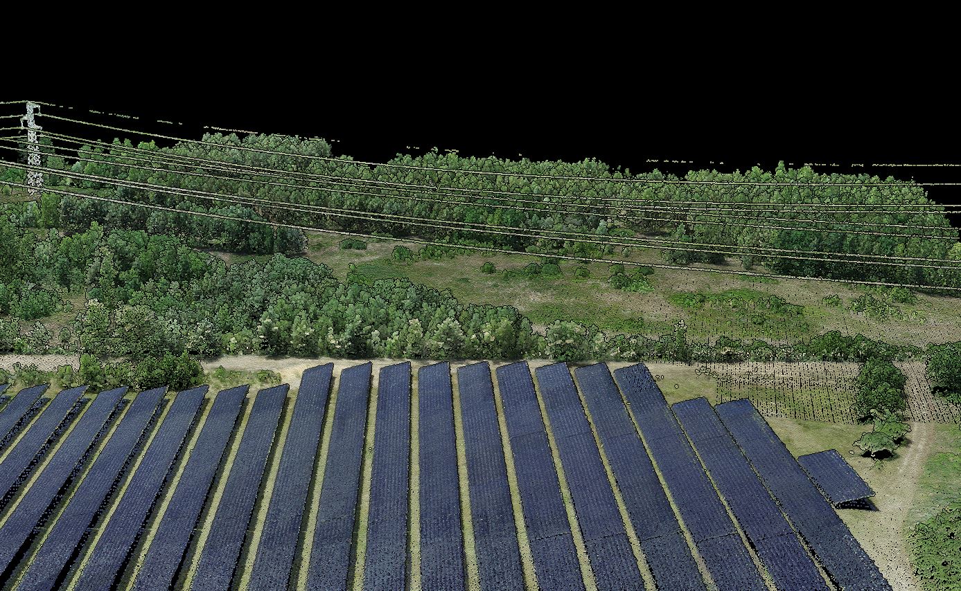
SOLAR SITE PLANNING
Why LiDAR Matters for Solar
Solar site assessment is heavily terrain-dependent. Small differences in slope, grade change, and drainage behavior can affect earthworks, mounting strategy, access, and cost. LiDAR helps teams inspect those conditions with much better detail early in the planning process.
That makes it useful for screening candidate parcels, refining site assumptions, and supporting civil design decisions downstream.
SOLAR DELIVERABLES
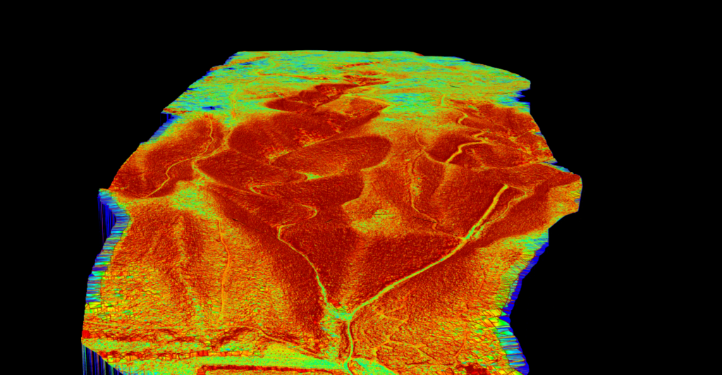
Key Deliverables for Solar Assessment
Solar teams usually need terrain outputs they can interpret and share, not just a point cloud file sitting in storage.
Lidarvisor helps create the terrain and slope products that make early site review and downstream design discussion easier.
✦ DTM for bare-earth site understanding and grading context
✦ Slope maps for constructability and layout-relevant terrain review
✦ DXF contour outputs for engineering and civil coordination
✦ Classified point cloud context where the broader surface and surroundings still matter
Additional Products
Frequently Asked Questions
Because terrain strongly affects constructability, grading, drainage, and layout assumptions. LiDAR helps teams inspect those conditions with much better detail early in the project.
DTM, slope maps, and contour outputs are especially useful because they make terrain behavior easier to interpret for site planning and civil work.
Yes. Terrain and slope products help teams understand where grading complexity may increase and where the site may need closer review before design assumptions are locked in.
No. Any solar site where terrain affects cost, drainage, constructability, or design quality can benefit from higher-resolution terrain data.
Yes, for standard LAS or LAZ workflows. Lidarvisor is designed to help you upload point cloud data and generate terrain-focused outputs without relying on a heavy desktop-processing chain for routine tasks.
Create a free account and start processing solar-site LiDAR
Start with 2 GB of storage and process up to 50 hectares for free. Upload solar-site LiDAR and turn it into DTM, slope, and contour outputs in one browser-based workflow.
No credit card required • 2 GB included on free signup
Related Articles
Solar Adjacent
• LiDAR for Construction
• Terrain Mapping with LiDAR
Terrain Outputs
• Create Accurate Terrain Models
• Digital Terrain Model Guide
More Applications
• Bridge & Road Inspection
• LiDAR for Mining