
TRANSPORT INFRASTRUCTURE
Bridge Inspection Software for LiDAR Roads and Corridors
Bridge inspection software should help teams review bridge decks, road corridors, embankments, and surrounding terrain from one LiDAR dataset.
No credit card required • 50 hectares included
Capture geometry faster than manual field measurement, classify the point cloud automatically, and export corridor-ready deliverables for engineering review.
Quantified Geometry
Capture deck shape, corridor surfaces, and terrain with measurable point cloud data
Corridor Context
Inspect the bridge and the surrounding road, slope, and access environment together
Terrain Outputs
Generate terrain models, contours, and slope outputs for downstream analysis
Browser Workflow
Upload LAS or LAZ and move from raw scan to deliverables without desktop-tool sprawl
Why LiDAR for Transportation Infrastructure
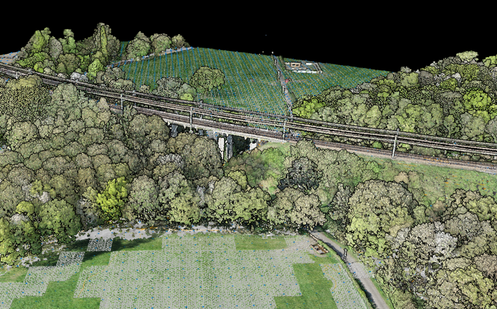
Bridges and roads sit inside messy real-world conditions: waterways, embankments, vegetation, utilities, retaining features, and traffic constraints. LiDAR captures that full spatial context in one dataset, which makes it useful for both structural surroundings and corridor-level terrain review.
Instead of collecting disconnected measurements, you can work from a measurable point cloud that supports inspection, terrain modeling, and follow-up engineering tasks.
Surface Detail
Inspect deck geometry, surface shape, grade change, and visible deformation patterns
Vegetation Context
See encroachment, access limitations, and vegetation conditions around the asset
Terrain + Drainage
Model embankments, slopes, approaches, and surrounding terrain behavior
Repeatable Measurement
Work from consistent spatial data for repeat surveys and change comparison
Bridge Inspection Deliverables
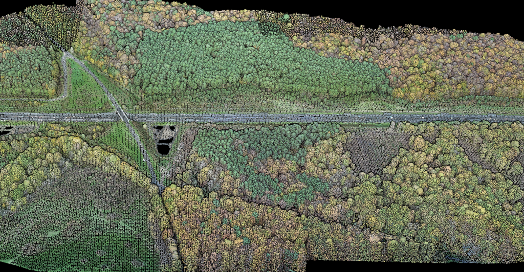
A bridge survey is rarely just about the deck. You usually need the deck, approaches, terrain below, and nearby corridor conditions in one inspection-ready package.
Use LiDAR outputs to support geometry review, terrain interpretation, planning, and engineering communication without relying only on manual notes and spot measurements.
- Classified point cloud for bridge deck, surroundings, and visible context
- DTM around abutments, slopes, and drainage-sensitive terrain near the structure
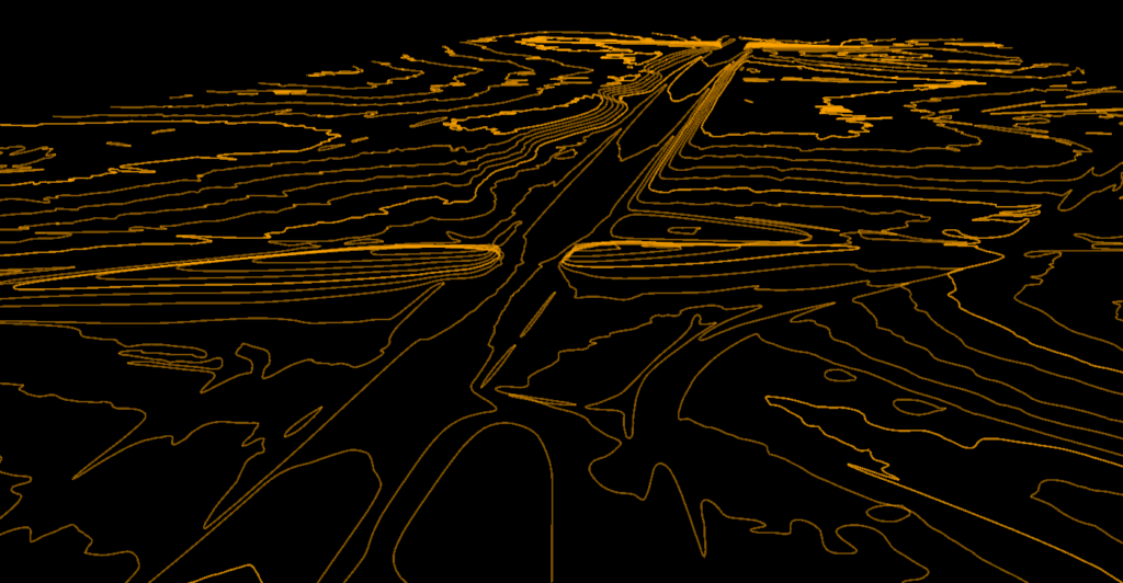
- Slope and terrain derivatives for approach analysis and embankment review
- Measurable visual context for repeat inspections and change tracking over time
ROAD CORRIDORS
Road Corridor Deliverables
Road inspection work often extends beyond the paved surface. Corridor LiDAR helps when the job includes shoulders, drainage, vegetation edges, slopes, and adjacent terrain behavior.
The value comes from turning the raw scan into usable outputs, not from the point cloud alone. That is where processing discipline matters.
- Classified point cloud for surface, roadside context, and corridor features
- GeoTIFF terrain outputs for drainage, grading, and slope interpretation
- DXF contour deliverables for corridor drafting and engineering review
- Better terrain context for access planning, embankment review, and follow-up site decisions
Traditional Inspection vs LiDAR-Based Inspection
Bridge and road inspection still needs engineering judgment. The advantage of LiDAR is that the judgment starts from richer geometry and terrain context instead of sparse manual capture alone.
Traditional Inspection
- More reliance on spot measurements, notes, and what crews can safely access
- Harder to preserve full corridor context for later review
- Less efficient when terrain and surrounding features matter to the decision
- Follow-up questions often require returning to the field or rebuilding context
LiDAR-Based Inspection
- Work from measurable bridge, corridor, and terrain geometry in one dataset
- Preserve context for later engineering review without recollecting the site
- Generate terrain and vector outputs that support actual downstream work
- Better fit for repeat surveys, comparison, and planning around the inspected asset
Frequently Asked Questions
What can LiDAR help measure during bridge inspection work?
LiDAR can help document deck geometry, approaches, surrounding terrain, drainage-relevant slopes, and visible corridor context. The exact engineering interpretation still depends on the inspection goal, but the point cloud gives you measurable spatial data to work from.
Is LiDAR replacing bridge inspectors?
No. LiDAR supports inspection teams by improving how site geometry and surroundings are captured. It does not replace engineering judgment, condition assessment expertise, or any required field procedures.
Why use LiDAR for road corridor surveys?
Road corridors involve more than pavement alone. LiDAR is useful when you need terrain, embankment, vegetation edge, drainage, and alignment context in addition to the surface itself.
What deliverables can come from infrastructure LiDAR processing?
Common outputs include classified point clouds, terrain models, slope products, and DXF contour deliverables for engineering or mapping workflows. The exact deliverables depend on the project scope and how the data will be used downstream.
Can I process bridge and road LiDAR in the browser?
Yes, for standard LAS or LAZ workflows. Lidarvisor is designed to let you upload point cloud data, classify it automatically, and export terrain-focused outputs without relying on a full local desktop processing chain for routine tasks.
Related Articles
Infrastructure
• LiDAR for Construction
• Powerline Wire Extraction
Terrain Outputs
• Create Accurate Terrain Models
• Point Cloud Vectorization
Related Use Cases
• Terrain Mapping with LiDAR
• LiDAR Surveying
Create a free account and start processing transportation infrastructure LiDAR
Start with 5 GB of storage and process up to 50 hectares for free. Upload bridge, road, or corridor point clouds and turn them into classified and terrain deliverables in one browser-based workflow. No credit card required • 5 GB included on free signup
Create free account50 hectares free. No credit card. No software to install.