Automate wire classification, corridor mapping, and vector deliverables for utility LiDAR workflows
Why Utility Teams Extract Wires from LiDAR
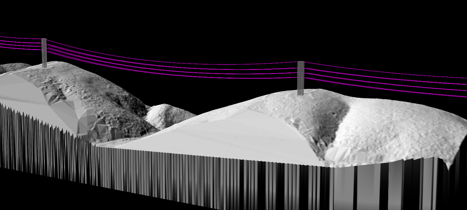
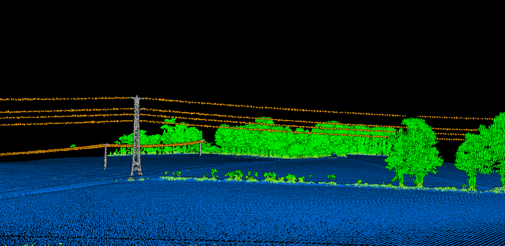
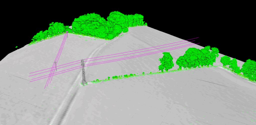
Transmission and distribution corridors contain overlapping features: conductors, shield wires, poles, towers, insulators, vegetation, ground, roads, and nearby structures. Manual review inside desktop software is possible, but it becomes slow and inconsistent when projects cover long corridors or dense vegetation.
Wire extraction helps teams isolate the features that matter for clearance studies, corridor inventories, vegetation risk assessment, and engineering deliverables. Once wires are correctly classified, you can generate cleaner vector outputs, measure sag and proximity more reliably, and reduce the time spent cleaning noisy point clouds by hand.
Powerline LiDAR Workflow
A typical utility corridor project moves through classification, feature isolation, and export. The key challenge is preserving wire geometry while removing confusion from vegetation and nearby structures.
01
Upload Corridor Data
Import LAS or LAZ point clouds from airborne or drone utility surveys.
02
Classify Wires & Structures
Separate wires, towers, poles, vegetation, and ground into distinct classes.
03
Review Corridor Outputs
Inspect extracted wires and corridor context in 3D before export.
04
Export Deliverables
Download classified point clouds and vector products for GIS, CAD, or reporting workflows.
CLASSIFICATION
Wire Extraction Starts with Correct Classification
If wires are misclassified as vegetation or noise, every downstream deliverable becomes less reliable
Thin conductors are difficult because they contain fewer returns than towers or tree canopies. Utility processing depends on algorithms that preserve those sparse linear features while still filtering surrounding clutter. That is why wire extraction and classification are tightly linked in any serious corridor workflow.
✦Isolate conductors from trees, poles, and terrain
✦Keep corridor context for vegetation encroachment review
✦Prepare cleaner inputs for vectorization and measurement
DELIVERABLES
What Utility Teams Usually Need
Point clouds alone are rarely the final product for corridor engineering or inspection teams
Depending on the project, deliverables may include classified LAZ files, vector wire lines, tower and pole extraction, corridor maps, or terrain models used alongside clearance review. Good processing makes those outputs easier to trust and easier to use downstream in GIS and CAD environments.
✦Classified point clouds for review and archive
✦Vectorized wire linework for design and mapping
✦Supporting terrain and vegetation context for corridor decisions
Traditional Utility Processing vs Lidarvisor
Traditional Tools
Long corridor projects often involve manual class cleanup, repeated desktop review, and separate export steps for every deliverable. Thin features like wires are easy to miss, especially when vegetation density is high.
Lidarvisor AI
Lidarvisor automates classification and supports downstream outputs like vectorization, terrain generation, and corridor review so utility teams can move from raw point clouds to usable products with less cleanup.
Frequently Asked Questions
It is the process of identifying and isolating powerline conductors inside a LiDAR point cloud so they can be reviewed, measured, and exported separately from vegetation, towers, poles, and ground.
Wires are thin linear features with fewer returns than surrounding vegetation and structures. That makes them easier to misclassify unless the workflow preserves sparse conductor points carefully.
Lidarvisor supports vectorization outputs such as DXF, SHP, and GeoJSON, which helps utility teams turn classified corridor features into mapping and engineering deliverables.
Teams often need classified point clouds, terrain models, vegetation context, extracted towers or poles, and vector linework that can be used in CAD or GIS environments.
No. The same type of workflow can support transmission, distribution, and utility vegetation management projects wherever corridor LiDAR is used to understand assets and nearby vegetation.