
Learn LiDAR
How to Download Free LiDAR Data from Spain PNOA
Complete Step-by-Step Tutorial
No credit card required • 50 hectares included
Spain’s PNOA-LiDAR program provides free access to high-resolution point clouds and terrain models covering the entire country. With three coverage generations offering up to 5 points per square metre and 10cm vertical accuracy, it’s one of Europe’s most comprehensive national LiDAR datasets. No registration required.
The Plan Nacional de Ortofotografía Aérea (PNOA) is Spain’s national program for capturing aerial imagery and elevation data. Since 2009, the PNOA-LiDAR project has been systematically scanning the entire Spanish territory using airborne LiDAR sensors.
Data is provided by IGN (Instituto Geográfico Nacional) and distributed through the CNIG (Centro Nacional de Información Geográfica).
What is PNOA LiDAR?
Point Clouds
Classified LAZ with RGB color
High Precision
Up to 5 pts/m², ≤10cm accuracy
Full Coverage
Spain + Islands + Ceuta/Melilla
Free Access
CC-BY 4.0 license
Key Specifications by Coverage
Three Generations of National LiDAR Collection
| Specification | 1st Coverage (2009-2015) | 2nd Coverage (2015-2021) | 3rd Coverage (2022-2025) |
|---|---|---|---|
| Point Density | 0.5 pts/m² | 0.5–2 pts/m² | 5 pts/m² |
| Vertical Accuracy | ≤40 cm | ≤20 cm | ≤10 cm |
| Horizontal Accuracy | ≤30 cm | ≤30 cm | ≤25 cm |
| Tile Size | 2×2 km | 2×2 km | 1×1 km |
| DEM Resolution | 5 m | 2 m | 0.5 m |
| RGB Imagery | No (except Baleares) | Yes (from 2016) | Yes (RGBI) |
Coordinate System: ETRS89/REGCAN95 in UTM zones 28-31 | Vertical Datum: EGM08 geoid
Step-by-Step Download Guide
Navigate the CNIG Download Center
Follow these steps to access and download LiDAR point cloud data from Spain’s national download center. The interface is available in Spanish and English.
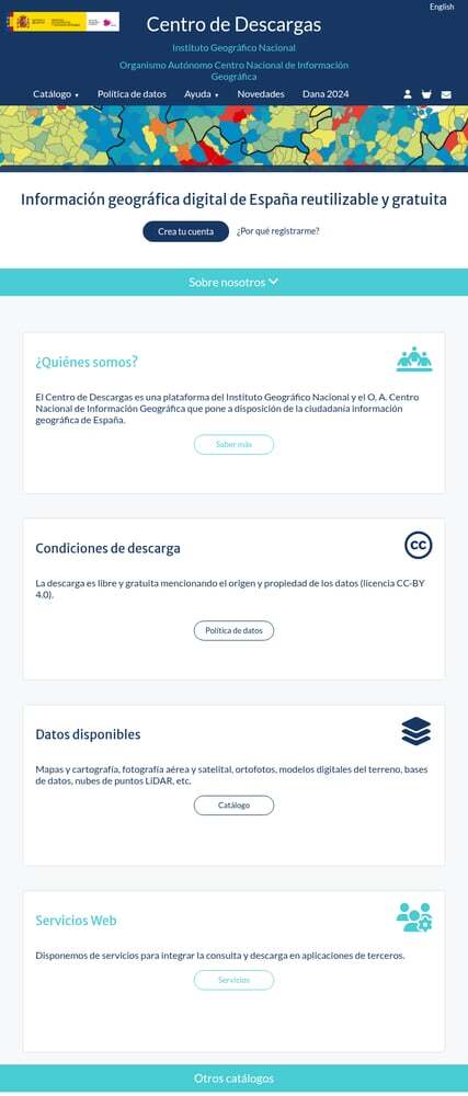
Getting started:
- No registration required: Download immediately as a guest
- Free account: Removes 20-file limit for bulk downloads
- Popular products: LiDAR, orthofotos, terrain models on homepage
Direct product links:
- 2nd Coverage LiDAR (2015-2021) — Complete national coverage
- 3rd Coverage LiDAR (2022-2025) — Highest quality, being completed
You can also search directly for “LIDAR” in the text search box.
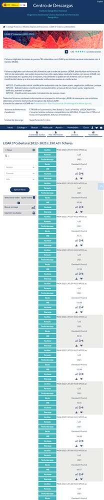
Access the CNIG Download Center
Navigate to centrodedescargas.cnig.es to access Spain’s official geospatial data repository. Use the language toggle for English.
Navigate to LiDAR Products
From the main page, go to Catálogo (Catalog) and select “Modelos digitales de elevaciones” (Digital Elevation Models). Or use direct links:
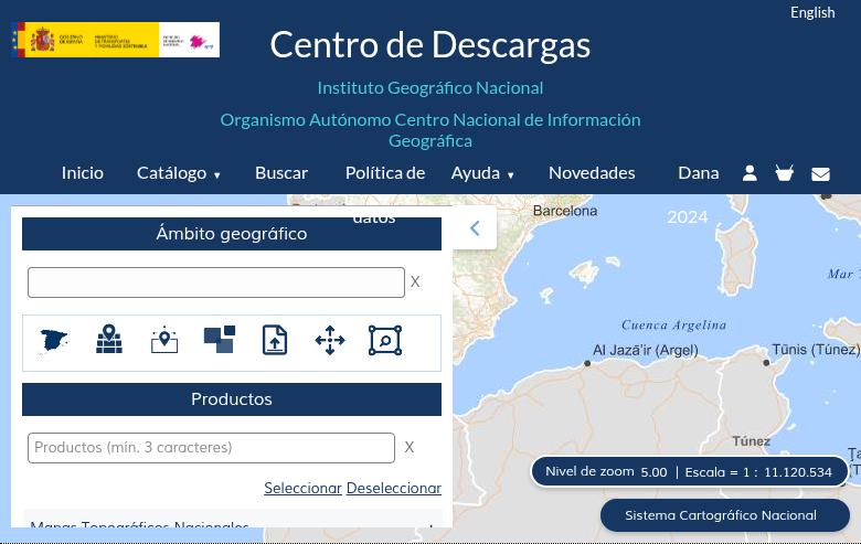
Search methods:
- Map Search: Click “Buscar en mapa” to navigate and select tiles visually
- Text Search: Enter municipality name, province, or coordinates
- MTN50 Sheet: Search by 1:50,000 topographic map sheet (1-1111)
- Administrative Unit: Filter by Autonomous Community, Province, or Municipality
Click on any tile to see metadata and add it to your download cart.
Download process:
- Click the shopping cart icon to add individual files
- Or use “Seleccionar todos” (Select All) for bulk selection
- Click “Descargar” (Download) for individual files
- Or use “Descarga masiva” (Bulk Download) for multiple files
Note: Without registration, you can download up to 20 files at once. Register for free to remove this limit.
Select Your Area of Interest
You have several options to find data for your area:
Add Files & Download
For each file you want to download:
Using the Download Cart
Files can be added to your cart using the shopping cart icon next to each file. Your cart appears in the top right corner showing pending files.
Review selections before downloading
Available Data Products
Point Clouds and Derived Terrain Models
Point Clouds (LAZ)
Classified 3D point clouds with RGB color information. Third coverage includes automatic (NPC01) and edited (NPC02) classifications.
MDT (Terrain Model)
Bare-earth elevation model showing terrain without buildings or vegetation. Available at 5m, 2m, and 0.5m resolution.
MDS (Surface Model)
Elevation model including all surface features: buildings, vegetation, bridges, and other structures.
MDSn (Normalized DSM)
Height of objects above ground level. Useful for vegetation height analysis and building height estimation.
MDP (Slope Model)
Derived product showing terrain slope as percentage gradient. Useful for drainage analysis and construction planning.
LiDAR Map (ECW)
Rasterized visualization combining building classes, vegetation classes, and hydrography into a colored map product.
File Formats Available
Point Cloud Formats
LAZ: Compressed LAS point cloud (LAS 1.2 or 1.4)
Best for: Point cloud analysis, 3D visualization, custom processing
File Sizes:
1st/2nd Coverage: 5-100 MB per tile
3rd Coverage: 50-300 MB per tile
DEM Formats
- GeoTIFF — GIS analysis, terrain visualization
- ASC / TXT — ASCII grid, simple text processing
- ECW — Large area visualization, web mapping
Tips for Large Downloads
Register for Free
Create a free account to remove the 20-file download limit and access your download history.
Use Download Manager
For bulk downloads, use tools like aria2 or DownThemAll for reliable parallel downloads.
Off-Peak Hours
Download during European night hours (00:00-06:00 CET) for faster speeds when server load is lower.
Plan Storage
LAZ files are typically 50-300 MB per tile. Plan for 100+ GB for provincial coverage.
Verify Downloads
Check file integrity after download. Corrupted LAZ files will fail to open in most software.
Check Coverage First
Not all areas have 3rd coverage yet. Check the project status page for availability.
Technical Specifications
Coordinate Systems
Horizontal CRS: ETRS89 (mainland, Baleares, Ceuta, Melilla)
Canary Islands: REGCAN95 (compatible with WGS84)
Projection: UTM zones 28, 29, 30, or 31
EPSG Codes: 25828, 25829, 25830, 25831
Point Classification
PNOA LiDAR data includes ASPRS standard classification:
- Ground (Class 2)
- Vegetation (Classes 3-5)
- Buildings (Class 6)
- Water (Class 9)
Processing Your Downloaded Data
Once you have downloaded your Spanish LAZ files, you’ll need to process them to extract useful products. Lidarvisor offers a streamlined workflow for processing point clouds
Upload LAZ Directly
No conversion needed — upload your PNOA LAZ files directly to Lidarvisor for processing.
Automatic Classification
AI-powered ground classification and noise removal works automatically on your data.
Generate Products
Create DTMs, DSMs, hillshades, slope maps, contours, and more from your point clouds.
Frequently Asked Questions
Is PNOA LiDAR data free to use?
Yes! All PNOA LiDAR data is freely available for download and use under Spain’s CC-BY 4.0 license. When using the data publicly, attribute it to: “© Instituto Geográfico Nacional de España” or “PNOA LiDAR – IGN”. Commercial use is permitted with attribution.
Do I need to create an account to download?
No, you can download without registration. However, creating a free account offers benefits: unlimited bulk downloads (vs. 20 files for guests), download history tracking, notifications for new data releases, and ability to save favorite products. Registration only requires an email address.
Which coverage should I download?
Choose based on your needs:
- 3rd Coverage (2022-2025): Best quality with 5 pts/m² density and ≤10 cm vertical accuracy. Ideal for detailed analysis, but coverage is still being completed.
- 2nd Coverage (2015-2021): Good balance of quality and complete national coverage. Recommended for most users needing full Spain coverage.
- 1st Coverage (2009-2015): Lower density (0.5 pts/m²) but useful for historical comparison or large-scale regional analysis.
Check the project status page for current 3rd coverage availability.
What coordinate system does PNOA LiDAR use?
PNOA LiDAR uses ETRS89 for mainland Spain, Balearic Islands, Ceuta, and Melilla; REGCAN95 for Canary Islands (both compatible with WGS84). The projection is UTM in the appropriate zone (28, 29, 30, or 31). Vertical heights are orthometric using the EGM08 geoid model. Use EPSG codes 25828, 25829, 25830, or 25831 depending on the UTM zone.
How do I find which tiles cover my project area?
Several methods: Use “Búsqueda por mapa” in the CNIG portal to visually select tiles, enter municipality names/provinces/coordinates in text search, search by 1:50,000 map sheet number if known, or enter UTM or lat/lon coordinates. Tile naming follows UTM coordinates of the upper-left corner — for example, “PNOA_2022_NAV_442_4754_ORT-CLA-COL” is in Navarra at UTM coordinates 442000, 4754000.
What software can open Spanish LAZ files?
LAZ files from CNIG can be opened with any LAS-compatible software. Free options include CloudCompare, QGIS (with LAStools plugin), and Fugro Viewer. Commercial options include Global Mapper, ArcGIS Pro, and AutoCAD. For cloud-based processing without software installation, upload directly to Lidarvisor.
Additional Resources
Official Resources
Ready to Process Your Spain LiDAR Data?
Upload your PNOA LAZ files to Lidarvisor and generate DTMs, DSMs, contours, and more — no desktop software required. Start with 50 Hectares of free processing.
Create free account50 hectares free. No credit card. No software to install.