
Tutorials
How to Download Free LiDAR Data for Slovenia
Complete Step-by-Step Tutorial
No credit card required • 50 hectares included
Access comprehensive 1-meter resolution LiDAR data covering the entire country through the ARSO (Slovenian Environment Agency) Portal—completely free with no registration required.
The Slovenian Environment Agency (ARSO) provides free, open access to high-resolution LiDAR data covering the entire country. Collected through national mapping initiatives, this dataset offers 1-meter resolution terrain models and classified point clouds for any application.
What is ARSO LiDAR?
Full Coverage
Entire Slovenia (~20,273 km²)
1m Resolution
DTM and DSM products
2-5 pts/m²
Classified point clouds
Free Access
No registration required
Step-by-Step Download Guide
Navigate the ARSO Atlas Okolja Interface
Follow these steps to access and download LiDAR point cloud data from Slovenia’s ARSO portal. The interface is straightforward with English-like navigation.
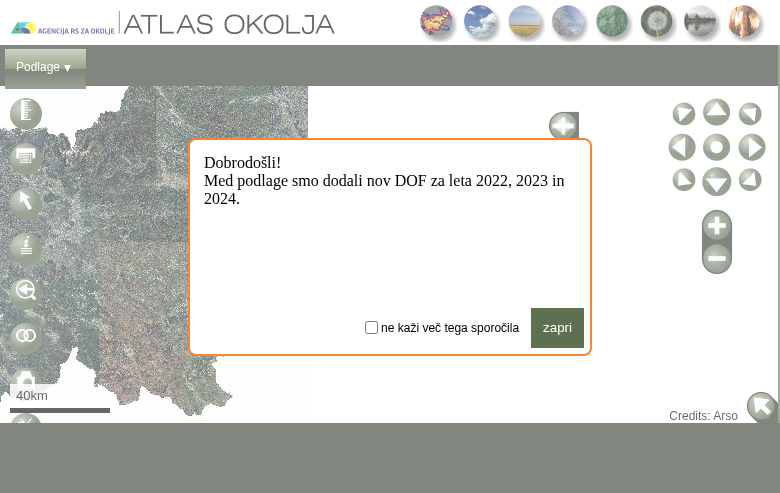
Getting started:
- Click “Prenos Lidar podatkov” — LiDAR Data Download link
- No account needed: Downloads are completely free
- Multiple formats: LAZ, zLAS, and ASC available
Navigation tips:
- Sloji (Layers): Manage visible data layers in the sidebar
- Scroll wheel: Zoom in/out on the map
- Click and drag: Pan across Slovenia
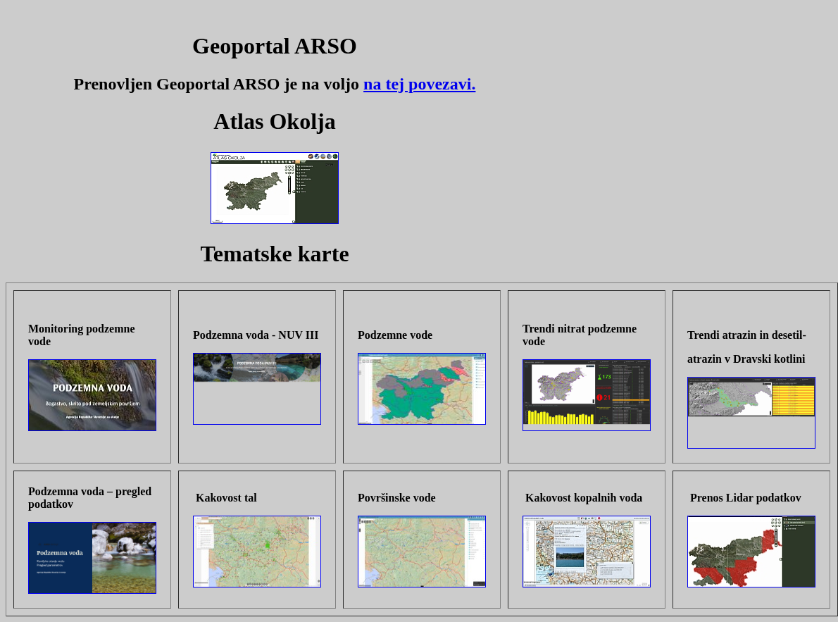
Access the ARSO Geoportal
Navigate to gis.arso.gov.si to access the ARSO GIS portal. The main page displays various thematic maps and data services available from the Slovenian Environment Agency.
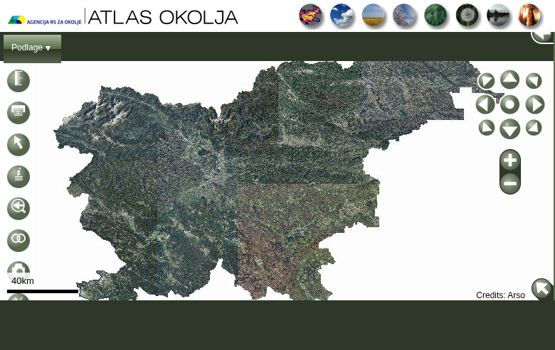
Open the Atlas Okolja Map
The LiDAR viewer opens in the Atlas Okolja (Environmental Atlas) interface. You’ll see an interactive map of Slovenia with various environmental data layers.
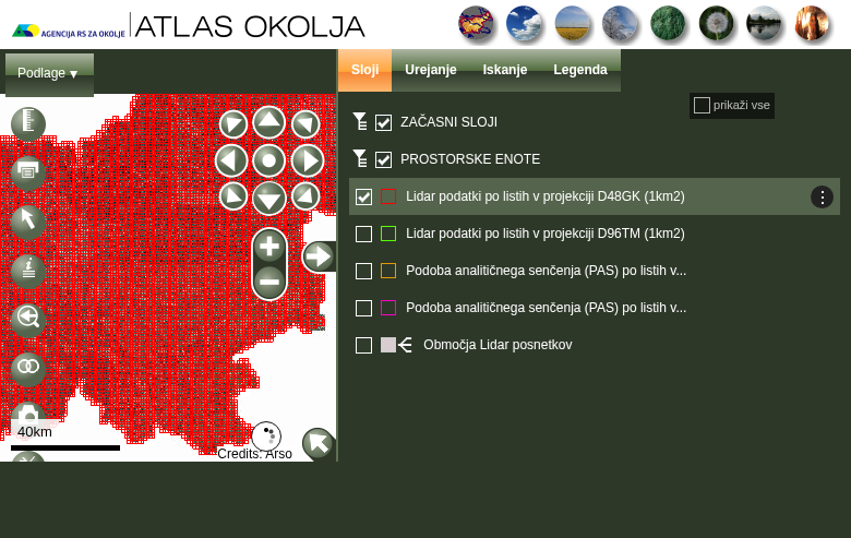
Two coordinate systems available:
- D48GK (EPSG:3912) — Older Slovenian national grid, compatible with legacy data
- D96TM (EPSG:3794) — Newer GPS-compatible system for modern projects
Each tile covers 1 km × 1 km. Enable the grid layer to see available tiles.
Available formats:
- GKOT (laz): Full classified point cloud ✅ Recommended
- GKOT (zlas): Classified point cloud in ESRI format
- OTR (laz): Ground points only (ideal for DTM generation)
- DMR: Pre-computed DTM raster in ASC format
Each tile is approximately 15-30 MB for point cloud formats.
Enable the LiDAR Tile Grid
In the Sloji (Layers) panel, enable one of the LiDAR tile grid options:
Click a Tile to Download
Click on any visible tile to open the download dialog with multiple format options:
Available Data Products
Point Clouds and Terrain Models
GKOT – Classified Point Cloud
Full point cloud with classification codes (ground, vegetation, buildings). Available in open LAZ and proprietary zLAS formats.
OTR – Ground Points Only
Pre-filtered point cloud containing only ground-classified points. Ideal for generating clean DTM surfaces quickly.
DMR – Digital Terrain Model
Pre-computed 1m resolution terrain raster in ASC format. Ready-to-use for quick visualization projects.
Technical Specifications
Data Specifications
File Format: LAZ, zLAS, ASC
Point Density: 2-5 points per m²
Resolution: 1 meter (DTM/DSM)
Tile Size: 1 km × 1 km
Coordinate Systems
D48GK: EPSG:3912 (legacy Slovenian grid)
D96TM: EPSG:3794 (modern GPS-compatible)
Coverage: 100% of Slovenia
License: Free, attribution requested
File Format Comparison
| Format | Type | Description | Best For |
|---|---|---|---|
| LAZ | Point Cloud | Open-source compressed LAS. Works with QGIS, CloudCompare, PDAL. | Most users |
| zLAS | Point Cloud | ESRI proprietary compressed format. Native to ArcGIS products only. | ArcGIS users |
| ASC | Raster | ASCII grid format with pre-computed DTM values at 1m resolution. | Quick visualization |
Note: The ASC files may have an X-Y coordinate swap that causes issues in some GIS software. If you encounter problems, generate your own DTM from the point cloud data.
Tips for Slovenia LiDAR Data
Choose the Right CRS
Use D48GK for compatibility with older Slovenian datasets, or D96TM for new GPS-based projects and GNSS survey data.
Plan for File Sizes
Individual LAZ tiles are 15-30 MB. Full Slovenia coverage requires 500+ GB. Download only the tiles you need for your specific project area.
Download Off-Peak Hours
The ARSO server can be slow during business hours. Schedule large batch downloads during evenings or weekends (CET) for faster speeds.
Bulk Downloads with QGIS
Legacy QGIS 2.x Plugin Available
QGIS Plugin (Legacy Only)
The Lidar Slovenia Data Downloader plugin can batch-download multiple tiles by area selection.
Important: Only works with QGIS 2.x (legacy versions). Not compatible with QGIS 3.x.
Manual Bulk Downloads
1. Download tiles manually via web portal
2. Use browser download manager for queuing
3. Verify downloads with CloudCompare
4. Contact ARSO for complete datasets
Processing Your Downloaded Data
Once you have downloaded your Slovenia LAZ files, you’ll need to process them to extract useful products. Lidarvisor offers a streamlined workflow for processing point clouds
Upload LAZ Directly
No conversion needed — upload your Slovenia LAZ files directly to Lidarvisor for processing.
Automatic Classification
AI-powered ground classification and noise removal works automatically on your data.
Generate Products
Create DTMs, DSMs, hillshades, slope maps, contours, and more from your point clouds.
Additional Resources
ARSO eVode LiDAR Portal
Official data download portal for Slovenia LiDAR
QGIS Lidar Slovenia Plugin
Bulk download tool (QGIS 2.x only)
Frequently Asked Questions
Is the Slovenia LiDAR data really free?
Yes! All data from the ARSO eVode portal is free for both commercial and non-commercial use. Attribution to the Ministry of Environment and Spatial Planning / Slovenian Environment Agency is requested but not legally required.
Which coordinate system should I choose?
D48GK (EPSG:3912) is the older Slovenian national grid. Most legacy GIS data from GURS uses this system, making it better for compatibility with existing datasets.
D96TM (EPSG:3794) is the newer system gradually replacing D48GK. Use it for new projects or when working with GPS-surveyed data.
What is the point density of the data?
Point density varies across the dataset but is typically 2-5 points per square meter, which is suitable for most applications including terrain analysis, forestry assessments, and general mapping purposes.
Should I download LAZ or zLAS format?
Choose LAZ unless you work exclusively in ArcGIS. LAZ is an open format supported by virtually all LiDAR software including QGIS, CloudCompare, PDAL, LAStools, and Lidarvisor. zLAS is proprietary to ESRI and has limited support outside their ecosystem.
Can I download the entire country at once?
The portal only allows single-tile downloads through the web interface. For bulk downloads, consider using the QGIS plugin (requires legacy QGIS 2.x), downloading tiles manually in batches, or contacting ARSO directly about obtaining complete datasets.
Does the QGIS plugin work with QGIS 3?
No. The Lidar Slovenia Data Downloader plugin only works with QGIS 2.x (legacy versions). It has not been updated for QGIS 3.x compatibility. QGIS 3 users need to download tiles manually through the web portal.
More Free LiDAR Data Tutorials
Explore our complete collection of free LiDAR data download tutorials
Central & Southern Europe
• Poland • Spain PNOA
Global Portals
Ready to Process Your Slovenia LiDAR Data?
Upload your LAZ files to Lidarvisor and generate DTMs, DSMs, contours, and more — no desktop software required. Start with 50 Hectares of free processing.
Create free account50 hectares free. No credit card. No software to install.