
Learn LiDAR
How to Download Free LiDAR Data from Finland NLS
Complete Step-by-Step Tutorial
No credit card required • 50 hectares included
The National Land Survey of Finland (Maanmittauslaitos) provides free access to high-quality laser scanning data covering the entire country. Download classified point clouds and elevation models under the CC BY 4.0 license — no registration required.
The National Land Survey of Finland (Maanmittauslaitos, NLS) is the government agency responsible for producing and maintaining geospatial data for Finland. As part of Finland’s commitment to open data, the NLS provides free access to extensive laser scanning datasets covering the entire country since 2019.
What is the National Land Survey of Finland?
Point Clouds
LAZ format, classified data
Elevation Models
2m DTM from laser scanning
Full Coverage
100% of Finland (~338,000 km²)
CC BY 4.0
Free for any use
Step-by-Step Download Guide
Navigate the NLS MapSite Interface
Follow these steps to access and download laser scanning data from Finland’s national mapping service. The interface is available in English, Finnish, and Swedish.
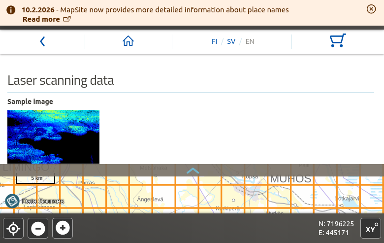
asiointi.maanmittauslaitos.fi/karttapaikka/tiedostopalvelu
Getting started:
- Language: Switch to English using the language selector
- No registration: Free data requires no account
- Map navigation: Zoom and pan to your area of interest
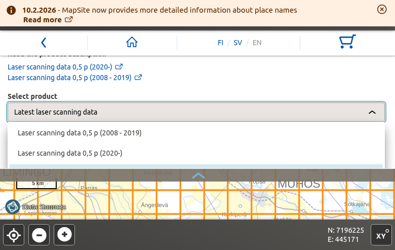
Two product options:
- Latest laser scanning data — Recommended, combines all available data
- 0.5 p (2020-) — Newer high-density derived data
- 0.5 p (2008-2019) — Legacy coverage
The map interface will display the tile grid overlay for your selected product.
Access the NLS MapSite
Navigate to the National Land Survey’s MapSite download service:
Select Laser Scanning Data
On the download page, scroll down to find “Open vector datasets” and click on “Laser scanning data”.
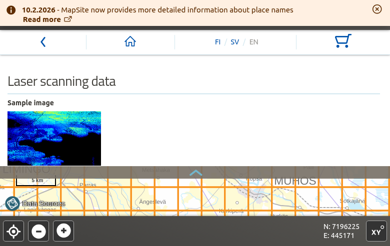
Selection options:
- Click tiles — Select individual 3×3 km map sheets
- Rectangle tool — Draw a box to select multiple tiles
- Search — Find locations by place name
The orange grid lines show available tile boundaries. You can select up to 100 map sheets per order.
Order process:
- Click “Add to shopping cart”
- Review your selection in the cart (cart icon)
- Enter your email address to receive download links
- Click “Order” to submit
You’ll receive an email with download links within minutes. Links remain active for approximately 7 days.
Select Your Area on the Map
Navigate to your area of interest using the map controls:
Add to Cart and Download
After selecting your tiles:
Pro Tip
Downloadable open data products are always free of charge. The files are delivered in compressed LAZ format which can be opened directly in most LiDAR software.
Alternative access: Use kartat.kapsi.fi for direct FTP/HTTP downloads without the order system.
Technical Specifications
Laser Scanning Data 0.5 p (Free)
Point Density: 0.5 points/m² (~1.4m spacing)
Coverage: 100% of Finland
Tile Size: 3 × 3 km (UTM 5000 sheets)
File Format: LAZ 1.2
License: CC BY 4.0
Laser Scanning Data 5 p (Fee-based)
Point Density: ≥5 points/m² (~0.4m spacing)
Coverage: Expanding (2020 onwards)
Tile Size: 1 × 1 km blocks
File Format: LAZ 1.2 (2020-2023), LAZ 1.4 (2024+)
License: Separate terms (requires authentication)
Coordinate Systems
Horizontal CRS: ETRS-TM35FIN (EPSG:3067)
Vertical Datum: N2000 height system
Reference: European Vertical Reference System (EVRS)
Data Timeline
Legacy Coverage: 2008-2019 (nationwide)
High-Density Programme: 2020 onwards
Updates: Continuous scanning and processing
Point Cloud Classifications
Standard LAS 1.2 Classification Schema
Class 2: Ground
Points representing the lowest surface visible from the air (bare earth). Used for DTM generation.
Class 3: Low Vegetation
Points 0.0–0.5 meters above ground level. Shrubs, grass, and low-growing plants.
Class 4: Medium Vegetation
Points 0.5–2.0 meters above ground level. Bushes and young trees.
Class 5: High Vegetation
Points 2.0–50.0 meters above ground level. Mature trees and forest canopy.
Class 7: Low Noise
Points statistically too low compared to surroundings. Filtered during processing.
Class 1: Unclassified
Points not assigned to other classes during automated processing.
Available File Formats
LAZ
Primary Format
Losslessly compressed LAS format (7-20% of original size). Point cloud data — primary distribution format for laser scanning.
GeoTIFF
Raster Format
Georeferenced raster image format. Used for elevation models (DTM, DSM) and derived products.
ASCII Grid
Text Format
Text-based raster format. Alternative format for elevation models with wide software compatibility.
Tips for Finland LiDAR Data
Batch Downloads
For large areas, place multiple orders covering different regions. Each order generates separate download links that can be processed in parallel.
Download Timing
Download during off-peak hours (evenings and weekends in Finland timezone, UTC+2/+3) for faster speeds and more reliable connections.
Storage Planning
Estimate ~50-150 MB per 3×3 km LAZ tile for 0.5 pts/m² data. Plan for approximately 500 GB to store complete national coverage.
Download Manager
Use a download manager like aria2 or browser extensions to handle multiple files and resume interrupted downloads.
Verify Downloads
After downloading, verify file integrity by checking that files open correctly in your LiDAR software before deleting source files.
Alternative Mirror
Community mirror at kartat.kapsi.fi provides direct FTP/HTTP access to NLS open data, including laser scanning files.
Processing Your Downloaded Data
Once you have downloaded your Finland LAZ files, you’ll need to process them to extract useful products. Lidarvisor offers a streamlined workflow for processing point clouds
Upload LAZ Directly
No conversion needed — upload your Finland LAZ files directly to Lidarvisor for processing.
Automatic Classification
AI-powered ground classification and noise removal works automatically on your data.
Generate Products
Create DTMs, DSMs, hillshades, slope maps, contours, and more from your point clouds.
Frequently Asked Questions
Is Finland LiDAR data really free?
Yes! The Laser scanning data 0.5 p and Elevation model 2 m products are completely free under the CC BY 4.0 license. You can use the data for any purpose, including commercial applications, as long as you provide attribution to the National Land Survey of Finland. The higher-density Laser scanning data 5 p requires authentication and has a fee.
What is the difference between 0.5 p and 5 p data?
The number refers to point density per square meter. 0.5 p means 0.5 points/m² (~1.4m average spacing) — free with nationwide coverage. 5 p means 5 points/m² (~0.4m average spacing) — fee-based with expanding coverage since 2020. The 0.5 p data is derived from 5 p data through a “spaced out” process that maintains even point distribution while reducing density.
What coordinate system does Finland LiDAR use?
All NLS laser scanning data uses the ETRS-TM35FIN coordinate system (EPSG:3067), which is the official coordinate reference system for Finland. Heights are referenced to the N2000 height system, which is part of the European Vertical Reference System (EVRS). When importing into GIS software, set the CRS to EPSG:3067 for correct positioning.
How current is the data?
The original nationwide laser scanning was completed between 2008-2019. This legacy data is available as “Laser scanning data 0.5 p (2008-2019)”. Since 2020, Finland has been collecting new high-density (5 pts/m²) data through the National Laser Scanning Programme. The spaced-out 0.5 p version of this new data is continuously added to the open data service.
Can I download data for the entire country?
Yes, you can download data for all of Finland. Due to the large data volume (~500+ GB for nationwide point cloud coverage), you’ll need to place multiple orders covering different regions. For bulk downloads, consider using the community mirror at kartat.kapsi.fi, which provides direct HTTP/FTP access without the order system.
What software can open Finland LAZ files?
LAZ files from Finland NLS can be opened with any LAS-compatible software. Free options include CloudCompare, QGIS (with LAStools plugin), and Fugro Viewer. Commercial options include Global Mapper, ArcGIS Pro, and AutoCAD. For cloud-based processing without software installation, upload directly to Lidarvisor.
Additional Resources
Alternative Access
- Kapsi.fi Community Mirror — Direct FTP/HTTP downloads
- National Laser Scanning Programme (Finnish)
Ready to Process Your Finland LiDAR Data?
Upload your LAZ files to Lidarvisor and generate DTMs, DSMs, contours, and more — no desktop software required. Start with 50 Hectares of free processing.
Create free account50 hectares free. No credit card. No software to install.