
Learn LiDAR
Tree Mapping Software: LiDAR Workflows for Forestry, Urban Trees, and Utility Corridors
Tree crowns, tree tops, terrain surfaces, and GIS-ready outputs
No credit card required • 50 hectares included
Searching for tree mapping software usually surfaces two very different categories of tools: field inventory platforms that store tree records, and LiDAR workflows that extract tree and vegetation features from spatial data. If your project starts with aerial LiDAR, you usually need the second category first: a workflow that can turn point clouds into tree crowns, tree tops, terrain surfaces, and GIS-ready outputs.
That matters for forestry teams mapping canopy structure, urban tree programs building baseline inventories, and utility vegetation teams reviewing long corridors. The goal is not just to place pins on a map.
It is to create repeatable, export-ready tree data in a browser-based workflow without forcing every stakeholder into heavy desktop software.
Need LiDAR-derived tree outputs? Start free in Lidarvisor or see pricing and plan limits.
Not all tree mapping software solves the same job
Field inventory platforms
Many tools focus on field collection, work orders, or municipal asset management. Those can be useful, but they are not the same as LiDAR processing.
If the main need is ongoing maintenance records, inspection histories, or arborist workflows, a field or asset system may be the right layer.
LiDAR workflows
When the real need is consistent extraction across large areas, teams often need point cloud processing before they need a tree record database. LiDAR workflows support repeatable extraction of tree crowns, tree tops, vegetation classes, and terrain outputs that downstream GIS, CAD, and reporting systems can use.
Tree mapping software by workflow
Urban tree inventory
Mapped locations, baseline inventories, and height-related context before field confirmation.
Forestry planning
Coverage, canopy structure, stand patterns, and terrain-aware analysis across larger areas.
Utility corridors
Vegetation assessment near poles, wires, and corridor risk areas with extracted features.
Planning and baseline mapping
Tree locations that affect grading, construction, environmental baselines, and monitoring.
What to look for in tree mapping software
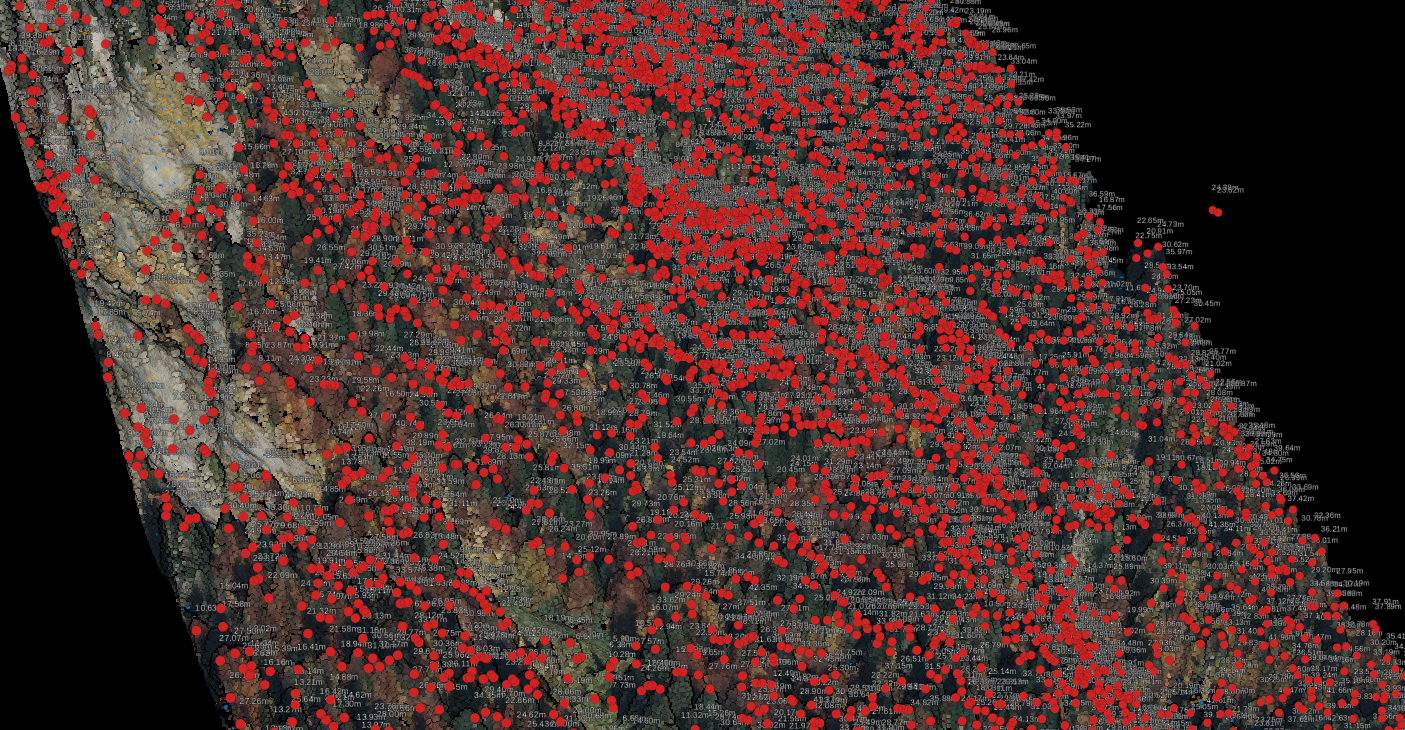
- Tree crown extraction for mapped canopy footprints
- Tree top detection for inventory and height-related workflows
- Vegetation classification to separate low, medium, and high vegetation
- Terrain context using DTM, DSM, hillshade, or slope outputs
- Export formats such as SHP, GeoJSON, DXF, GeoTIFF, and LAS
- Browser-based review so GIS, survey, and planning teams can inspect results more easily
When LiDAR adds the most value
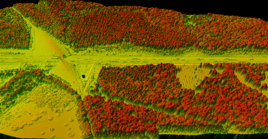
LiDAR is especially useful when tree mapping depends on structure, elevation, and repeatable extraction.
Instead of relying only on visual interpretation, teams can work from classified point clouds and derived surfaces. Forestry teams can map crowns and canopy patterns across large tracts, urban tree teams can build baseline inventories before field verification, and utility vegetation teams can map vegetation near poles and wire corridors.
- Classified point clouds support repeatable extraction instead of manual drawing
- Derived surfaces add terrain context for survey and engineering teams
- Browser-based review helps more stakeholders inspect outputs without desktop software
BROWSER-BASED OUTPUTS
How Lidarvisor fits tree mapping workflows
Tree and vegetation outputs for downstream GIS, CAD, and reporting systems
Lidarvisor is not a field arborist CRM or a full asset-management suite. It is a cloud LiDAR processing workflow for teams that need tree and vegetation outputs that downstream GIS, CAD, and reporting systems can use.
Relevant outputs include tree crowns, tree tops, vegetation classification, terrain models, contours, and export-ready files.
- Extract tree crowns and tree tops from LiDAR datasets
- Classify low, medium, and high vegetation
- Generate DTM, DSM, hillshade, and slope for terrain context
- Export deliverables as SHP, GeoJSON, DXF, GeoTIFF, and LAS
- Review and share results in a browser-based workflow without desktop installs for every stakeholder
Urban tree inventory
These teams usually need mapped locations, species and condition fields, maintenance planning, and reporting. LiDAR helps by improving the starting inventory with crown delineation and height-related context before field confirmation, but most programs will still use a separate field or asset system for ongoing management.
Forestry and land management
These workflows often care more about coverage, canopy structure, stand patterns, and terrain-aware analysis across larger areas. LiDAR-derived tree outputs are often more useful here than simple map markers because they support analysis at landscape scale.
Utility vegetation management
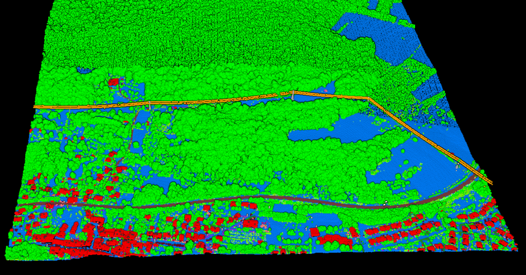
Here the map matters because vegetation exists in relation to wires, poles, and corridor risk. Tree mapping software becomes more valuable when it can feed a broader vegetation or utility workflow with extracted features instead of acting only as a standalone inventory map.
Why tree mapping software shortlists are splitting in 2026
Tree mapping software buyers are splitting into two camps. One group needs a long-term field inventory system for inspections, maintenance records, and municipal workflows.
The other needs LiDAR-first extraction that can turn aerial point clouds into tree crowns, tree tops, vegetation classes, and terrain-aware outputs before the project moves into GIS, CAD, or corridor review.
Inventory-first buyers
Usually care most about field edits, ongoing asset records, arborist workflows, and work-order history.
LiDAR-first buyers
Usually care most about repeatable extraction, canopy coverage, utility corridor screening, and export-ready outputs that downstream teams can verify and use.
That split matters because many competing pages frame tree mapping around field databases, while LiDAR teams often need upstream processing first. If the job starts with aerial LiDAR, tree mapping software is most useful when it helps produce clean forestry, urban-tree, or utility-ready outputs rather than stopping at a static map.
Frequently Asked Questions
Do you need field inventory software, LiDAR processing software, or both?
Many tools focus on field collection, work orders, or municipal asset management, and those can be useful. But they are not the same as LiDAR processing. When the real need is consistent extraction across large areas, teams often need point cloud processing before they need a tree record database.
What should the tool produce for downstream teams?
For many projects, the practical need is export-ready tree data that GIS, CAD, and reporting systems can use. Useful outputs include tree crowns, tree tops, vegetation classes, terrain models, contours, and export formats such as SHP, GeoJSON, DXF, GeoTIFF, and LAS.
When does LiDAR add the most value to tree mapping?
LiDAR is especially useful when tree mapping depends on structure, elevation, and repeatable extraction. Instead of relying only on visual interpretation, teams can work from classified point clouds and derived surfaces for forestry, urban tree, utility, survey, and planning workflows.
Can browser-based review replace desktop software for every stakeholder?
The goal is to create repeatable, export-ready tree data in a browser-based workflow without forcing every stakeholder into heavy desktop software. Teams can review and share results online even if downstream analysis still moves into GIS or CAD.
Does one tree mapping workflow fit forestry, urban trees, and utility corridors equally well?
Not always. Urban tree programs often need baseline inventories before field confirmation, forestry workflows care more about canopy structure and terrain-aware analysis, and utility vegetation teams need outputs tied to poles, wires, and corridor risk. The best setup depends on the workflow you need to support after extraction.
Bottom line
The best tree mapping software depends on whether your job is inventory management or LiDAR-derived feature extraction. For teams working from aerial LiDAR, the practical need is often not just a map of trees but exportable tree and vegetation outputs that support forestry, utility, survey, and planning workflows.
Ready to Map Trees from LiDAR?
If your team needs LiDAR-derived tree crowns, tree tops, vegetation classes, and terrain outputs in a browser-based workflow, start free with Lidarvisor or view pricing.
Create free account50 hectares free. No credit card. No software to install.