
Tutorials
How to Download Free LiDAR Data from Scotland
Complete Step-by-Step Tutorial
No credit card required • 50 hectares included
Access high-quality elevation data from the Scottish Remote Sensing Portal — a collaborative initiative between the Scottish Government and JNCC. Free for commercial and non-commercial use, with no registration required.
Browse Datasets
The Scottish Remote Sensing Portal provides free access to airborne LiDAR data collected across Scotland by various public sector organizations. The portal offers 47+ datasets with point clouds and derived products covering over 45,000 km² of Scotland.
What is the Scottish Remote Sensing Portal?
Point Clouds
LAZ format, classified data
High Density
4-10 points/m²
Free Access
No registration required
Coverage Overview
Data Collection Phases
The portal contains data from multiple collection phases, each targeting different regions and use cases.
Phase I–II (2011–2014)
- 11,845 km² (Phase I)
- 3,516 km² (Phase II)
- Flood risk & power corridors
Phase III–IV (2015–2019)
- 11,772 km² (Phase III)
- 17,945 km² (Phase IV)
- 4 points/m² density
NLP 2025–2027
- National coverage planned
- 10 points/m² density
- Complete Scotland by 2027
Step-by-Step Download Guide
Navigate the Scottish Remote Sensing Portal
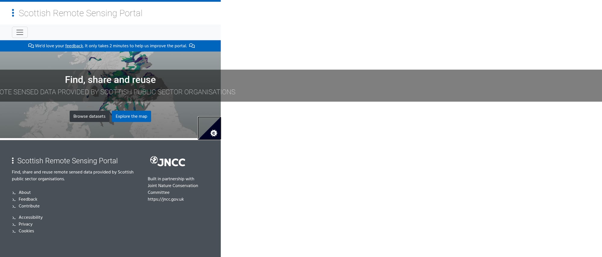
Follow these steps to access and download LiDAR point cloud data from Scotland’s national portal. The interface is user-friendly and no registration is required.
Getting started:
- Browse Datasets: View all 47+ datasets in a list format
- Explore the Map: Interactive tile selector for geographic navigation
- No account needed: Downloads are completely free
Available datasets:
- Phase datasets (I–VI) for general coverage
- HES datasets for Historic Environment Scotland sites (higher resolution: 0.25–0.5m)
- NLP 2025 for the newest national programme data
- Outer Hebrides 2019 for island coverage
Product types:
- DSM – Digital Surface Model (includes buildings/vegetation)
- DTM – Digital Terrain Model (bare earth)
- LAZ – Compressed point cloud data
Access the Portal
Navigate to remotesensingdata.gov.scot and choose how to explore the data:
Select Your Dataset
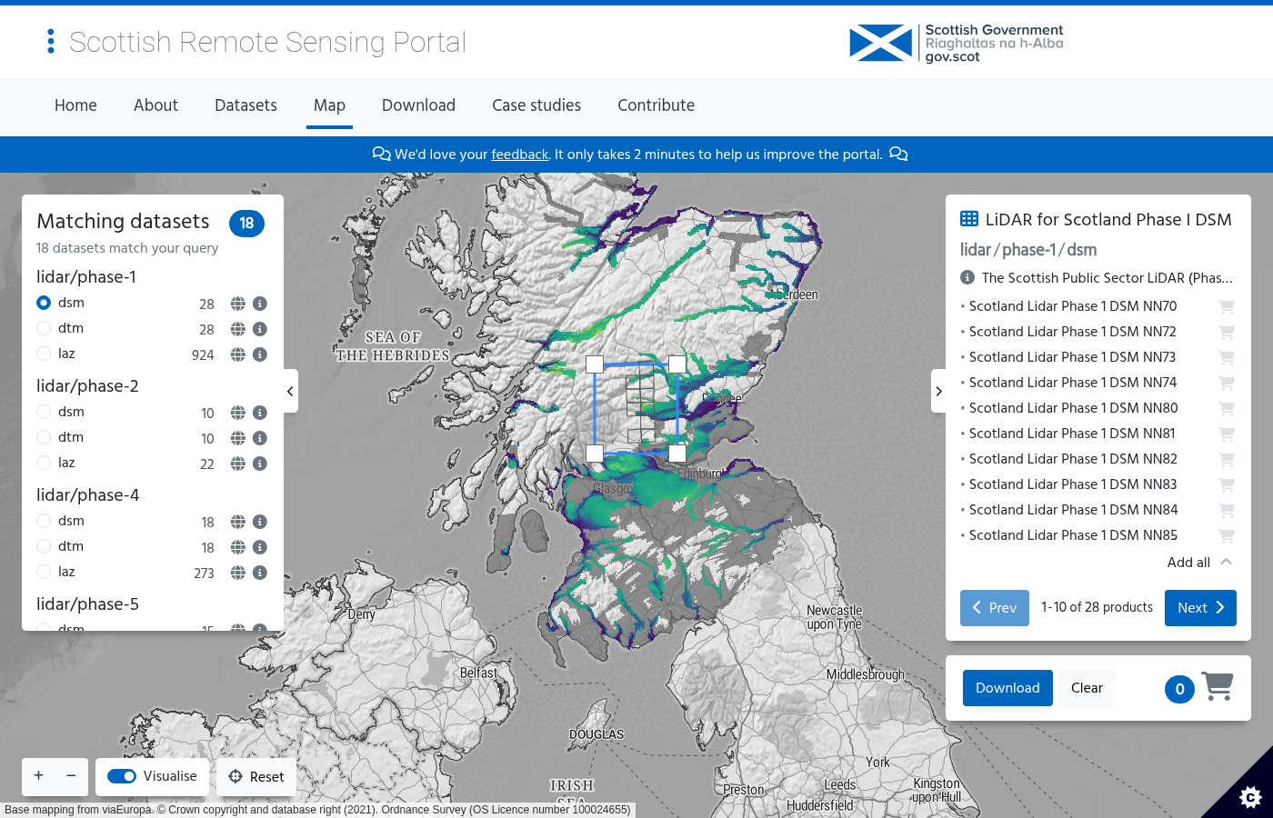
Use the left panel to choose which dataset(s) you want to download:
Selection process:
- Navigate to your area of interest using zoom and pan controls
- The right panel shows available tiles for your selected dataset
- Click the basket icon next to each tile to add it to your download basket
- The basket counter at the bottom right shows your selection count
Download process:
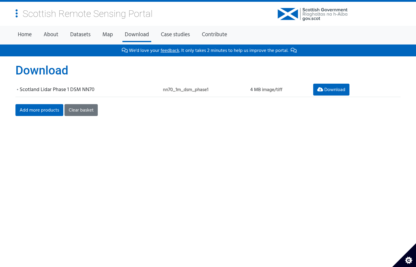
- Review your basket contents showing tile names, filenames, and file sizes
- Click the Download button next to each file to get your data
- Files download immediately — no registration required!
Alternative access: Data is also available via AWS Open Data for bulk downloads.
Select Tiles on the Map
The data is organized into 10 km × 10 km tiles aligned to the British National Grid:
Download Your Data
Click the “Download” button in the bottom right corner to access your basket:
Available File Formats
Compressed LAS format with full point data
80-90% smaller than uncompressed File sizes: 50–200 MB per tile
Digital Terrain Model showing bare earth
Ideal for hydrology & terrain analysis File sizes: 5–20 MB per tile
Digital Surface Model with buildings & vegetation
Perfect for urban planning & forestry File sizes: 5–20 MB per tile
Technical Specifications
Data Specifications
File Format: LAZ (compressed LAS), GeoTIFF
Point Density: 4 pts/m² (Phase III-VI), 10 pts/m² (NLP)
Vertical Accuracy: ±5–15 cm RMSE
Horizontal Accuracy: ±20–50 cm
Coordinate Systems
Horizontal CRS: EPSG:27700 (British National Grid)
Tile Size: 10 km × 10 km
Coverage: ~45,000 km² (phases I–VI)
License: Open Government Licence v3
Tips for Scottish LiDAR Data
Plan Your Coverage
Use the Datasets list to understand what coverage is available. Not all areas have data from every phase.
Check Metadata
Each dataset links to the Scottish Spatial Data Infrastructure catalog for detailed specifications and collection dates.
Use WMS for Preview
Click the “WMS” button next to any dataset to get the service URL for previewing in QGIS, ArcGIS, or other GIS software.
Download in Batches
For large areas, download tiles in batches. Start with DTM/DSM files (smaller) before point clouds.
AWS Open Data
Data is mirrored on AWS Open Data for programmatic access and bulk downloads via S3.
Check License
Most data is OGL v3 (commercial OK). Some HES datasets use Non-Commercial Government Licence — check the licence icon.
Processing Your Downloaded Data
Once you have downloaded your Scottish LAZ files, you’ll need to process them to extract useful products. Lidarvisor offers a streamlined workflow for processing point clouds
Upload LAZ Directly
No conversion needed — upload your Scottish LAZ files directly to Lidarvisor for instant 3D visualization.
Generate Products
Create hillshades, contours, slope maps, and other derived products from your point cloud data.
Merge Tiles
Combine multiple 10 km tiles into seamless coverage of your study area. EPSG:27700 fully supported.
Frequently Asked Questions
Yes. Most datasets are licensed under the Open Government Licence v3, which allows free use for commercial and non-commercial purposes with attribution.
Some Historic Environment Scotland datasets use the Non-Commercial Government Licence, which restricts commercial use—check the licence icon on each dataset.
Not yet. Earlier phases (I–VI) cover specific areas totaling approximately 45,000 km², primarily focused on flood risk zones, power network corridors, and heritage sites.
However, the Scottish Land LiDAR Programme (NLP) that began in 2025 aims to provide complete national coverage by 2027 at 10 points per square metre.
Accuracy varies by dataset and phase. Generally, you can expect:
- Vertical accuracy: ±5–15 cm RMSE for most datasets
- Horizontal accuracy: ±20–50 cm
- Point density: 4 points/m² (phases III–VI) to 10 points/m² (NLP 2025)
Check the metadata for each specific dataset for exact specifications.
No. The Scottish Remote Sensing Portal allows immediate downloads without registration. Simply select your tiles on the map and download.
Yes. Each dataset provides a WMS endpoint for direct integration into GIS applications.
Click the “WMS” button next to any dataset in the list view to get the service URL. Data is also available via AWS Open Data for programmatic access.
More Free LiDAR Data Tutorials
Explore our complete collection of free LiDAR data download tutorials
UK & Ireland
Western Europe
• France IGN • Germany NRW • Germany Bavaria • Netherlands AHN
Additional Resources
Ready to Process Your Scottish LiDAR Data?
Upload your downloaded files to Lidarvisor for instant visualization, analysis, and export. British National Grid (EPSG:27700) fully supported.
Create free account50 hectares free. No credit card. No software to install.