
Tutorials
How to Download Free LiDAR Data from Bavaria, Germany
Step-by-Step Tutorial
No credit card required • 50 hectares included
Bavaria (Bayern) offers comprehensive free LiDAR data through the Bayerische Vermessungsverwaltung (Bavarian Surveying Administration). This tutorial walks you through downloading Digital Terrain Models (DGM), Digital Surface Models (DOM), and raw laser point clouds covering the entire 70,550 km² of Germany’s largest state.
The Geoportal Bayern is the official geospatial data portal for Bavaria, operated by the Landesamt für Digitalisierung, Breitband und Vermessung (LDBV) — the State Office for Digitization, Broadband and Surveying. Since January 2023, the LDBV has made extensive geodata available as OpenData through their dedicated portal at geodaten.bayern.de/opengeodata/.
What is Geoportal Bayern?
Terrain Models (DGM)
Bare-earth elevation at 1m and 5m resolution, covering all of Bavaria.
Surface Models (DOM)
20cm resolution including buildings, vegetation, and all surface features.
Point Clouds (Laserpunkte)
Classified 3D point clouds in LAZ format with 4+ points/m² density.
Key Specifications
| Specification | Details |
|---|---|
| Coverage | Complete (Flächendeckend) — all of Bavaria (~70,550 km²) |
| Point Density | Pre-2012: ≥1 pt/m² | 2012+: ≥4 pts/m² |
| Vertical Accuracy | ±10 cm (flat, open terrain) |
| Tile Size | 1 km × 1 km |
| Coordinate System | ETRS89 / UTM Zone 32 (EPSG:25832) |
| Vertical Datum | DHHN2016 (German Main Elevation Network) |
| License | CC BY 4.0 (free for commercial use) |
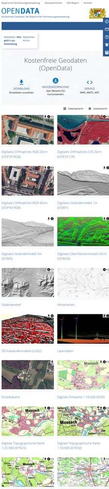
The portal offers a clean gallery interface organized by product type. No account or registration is required to download data — just click and download.
Look for these key products:
- Digitales Geländemodell (DGM1/DGM5) — Terrain models
- Digitales Oberflächenmodell (DOM) — Surface model
- Laserdaten — Raw point cloud data
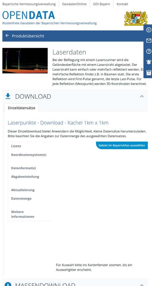
The detail page shows important specifications:
- Lizenz — CC BY 4.0 (free for commercial use)
- Koordinatensystem — UTM32 (EPSG:25832)
- Datenformat — LAZ (compressed point cloud)
- Kachelung — 1 km × 1 km tiles
- Datenmenge — Up to 1 GB per tile
You have two download options: Download (individual tiles) or Massendownload (bulk download via Metalink).
Access the OpenData Portal
Navigate to the Bavarian OpenData portal at geodaten.bayern.de/opengeodata/
Select Your Data Product
Click on your desired product to access the download page. For point clouds, select Laserdaten.
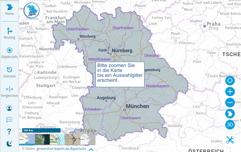
The map shows all of Bavaria with LiDAR coverage highlighted in blue. This confirms that data is available statewide — complete coverage of all 70,550 km².
Navigation tips:
- Use the search bar to find specific locations
- Zoom in until the selection grid appears
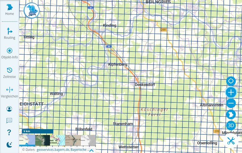
- The grid shows individual 1 km × 1 km tiles
For individual tiles:
- Click on your area of interest
- A popup shows tile information and download links
- Click the download link to get the LAZ file directly
For bulk downloads (Massendownload):
- Use the “Polygonale Auswahl” to draw a selection area
- Or select by “Verwaltungseinheiten” (administrative units)
- Download via Metalink (.meta4) for efficient multi-file downloads
Tip: Each tile can be up to 1 GB — plan your storage accordingly!
Open the Interactive Map
Click “Gebiet im BayernAtlas auswählen” to open the interactive tile selection map in BayernAtlas.
Select and Download Tiles
Once zoomed in, you’ll see the 1 km × 1 km tile grid. Click on any tile to select it for download.
Available File Formats
Bavaria’s OpenData portal offers multiple output formats depending on your needs
| Product | Format | Description |
|---|---|---|
| Point Clouds | LAZ | Compressed LAS format (recommended, 70-90% smaller) |
| Terrain Models | GeoTIFF | 32-bit floating point elevation raster |
| Terrain Models | ASCII-TXT (XYZ) | Plain text with X, Y, Z coordinates per line |
| Surface Models | GeoTIFF | High-resolution surface elevation raster |
Tips for Large Downloads
Use aria2 for Bulk Downloads
The Metalink files work seamlessly with aria2. Use aria2c -V --follow-metalink=mem URL for verified parallel downloads.
Download Off-Peak
For multi-gigabyte downloads, schedule during evening/night hours (European time) for better speeds.
Frequently Asked Questions
Is Bavaria LiDAR data really free?
Yes. Since January 2023, the Bayerische Vermessungsverwaltung provides DGM (terrain models), DOM (surface models), and raw laser point clouds as OpenData under CC BY 4.0. There are no licensing fees — just provide attribution: “Datenquelle: Bayerische Vermessungsverwaltung – www.geodaten.bayern.de”
What coordinate system should I use?
Bavaria’s data is provided in ETRS89 / UTM Zone 32 (EPSG:25832). UTM Zone 33 versions are also available for eastern Bavaria. The vertical datum is DHHN2016, Germany’s official height reference system.
How current is the data?
Bavaria updates its LiDAR through regular flight campaigns (Bayernbefliegung). Most data is from 2012 onwards with 4+ points/m² density. Use the flight overview KML file in BayernAtlas to check capture dates for specific areas.
Can I use this data commercially?
Absolutely. The CC BY 4.0 license allows commercial use. Just include the required attribution: “Datenquelle: Bayerische Vermessungsverwaltung – www.geodaten.bayern.de”
What’s the difference between DGM and DOM?
DGM (Digitales Geländemodell) is a bare-earth terrain model showing ground elevation with vegetation and buildings removed. DOM (Digitales Oberflächenmodell) shows the actual surface including trees, buildings, and all features. DGM is derived from classified ground points; DOM uses first-return data.
What point classes are available?
Bavaria’s point clouds include: Ground points (Bodenpunkte), Object points (Objektpunkte — vegetation), Building points (Gebäudepunkte), Unclassified near-ground points, and since 2025, Power lines & poles (utility infrastructure).
More Free LiDAR Data Tutorials
Explore our complete collection of free LiDAR data download tutorials
Western Europe
Global Portals
Additional Resources
- Geoportal Bayern — Main geospatial portal
- BayernAtlas — Interactive map viewer with terrain relief
- LDBV Laserpunkte Info — Official product documentation
- Point Classification Guide (PDF) — Detailed class descriptions
Attribution: When using Bavaria’s LiDAR data, include: “Datenquelle: Bayerische Vermessungsverwaltung – www.geodaten.bayern.de”
Process Your Bavaria Data with Lidarvisor
Once you’ve downloaded your Bavaria LiDAR data, Lidarvisor makes processing straightforward. Upload your LAZ files or GeoTIFFs, visualize in 3D, filter by point classification, and generate hillshades, contours, and cross-sections — all in your browser.
Create free account50 hectares free. No credit card. No software to install.