
Tutorials
Download Free Ireland LiDAR Data
data.gov.ie + GSI Open Topographic Data Viewer tutorial
No credit card required • 50 hectares included
Download free Ireland LiDAR data from the data.gov.ie listing and the GSI Open Topographic Data Viewer. This guide shows how to find Irish DTM and DSM GeoTIFF tiles, check coverage, and pull the elevation files you need for terrain, flood, archaeology, and planning workflows.
The Open Topographic Data Viewer is Ireland’s gateway to free, high-quality LiDAR data. Hosted by Geological Survey Ireland (GSI), it aggregates elevation data from seven government organizations. All data is free to download under Creative Commons Attribution 4.0.
What is the GSI Open Topographic Data Viewer?
2×2 km Tiles
Individual download tiles
0.13m–2m Resolution
Multiple resolutions available
DTM & DSM
GeoTIFF raster products
Free CC BY 4.0
No registration required
Data Providers
The portal aggregates LiDAR data collected between 2006–2021 from multiple Irish government organizations
Geological Survey Ireland
1m resolution coverage — Primary data host
Dept. of Culture, Heritage
0.13m–1m resolution heritage sites
Discovery Programme
High-resolution archaeological surveys
Transport Infrastructure Ireland
2m resolution transport corridors
Office of Public Works
2m resolution coastal flood mapping
NYU & Westmeath CC
1m Dublin, 0.25m Westmeath
Step-by-Step Download Guide
Follow these steps to download Irish LiDAR data
No registration required — the data is freely accessible to everyone under the CC BY 4.0 license.
- Search box: Enter an Eircode, address, or place name
- Zoom controls: Use +/- buttons or scroll wheel
- Pan: Click and drag the map
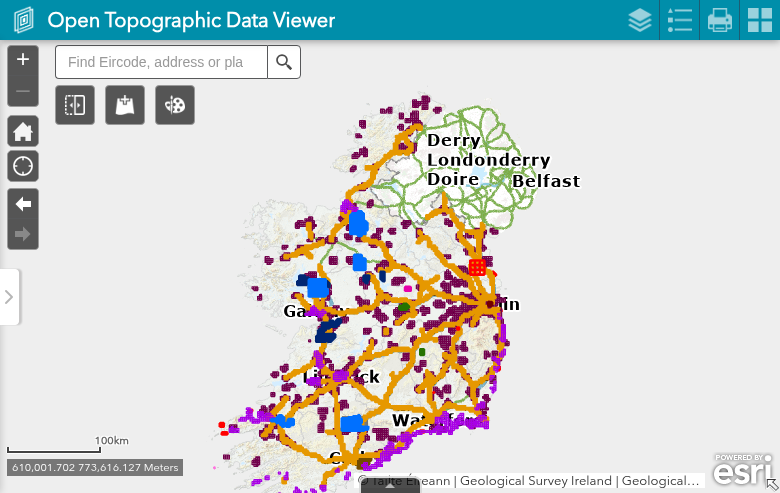
The map displays color-coded tile boundaries indicating which organization provided the data. Use the Legend button in the toolbar to see all layer color codes.
Access the Viewer
Navigate to the Open Topographic Data Viewer. When the welcome screen appears showing logos from all data providers, click “I agree” to accept the terms of use and proceed to the map interface.
Navigate to Your Area
Use the map controls to find your area of interest:
- Data provider and owner organization
- Capture date and published date
- Resolution (pixel size in meters)
- RMS error (vertical accuracy)
- License information
- Download links for DTM and DSM files
Note: You can only download one tile at a time through the popup interface.
- DTM (Digital Terrain Model): Bare earth elevation with buildings and vegetation removed — ideal for hydrology, archaeology
- DSM (Digital Surface Model): First-return elevation including buildings, trees, and features — ideal for urban planning, forestry
Files download as GeoTIFF rasters, typically 5–20 MB per tile depending on resolution.
Pro Tip: Use the Attribute Table at the bottom of the map to see all available tiles in a spreadsheet view with direct download URLs.
Select a Tile
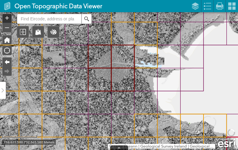
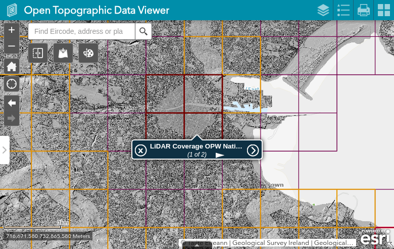
Click directly on a tile to view its attributes in a popup window. The popup displays:
Download Your Data
In the popup window, click the download link for either:
Technical Specifications
Coordinate System
Irish Transverse Mercator (ITM) — EPSG:2157
All data uses the ITM coordinate system with the Malin Head Ordnance Datum for vertical reference (mean sea level 1960-1969).
Resolution by Provider
- GSI: 1m
- DCHG/Discovery: 0.13m – 1m
- NYU: 1m (Dublin)
- TII / OPW: 2m
- Westmeath CC: 0.25m
Tips for Large Downloads
Plan Your Coverage
Use the Layer List to toggle providers and check for overlapping coverage. Higher resolution data is more limited in extent.
Use the Attribute Table
Sort tiles by provider, date, or resolution. Filter to specific attributes and export the tile index for batch processing.
Storage Requirements
1m DTM: ~8–15 MB each 0.25m DTM: ~30–50 MB each Plan ~500 MB–1 GB per 10×10 km area.
Processing Irish LiDAR in Lidarvisor
For raw point clouds, request LAS/LAZ from GSI, OPW or TII — then Lidarvisor makes it easy to visualize and analyze your Irish LiDAR data
Upload LAS/LAZ Point Clouds
Instant visualization and automatic classification. Lidarvisor fully supports ITM (EPSG:2157).
Generate Hillshades
Generate DTM and hillshade terrain visualizations automatically from classified ground points.
Create Contours
Generate contour lines at your preferred interval. Export as vector files for GIS workflows.
Frequently Asked Questions
Is the Irish LiDAR data free to use?
Yes. All data on the Open Topographic Data Viewer is licensed under the Creative Commons Attribution 4.0 International license (CC BY 4.0). You can use it for any purpose—commercial or non-commercial—as long as you credit the data provider.
Does the data cover all of Ireland?
No, coverage is not nationwide. The data focuses on specific areas surveyed by each organization, primarily along:
- Coastal zones (OPW flood mapping)
- Transport corridors (TII)
- Archaeological and heritage sites (DCHG, Discovery Programme)
- Urban areas (NYU Dublin, GSI)
- Specific counties (Westmeath)
Use the map viewer to check coverage for your specific area of interest.
Why can I only download one tile at a time?
The portal was designed for individual tile downloads to manage server load. For bulk data access, consider contacting the data providers directly or checking if your organization qualifies for data sharing agreements.
What is the Malin Head Vertical Datum?
All elevation values in the Irish LiDAR data reference the Malin Head Ordnance Datum, which is based on mean sea level recorded at the tide gauge in Malin Head, County Donegal, between 1960 and 1969. It was adopted as Ireland’s national vertical datum in 1970.
Can I get point cloud data instead of rasters?
The Open Topographic Data Viewer only provides processed raster products (DTM/DSM). For raw point cloud data (LAS/LAZ format), you may need to contact the original data providers directly:
Additional Resources
Official Links
- data.gov.ie Dataset Page — Official metadata
- Geological Survey Ireland — Primary portal host
- CC BY 4.0 License — Full license terms
Learning
- Video Tutorial — Download and create hillshade models
- GSI Viewer — Start exploring now
More Free LiDAR Data Tutorials
Explore our complete collection of free LiDAR data download tutorials
UK & Ireland
Western Europe
• France IGN • Germany NRW • Germany Bavaria • Netherlands AHN
Ready to Process Your Irish LiDAR Data?
Upload your LAS/LAZ files to Lidarvisor and create stunning terrain visualizations in minutes. Start with 50 Hectares of free processing.
Create free account50 hectares free. No credit card. No software to install.