
Tutorials
How to Download Free LiDAR Data from New Zealand LINZ
Complete Step-by-Step Tutorial
No credit card required • 50 hectares included
Toitū Te Whenua Land Information New Zealand (LINZ) provides free, high-quality LiDAR elevation data through their National Elevation Programme. Access 1-metre resolution DEMs and DSMs under Creative Commons Attribution 4.0 (CC-BY-4.0).
Toitū Te Whenua Land Information New Zealand (LINZ) is New Zealand’s government agency responsible for land information and geospatial data. Through the National Elevation Programme, LINZ coordinates LiDAR acquisition across the country, making high-resolution elevation data freely available for everyone.
What is LINZ?
1m DEMs
Bare-earth terrain models
1m DSMs
With vegetation & buildings
NZ Coverage
Most of New Zealand
CC-BY-4.0
Free for any use
Step-by-Step Download Guide
Navigate the LINZ Data Service
Follow these steps to download elevation data from New Zealand’s national LINZ Data Service. You’ll need a free Koordinates account to export data.
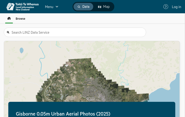
Getting started:
- Data tab: Browse available datasets by category
- Search bar: Find “LiDAR” or “DEM” datasets directly
- Elevation category: Contains all terrain products
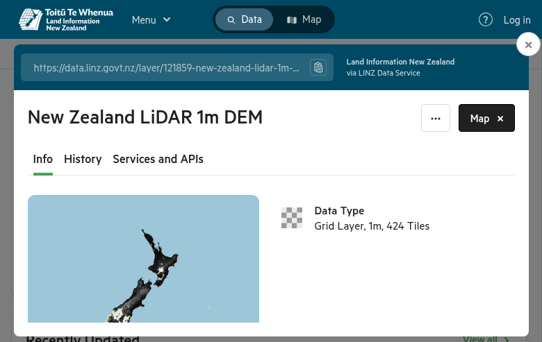
Available datasets:
- NZ LiDAR 1m DEM — Merged national bare-earth model
- NZ LiDAR 1m DSM — Merged national surface model
- NZ DEM Hillshade — Pre-rendered 3D visualization
Click on a dataset to view its details, metadata, and coverage area. The map interface shows the geographic extent.
Access the LINZ Data Service
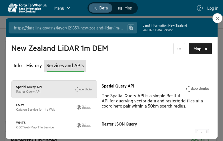
Navigate to data.linz.govt.nz to access the LINZ Data Service. You can browse without registering, but you’ll need a free Koordinates account to download data.
Find Your Dataset
Use the search bar to find specific LiDAR datasets. Key national products include:
Cropping options:
- Rectangle: Draw a box around your area of interest
- Region: Select predefined areas (Topo50 sheets, territorial authorities)
Then click Export to configure:
- File Format: GeoTIFF (recommended), ESRI File GDB, GeoPackage
- Projection: NZTM2000 (default), NZGD2000, or WGS84
Processing times:
- Small areas: Immediate to a few minutes
- Large areas: Up to several hours
- Full datasets: Consider AWS bulk downloads
When ready, click Download to save the ZIP file containing your data plus metadata and licensing information.
Define Your Area & Export
Click the Crop button above the map to limit your download area:
Create Export & Download
Click Create Export to start processing. You’ll need to agree to the CC-BY-4.0 license terms.
Alternative Download Methods
Point Clouds & Bulk Downloads
For raw point cloud data or large-scale downloads, use these additional resources:
OpenTopography Point Clouds
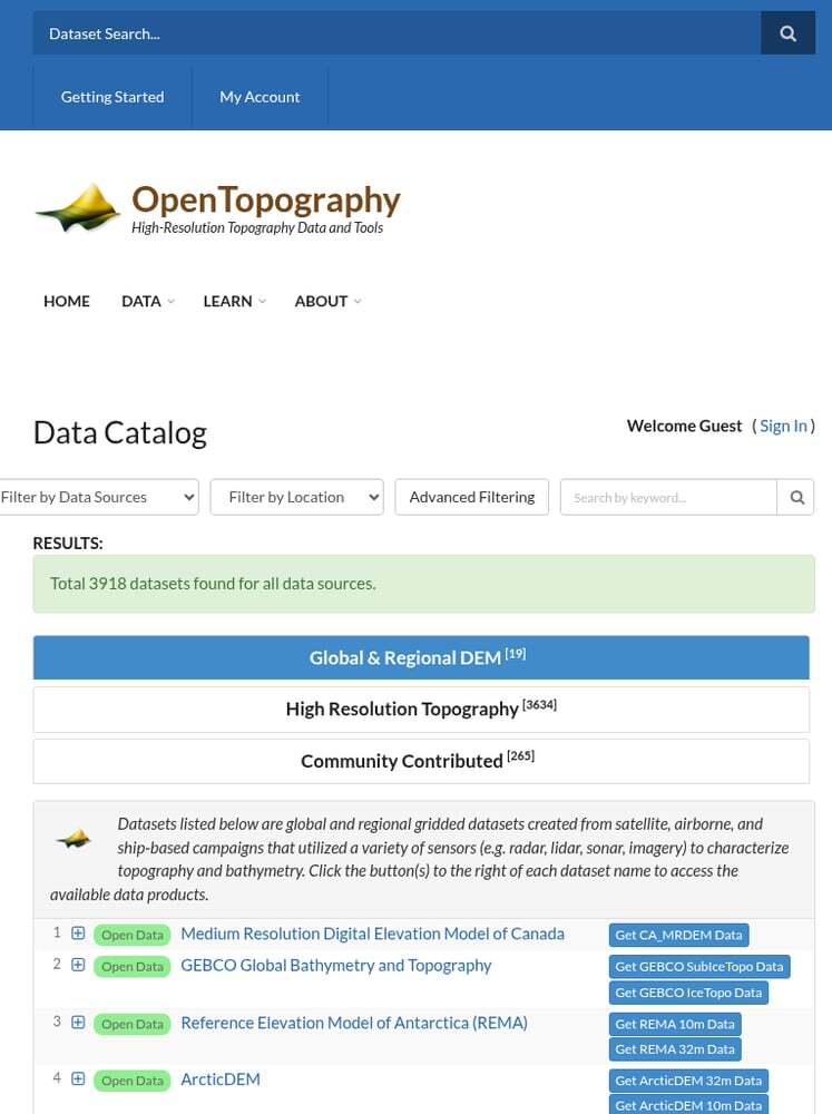
Full-resolution LAZ point clouds are available through OpenTopography. Use their tools for:
- Point cloud visualization
- On-demand DEM generation
- Direct LAZ file downloads
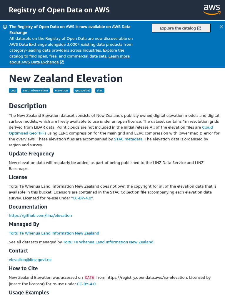
AWS Registry of Open Data
For entire datasets, use the NZ Elevation dataset on AWS:
- Cloud Optimized GeoTIFFs (COGs)
- Stream data without full downloads
- STAC catalog access
- No login required
Technical Specifications
Data Specifications
Resolution: 1 metre (DEM/DSM)
Point Density: 2-8 points/m²
Products: DEM, DSM, Hillshade
License: CC-BY-4.0 (free for any use)
Coordinate Systems
Default CRS: NZTM2000 (EPSG:2193)
Alternative: NZGD2000 (EPSG:4167)
Global: WGS84 (EPSG:4326)
Vertical Datum: NZVD2016
Available File Formats
LINZ Data Service supports multiple export formats for different use cases
| Format | Type | Best For |
|---|---|---|
| GeoTIFF | Raster | DEMs and DSMs – universal GIS compatibility |
| LAZ | Point Cloud | Compressed LiDAR data via OpenTopography |
| ESRI File GDB | Vector/Raster | ArcGIS Pro workflows |
| GeoPackage | Vector/Raster | Open format for QGIS and other GIS software |
| COG (AWS) | Cloud Raster | Cloud streaming, no full download needed |
Tips for Downloading LINZ Data
Use NZTM2000 Projection
New Zealand Transverse Mercator 2000 is the standard projection for NZ data. Keep data in NZTM for accurate measurements and compatibility with other NZ datasets.
Check Coverage First
Use the NZ Elevation Survey Index to see which areas have LiDAR coverage and find links to individual survey datasets.
Download by Topo50 Sheet
For large areas, download by Topo50 map sheet to keep file sizes manageable. The region filter includes predefined Topo50 sheet boundaries.
Processing Your Downloaded Data
Once you have downloaded your LINZ LiDAR data, you’ll need to process it to extract useful products. Lidarvisor offers a streamlined workflow for processing point clouds
Upload LAZ Directly
No conversion needed — upload your LINZ LAZ files directly to Lidarvisor for processing.
Automatic Classification
AI-powered ground classification and noise removal works automatically on your data.
Generate Products
Create DTMs, DSMs, hillshades, slope maps, contours, and more from your point clouds.
Frequently Asked Questions
Is LINZ LiDAR data free to use?
Yes! All LiDAR data from LINZ is released under the Creative Commons Attribution 4.0 (CC-BY-4.0) license. You can use it for commercial or non-commercial purposes as long as you attribute LINZ as the source.
What areas of New Zealand have LiDAR coverage?
As of 2024, most of New Zealand has LiDAR coverage through the National Elevation Programme. Check the NZ Elevation Survey Index for current coverage maps. Priority areas include urban centers, flood-prone regions, and coastal zones.
What’s the resolution of LINZ LiDAR data?
The national DEM and DSM products are provided at 1-metre resolution. Individual survey datasets may have different specifications depending on the acquisition parameters. Point density typically ranges from 2-8 points per square metre.
How do I download point cloud data (LAZ files)?
Full-resolution point cloud data is available through OpenTopography rather than the LINZ Data Service directly. LINZ provides the derived products (DEMs, DSMs, hillshades) while OpenTopography hosts the raw LAZ files.
What projection should I use?
For most New Zealand applications, use NZTM2000 (EPSG:2193) – New Zealand Transverse Mercator. This is the official projection for New Zealand and ensures accurate measurements. If you need global compatibility, you can convert to WGS84 (EPSG:4326).
What software can open LINZ data?
GeoTIFF files from LINZ can be opened with any GIS software including QGIS, ArcGIS Pro, Global Mapper, and Google Earth Pro. LAZ files can be opened with CloudCompare, QGIS (with LAStools plugin), and Fugro Viewer. For cloud-based processing without software installation, upload directly to Lidarvisor.
More Free LiDAR Data Tutorials
Explore our complete collection of free LiDAR data download tutorials
Oceania
Global Portals
• OpenTopography • AWS Open LiDAR • All Data Sources →
Ready to Process Your LINZ Data?
Upload your LAZ files to Lidarvisor and generate DTMs, DSMs, contours, and more — no desktop software required. Start with 50 Hectares of free processing.
Create free account50 hectares free. No credit card. No software to install.