
Learn LiDAR
Building Footprint Extraction
Automated Methods for Urban Mapping and Asset Management
No credit card required • 50 hectares included
Extract accurate building outlines from LiDAR point clouds automatically. Essential for urban planning, insurance risk assessment, construction, and asset management.
What is Building Footprint Extraction?
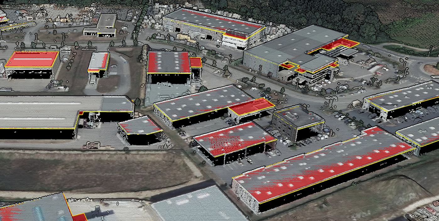
Building footprint extraction identifies and delineates the ground-level outline of structures from geospatial data, producing vector polygons representing each building’s base area
Urban Planning
Understanding built density and land use
Tax Assessment
Calculating building square footage for valuation
Insurance
Risk modeling, exposure analysis, claims processing
Emergency Response
Identifying structures in disaster zones
Telecommunications
Antenna placement and coverage modeling
Construction
Site surveys and as-built documentation
Why LiDAR is Ideal for Building Extraction
- 3D Precision — Centimeter accuracy distinguishing rooftops from ground level
- Penetrates Partial Occlusion — Multi-return captures buildings under trees
- Works Independent of Lighting — No shadows or sun angle issues
- Separates Buildings from Vegetation — Classification eliminates false positives
Automated Extraction Workflow
Upload Point Cloud
Upload your LAS, LAZ, or COPC aerial LiDAR data from drone surveys, manned aircraft, or national programs.
AI Classification
Automatic classification identifies building points as a distinct class, separating them from ground and vegetation.
Download Vectors
Export building footprints as regularized polygons in DXF or Shapefile format for CAD/GIS use.
Related
Footprints are one vector layer among several. Automatic vectorization to CAD covers the others.
Create a FREE account now and start processing your point cloud
Get 5 GB of storage space and classify up to 50 hectares for free.
Create free account50 hectares free. No credit card. No software to install.