
Learn LiDAR
How to Download Free LiDAR Data from Sweden (Lantmäteriet)
Step-by-Step Tutorial
No credit card required • 50 hectares included
Access Sweden’s comprehensive LiDAR point cloud data through Lantmäteriet’s Geotorget portal. The NH dataset provides complete national coverage (100% of Sweden), while the Forest dataset covers approximately 75% of productive forest land — all completely free under the CC0 license.
Lantmäteriet is Sweden’s national mapping, cadastral, and land registration authority. Through their open data initiative, they provide free access to high-quality LiDAR data collected from two major scanning campaigns: Laser data NH (2009-2019, covering the entire country) and Laser data Skog (2018-ongoing, focused on forested areas with higher density).
What is Lantmäteriet?
Point Cloud Data (LAZ)
Classified LiDAR point clouds with ground, water, bridges, and vegetation points. NH provides 0.5-1 pts/m², Forest provides 1-2 pts/m².
Two Dataset Options
NH dataset covers 100% of Sweden. Forest (Skog) dataset covers ~75% of productive forest land with higher density for vegetation analysis.
CC0 License (Free)
Completely free to use, modify, and redistribute — even for commercial purposes without attribution required.
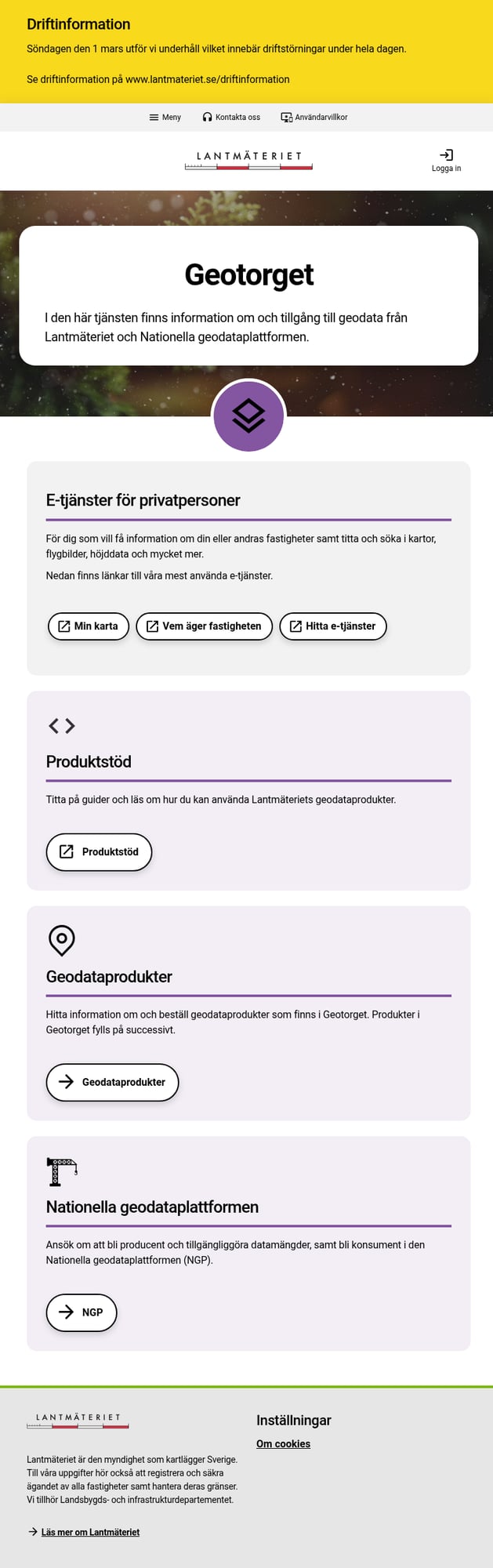
To create an account:
- Logga in (Log in) – Click in the top right corner
- Skapa konto (Create account) – Register as Privatperson (Private) or Organisation
- Verify email – Complete the registration process
- Log in – Access your new account
Note: The interface is primarily in Swedish. Use your browser’s translation if needed.
Use the filter Avgiftsfri (Free of charge) to show only open data, then look for:
- Laserdata Nedladdning, NH – Complete national coverage (2009-2019)
- Laserdata Nedladdning, skog – Higher density forest data (2018+)
Which dataset? Use NH for complete coverage (100% of Sweden). Use Skog for higher point density in forested areas (~75% of productive forest land).

Create a Geotorget Account
Go to geotorget.lantmateriet.se to access the download portal.
Navigate to Laser Data Products
From the Geotorget main page, click Geodataprodukter (Geodata products).
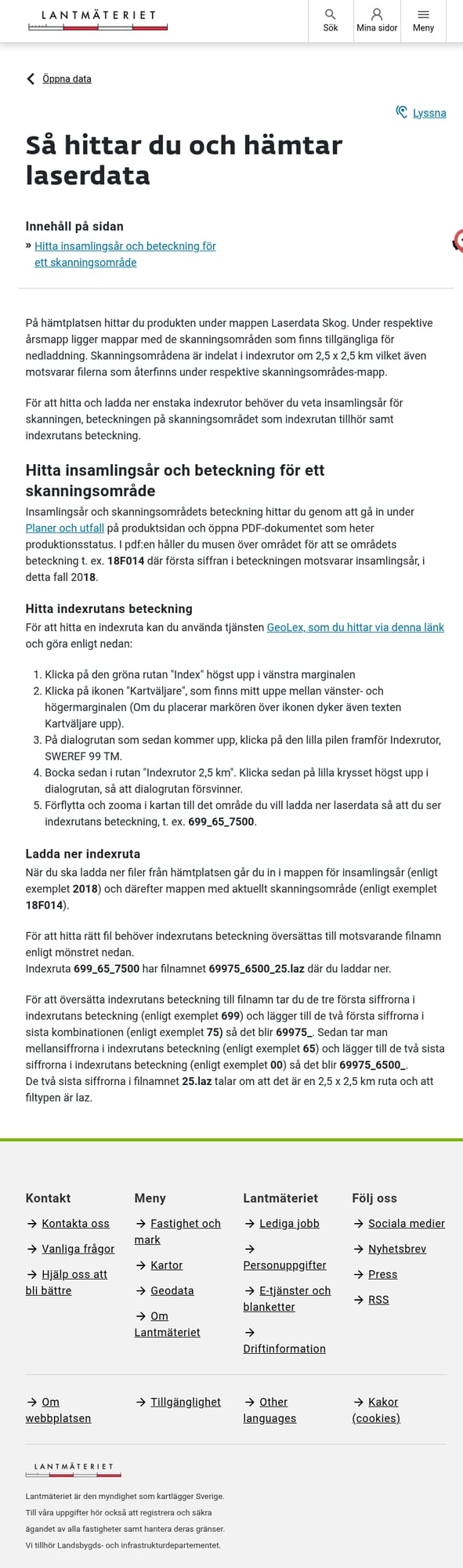
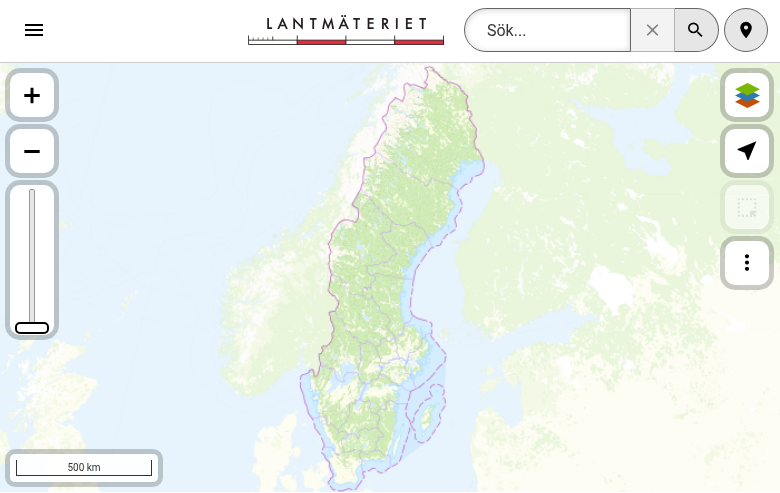
- Go to GeoLex
- Click the green Index button (top left)
- Click Kartväljare (Map selector) in the toolbar
- Expand Indexrutor, SWEREF 99 TM
- Check Indexrutor 2,5 km to display the tile grid
- Navigate to your area and note the tile reference (e.g., “699_65_7500”)
Area Selection Options:
- Index tiles – Enter specific tile references
- Polygon – Draw an area on the map
- Municipality (kommun) – Select by administrative area
- County (län) – Select entire regions
Submit your order and wait for processing. Download the LAZ files from Mitt konto (My account) → Leveranser (Deliveries).
Find Your Area of Interest
To download specific tiles, identify the tile reference using GeoLex:
Create Order & Download
In Geotorget, create a new order for the laser data product.
Dataset Specifications
Swedish LiDAR data is available in two primary datasets with different specifications
| Specification | Laser data NH | Laser data Skog (Forest) |
|---|---|---|
| Collection Period | 2009–2019 (complete) | 2018–ongoing |
| Coverage | 100% of Sweden | ~75% of productive forest |
| Point Density | 0.5–1 pts/m² | 1–2 pts/m² |
| Tile Size | 2.5 × 2.5 km | 2.5 × 2.5 km |
| Coordinate System | SWEREF 99 TM (EPSG:3006) | SWEREF 99 TM (EPSG:3006) |
Tips for Downloading Swedish LiDAR
Choose the Right Dataset
Use NH for complete national coverage. Use Skog (Forest) for higher density in forested areas — ideal for vegetation analysis and forestry applications.
Plan Your Storage
A single municipality can be several GB. A full county (län) may exceed 50-100 GB. Ensure adequate disk space before ordering.
⏱️ Processing Time
Large orders may take hours to process. You’ll receive an email when your data is ready in “Leveranser” (Deliveries).
Check Production Status
The Forest dataset is still being collected (~75% complete). Check the production status map to confirm data availability for your area.
Frequently Asked Questions
Is Lantmäteriet LiDAR data really free?
Yes! Lantmäteriet’s laser data is released under the CC0 (Creative Commons Zero) license, which means it’s completely free to use, modify, and redistribute — including for commercial purposes. You don’t even need to provide attribution, though citing Lantmäteriet as the source is appreciated.
What is the difference between NH and Skog (Forest) datasets?
Laser data NH (Nationell Höjdmodell) was collected 2009-2019 and provides complete national coverage (100% of Sweden) at 0.5-1 points per square meter. It’s ideal for terrain modeling and general-purpose applications.
Laser data Skog (Forest) started in 2018 and is ongoing, with higher point density (1-2 pts/m²) specifically designed for forestry applications. It covers approximately 75% of Sweden’s productive forest land and is being updated on a ~7-year cycle.
What coordinate system is the data in?
Swedish LiDAR data uses SWEREF 99 TM (EPSG:3006), which is Sweden’s national coordinate reference system based on the Transverse Mercator projection. Most GIS software can automatically transform this to WGS84 (GPS coordinates) or other coordinate systems.
What software can I use to view LAZ files?
LAZ files can be opened with many free and commercial applications:
Free options:
- Lidarvisor — Browser-based, no installation required
- CloudCompare — Open-source desktop application
- QGIS with LAStools plugin — GIS integration
Commercial options: Global Mapper, ArcGIS Pro, Terrasolid, LP360
Is there derived data available (DEM, DSM)?
Yes! Lantmäteriet also provides derived elevation products through Geotorget:
- Markhöjdmodell (Ground Height Model / DEM) — 1m and 2m resolution
- Höjdmodell (Height Model) — Various resolutions
These are available as GeoTIFF raster files. If you need custom derivatives (hillshade, slope, contours), you can generate them from the point cloud data using Lidarvisor.
Do I need an account to download?
Yes, you need to create a free Geotorget account to order and download data. Registration is quick — just provide an email address and choose between a private person (Privatperson) or organization account. No payment or subscription is required for accessing the free LiDAR data.
Ready to Process Your Swedish LiDAR?
Upload your downloaded Lantmäteriet files to Lidarvisor for instant visualization, analysis, and export. 5 GB free storage included.
Create free account50 hectares free. No credit card. No software to install.