
Learn LiDAR
Stockpile Inventory Software: LiDAR Workflows for Volume and Material Tracking
Prepare accurate inputs for volume, tonnage, and recurring material tracking
No credit card required • 50 hectares included
Stockpile reports get harder when the surface is messy. Vegetation, vehicles, and temporary site clutter can slow down cleanup and make it harder to trust the final volume model.
Lidarvisor helps with the processing stage first. Upload aerial LiDAR, generate classified point clouds, DTM, DSM, contours, and export-ready deliverables, then move those clean outputs into the stockpile measurement, GIS, CAD, or reporting workflow your team already uses.
What stockpile inventory software needs from LiDAR processing
Stockpile measurement workflows often rely on more than raw point clouds alone. Clean terrain and surface data make recurring volume comparisons and reporting easier to support across survey dates.
Before your team can estimate pile volume or combine it with density assumptions for tonnage, it usually needs:
- Bare-earth terrain models to define the stockpile base
- Surface models that preserve pile geometry
- Classification to separate ground from vegetation and temporary objects
- Exports such as GeoTIFF, LAS, SHP, DXF, or GeoJSON for downstream workflows
Lidarvisor fits this front half of the job. It prepares LiDAR outputs that downstream stockpile, GIS, CAD, and reporting workflows can use.
Built for recurring material tracking workflows
Lidarvisor supports the processing stage ahead of recurring stockpile checks across operations that depend on clean terrain and surface outputs
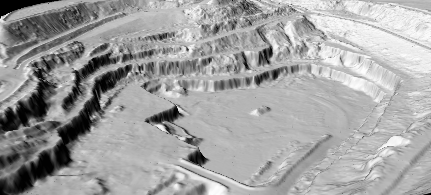
Mining and aggregates
Support recurring pile surveys, monthly reconciliation, and operational reporting with cleaner terrain and surface outputs.
Construction earthworks
Track borrow pits, staging yards, and grading changes when site conditions shift between survey dates.
Bulk-material storage
Prepare repeatable elevation surfaces for sand, gravel, compost, grain, salt, and other stockpiled materials.
Why teams use Lidarvisor before stockpile calculations
Evaluate how easily you can get from raw LiDAR to usable terrain and surface outputs.
Lidarvisor helps by making that preparation step simpler. It does not replace mine-planning, ERP, or stockpile accounting systems. It gives those systems cleaner LiDAR-derived inputs to work with.
- Automatic classification helps separate usable ground and surface data from surrounding clutter.
- Cloud-based processing means no desktop installation is required before you start.
- DTM, DSM, contours, and standard exports make handoff easier for CAD, GIS, and reporting workflows.
- Repeatable outputs support recurring inventory checks on new survey data.
A practical LiDAR workflow for stockpile inventory
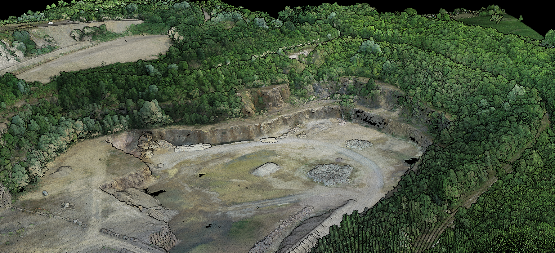
This workflow keeps the processing stage efficient while leaving final inventory calculations in the tools built for them.
- Capture aerial LiDAR over the yard, quarry, or site.
- Process and classify the dataset to isolate ground and clean up non-stockpile features where needed.
- Generate DTM and DSM outputs for base and top surfaces.
- Export deliverables in formats your team already supports.
- Calculate volume and tonnage downstream inside the operational system your team uses for reporting.
Learn more about LiDAR classification and how it supports cleaner stockpile surfaces.
Why stockpile inventory software shortlists are shifting in 2026
Teams evaluating stockpile inventory software in 2026 are less willing to babysit raw point clouds before each volume run. Competitor messaging from Virtual Surveyor still leans on stockpile, cut/fill, and drone-survey deliverables, which is a reminder that buyers care about how quickly they can move from capture to a trusted surface, not just the final report screen.
That shift matters for LiDAR workflows. Before a stockpile tool can compare survey dates or support tonnage reporting, the upstream dataset usually needs reliable ground separation, cleaner pile surfaces, and exports that fit the downstream system without extra cleanup.
Lidarvisor fits that preparation stage. It helps teams produce DTM, DSM, contours, and classified point clouds that are easier to hand off into stockpile measurement or reporting software when repeat surveys start to pile up.
Where Lidarvisor fits
Lidarvisor prepares the terrain, surface, and export outputs that downstream stockpile measurement, GIS, and reporting workflows can use
DTM
Bare-earth reference surfaces for defining the stockpile base.
DSM
Top-of-surface models that preserve pile geometry and site structures.
Contours
Contour lines for topographic interpretation and reporting handoff.
Standard exports
Classified LAS plus GeoTIFF, SHP, DXF, and GeoJSON for downstream analysis.
Want cleaner inputs for stockpile volume calculations?
Test Lidarvisor on a real aerial LiDAR dataset and see how quickly you can move from raw data to usable terrain and surface outputs.
Frequently Asked Questions
Does Lidarvisor calculate stockpile tonnage?
Lidarvisor focuses on LiDAR processing outputs such as classification, DTM, DSM, contours, and exports. Tonnage calculations typically happen downstream after volume is combined with material-density assumptions.
Can this workflow support cut and fill as well?
Yes. The same processed surfaces used for stockpile measurement can also support cut/fill analysis or survey-date comparisons in downstream workflows.
Does Lidarvisor replace stockpile inventory software?
No. Lidarvisor prepares the LiDAR outputs that stockpile inventory, mine-planning, GIS, and reporting workflows can use downstream.
What industries use stockpile inventory software?
Mining, aggregates, construction, waste management, and other bulk-material operations use these workflows to track material quantities over time.
Ready to prepare cleaner stockpile surfaces?
Create a free account and start processing your point cloud. Lidarvisor helps your team move from raw aerial LiDAR to classification, terrain, surface, and export-ready outputs for downstream stockpile workflows.
Create free account50 hectares free. No credit card. No software to install.