
Learn LiDAR
Best Point Cloud Viewer Software: Browser, Desktop, and Free Tools Compared
Compare the best point cloud viewer software for fast browser review, desktop analysis, and full LiDAR workflows—so you can pick the right tool for your team faster.
No credit card required • 50 hectares included
Looking for the best point cloud viewer software? This guide compares browser-based, desktop, and free tools so you can choose the right option for quick review, collaboration, or fuller LiDAR workflows.
If you only need to open a point cloud and check what is in the file, a simple viewer may be enough. The harder question is what happens next: do you only need quick review, or do you also need terrain products, extracted vector outputs, and a clean CAD or GIS handoff?
This guide compares browser, desktop, and free-tool paths so you can choose the right point cloud viewer software without overbuying or getting stuck in a viewer-only workflow.
What good point cloud viewer software should let you do
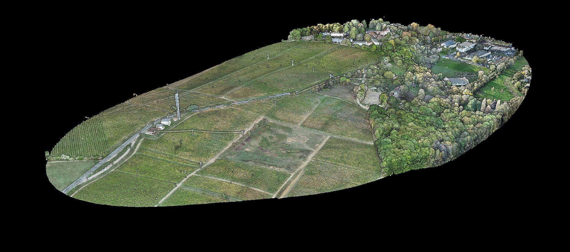
- Open the point cloud formats your team uses most often
- Navigate dense datasets without long setup or heavy IT overhead
- Switch between RGB, elevation, intensity, and classification views
- Measure, clip, review QA issues, and share findings clearly
- Hand data off cleanly when the job moves into CAD, GIS, or production outputs
Browser, desktop, and free tools: the three main paths
Most teams are not just choosing a viewer. They are choosing the fastest path from raw data to a decision, an approval, or a deliverable.
Free browser viewer
Best fit
Fast QA, link sharing, stakeholder review, and no-install access
Main tradeoff
Usually lighter on advanced editing and downstream production tools
Free or open-source desktop viewer
Best fit
Local inspection, measurement, and power-user review workflows
Main tradeoff
Setup, hardware, and file-sharing friction stay with your team
Full LiDAR processing platform
Best fit
Teams that need viewer access plus classification, terrain products, and export-ready handoff
Main tradeoff
You need to evaluate the whole workflow, not just the viewer itself
If your shortlist only compares rendering speed, you can miss the bigger bottleneck: what happens after review.
Questions to answer before you choose
Viewing or deliverables
Do you only need viewing, or do you also need classification and deliverables?
Who needs access
Will project managers, field crews, or clients need browser access?
Output requirements
Do you need outputs such as DTM, DSM, contours, or vector layers after review?
Workflow frequency
Are you reviewing one-off files or building a repeatable QA workflow?
Team friction
Will large local installs and file transfers slow the team down?
File size
How large are your surveys, and can the tool open them without running into local hardware limits?
When a browser viewer is enough
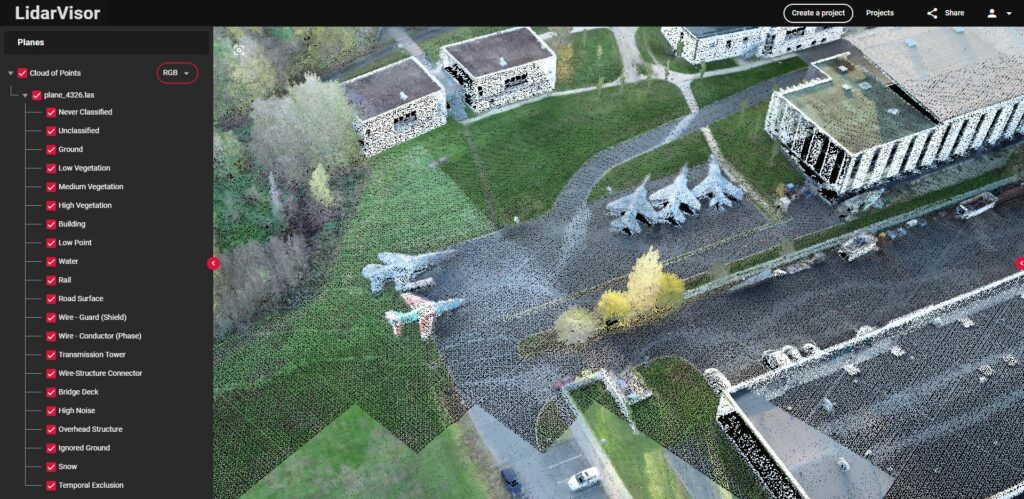
Quick inspection, internal QA, markup review, and no-install sharing are where browser viewers shine.
A browser viewer is a strong fit when the main job is inspection, internal QA, markup review, or sharing a scene with someone who should not have to install software. It is especially useful when multiple people need fast access to the same dataset from different devices.
- Quick scan review before the next workflow step
- Client or stakeholder sharing without sending large files
- Early project triage before deeper processing starts
- Distributed teams that need the same view in the browser
When viewer-only tools become the bottleneck
Viewer-only tools
Viewer-only tools start to feel small when the same job also needs production outputs. Once your team has to move from visual review into classification, terrain modeling, contours, building footprints, tree metrics, or corridor vectors, the question stops being “which viewer opens the file?” and becomes “which workflow gets us to the deliverable with the least friction?”
Workflow-ready platform
Lidarvisor fits teams that want browser-based review without stopping at the viewer. It combines a shareable 3D point cloud viewer with classification, terrain models, vector extraction, and export formats used in survey, GIS, forestry, and utility workflows.
WORKFLOW HANDOFF
Where Lidarvisor fits
Browser-based review is more useful when it stays connected to classification, terrain, vector, and export-ready outputs.
Lidarvisor fits teams that want browser-based review without stopping at the viewer. It combines a shareable 3D point cloud viewer with classification, terrain models, vector extraction, and export formats used in survey, GIS, forestry, and utility workflows.
- Review point clouds in the browser and share interactive views by link
- Generate DTM, DSM, hillshade, and slope outputs
- Extract contours, building footprints, tree crowns, tree tops, and power line vectors
- Export LAS, LAZ, GeoTIFF, DXF, SHP, and GeoJSON for downstream handoff
Match the viewer to your file types and handoff
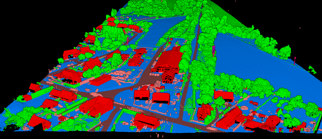
Search demand around point cloud viewer software usually overlaps with real file-format questions: can the tool open LAS or LAZ quickly, can it review E57 handoffs, and can the team move from viewing into export-ready survey or GIS outputs without adding another bottleneck?
LAS / LAZ review
Best when you need
Fast browser opening, QA checks, and simple sharing for airborne LiDAR deliverables.
Workflow signal
If the job will continue into DTM, DSM, contours, or CAD export, compare the full handoff path instead of just the viewer.
E57 handoff review
Best when you need
Quick scan review, stakeholder access, and easier collaboration around terrestrial or mixed point-cloud handoffs.
Workflow signal
If teams mostly need review and markup before another specialist takes over, browser access matters more than deep desktop setup.
Viewer + outputs
Best when you need
One workflow that covers review, classification, terrain products, vector extraction, and export formats.
Workflow signal
This is usually the right direction when survey, utility, forestry, or construction teams do not want a viewer-only dead end.
Why point cloud viewer software shortlists are shifting in 2026
The shortlist is moving beyond simple file opening. Teams now expect viewer software to fit mobile capture, handheld SLAM, and faster survey handoff workflows.
Current category messaging from vendors such as GeoCue and ROCK Robotic keeps reinforcing the same shift: buyers are being sold on raw-to-deliverable workflow coverage, not just point cloud rendering. At the same time, handheld and mobile LiDAR growth keeps raising the value of browser review because more people need quick access to the same dataset without another install step.
That means point cloud viewer software is now being judged on three layers at once: how quickly it opens LAS, LAZ, or E57 files, how easily it supports team review, and how cleanly it connects to terrain, classification, vector, or export-ready deliverables after the review stage.
What buyers now screen for first
Format coverage
Can the viewer handle LAS, LAZ, and E57 without forcing a separate workaround?
Review friction
Can survey managers, field crews, and stakeholders open the same scene quickly?
Workflow exit
After the viewer step, can the team move into DTM, DSM, contours, vectors, or GIS and CAD exports without starting over?
Frequently Asked Questions
Is point cloud viewer software the same as LiDAR processing software?
No. Viewer software focuses on opening, navigating, and reviewing point clouds. LiDAR processing software goes further into classification, terrain models, vector extraction, reporting, and export-ready deliverables.
Are free point cloud viewer tools enough for LiDAR projects?
Free tools can be a good fit for quick inspection, learning, or occasional QA. They are less likely to be enough when the same job also needs repeatable production outputs, browser sharing, or a fast handoff into CAD and GIS workflows.
What should I check first when comparing viewer software?
Check whether the tool matches your real workflow: browser access versus local install, review-only versus production outputs, sharing needs, and the formats or exports your downstream team expects.
When is a browser viewer the better choice?
A browser viewer is often the better choice when multiple people need access to the same dataset quickly, especially for QA, stakeholder review, and no-install collaboration.
Need More Than a Viewer?
If your team wants review plus usable outputs from the same workflow, test Lidarvisor on a real dataset and see whether a browser-based path fits better than another desktop-only step.
Create free account50 hectares free. No credit card. No software to install.