LiDAR data acquisition captures three-dimensional spatial information using laser scanning technology. This active remote sensing method provides centimeter-level accuracy, penetrates vegetation, and works in low-light conditions.
Types of Acquisition Systems
Airborne LiDAR (ALS)
The standard for large-scale mapping. Point density 5-30 pts/m², vertical accuracy 5-10 cm.
Drone LiDAR
Flexibility and lower cost for medium-scale projects. Point density 50-500 pts/m², 3-5 cm accuracy.
Terrestrial Scanning (TLS)
Extremely dense point clouds from fixed positions. Millimeter accuracy for localized surveys.
Mobile Laser Scanning (MLS)
Vehicle-mounted systems for corridor mapping. Efficient capture along roads and railways.
The Acquisition Workflow
Forest Corridor Acquisition
RGB-colorized point clouds combine LiDAR geometry with photographic color data. This fusion provides intuitive visualization while preserving precise 3D measurements for forest corridors, road networks, and infrastructure mapping.
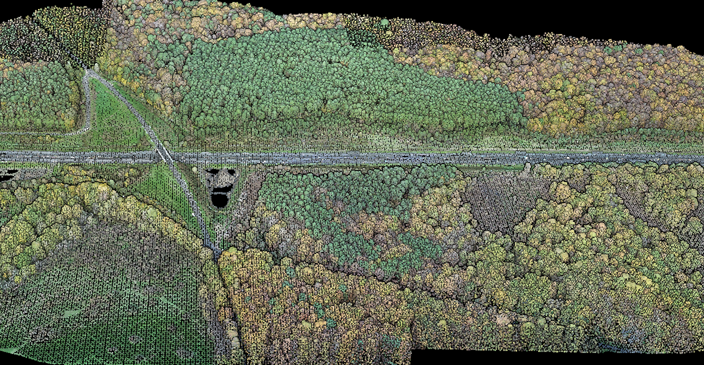
RGB-colorized point cloud showing a forest area with road corridor.
Airborne LiDAR Specifications
Key Specifications
- Point density: 5-30 points/m²
- Vertical accuracy: 5-10 cm RMSE
- Horizontal resolution: ~20 cm
- Pulse repetition rate: 2 MHz+
Leading manufacturers: Leica Geosystems, RIEGL, Teledyne Geospatial with Nd:YAG lasers at 1064 nm wavelength.
Best Suited For
- National elevation programs
- Corridor mapping (highways, railways, pipelines)
- Large-area forestry inventory
- Coastal zone mapping
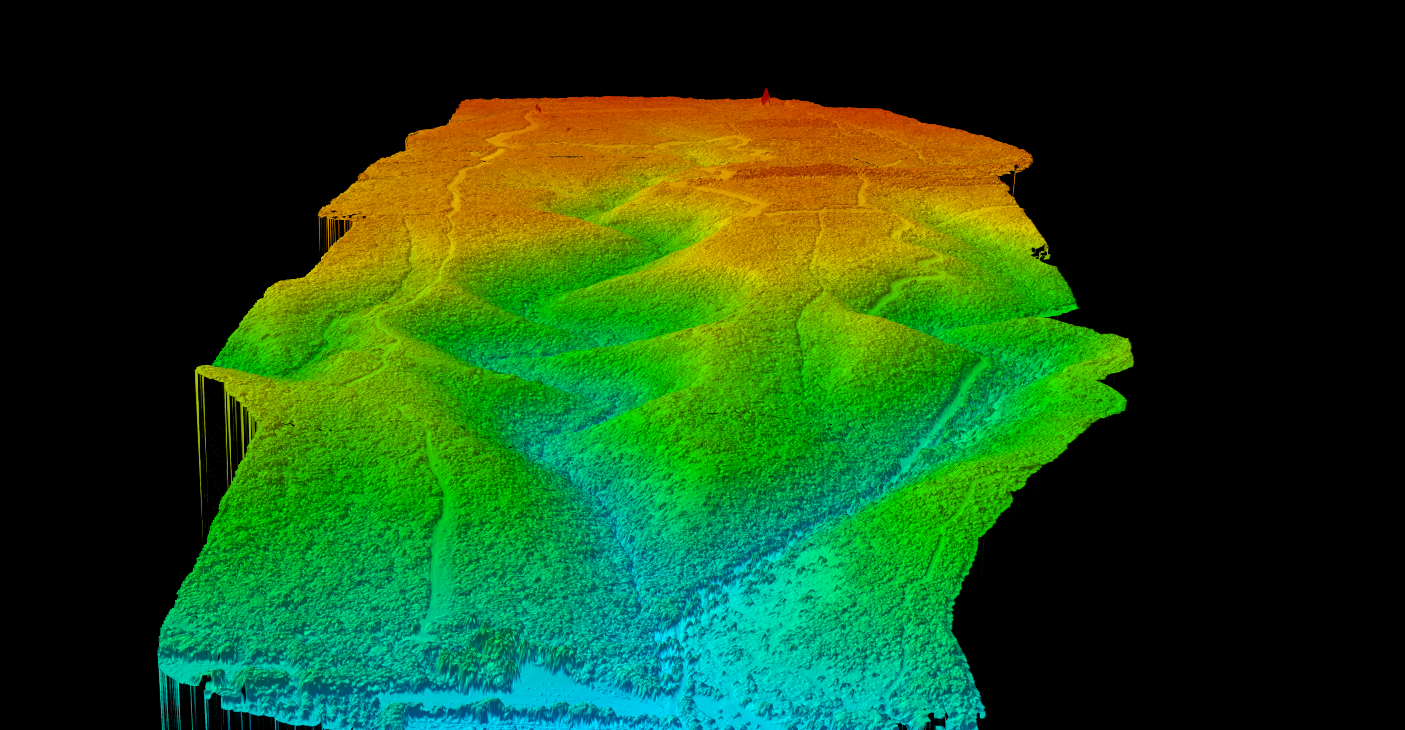
Elevation data visualization of mountainous terrain captured via LiDAR.
Elevation Data Products
LiDAR-derived elevation models reveal terrain features invisible to photogrammetry. Digital Terrain Models (DTM) show bare-earth surfaces, while Digital Surface Models (DSM) capture vegetation and structures for comprehensive topographic analysis.
Drone LiDAR Advantages
Corridor Mapping Applications
Linear infrastructure projects benefit from elevation-coded visualization. Highway planning, power line routing, and pipeline surveys use LiDAR to analyze terrain along proposed corridors, identify obstacles, and optimize alignment.
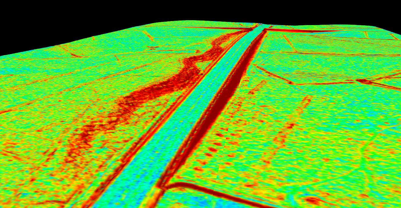
Elevation visualization of highway corridor with power line infrastructure.
Critical Success Factors
- Leaf-off vs Leaf-on — Timing affects ground penetration in vegetated areas
- Weather Constraints — Precipitation, wind, and visibility impact data quality
- Ground Control — Check points validate and improve absolute accuracy
- Flight Planning — Overlap percentage ensures complete coverage
Related Articles
Have LiDAR Data Ready to Process?
LidarVisor automates the post-acquisition workflow — classification, terrain modeling, and feature extraction. Upload your LAS/LAZ files and generate deliverables without specialized software.