
Learn LiDAR
Forest Mapping Software: Turn Raw LiDAR Into Terrain, Canopy and Inventory Outputs
DTM, CHM, classification, tree crowns, and GIS-ready forestry deliverables
No credit card required • 50 hectares included
Forestry teams rarely struggle to collect LiDAR data. The delay usually starts after capture, when raw point clouds still need to be classified, converted into terrain and canopy products, and packaged into outputs that GIS, planning, and inventory teams can actually use. Good forest mapping software should reduce that friction, not add another desktop bottleneck.
If you already have airborne LiDAR or drone LiDAR and need terrain, canopy, and inventory-ready deliverables, Lidarvisor is built for that processing stage. Upload the dataset, review it in the browser, and generate forestry outputs without forcing every stakeholder into a heavy local workflow.
Evaluating tools for forestry LiDAR? See Lidarvisor forestry workflows or review pricing and plan options.
The bottleneck is rarely capture — it is output prep
Raw LiDAR inputs
Point clouds on their own do not answer the questions most forestry teams are actually asking. Access planning still needs bare-earth terrain.
Canopy review still needs height context. Inventory workflows still need extracted features and structured outputs that can be reused elsewhere.
Forestry-ready outputs
The useful layer is what comes next: classified points, DTM and DSM surfaces, canopy height products, tree crowns, tree tops, and exports that GIS, CAD, and reporting teams can open without a separate cleanup pass.
Forest mapping software by deliverable
Terrain models
DTM, hillshade, and slope outputs for roads, drainage, access, and site planning.
Canopy products
DSM, CHM, and vegetation layers that reveal height, cover, and forest structure.
Inventory support
Tree crowns, tree tops, and structured outputs that can feed inventory workflows downstream.
Corridor vegetation review
Forest-corridor outputs that help utility and planning teams inspect vegetation context faster.
What forestry teams should expect from the software
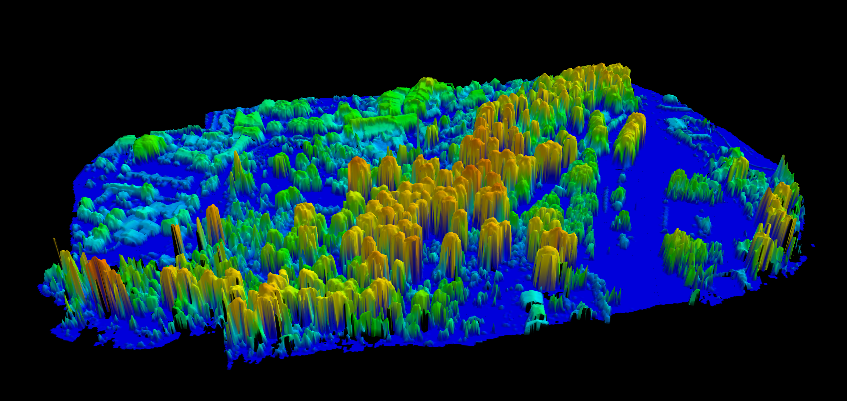
- Ground classification that separates terrain from vegetation before analysis starts
- DTM, hillshade, and slope outputs for access, grading, and terrain review
- DSM and CHM products for canopy height and stand-structure interpretation
- Tree crown and tree top extraction for inventory and mapping support
- Exports such as GeoTIFF, SHP, GeoJSON, DXF, and LAS/LAZ for downstream GIS and CAD teams
- Browser-based review so planners, surveyors, and forestry stakeholders can inspect results more easily
Use CHM and derived surfaces to read the forest faster
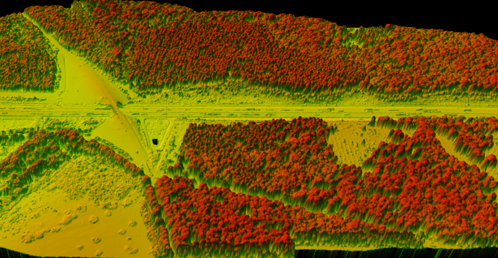
Canopy products help forestry teams move from visual inspection to measurable structure and height context.
A canopy height model is often one of the fastest ways to understand how vegetation varies across a tract or corridor. Combined with classified vegetation and terrain layers, it gives planners, analysts, and inventory teams a clearer view of height patterns before they commit to deeper downstream work.
- Compare canopy height across larger forestry extents or corridors
- Pair vegetation structure with terrain context instead of reviewing each layer in isolation
- Build cleaner inputs for stand review, planning, and inventory support workflows
CLASSIFICATION + HANDOFF
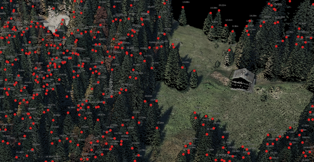
Upload and classify
Start with the raw point cloud, then separate ground and vegetation so the rest of the workflow is built on cleaner inputs rather than manual cleanup later.
Generate terrain and canopy layers
Create the DTM, DSM, CHM, hillshade, slope, and vegetation context that forestry and planning teams actually use to interpret the site.
Export for downstream teams
Hand off crown vectors, tree tops, terrain rasters, or classified files in formats that GIS, CAD, and reporting teams can take forward with less rework.
Frequently Asked Questions
What should forest mapping software produce from raw LiDAR?
For many forestry workflows, the useful outputs are not the raw points alone but terrain, canopy, and vector deliverables derived from them. That usually means classified points, DTM and DSM layers, canopy height products, tree crowns, tree tops, and export-ready files for downstream teams.
Why does terrain still matter in forest mapping?
Because access, grading, drainage, and site-planning questions do not disappear just because the area is vegetated. Bare-earth terrain products such as DTM, hillshade, and slope help teams separate the shape of the ground from the height of the canopy above it.
How does LiDAR support canopy and inventory workflows?
LiDAR adds the most value when forestry teams need repeatable extraction based on structure and elevation, not just visual interpretation. CHM, vegetation classification, tree crowns, and tree tops can provide better starting layers for stand review, canopy analysis, and inventory support workflows.
Is browser-based review enough for every forestry stakeholder?
Not always for every task, but it can remove a lot of friction. Browser-based review makes it easier for planners, managers, GIS staff, and outside collaborators to inspect outputs without requiring a full desktop setup for every person who needs to see the result.
Where does Lidarvisor fit in the overall stack?
Lidarvisor fits the LiDAR processing layer. It helps turn raw point clouds into terrain, vegetation, and vector outputs that can move into GIS, CAD, reporting, or inventory systems, rather than trying to replace every downstream forestry application itself.
Bottom line
The best forest mapping software is usually the tool that helps your team move cleanly from raw LiDAR to terrain, canopy, and inventory-ready outputs. If the bottleneck in your workflow starts after capture, that processing layer is the part worth simplifying first.
Why forest mapping software shortlists are splitting in 2026
Forestry teams are increasingly separating capture, processing, and long-term inventory systems instead of expecting one tool to do everything. Current competitor messaging from PlanIT Geo and mobile LiDAR vendors keeps pushing hybrid inventory, canopy measurement, and field-to-office data handoff, which makes the processing layer more visible in buyer research.
That is where forest mapping software decisions often get made. Teams need a workflow that can classify raw LiDAR, generate DTM and canopy outputs, extract tree-level context, and hand clean files into GIS or inventory platforms without adding a heavy review bottleneck.
For Lidarvisor, the strongest fit is this upstream mapping and QA stage before downstream forestry databases take over.
Ready to Process Forestry LiDAR Faster?
If your team needs terrain models, canopy products, and forestry-ready exports in a browser-based workflow, start free with Lidarvisor or view pricing.
Create free account50 hectares free. No credit card. No software to install.