FLOOD RISK ASSESSMENT
The Problem with Current Flood Risk Data
Many underwriting workflows still depend on generalized flood maps and coarse elevation assumptions. That creates a gap between mapped risk categories and the actual terrain conditions around a property or neighborhood.
TERRAIN ANALYSIS
How LiDAR Improves Flood Risk Assessment
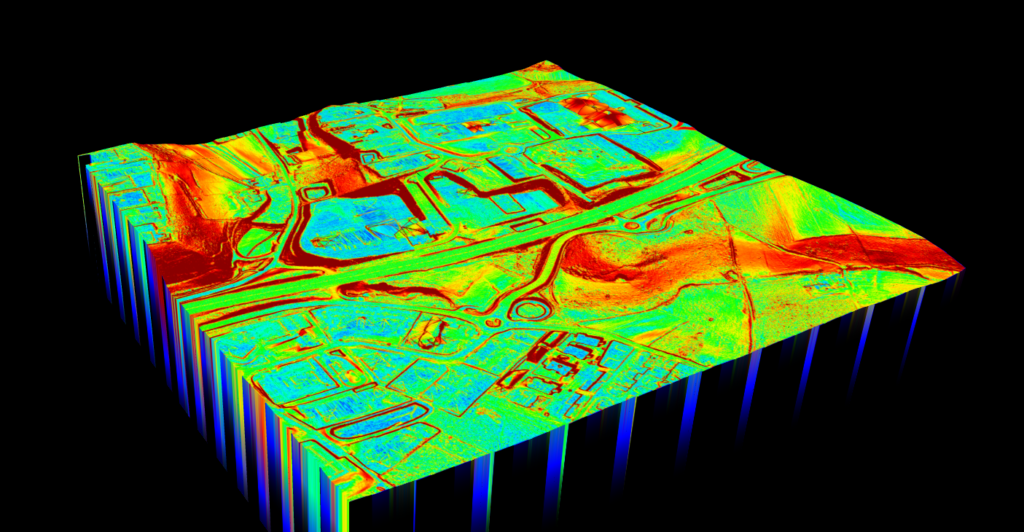
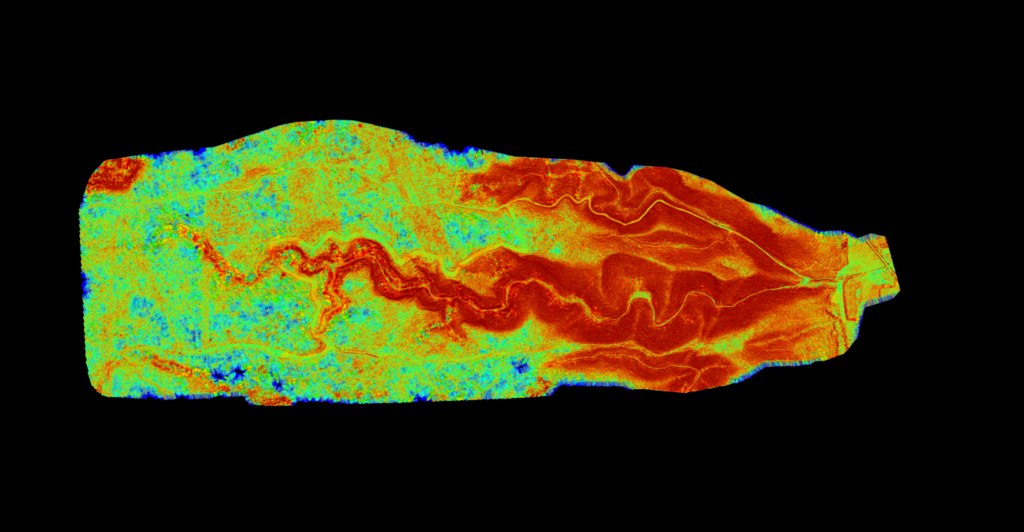
Flood exposure is controlled by terrain, not just administrative map boundaries. LiDAR helps insurers evaluate how water can actually move across the land surface.
With higher-resolution terrain models, underwriting teams can review low points, slope changes, drainage pathways, and surface behavior with much better geographic specificity.
✦ Identify local depressions and terrain breaks that broad flood layers can miss
✦ Review slope and runoff context around specific properties or insured assets
✦ Support better conversations between underwriting, risk, and geospatial teams
✦ Move from generic risk labels toward more evidence-based terrain interpretation
DELIVERABLES
LiDAR Deliverables for Insurance
The useful outcome for insurance teams is not raw point cloud data. It is terrain evidence that can feed risk review and internal assessment workflows.
Lidarvisor helps generate the terrain-focused outputs that make LiDAR easier to interpret and share internally.
✦ DTM for bare-earth surface understanding
✦ Slope maps for runoff and terrain behavior interpretation
✦ Classified point cloud context where broader review needs the underlying data
✦ Terrain visuals that make local exposure differences easier to communicate
USE CASES
Insurance Use Cases
Terrain-aware risk review can support multiple insurance workflows, not just one flood-score lookup step.
🏠
Property Review
Assess how local terrain changes exposure around homes or insured structures.
🧾
Underwriting Support
Bring higher-resolution terrain evidence into pricing and policy review discussions.
🌊
Flood Exposure Review
Understand low points, drainage direction, and terrain behavior around exposed areas.
📍
Portfolio Triage
Flag areas that deserve deeper geospatial review instead of blanket assumptions.
Getting Started
A practical terrain-review workflow for insurance teams is simpler than a full GIS implementation. Focus on the outputs that actually improve decisions.
01
Collect or source LiDAR
Start with LiDAR data that covers the area or asset portfolio you need to evaluate.
02
Generate terrain outputs
Create DTM and slope products that make local elevation behavior easier to review.
03
Review exposure context
Inspect low areas, slope transitions, and runoff-relevant terrain around the property or zone.
04
Use findings in underwriting
Bring the terrain evidence into pricing, review, escalation, or internal risk discussion workflows.
Make Flood Risk Assessment Practical
The value of LiDAR in insurance is not complexity. It is practical terrain insight that helps teams make better risk judgments with better evidence.
Generic Flood Inputs
❌ Coarser terrain assumptions can blur local risk differences
❌ Broad zone labels can hide property-specific terrain behavior
❌ Harder to explain borderline cases with confidence
❌ Risk review gets less precise when terrain context is missing
LiDAR Terrain Review
✓ Higher-resolution elevation context for local risk interpretation
✓ Better visibility into low points, slope shifts, and drainage-related exposure
✓ More specific internal review when properties do not fit broad assumptions cleanly
✓ Stronger support for underwriting and risk discussions that need terrain evidence
Frequently Asked Questions
Because water movement depends on local elevation behavior. Higher-resolution terrain data can reveal low points, runoff paths, and exposure differences that broad flood zones do not express well.
No. LiDAR is an additional terrain data source that can improve local risk understanding and supplement broader flood-mapping inputs. It is not a replacement for all official models or regulatory requirements.
DTM and slope products are especially useful because they make terrain behavior easier to interpret. Depending on the workflow, classified point clouds and terrain visuals can also support deeper internal review.
Yes. One of its biggest advantages is that it helps teams look beyond broad area categories and inspect terrain conditions closer to the actual property or insured asset.
Yes, for standard LAS or LAZ workflows. Lidarvisor is designed to let you upload point cloud data, generate terrain outputs, and work from higher-resolution elevation context without a heavy local processing setup for routine tasks.
Create a free account and start processing flood-risk terrain data
Start with 2 GB of storage and process up to 50 hectares for free. Upload LiDAR data, generate terrain outputs, and review flood-relevant elevation context in one browser-based workflow.
No credit card required • 2 GB included on free signup
Related Articles
Flood + Terrain
• Create Accurate Terrain Models
• Terrain Mapping with LiDAR
Related Applications
• LiDAR for Construction
• Bridge & Road Inspection
More Processing
• Digital Terrain Model Guide
• Point Cloud Viewer