Understanding Remote Sensing Technologies
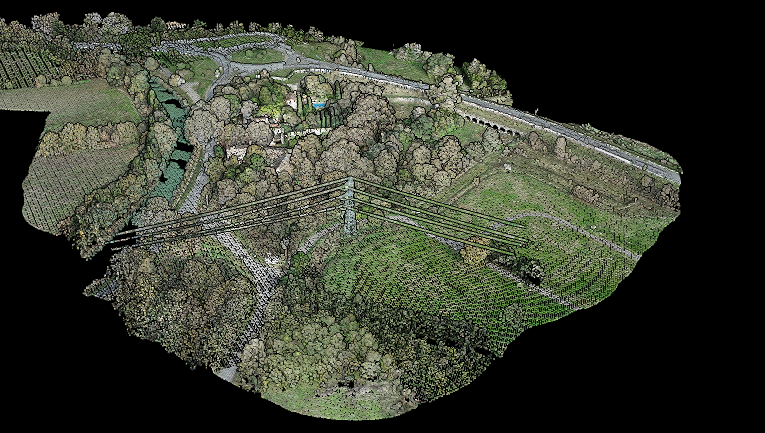
LiDAR point cloud showing centimeter-level detail — precision that Radar cannot match.
The Core Difference: Light vs Radio Waves
The fundamental difference between LiDAR and Radar lies in the type of electromagnetic radiation they use:
- LiDAR (Light Detection and Ranging) uses laser light pulses, typically in wavelengths between 700 and 1550 nanometers
- Radar (Radio Detection and Ranging) uses radio waves with wavelengths between 0.3 and 100 centimeters
This wavelength difference is what drives all the practical differences between these technologies in terms of accuracy, weather sensitivity, and cost.
How LiDAR Works
LiDAR systems work by sending out rapid laser pulses and measuring how long each pulse takes to reflect back from objects. This time-of-flight (ToF) calculation, combined with the known speed of light, provides precise distance measurements.
A LiDAR system consists of three main components:
- Laser source that generates light pulses
- Scanner (typically a spinning mirror or MEMS device) that directs the laser beam
- Detector that receives the reflected light and calculates distances
By rapidly scanning an area with thousands of laser pulses per second, LiDAR creates detailed 3D point clouds that capture the shape and position of every surface the laser hits.
How Radar Works
Radar systems transmit electromagnetic waves in the radio frequency spectrum and detect the echoes that bounce back from objects. The system calculates the range, angle, and speed of objects based on the time delay and properties of the returned signal.
A radar system includes:
- Transmitter that generates radio waves
- Antenna that broadcasts and receives the radio waves
- Receiver that processes the returned signals
Because radio waves have longer wavelengths, radar excels at detecting objects over vast distances and through adverse weather conditions.
LiDAR vs Radar: Comparison Table
| Factor | LiDAR | Radar |
|---|---|---|
| Technology | Laser light (700-1550nm) | Radio waves (0.3-100cm) |
| Accuracy | Centimeter-level precision ✓ | Meter-level precision |
| Resolution | Very high (detects small features) ✓ | Lower (misses fine details) |
| Range | Up to several miles | Hundreds of miles possible ✓ |
| Weather Sensitivity | Affected by rain, fog, snow | Works in all weather ✓ |
| Cost | Higher (precision components) | Lower (simpler components) ✓ |
| Data Output | 3D point clouds ✓ | 2D images or object detection |
| Best For | Mapping, surveying, 3D modeling ✓ | Weather monitoring, aviation, long-range detection |
When to Use LiDAR
Choose LiDAR when your application requires:
- High precision: Surveying, engineering, and construction projects
- 3D modeling: Creating detailed point clouds of terrain or structures
- Vegetation analysis: Forestry, agriculture, and environmental monitoring
- Small feature detection: Utility line mapping, archaeology
- Ground penetration: LiDAR can detect features beneath vegetation canopy
If you’re working with LiDAR for surveying, mapping, or forestry, you’ll need to process those massive point clouds into usable outputs. Lidarvisor transforms raw data into classified point clouds, terrain models, and contours in minutes.
When to Use Radar
Choose Radar when your application requires:
- All-weather operation: Applications that must work in rain, snow, or fog
- Long-range detection: Tracking objects at distances of many miles
- Speed measurement: Detecting velocity of moving objects
- Continuous monitoring: Air traffic control, weather systems
- Cost efficiency: When budget is the primary constraint
While LiDAR hardware can be expensive, cloud processing services like Lidarvisor make it more accessible. Plans start at $89/month with 10 free hectares to start.
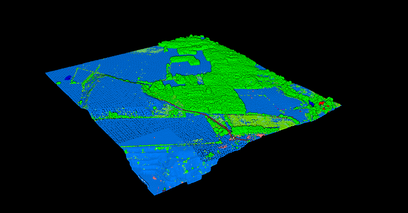
Classified LiDAR point cloud showing ground, vegetation, and buildings — processed by Lidarvisor.
LiDAR and Radar in Autonomous Vehicles
The autonomous vehicle industry uses both LiDAR and radar because each technology has complementary strengths. LiDAR provides the high-resolution 3D mapping needed to identify road features, lane markings, and obstacles with precision. Radar provides reliable object detection in all weather conditions and excels at measuring the speed of other vehicles.
Most advanced autonomous vehicle systems combine both sensors (along with cameras) to create a robust perception system that works in all conditions.
Processing LiDAR Data with Lidarvisor
For surveying, mapping, and 3D modeling applications where LiDAR’s precision is essential, Lidarvisor provides cloud-based processing that transforms raw point cloud data into actionable deliverables.
Frequently Asked Questions
Yes. LiDAR provides centimeter-level accuracy while Radar typically offers meter-level precision. LiDAR’s shorter wavelengths allow it to detect and map much smaller features, making it ideal for surveying, mapping, and 3D modeling applications that require high precision.
LiDAR performance can be degraded by rain, fog, and snow because these conditions scatter the laser light. For mission-critical applications that must operate in all weather conditions, Radar is the better choice. However, for surveying and mapping work, data collection is typically scheduled for clear conditions.
Autonomous vehicles combine both technologies because they have complementary strengths. LiDAR provides high-resolution 3D mapping for precise object detection and lane identification. Radar provides all-weather reliability and excels at measuring the speed of moving objects. Together with cameras, they create a robust perception system.
Radar systems are generally less expensive than LiDAR systems. LiDAR’s precision components (high-accuracy lasers, sensitive detectors, advanced processors) drive higher hardware costs. However, cloud processing services like Lidarvisor make LiDAR data processing affordable — plans start at $89/month with 10 free hectares.
Summary
LiDAR and Radar are complementary technologies rather than direct competitors. LiDAR excels at high-precision, short-range applications like surveying, mapping, and 3D modeling. Radar excels at long-range, all-weather applications like aviation, weather monitoring, and continuous surveillance.
For professionals working with point cloud data from aerial or mobile LiDAR systems, understanding these differences helps you choose the right sensor for your projects and process the resulting data effectively.