Multi-date LiDAR review for terrain, vegetation, and built-feature workflows
What strong change detection software should help you compare
The best workflow helps you review multi-date datasets consistently, isolate the feature classes that matter, and compare outputs that fit the decision you need to make. For terrain teams, that may mean grading, erosion, or stockpile change. For vegetation workflows, it may mean canopy growth, clearing, or corridor encroachment. For built environments, it may mean changes to roofs, roads, structures, or site conditions.
Terrain change
Compare the ground surface without letting canopy or structures hide the answer
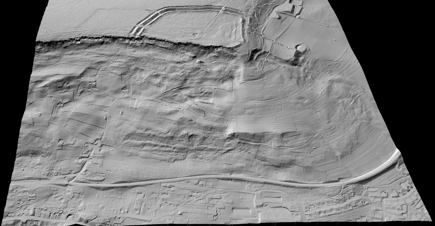
Terrain change gets messy fast when the two datasets were processed differently or when vegetation and above-ground objects are still mixed into the review. For grading, erosion, drainage, corridor, and stockpile work, teams usually need a consistent bare-earth view before they trust the comparison.
That is why DTM, hillshade, and slope outputs matter so much in multi-date workflows. They help teams compare the surface that actually moved instead of getting distracted by everything sitting on top of it.
✦Use the same terrain workflow across both survey dates
✦Compare DTM, hillshade, or slope outputs based on the decision at hand
✦Export map-ready layers for GIS, CAD, QA, or reporting
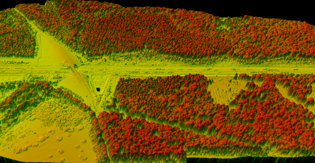
Vegetation change
Track canopy growth, clearing, and corridor encroachment with the right layer
Separate canopy-related change from ground or built-feature noise
Vegetation workflows often break when teams compare raw points without first checking classification quality or choosing the right derived output. Canopy height, vegetation classes, and tree-related layers usually make growth, removal, and regrowth easier to explain than raw point clouds alone.
✦Compare classified vegetation instead of mixed, noisy scenes
✦Use CHM or tree-related outputs for canopy-focused review
✦Support forestry, utility, and corridor inspection workflows
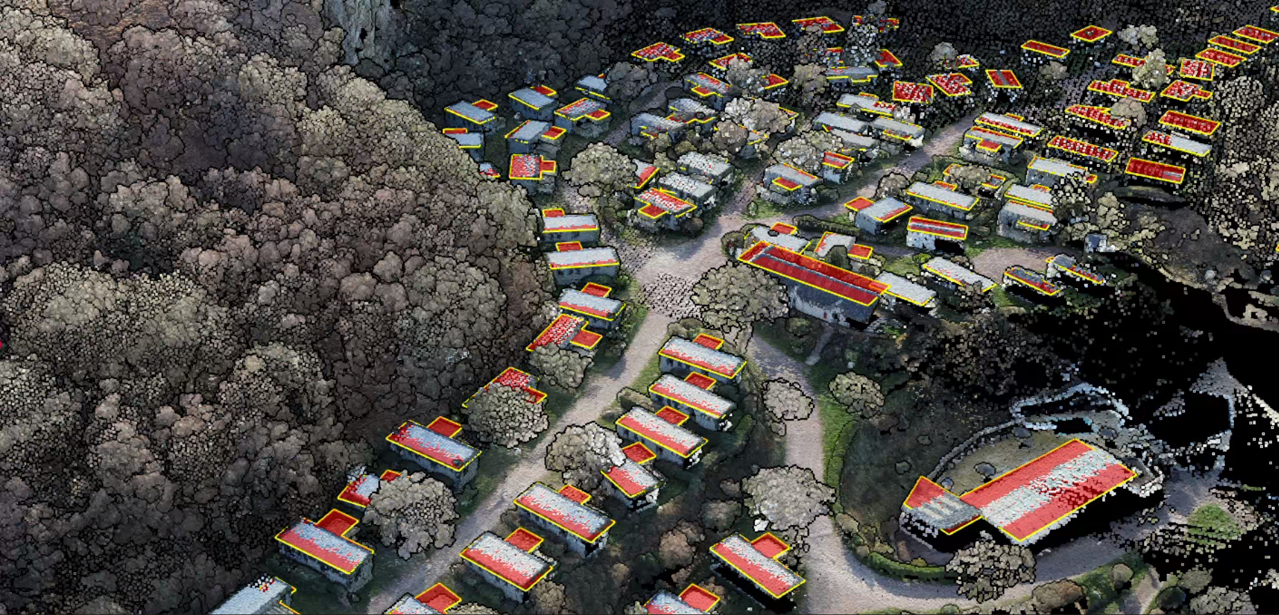
Built-feature change
Review structures, roads, and site updates with outputs that communicate clearly
Built-environment change is easier to explain after the data has been cleaned, surfaced, or extracted into layers that match what reviewers care about. In many projects, map-ready footprints, corridor layers, or classified structure views communicate site change better than a raw cloud alone.
That matters for site progress checks, utility corridor review, and urban or civil workflows where people outside the LiDAR team still need a clear before-and-after story.
✦Compare buildings, roads, pads, and corridor assets with less visual clutter
✦Use extracted layers when stakeholders need simpler review artifacts
✦Move outputs into CAD, GIS, and reporting workflows without extra friction
What to look for before you choose a LiDAR change detection tool
You need a workflow that makes comparison clearer before the final reporting step, not another black-box output that is harder to trust.
Where Lidarvisor fits in a multi-date workflow
Lidarvisor is a strong fit for teams that need to upload LAS or LAZ files, review classified point clouds, generate terrain products, and export outputs that support downstream comparison. It helps prepare the layers your change review depends on without forcing every reviewer into a heavyweight desktop workflow.
Raw side-by-side review only
Comparisons stay noisy when terrain, canopy, and built features are still mixed together. Reviewers spend more time explaining clutter and less time explaining the change that matters.
Prepared layers with Lidarvisor
Review classified points, generate terrain products, inspect vegetation outputs, and export building or corridor layers so the downstream comparison starts from cleaner evidence.
Frequently asked questions
LiDAR change detection software helps teams compare point clouds, surface models, or extracted outputs collected at different times so they can review what changed in a site, corridor, forest, or built environment.
It should. That separation is one of the main reasons classification, terrain modeling, and feature extraction matter before the final comparison step.
No. It helps narrow the review, surface likely changes faster, and create clearer deliverables, but many workflows still need engineering judgment or field confirmation.
That depends on the job. Terrain teams may focus on DTM, hillshade, or contours. Vegetation workflows may focus on canopy-related outputs. Site and urban workflows may need building, corridor, or map-ready vector layers.
When the question is specific and the scene is complex. If vegetation, buildings, or surface clutter can hide the real change, it is often better to compare cleaned or derived outputs that match the decision you need to make.