
Learn LiDAR
Power Line Inspection Software: LiDAR Workflows for Utility Corridor Review
Turn captured corridor LiDAR into review-ready utility outputs
No credit card required • 50 hectares included
If your power line inspection software stops at a point cloud viewer, your team still has the real work ahead. After capture, utility reviewers need terrain context, vegetation screening, wire and pole review, and exportable outputs that support engineering review, field follow-up, and contractor handoff.
Lidarvisor fits that post-capture step. It helps utility teams review, classify, and hand off captured corridor LiDAR in one browser-based workflow, so engineering, GIS, and field teams can work from the same utility-ready outputs.
Why power line inspection software shortlists are shifting in 2026
Utility inspection buyers are seeing more messaging around automated corridor triage, faster review of large captures, and cleaner handoff between LiDAR analysts, engineering teams, GIS staff, and field crews. Recent LP360 and GeoCue positioning keeps reinforcing that shift: the category is moving beyond simple viewing toward workflows that help teams classify wires and vegetation, confirm terrain context, and export usable deliverables without a long desktop bottleneck.
That is where Lidarvisor fits. Instead of trying to be a full asset management platform, it helps utility teams get from captured corridor LiDAR to review-ready outputs such as DTM, DSM, vegetation classes, pole locations, wire lines, and CAD or GIS-friendly exports that support inspection follow-up.
- Review speed: browse large corridor outputs quickly instead of waiting on a heavy desktop-only workflow
- Inspection context: keep wires, poles, vegetation, and terrain in the same QA flow
- Handoff quality: export utility-ready outputs that GIS, CAD, and contractor teams can actually use
What utility teams usually need after corridor capture
Corridor review
for wires, poles, vegetation, and terrain context.
Inspection-ready outputs
such as DTM, DSM, hillshade, slope, and utility layers.
Exportable deliverables
for GIS, CAD, reporting, and follow-up work.
What power line inspection software should help your team answer after capture
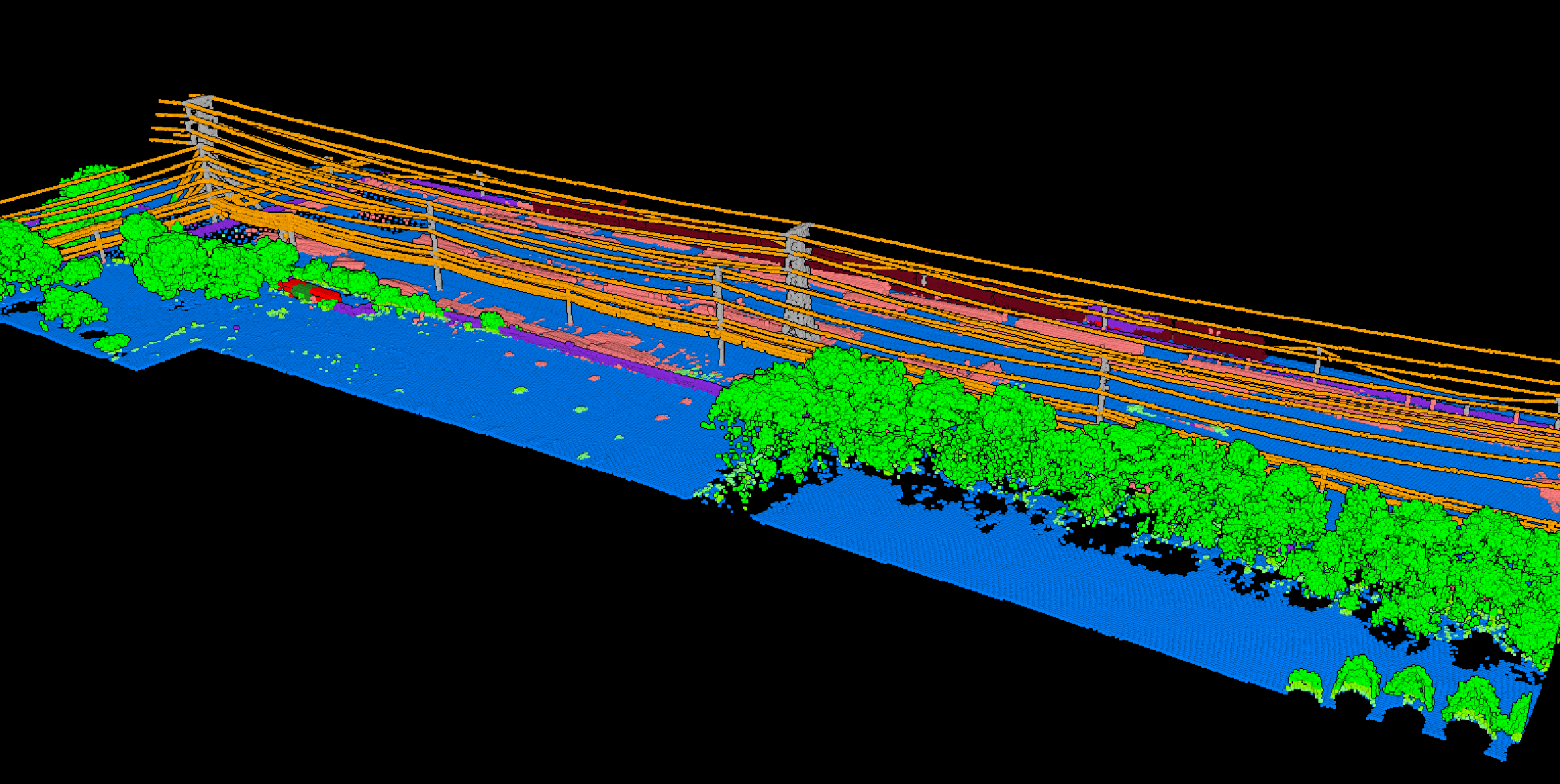
After corridor LiDAR has been captured, utility review usually comes down to a few practical questions: Where are the wires and poles, where does vegetation need closer attention, what does the terrain look like around the line, and what can the next team act on quickly? Good software should help answer those questions in the office handoff stage, not just display raw data.
- Wire and conductor review with corridor visibility and nearby hazard context
- Pole and structure context that supports field follow-up planning
- Vegetation risk screening with clear utility feature separation
- Terrain and access review using slope, ground surface, and surrounding context
A practical post-capture LiDAR workflow for power line inspection
Load captured corridor LiDAR and check coverage
The first step is opening captured corridor LiDAR in a workflow where reviewers can check coverage, structure visibility, and obvious terrain or vegetation issues without passing large files between separate desktop tools.
Classify the corridor before review decisions
Inspection gets faster when the point cloud is already separated into ground, vegetation, buildings, wires, poles, and related corridor classes. That helps reviewers focus on the features that matter instead of scanning a raw cloud.
Generate terrain and corridor context outputs
After classification, utility teams usually need more than a visual check. They need outputs that support follow-up across long linear corridors.
Export clean deliverables to the next team
The workflow only helps if the next team can act on the result. Power line inspection software should make it easy to export usable GIS and CAD deliverables instead of trapping corridor review inside one viewer.
Review wires, poles, and vegetation in the same scene
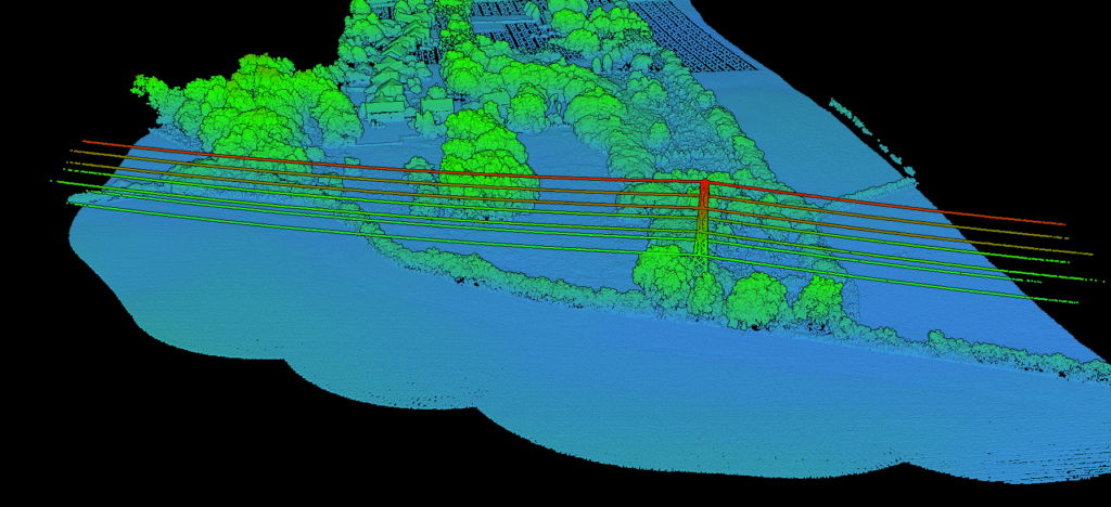
Classified point clouds make corridor review faster because the utility features are already separated before the handoff stage begins.
Inspection gets faster when the point cloud is already separated into ground, vegetation, buildings, wires, poles, and related corridor classes. That helps reviewers focus on the features that matter instead of scanning a raw cloud. Related reading: LiDAR classification guide and point cloud vectorization.
- Separate ground, vegetation, wires, poles, and related corridor classes before review
- Reduce manual scanning across dense or cluttered utility scenes
- Keep engineering, GIS, and field reviewers aligned on the same corridor context
- Move faster into export and downstream follow-up workflows
DELIVERABLES
After classification, utility teams usually need more than a visual check. They need outputs that support follow-up across long linear corridors.
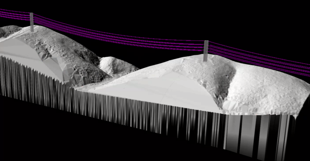
They need DTM and DSM for surface context, hillshade and slope for terrain interpretation, and utility layers that can move straight into GIS, CAD, reporting, and contractor workflows without another cleanup cycle.
- DTM and DSM for bare-earth and surface context across the corridor
- Hillshade and slope for terrain complexity, access, and surrounding context
- Wire and pole layers for mapped utility review and downstream follow-up
- GeoJSON, SHP, DXF, LAS, and LAZ exports for GIS, CAD, and reporting workflows
How to evaluate power line inspection software for LiDAR work
Review speed, context, and export flexibility matter as much as basic visualization when your team is working with long utility corridors
Feature separation
Can your team clearly isolate wires, poles, ground, and vegetation for review?
Terrain context
Can it generate outputs that support line review, access understanding, and corridor interpretation?
Workflow speed
Can reviewers move from raw LiDAR to usable outputs without unnecessary desktop friction?
Export flexibility
Can the results move cleanly into GIS, CAD, or reporting workflows?
Utility fit
Is it built for post-capture corridor review and handoff, not just generic point cloud viewing?
Repeatability
Can the same settings be reused across recurring inspections, so results stay comparable year to year?
Frequently Asked Questions
What is power line inspection software used for?
It is used to review power line corridors, inspect wires, poles, terrain, and vegetation, and export outputs that support utility follow-up work.
Why use LiDAR for power line inspection workflows?
LiDAR gives utility teams terrain context and feature separation that support corridor review, vegetation screening, and export-ready mapping workflows.
Is this the same as flight-planning or capture software?
No. This workflow starts after capture. The goal is to review the corridor, generate usable outputs, and hand off results to GIS, CAD, reporting, or field teams.
What outputs matter most for utility corridor review?
Common outputs include DTM, DSM, hillshade, slope, classified point clouds, utility layers, and GIS or CAD exports for downstream handoff.
Is power line inspection software the same as a point cloud viewer?
No. A viewer helps inspect the cloud, but inspection software should also support classification, terrain generation, corridor interpretation, and export-ready deliverables.
Ready to Review a Power Line Corridor?
Captured corridor LiDAR becomes more useful when your team can review it, classify it, and hand off clean outputs in one browser-based workflow. That helps engineering, GIS, and field teams move from corridor capture to follow-up faster.
Create free account50 hectares free. No credit card. No software to install.