Light Detection and Ranging Technology Explained
What Does LiDAR Stand For?
LiDAR (Light Detection and Ranging) is a remote sensing technology that uses laser pulses to measure distances and create precise 3D representations of objects and environments.
The technology was first developed in the 1960s, shortly after the invention of the laser. Early LiDAR systems were used to measure distances to the moon during the Apollo missions. Today, LiDAR has become smaller, faster, and more affordable—making it accessible for everything from smartphone depth cameras to city-scale mapping projects.
How Does LiDAR Work?
LiDAR works by emitting rapid laser pulses toward a target and measuring how long it takes for the light to return. Here’s the basic process:
01
Pulse Emission
A LiDAR sensor emits a laser pulse (typically near-infrared light)
02
Surface Contact
The pulse travels at the speed of light until it hits a surface
03
Return Detection
The light reflects back to the sensor
04
Distance Calc
Distance = (Speed of Light × Time) / 2
05
Point Recording
Each measurement becomes a point with X, Y, Z coordinates
Modern LiDAR sensors fire hundreds of thousands to millions of laser pulses per second. The result is a dense collection of 3D points called a point cloud.
What is a Point Cloud?
A point cloud is the raw output of a LiDAR scan: a dataset containing millions (or billions) of individual 3D points. Each point represents a location where a laser pulse hit a surface.
Point clouds can be:
- Visualized in 3D: Navigate through a digital twin of the scanned environment
- Classified: Label points as ground, vegetation, buildings, water, etc.
- Processed into products: Digital Terrain Models (DTM), Digital Surface Models (DSM), contour lines, building footprints, and more
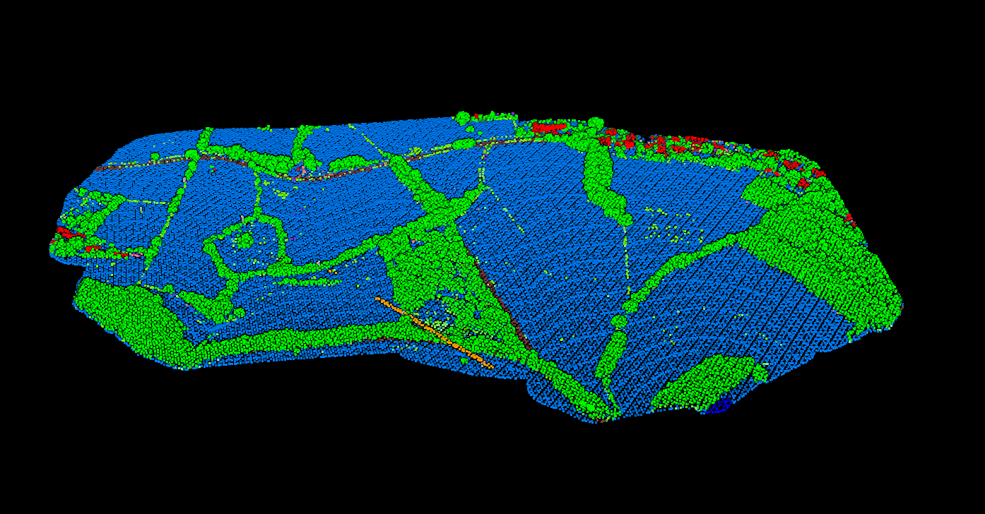
A classified point cloud showing ground, vegetation, and buildings in distinct colors
Types of LiDAR Systems
LiDAR systems are categorized by how they’re deployed:
LiDAR Applications: Where Is LiDAR Used?
LiDAR technology has transformed dozens of industries
📐
Surveying & Mapping
Topographic maps, terrain measurement, contour lines, and DTMs
🚗
Autonomous Vehicles
360-degree obstacle detection for self-driving cars
🌲
Forestry
Forest inventory, biomass estimation, and fire risk assessment
⚡
Utilities
Power line inspection and vegetation management
🏛️
Archaeology
Reveal hidden structures beneath vegetation
🌊
Flood Modeling
Terrain data for water flow prediction
🏗️
Construction
Site planning, progress monitoring, earthwork calculations
🏙️
Urban Planning
City modeling and infrastructure planning
LiDAR vs Photogrammetry vs Radar
| Feature | LiDAR | Photogrammetry | Radar |
|---|---|---|---|
| What it uses | Laser light | Photographs/images | Radio waves |
| Works in darkness | ✓ Yes | ✗ No | ✓ Yes |
| Penetrates vegetation | ✓ Yes (multi-return) | ✗ No | Partially (SAR) |
| Typical accuracy | 1-5 cm vertical | 5-10 cm | 10-50 cm |
| Captures color | ✗ No (intensity only) | ✓ Yes (RGB) | ✗ No |
| Cost | Higher hardware cost | Lower hardware cost | Varies widely |
Many projects combine LiDAR with photogrammetry: LiDAR provides accurate geometry while photos add color and texture.
Benefits & Limitations
✓ Key Benefits
High accuracy: Survey-grade vertical accuracy of 1-5 cm
Speed: Capture millions of points per second
Vegetation penetration: Multi-return LiDAR captures both canopy and ground
Works day or night: Active sensor doesn’t depend on sunlight
Dense data: Point densities of 10-100+ points per square meter
✗ Limitations
Cannot penetrate water: Requires specialized bathymetric LiDAR
Weather sensitive: Rain, fog, and snow can scatter laser pulses
No color data: Only captures intensity, not RGB color
Processing required: Raw point clouds need classification and filtering
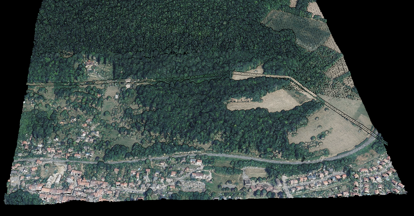
USGS LidarExplorer — one of many free LiDAR data sources
Free LiDAR Data Sources
Many countries provide free LiDAR data for public use. Major sources include:
- USGS 3DEP: Nationwide US LiDAR coverage
- UK Environment Agency: England and Wales LiDAR
- OpenTopography: Global LiDAR data archive
- AHN (Netherlands): Complete country coverage
Processing LiDAR Data
Raw LiDAR data needs processing to become useful. Key steps include:
01
Classification
Labeling points as ground, vegetation, buildings, etc.
02
Filtering
Removing noise and outliers from the data
03
Product Gen
Creating DTMs, DSMs, contours, and deliverables
04
Export
Converting to TIFF, DXF, Shapefile, etc.
Traditional LiDAR processing requires specialized desktop software, manual parameter tuning, and hours of work. Lidarvisor automates the entire workflow. Upload your point cloud and get classified data, DTMs, DSMs, and contours in minutes — no software to install, no learning curve.
Frequently Asked Questions
LiDAR uses laser light (optical wavelengths), while radar uses radio waves. LiDAR achieves higher spatial resolution and accuracy, but radar can see through clouds and some materials that block light.
LiDAR is one type of 3D scanning technology. Other methods include structured light scanning, time-of-flight cameras, and photogrammetry. LiDAR is distinguished by its use of laser pulses and ability to capture data over long ranges.
Modern LiDAR systems achieve vertical accuracy of 1-5 cm under typical conditions. Factors affecting accuracy include sensor quality, flight altitude, ground control, and terrain characteristics.
No. LiDAR laser pulses cannot penetrate solid structures like buildings, walls, or roofs. LiDAR maps external surfaces only.
Yes. Multi-return LiDAR can penetrate tree canopy. Some pulses hit leaves and branches (first returns), while others reach the ground (last returns). This makes LiDAR valuable for mapping terrain beneath forests.