Per-Hectare and Per-Acre Pricing Comparison (2026)
The Three Cost Components of a LiDAR Project
Every LiDAR project has three distinct cost phases. Understanding where your money goes helps you optimize spending and identify where automation delivers the biggest savings.
Processing Software Comparison
| Approach | Annual Cost | Per-Ha Cost |
|---|---|---|
| Desktop Software | $5,000-$20,000+ | $0 after license |
| Open-source | $0 | $0 |
| Manual (outsourced) | Varies | $5-$20/ha |
| Lidarvisor | $0-$2,004 | $0.35-$0.99/ha |
Save 70-90% on Processing Costs With Cloud Automation
Cost Per Hectare Breakdown
The cost per hectare depends on what deliverables you need. Here is a realistic breakdown based on industry data and common pricing models. Basic Classification Only Separating ground from non-ground points enables DTM generation.
- Manual outsourcing: $3-$10 per hectare
- Desktop software: 1-3 hours per 100 ha
- Lidarvisor: $0.35-$0.99/ha, fully automated
Full Classification (12 Classes) Ground, vegetation, buildings, water, wires, towers, poles, and more.
- Manual outsourcing: $8-$25+ per hectare
- Desktop software: 5-20+ hours per 100 ha
- Lidarvisor: Same rate, all 12 classes included
Traditional vs. Automated: 500 Ha Real-World Comparison
| Cost Category | Traditional Desktop | Outsourced | Lidarvisor |
|---|---|---|---|
| Software license | $5,000-$15,000/yr | Included | $167/mo |
| Processing labor | $1,600-$4,800 | $7,500-$25,000 | ~30 min upload |
| Per-hectare cost | In license | $15-$50/ha | $0.33/ha ($165) |
| QC and review | $320-$960 | Included | Automated |
| Total for 500 ha | $6,920-$20,760 | $7,500-$25,000 | $332 |
What Affects LiDAR Processing Cost?
01
Point Density
Higher point density (points per square meter) means larger file sizes. Drone surveys produce 50-300+ points/m², while airborne ranges from 2-20 points/m².
02
Terrain Complexity
Flat agricultural land is simpler than dense urban areas or forested terrain. Automated tools handle complexity consistently.
03
Required Deliverables
Basic classification costs less than a full package with DTM, DSM, contours, and vector exports. With automated platforms, most deliverables generate simultaneously at no extra cost.
04
Accuracy Requirements
Survey-grade accuracy (±5 cm) requires cleaner input data and careful QC. Engineering projects demand higher accuracy than reconnaissance mapping.
How to Reduce Your LiDAR Processing Costs
Lidarvisor Pricing
Transparent, Per-Hectare Processing
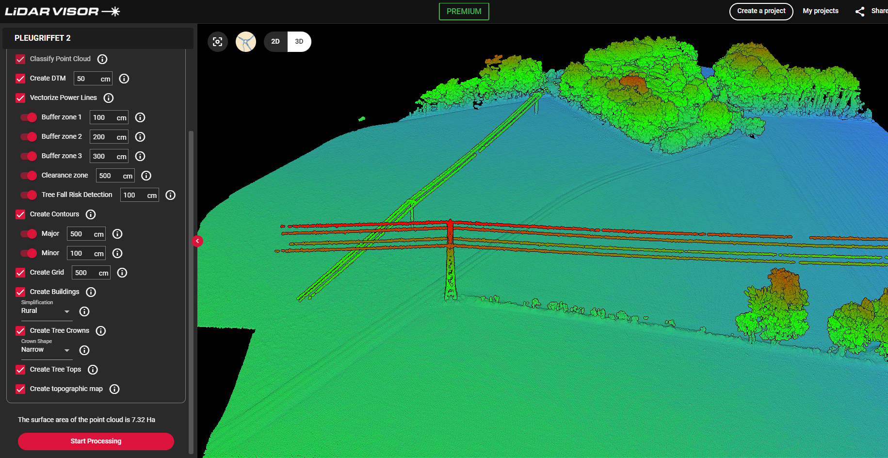
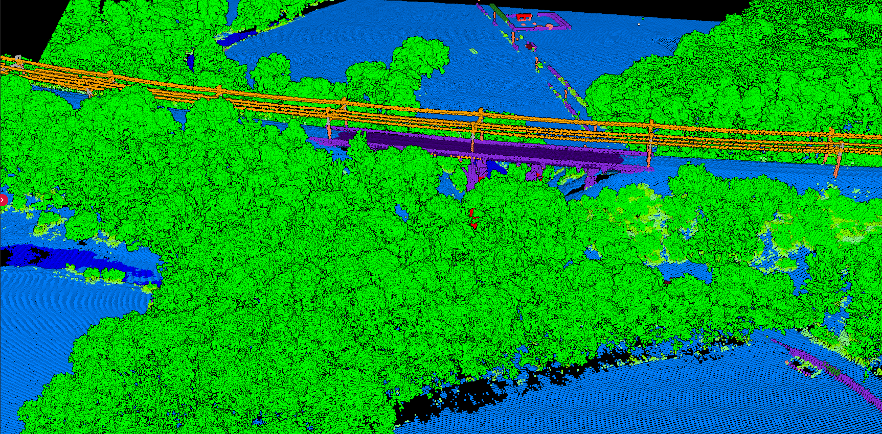
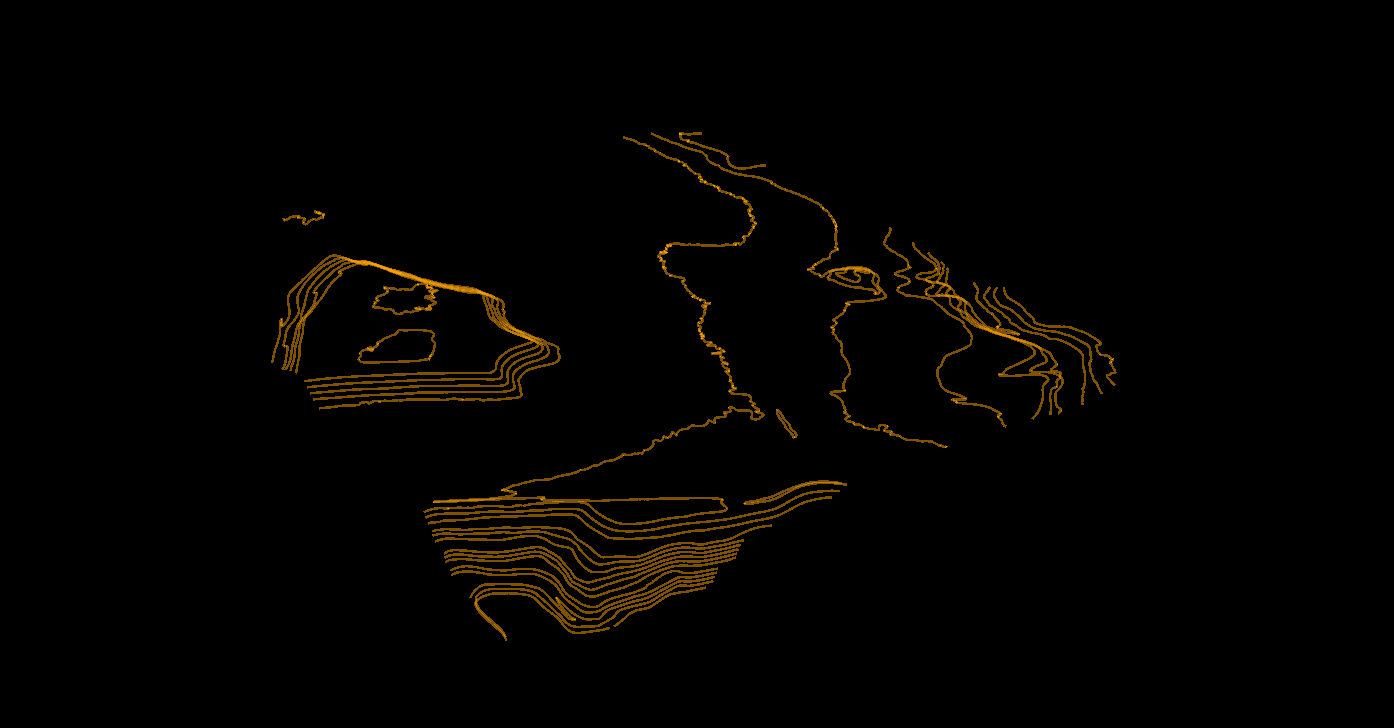
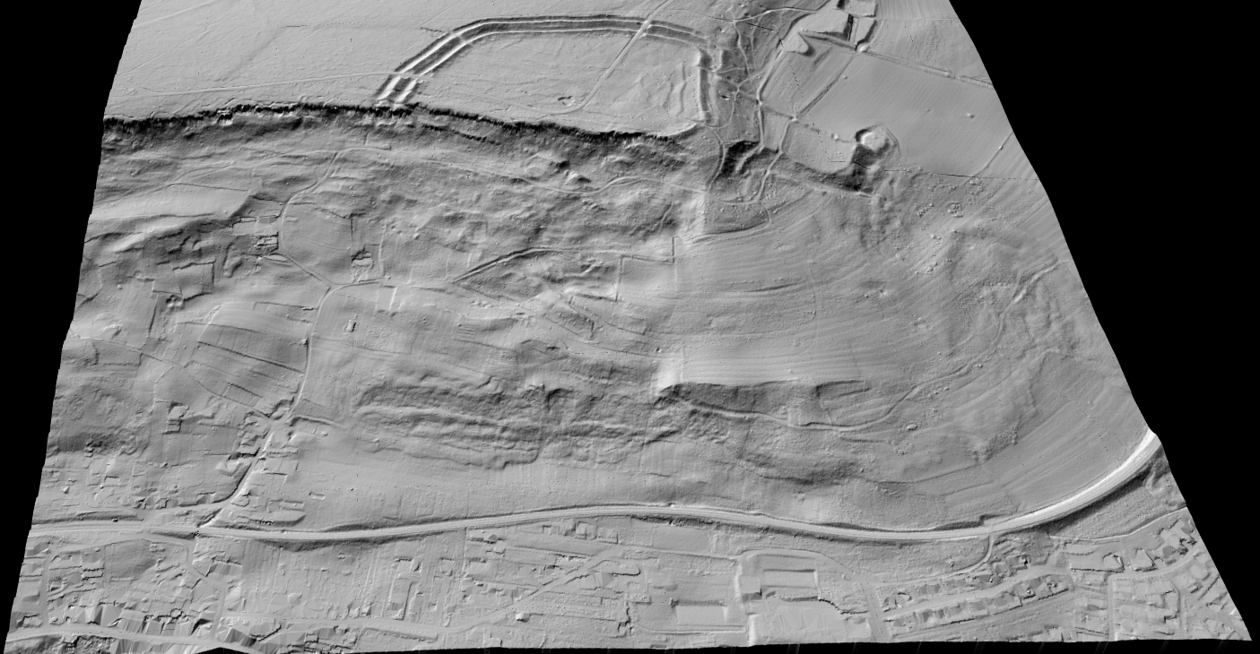
Every plan includes the full processing suite: automated classification (12 classes), DTM, DSM, hillshade, slope map, contour lines, building footprints, tree crown extraction, and vector exports in DXF, SHP, and GeoJSON formats. Unused credits roll over to the next month.
| Plan | Monthly | Hectares | Rate |
|---|---|---|---|
| Free | $0 | 10 ha total | $0 |
| Premium | $59 | 100 ha/mo | $0.59/ha |
| Advanced | $167 | 500 ha/mo | $0.33/ha |
| Credit Packs | One-time | 100-10,000 | $0.35-$0.99 |
Frequently Asked Questions
LiDAR processing costs range from $0.14 to $8+ per acre depending on the method. Automated cloud platforms like Lidarvisor cost $0.14-$0.40 per acre ($0.35-$0.99 per hectare). Traditional outsourcing runs $2-$10+ per acre. One hectare equals approximately 2.47 acres.
Yes. Open-source tools like CloudCompare, PDAL, and LAStools (limited free version) can process LiDAR data at no cost. However, they require significant technical expertise. Lidarvisor also offers a free tier with 10 hectares of fully automated processing, including classification, terrain models, and vector outputs.
For small projects, Lidarvisor’s free tier (10 ha) is the cheapest option with professional-quality results. For larger projects, Lidarvisor’s credit packs at $0.35/ha offer the lowest per-hectare cost with fully automated processing. Open-source tools are free but require significant labor time.
Processing time depends on the method and project size. Manual classification of 100 hectares takes 5-20+ hours of skilled technician time. Automated cloud processing with Lidarvisor is significantly faster, with processing time depending on point density and dataset size.