A Complete Guide to Shoreline Change Detection
The Coastal Erosion Challenge
Coastal erosion is a growing global challenge, threatening infrastructure, ecosystems, and communities worldwide. Traditional survey methods struggle to capture the rapid, complex changes occurring along shorelines. LiDAR technology offers a powerful solution, enabling precise, repeatable measurements of coastal terrain that reveal even subtle changes over time.
This guide explains how to use LiDAR for coastal erosion monitoring, from data acquisition to analysis, and how Lidarvisor simplifies the process of generating the Digital Terrain Models (DTMs) that form the foundation of shoreline change detection.
Why LiDAR for Coastal Monitoring?
Coastal environments present unique challenges for surveyors: soft sand surfaces, breaking waves, dense dune vegetation, and rapidly changing conditions. LiDAR addresses these challenges through several key advantages:
Key Applications in Coastal Erosion Studies
Beach Erosion and Sediment Transport
Sandy beaches are dynamic environments where sediment constantly moves alongshore and cross-shore. LiDAR surveys capture the beach profile from the dune crest to the waterline, enabling:
- Volumetric change analysis between surveys
- Identification of erosion hotspots
- Sediment budget calculations
- Beach nourishment project monitoring
Cliff Retreat Monitoring
Coastal cliffs erode through a combination of wave undercutting, weathering, and mass movement. LiDAR provides:
- Precise cliff-top position tracking over time
- Identification of potential landslide areas
- Volume calculations of material lost
- Risk assessment for nearby infrastructure
Dune Migration and Stabilization
Coastal dunes serve as natural barriers against storm surge and erosion. LiDAR enables monitoring of:
- Dune crest elevation changes
- Blowout formation and expansion
- Vegetation recovery after storms
- Effectiveness of stabilization projects
Saltwater Intrusion Risk Assessment
Low-lying coastal areas are vulnerable to saltwater intrusion into freshwater aquifers. Accurate DTMs help identify areas where erosion may compromise the barrier between the sea and groundwater resources.
The LiDAR Coastal Monitoring Workflow
1. Data Acquisition
Coastal LiDAR surveys are typically conducted using:
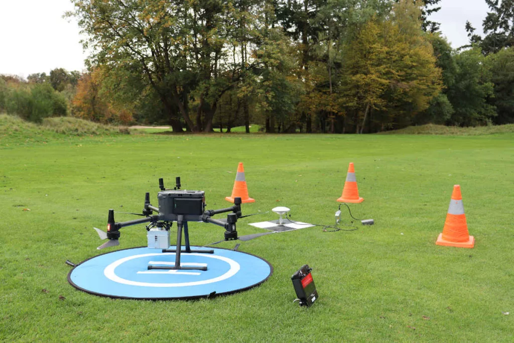
Drone-mounted LiDAR: Ideal for detailed surveys of specific beach sections or cliff faces. Flight altitudes of 30-50m provide high point densities.
Airborne LiDAR: Used for regional shoreline mapping, covering tens or hundreds of kilometers in a single mission.
Timing matters: surveys should be conducted at low tide to maximize beach coverage, and ideally during calm conditions to minimize wave interference.
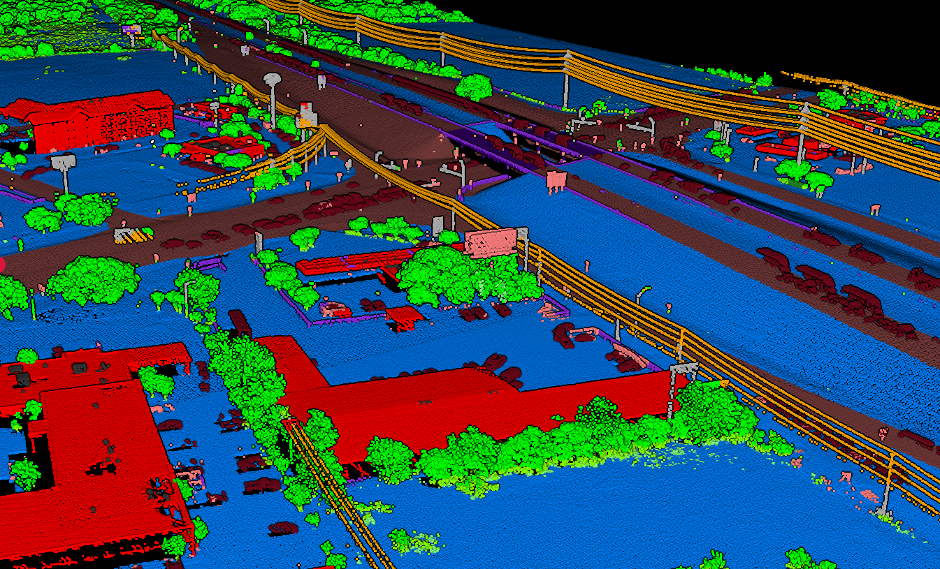
2. Point Cloud Classification
Raw LiDAR data includes returns from the ground, vegetation, water surface, and noise. Accurate coastal erosion analysis requires proper classification to separate:
- Ground points: The actual terrain surface
- Vegetation: Dune grass, shrubs, and coastal plants
- Water: Waves, standing water, and tidal pools
- Noise: Birds, atmospheric interference, and sensor artifacts
With Lidarvisor, this classification happens automatically when you upload your LAS file. The platform uses advanced algorithms to identify ground, vegetation, water, and other features without manual parameter tuning.
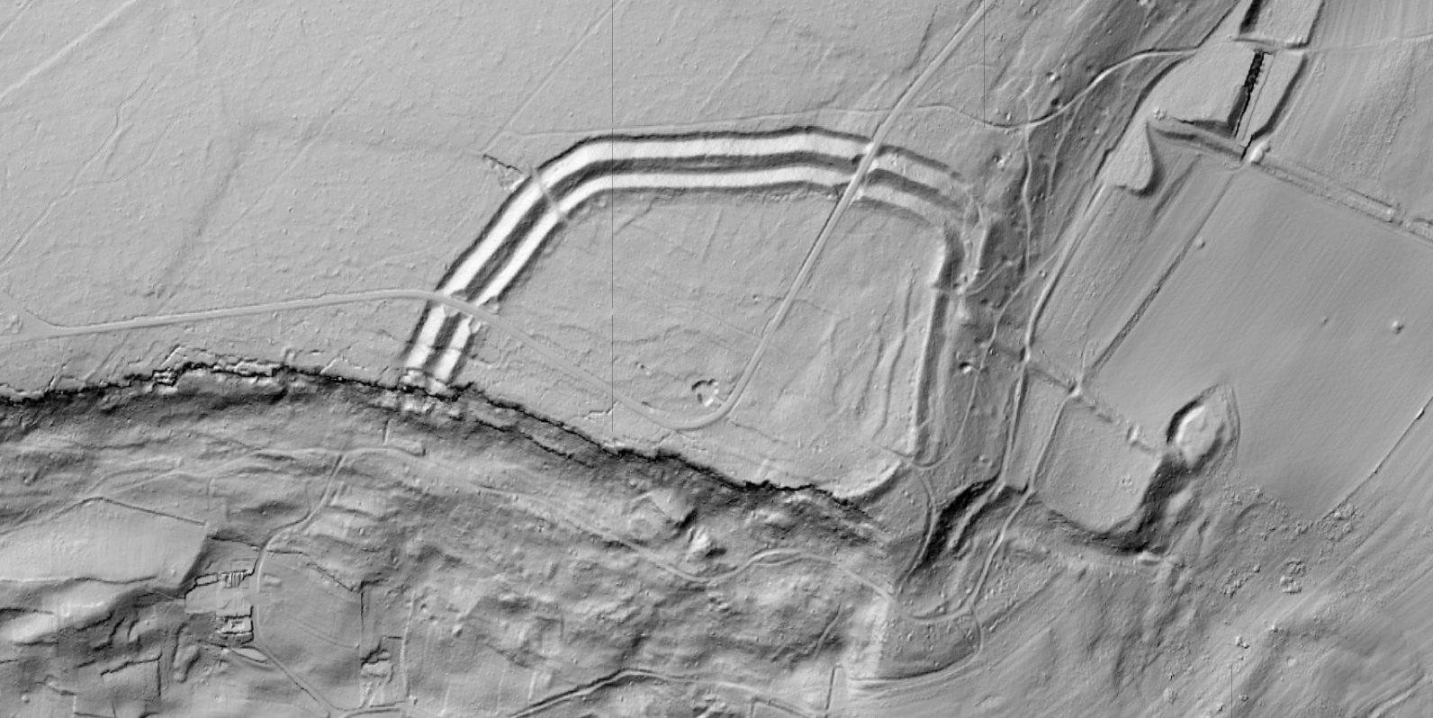
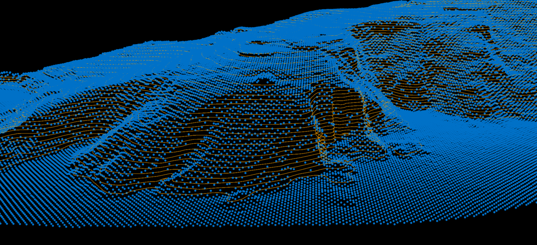
3. DTM Generation
The Digital Terrain Model is the foundation of coastal erosion analysis. A DTM represents the bare-earth surface, with vegetation and other features removed. For coastal monitoring:
- DTMs reveal the true beach profile beneath dune vegetation
- Hillshade visualizations highlight subtle terrain features
- Slope maps identify steep, erosion-prone areas
Lidarvisor automatically generates DTMs and hillshades from your classified point cloud, exportable as georeferenced TIFF files ready for GIS analysis.
4. Change Detection
The real value of LiDAR coastal monitoring comes from comparing surveys over time. By differencing DTMs from different dates, you can:
- Map areas of erosion (negative change) and accretion (positive change)
- Calculate volumetric changes in cubic meters
- Identify seasonal patterns versus long-term trends
- Assess storm damage immediately after events
Processing Coastal LiDAR with Lidarvisor
Lidarvisor streamlines the coastal erosion monitoring workflow by automating the most time-consuming steps:
The cloud-based platform means you can process coastal data from anywhere, without investing in expensive desktop software or high-powered workstations.
Best Practices for Coastal LiDAR Surveys
- Establish consistent survey timing — Conduct surveys at similar tidal stages for comparable results.
- Use ground control points — Place GCPs on stable features away from the active beach for accurate georeferencing.
- Plan for repeatability — Document flight parameters so future surveys can replicate the same coverage.
- Consider seasonal timing — Pre- and post-storm surveys capture event-driven changes; annual surveys track long-term trends.
- Archive all data — Keep raw point clouds, not just derived products, for future reprocessing as algorithms improve.
Create a FREE account now and start processing your point cloud
Get 2 GB of storage space and classify up to 10 hectares for free.