AI-Powered Classification • Manual Editing • Terrain Models • Vector Extraction
AI CLASSIFICATION
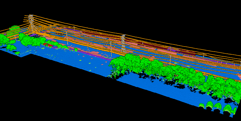
Point Cloud Classification
12+ ASPRS classes, one click, no tuning
Our AI automatically segments your point cloud into standard ASPRS LAS classes. Works on any terrain, flat or steep, urban or rural, without parameter adjustment.
✦ Ground, vegetation (low/med/high), buildings
✦ Wires, towers, poles, vehicles
✦ Water, bridges, fences, walls
✦ Manual editing tools: brush selection, class permutation, and filtering
All Classification Classes
Ground
Low Vegetation
Medium Vegetation
High Vegetation
Building
Water
Wire
Tower
Pole
Vehicle
Bridge Deck
Fence / Wall
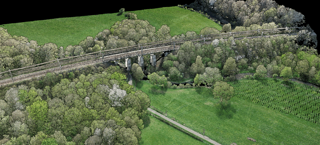
Terrain Models & Rasters
Generate terrain models and surface analysis maps. Each raster includes both elevation data and imagery, exported as GeoTIFF with full georeferencing.
DTM
Digital Terrain Model
Bare earth elevation grid derived from ground points. Essential for hydrological analysis, construction planning, and volume calculations.
DSM
Digital Surface Model
Top surface including buildings, trees, and structures. Perfect for urban planning, line-of-sight analysis, and solar studies.
Hillshade
Shaded Relief
Illuminated terrain visualization for intuitive understanding of topography. Ideal for presentations and overlay analysis.
Slope Map
Terrain Gradient
Gradient analysis for drainage patterns, slope stability assessment, and accessibility planning.
VECTOR EXTRACTION
CAD-Ready Vector Outputs
Extract features directly from classified point clouds
Generate survey-grade vector data for CAD and GIS workflows. Export to DXF, SHP, or GeoJSON with organized layers ready for immediate use.
✦ Contour lines with customizable intervals
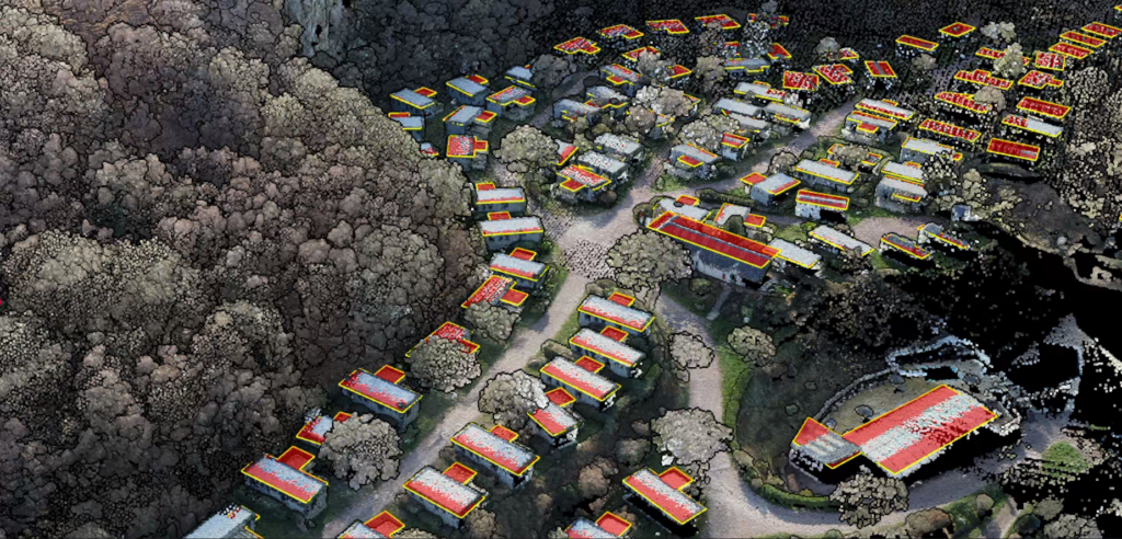
✦ Building footprints with orthogonalization
✦ Tree crowns & tree top detection
✦ Power line vectorization
✦ Tower vectorization
✦ Road vectorization
✦ Gridded DTM for CAD import
Professional Reports
Generate ready-to-deliver reports for surveying, forestry, and utility vegetation management.
📐
DXF Topographic Map
Complete CAD-ready topographic map with organized layers: contours, buildings, vegetation, infrastructure.
Format: DXF
🌲
Digital Forest Inventory
Individual tree detection with metrics: height, crown diameter, stem position, canopy area.
Format: PDF + CSV
🌿
Carbon Estimation
Per-tree carbon stock, CO₂eq, and biomass using 102 species models across 8 regions. IPCC-referenced methodology.
Format: PDF + CSV
⚡
Utility Vegetation Risk
Vegetation encroachment analysis for power line corridors with risk classification and clearance measurements.
Format: PDF + Vectors
VISUALIZATION
3D Point Cloud Viewer
Browser-based, no plugins required
Explore your point clouds in full 3D. Filter by class, switch color modes, and share interactive views with clients via link, no software installation needed.
✦ Elevation, classification, intensity, RGB color modes
✦ Filter by classification class
✦ Overlay rasters (DTM, hillshade) on vectors
✦ Shareable view links for client collaboration
Export Formats
☁️
Point Clouds
LAS — Standard format
LAZ — Compressed
🗺️
Rasters
GeoTIFF — Full georeferencing
Elevation + imagery included
📐
Vectors
DXF — CAD software
SHP — GIS software
GeoJSON — Web mapping
Built for Your Workflow
📐
Surveyors
Contours, TINs, and topographic deliverables in minutes
🌲
Forestry
Tree inventories with carbon estimation, CSV export, and PDF reports
🏗️
Urban Planners
Building footprints and terrain models for city planning
⚡
Utility Companies
Powerline vectors and vegetation clearance analysis
Platform Capabilities
01
Upload
LAS and LAZ files up to 50 GB. Any coordinate system supported.
02
Process
AI classifies automatically. No parameter tuning needed.
03
Generate
Create rasters, vectors, and reports with one click.
04
Download
Export in industry-standard formats. Ready for your workflow.
Documentation & Resources
Learn how to make the most of Lidarvisor with our documentation and API reference.