Shoreline Mapping and Erosion Analysis
LiDAR for Coastal Monitoring
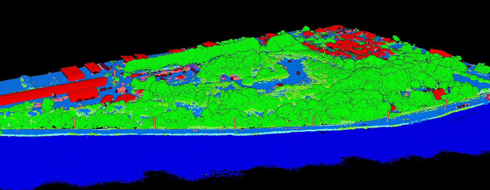
Coastal environments are among the most dynamic landscapes on Earth. LiDAR surveys capture high-resolution terrain data that enables precise shoreline mapping, erosion monitoring, and hazard assessment.
Why LiDAR for Coastal Work?
Coastlines change constantly through erosion, accretion, and storm events. Traditional surveying methods capture only snapshots. LiDAR enables rapid, comprehensive surveys that reveal subtle changes invisible to conventional methods.
Key Deliverables for Coastal Analysis
Digital Terrain Model (DTM)
The foundation for all coastal analysis:
• Beach elevations at centimeter precision
• Dune crest positions and heights
• Tidal flat topography
• Storm surge inundation modeling
Contour Lines
DXF format contours for engineering and planning:
• 10-25cm intervals for detailed beach profiles
• Shoreline position at specific elevations
• Direct import to CAD and GIS software
Slope Analysis
Critical for understanding coastal dynamics:
• Beach face gradients
• Dune stability assessment
• Cliff erosion risk areas
• Drainage patterns
Hillshade Visualization
Reveals subtle terrain features:
• Rip current channels
• Old storm scarps
• Buried structures
• Tidal channels
Coastal Applications
- Erosion Monitoring — compare surveys over time to quantify sediment loss
- Beach Nourishment — calculate volumes before and after restoration projects
- Flood Hazard Mapping — model storm surge inundation scenarios
- Habitat Mapping — classify dune vegetation and marsh areas
- Infrastructure Planning — design seawalls and coastal structures
Traditional Coastal Surveys
- ❌ Time-consuming beach profiles (days per km)
- ❌ Limited to accessible areas
- ❌ Sparse data between profile lines
- ❌ Weather and tide dependent
LiDAR Coastal Surveys
- ✅ Kilometers of coastline in hours
- ✅ Captures entire beach surface
- ✅ Millions of measurements
- ✅ Rapid deployment for post-storm assessment
Create a FREE account now and start processing your point cloud
Get 2 GB of storage space and classify up to 50 hectares for free.