
Learn LiDAR
Free LiDAR Point Cloud Manual Classification Tools for LAS and LAZ QA
Brush, Paint, and QA Workflows
No credit card required • 50 hectares included
Need a free point cloud classification brush or paint tool for manual LiDAR QA? This guide covers the free desktop workflows teams use to hand-label LAS and LAZ files, plus when it is faster to switch from brush-based editing to automated classification.
What Is Manual Point Cloud Classification?
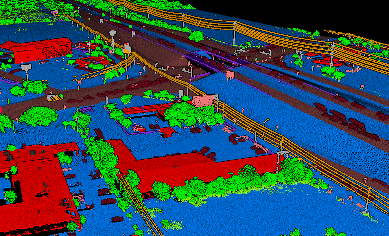
Manual point cloud classification involves selecting and labeling groups of points by hand using classification tools. While time-intensive, manual classification provides precise control over how points are categorized, making it essential for:
- Quality control — Verifying automated results
- Training data creation — Building labeled datasets for ML
- Edge cases — Handling what algorithms miss
Common Classification Classes (ASPRS LAS Standard)
Ground (Class 2)
Bare earth surface
Vegetation (3-5)
Low, medium, high
Building (Class 6)
Structures, roofs
Wire (Class 14)
Power lines, cables
Best Free Tools for Manual Classification
OPEN SOURCE
1. CloudCompare
Best for detailed manual editing, visual inspection, and learning
The most popular free point cloud viewer with manual classification capabilities. Supports LAS, LAZ, E57, and many other formats.
- Powerful selection tools & handles large datasets
- Extensive format support (LAS, LAZ, E57)
- Free for personal and commercial use (GPL)
// CloudCompare Workflow
1. Load point cloud (File → Open)
2. Use segmentation tool (scissors icon)
3. Right-click → Edit → Scalar Fields
4. Set SF Value to ASPRS class code
5. Export as LAS
// LAStools lasview Workflow
$ lasview -i yourfile.laz
Press ‘e’ to enter edit mode
Drag to select points
Press 2-9 for classification
Ctrl+S to save
FREE FOR NON-COMMERCIAL
2. LAStools lasview
Best for quick visual inspection and spot classification
A lightweight LAS/LAZ viewer with basic classification editing. Faster than CloudCompare for simple tasks.
- Fast, lightweight, keyboard-driven
- Quick spot-fixes and verification
Commercial use requires license
3. Lidarvisor
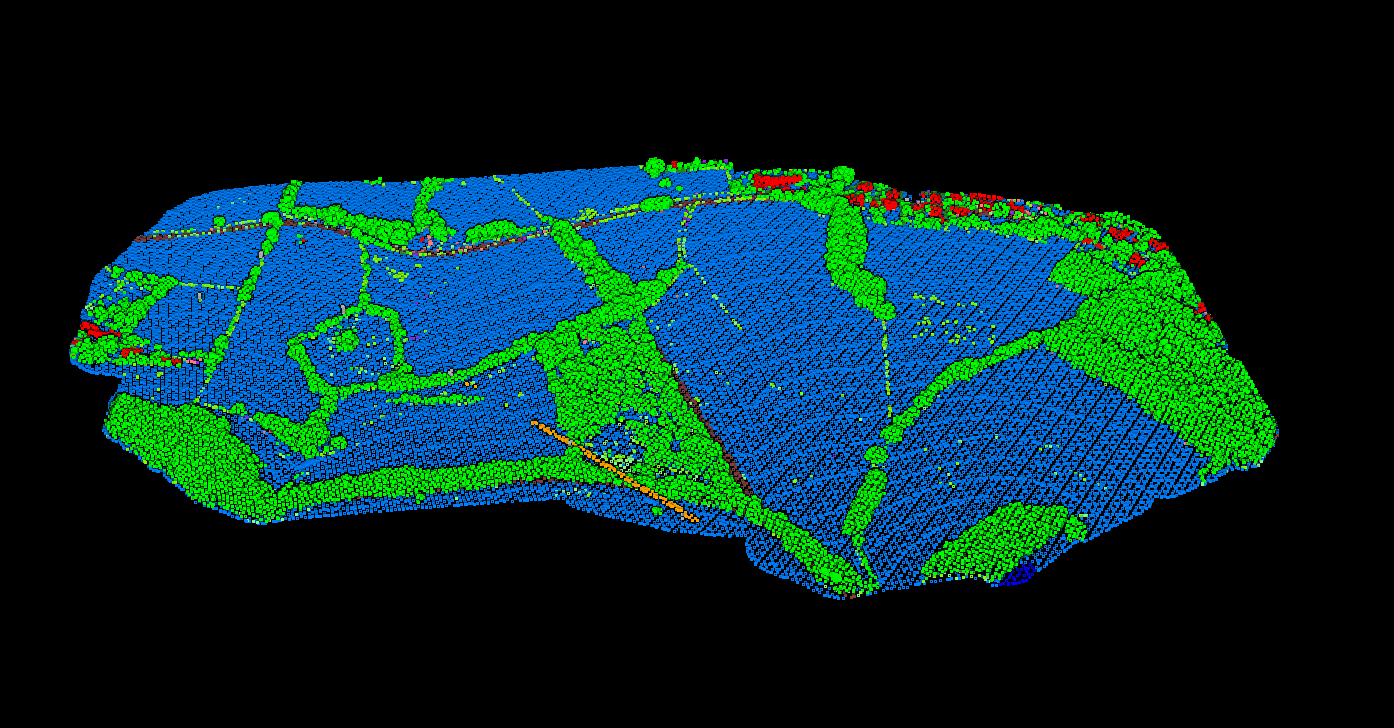
Let AI do 90% of the work, manually verify the rest
Why spend hours manually classifying every point when AI can handle most of it? Upload your LAS/LAZ, get automatic classification into 12+ ASPRS classes in minutes, then manually verify or adjust in CloudCompare.
- 50 hectares free — no credit card
- Minutes instead of hours
- No software to install
Lidarvisor has a brush too, in the browser and on the free plan. Start with automatic LiDAR classification of the whole cloud, then correct only the points it got wrong with the brush, box, height, color or intensity tools.
Manual Classification Techniques
Selection Methods
Polygon Selection: Draw boundaries around point groups. Best for large, distinct features like buildings.
Brush Selection: Paint-style selection for organic shapes. Works well for vegetation boundaries.
Height Filtering: Select points within elevation ranges. Useful for isolating ground points.
Cross-Section View: Slice through the cloud to see vertical profiles. Essential for ground vs vegetation.
Best Practices
01 Start with ground classification — it defines the foundation
02 Work in sections — divide large datasets into manageable tiles
03 Use multiple views — top-down, profile, and 3D perspective
04 Color by classification — visualize progress and catch errors
05 Save frequently — don’t lose hours of work
When to Use Manual vs. Automated
Manual Classification
Small datasets (under 10M points)
Training data creation for ML
Quality control verification
Complex edge cases
Budget constraints (time > money)
Automated (AI) Classification
Large datasets (10M+ points)
Production workflows
Repetitive classification tasks
Time-critical projects
Consistent, reproducible results
Best approach: Use AI for the initial 90%, then manually refine problem areas. This hybrid workflow combines automation speed with manual precision.
Related Resources
LiDAR Classification Guide
Complete overview of classification methods
ASPRS Classification Codes
Complete 0-255 code reference
Lidarvisor vs CloudCompare
Feature comparison guide
Frequently Asked Questions
Is CloudCompare really free for commercial use?
Yes. CloudCompare is released under the GPL license and is free for both personal and commercial use. There are no licensing fees or restrictions.
How long does manual classification take?
Expect 2-8 hours per million points for thorough manual classification, depending on scene complexity and required accuracy. Automated tools can reduce this to minutes for the initial pass, with manual work limited to quality control.
Can I use manual and automated classification together?
Yes, and this is the recommended approach for most projects. Use automated classification for the initial pass (Lidarvisor processes 50 hectares free), then manually refine problem areas in CloudCompare. This hybrid approach combines the speed of automation with the precision of manual work.
What file formats support classification data?
LAS and LAZ formats store classification codes natively. When exporting from any tool, ensure you save as LAS/LAZ to preserve your classification work.
Start Classifying Smarter, Not Harder
Upload your point cloud to Lidarvisor, let AI handle the tedious work, then focus your manual effort on the edge cases that actually need human judgment.
Create free account50 hectares free. No credit card. No software to install.