Automate ground, vegetation, buildings, and corridor classes in one cleaner workflow
Why Automated Ground Filtering Wins
Manual Filtering
Manual classification often means repeated parameter changes, slow QA passes, and inconsistent separation between bare earth, low vegetation, buildings, and corridor assets whenever site conditions change.
Automated Classification
Lidarvisor helps teams upload LAS or LAZ files, separate key classes faster, and move into terrain modeling, forestry review, or corridor inspection with cleaner outputs and fewer re-runs.
What Automated Classification Can Handle
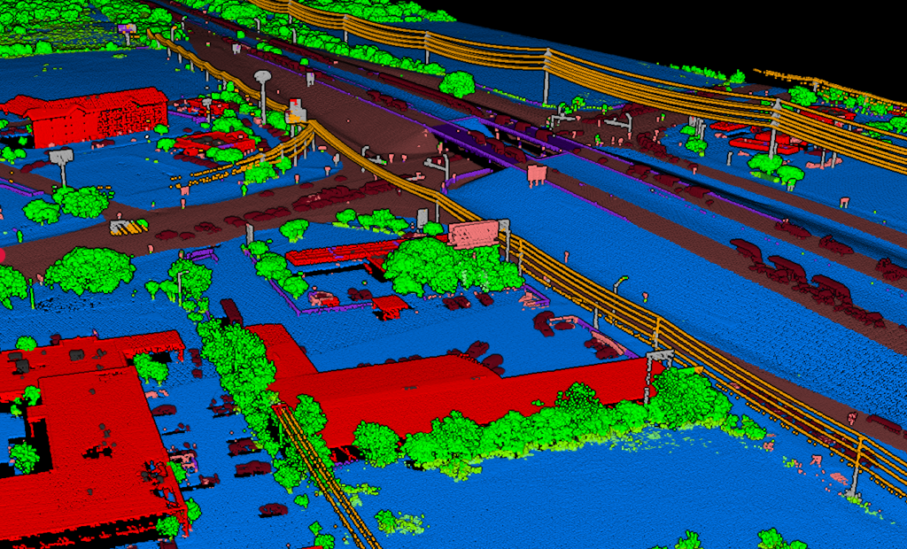
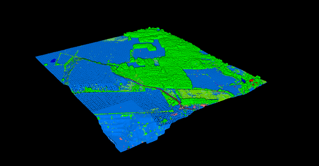
CLASSIFIED OUTPUTS
Turn raw points into a cleaner working view
See major classes separated earlier so review takes less effort and follow-on work moves faster
Automated classification is most useful when it reduces the amount of manual cleanup between upload and delivery. A cleaner first pass makes it easier to spot gaps, confirm the terrain surface, and hand off results with more confidence.
✦Review class separation visually before export
✦Reduce repeated manual filtering across similar jobs
✦Keep the workflow readable for mixed urban and natural scenes
A Simple Workflow for Faster Ground Classification
01
Upload Your LAS/LAZ
Bring in the point cloud and start from the same interface your team already uses for review and export workflows.
02
Run Automated Classes
Separate ground, vegetation, buildings, and infrastructure without rebuilding the workflow for every terrain type.
03
Review the Result
Confirm the surface looks right, inspect dense areas, and make sure the job is ready for terrain, forestry, or corridor follow-up.
04
Export and Deliver
Move faster into deliverables once the point cloud is cleaner and the class structure is easier to trust across the full site.
Built for Real LiDAR Workflows
📐
Survey Teams
Clean ground classes sooner for terrain review, contours, and mapping deliverables.
🌲
Forestry
Separate canopy and understory faster when vegetation density changes across the site.
🏗️
Planning & Mapping
Keep buildings, hardscape, and land cover easier to interpret in complex urban scenes.
⚡
Utility Corridors
Keep corridor review moving when lines, vegetation, and access routes share the same space.
DOWNSTREAM SPEED
Keep terrain, forestry, and corridor review moving
When the first classification pass is cleaner, every downstream deliverable becomes easier to review
Ground filtering is rarely the final output. It is the step that helps everything after it move with less friction, whether the job ends in terrain modeling, land cover review, or corridor inspection.
✦Reduce back-and-forth before terrain generation
✦Keep corridor scenes easier to inspect in dense vegetation
✦Hand off cleaner classified clouds for export and reporting
Frequently Asked Questions
Yes. Ground classification is usually the first need, but the same workflow can also help separate vegetation, buildings, and other site features so the full point cloud is easier to review and use downstream.
The goal of automated classification is to reduce how often teams need to reset the workflow between terrain types. Instead of repeating the same manual filtering steps across every project, you can move faster into review and delivery.
Most LiDAR teams start from standard LAS or LAZ point cloud files, then review the classified output before exporting or continuing into the next processing step.
Yes. A visual review step helps confirm that ground, vegetation, and structures are separated the way you expect before the job moves into terrain, corridor, or mapping deliverables.
It is especially useful for surveyors, forestry teams, utility corridor reviewers, and mapping groups that need faster classification without adding more manual cleanup to each project.