
Learn LiDAR
AI Ground Classification for LiDAR
Deep Learning Methods & Research (2024-2026)
No credit card required • 50 hectares included
Manual ground classification is the slowest, most frustrating step in LiDAR processing. Traditional filters fail on complex terrain. Deep learning methods now achieve higher accuracy while preserving critical features—automatically.
Why Traditional Ground Filters Struggle
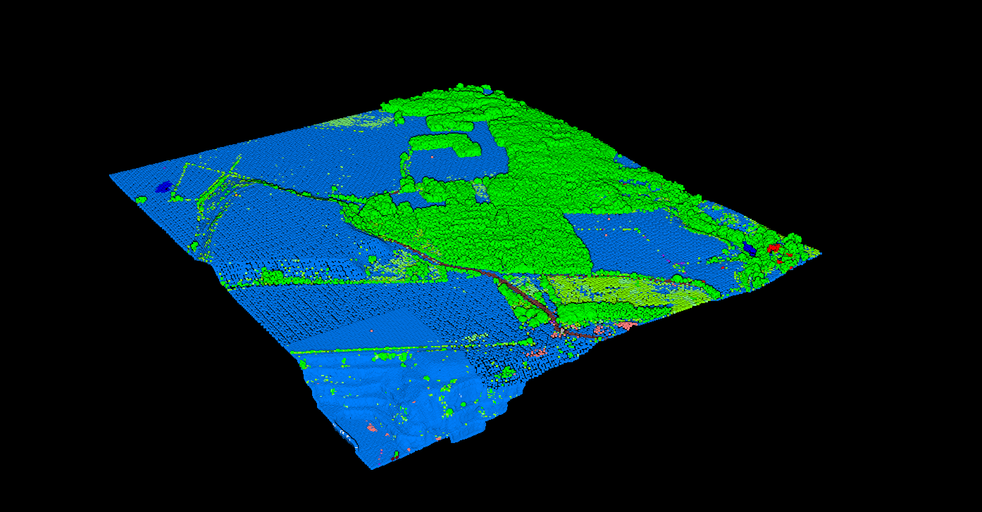
Ground point classification is the most critical step in LiDAR processing for terrain modeling. Accurate ground filtering directly determines the quality of Digital Terrain Models (DTM), watershed analysis, and flood modeling.
Traditional methods like Progressive Morphological Filters (PMF) and Cloth Simulation Filters (CSF) work well on flat terrain but struggle with:
- Complex landscapes with varying slopes and terrain types
- Dense vegetation where ground points are sparse
- Steep slopes that trigger false positives
- Urban areas with bridges, overpasses, and complex structures
Current Deep Learning Architectures
Since 2024, deep learning approaches have transformed ground classification, achieving higher accuracy while preserving important terrain features
Point Transformer Models
The Point Transformer architecture has become foundational for LiDAR classification. Updated self-attention and cross-attention mechanisms improve boundary detection between ground and non-ground points.
Terrain-Aware Hierarchical Networks
Published in 2025, terrain-aware hierarchical networks combine multi-scale spatial context to better separate gullies, ridges, and breaklines, showing stronger performance on complex terrain where traditional filters struggle.
USGS 3DEP Transformer
In September 2024, USGS published research on automated transformer-based classification for 3DEP LiDAR data—correcting noisy points at continental scale.
RandLA-Net for Scale
Uses random sampling to enable processing of massive point clouds (1M+ points) in single passes—real-time processing with reduced memory requirements.
Breakline Preservation Challenge
The Challenge
One of the most discussed challenges in 2024-2025 research is breakline fidelity: maintaining sharp terrain transitions (cliff edges, stream banks, road cuts) that traditional TIN interpolation preserves but some ML methods smooth over.
Current Solutions
Multi-scale feature learning: Architectures like terrain-aware hierarchical networks detect both broad trends and fine-scale discontinuities.
Edge-aware loss functions: Training networks to penalize breakline smoothing.
Hybrid approaches: Combining DL classification with traditional TIN generation.
USE AI CLASSIFICATION TODAY
DTM Generation Workflow
Modern AI-based ground classification fits into a production workflow
Ingest
LAS/LAZ files loaded with all returns
Classify
AI classifies ground vs non-ground
Validate
Automated QA checks accuracy
Interpolate
Ground points → DTM surface
Derive
Slope, aspect, contours
Export
GeoTIFF, DXF, or SHP handed to the next tool
No GPU Required. No Setup.
Process complex terrain in minutes, not hours
You don’t need local GPU hardware, Python expertise, or complex model training. Lidarvisor provides cloud-based AI classification that handles the entire workflow automatically.
- Upload your LAS/LAZ file directly in browser
- Automatic AI classification—no parameters
- Download ASPRS-compliant classified data
- Generate DTM, DSM, contours in same workflow
Key Research Papers (2024-2026)
USGS • September 2024
Automated Transformer-Based Classification for 3DEP LiDAR
Continental-scale classification using transformer models to correct noisy and incorrectly classified points.
2025
Terrain-Aware Hierarchical Networks for Complex Terrain Extraction
Multi-scale spatial feature learning for stronger performance on gullied and difficult terrain types.
PMC • 2024
Airborne LiDAR Classification Using Ensemble Learning
Ensemble methods combining multiple models for robust DTM production workflows.
Frequently Asked Questions
How does AI ground classification compare to traditional filters?
AI-based methods like transformer networks and terrain-aware hierarchical networks consistently outperform traditional filters (PMF, CSF) on complex terrain, achieving higher accuracy on steep slopes, dense vegetation, and urban areas while preserving breaklines and terrain features.
Do I need GPU hardware or ML expertise?
No. Lidarvisor runs AI classification in the cloud—you upload your point cloud via browser and download the classified results. No local GPU, Python environment, or model training required.
What file formats are supported?
Lidarvisor accepts LAS and LAZ files. Output includes ASPRS-compliant classified point clouds (Class 2 = Ground) plus derived products like DTM, DSM, and contour lines.
How long does AI classification take?
Processing time depends on point cloud size, but most datasets complete in minutes rather than the hours required for manual classification and correction of traditional filter results.
Is the classification output suitable for survey-grade DTMs?
Yes. The AI classification produces ASPRS-standard coded points that can be used for professional terrain modeling, watershed analysis, flood studies, and engineering applications.
Related Resources
Classification Methods
General classification overview
DTM Guide
Understanding terrain models
Classification Codes
ASPRS standard classes
AI Classification
How Lidarvisor AI works
Automate Your Ground Classification
Process complex terrain that breaks traditional filters. Upload your LAS/LAZ and get AI-classified results in minutes. Start with 50 hectares of free processing.
Create free account50 hectares free. No credit card. No software to install.